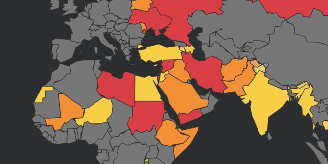
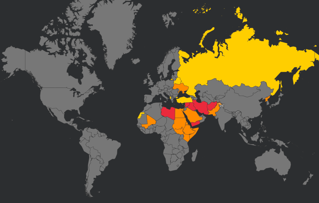
Mali: Airspace Risk Update
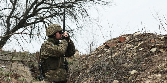
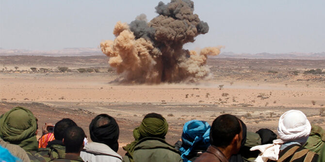
Mali’s security situation has taken a sharp turn for the worse in recent months, prompting several states to issue new airspace warnings and revisit existing guidance.
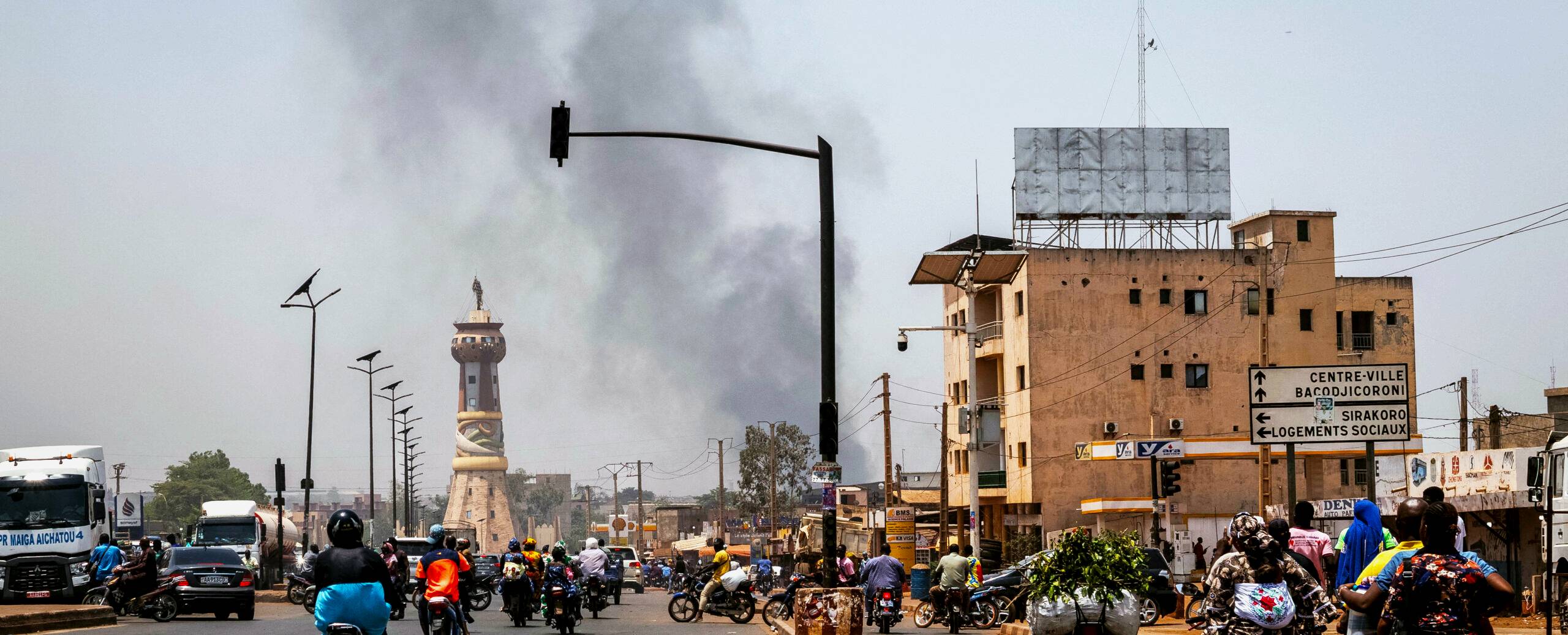
We’ve written about Mali before, particularly following the military coups of 2020 and 2021. What’s different now is that the conflict is no longer confined to remote areas. Since April, armed groups have shown an ability to coordinate attacks across multiple cities at the same time, including near Bamako.
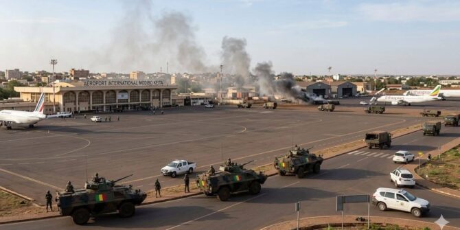
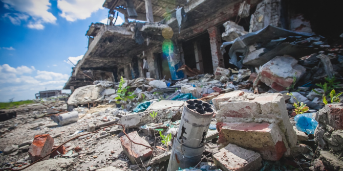
The biggest flashpoint came on April 25, when militants launched coordinated attacks across much of the country. Military bases, government facilities and GABS/Bamako airport were among the reported targets. The attacks highlighted a level of coordination not seen in Mali for more than a decade and raised fresh concerns about the government’s ability to contain the threat.
Although Bamako remains under government control and things have settled down since then, armed groups remain active across large parts of Mali, attacks continue regularly, and there’s a real possibility of further coordinated offensives in the months ahead.
The April 25 attacks were the largest coordinated militant attacks Mali has seen since 2012.
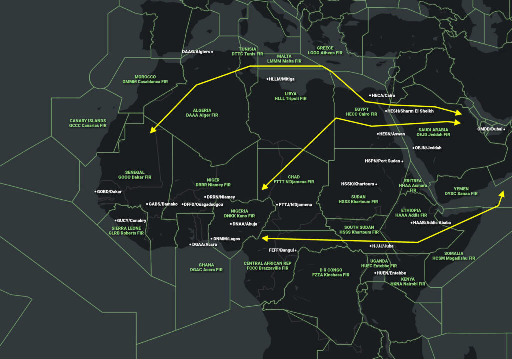
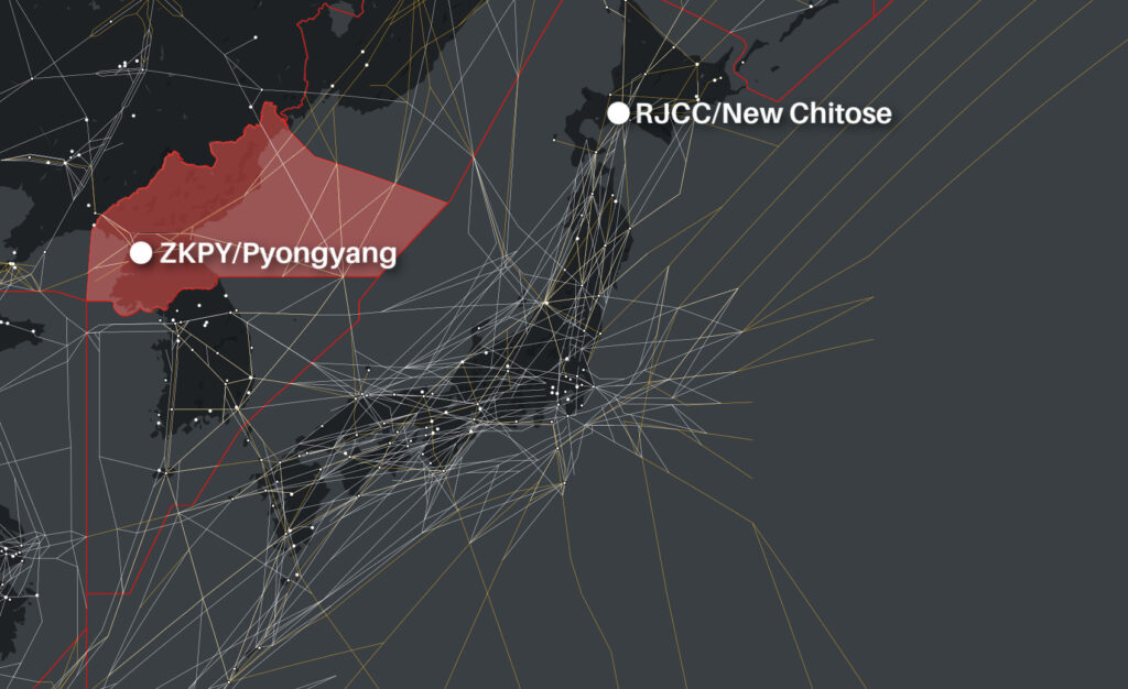
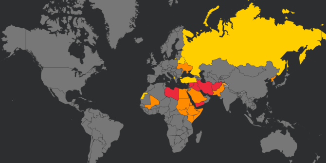
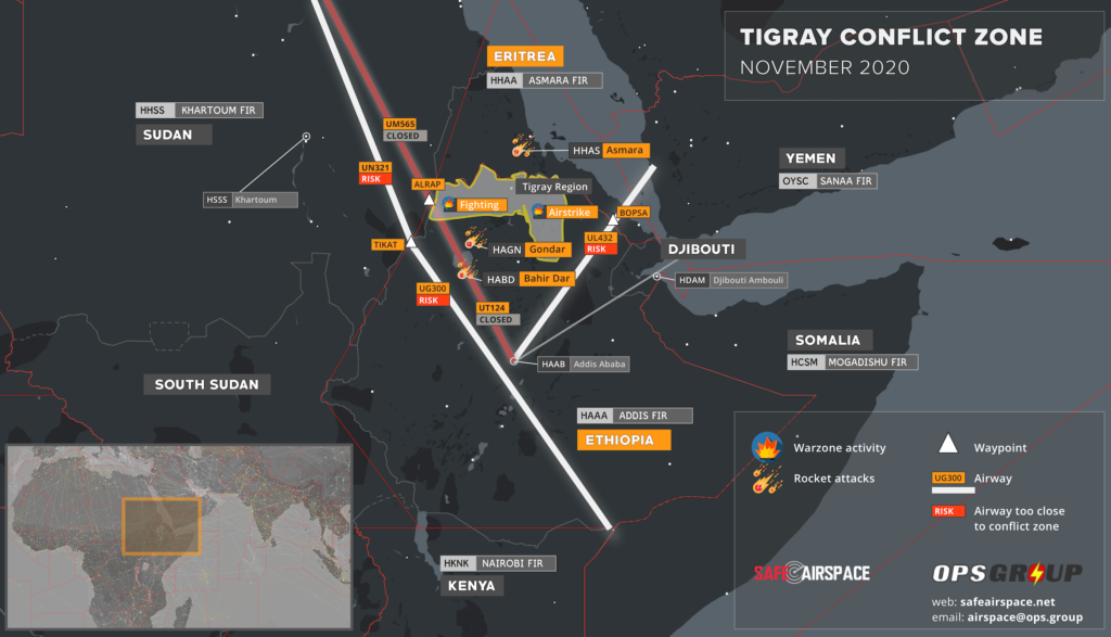
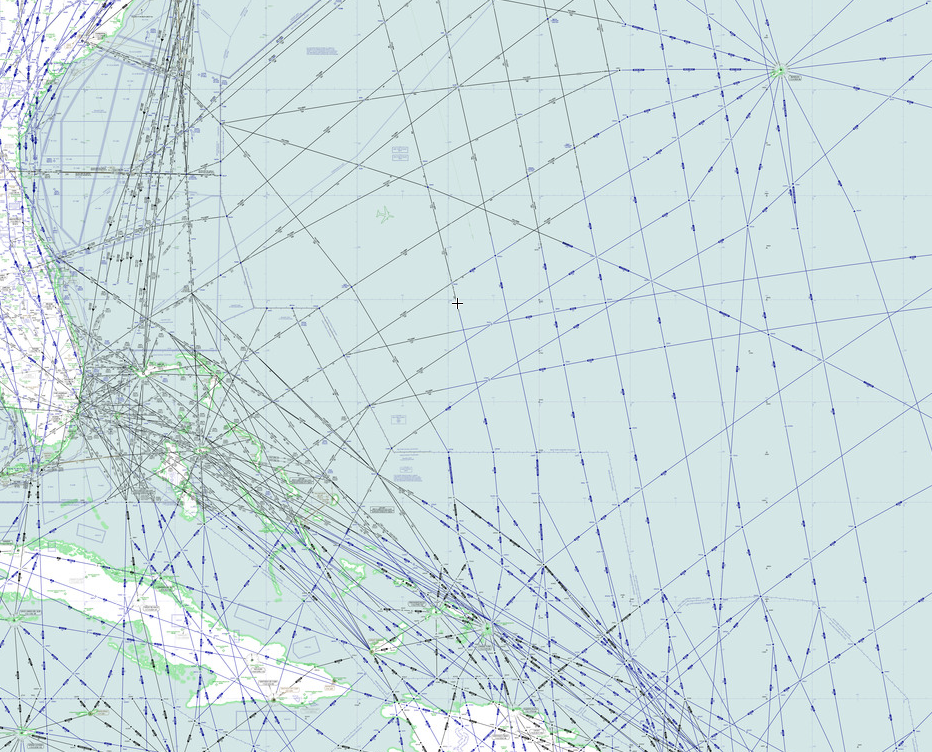
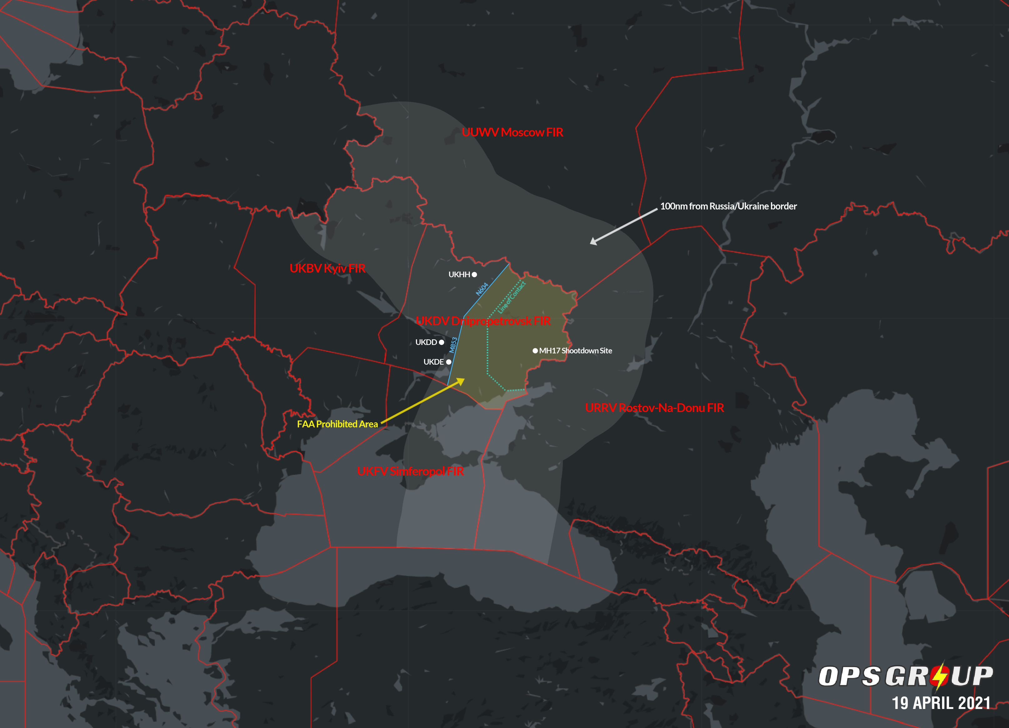
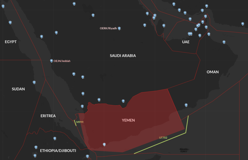
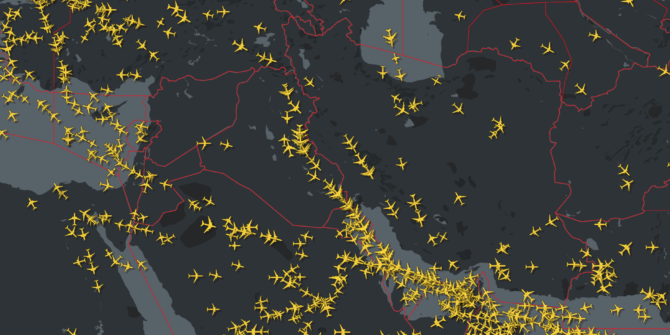
The Airspace Picture
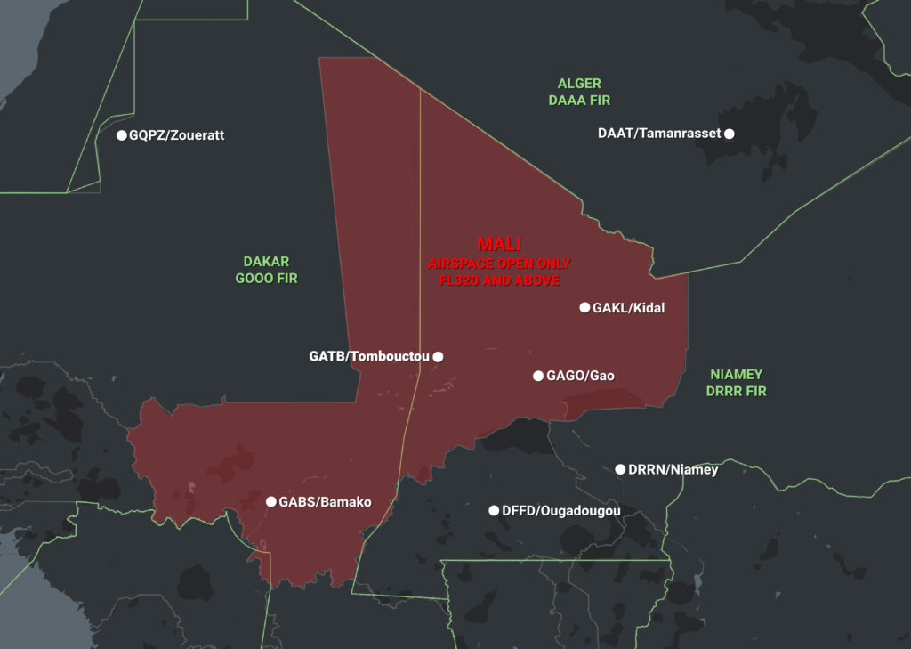
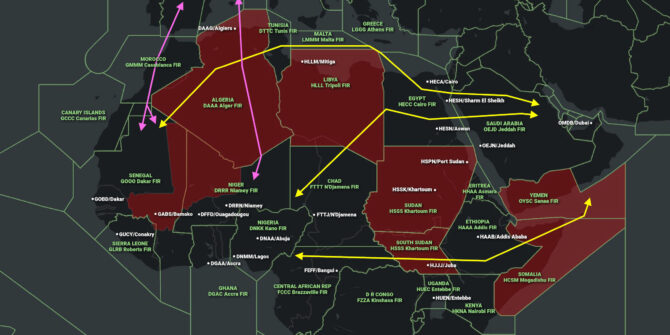
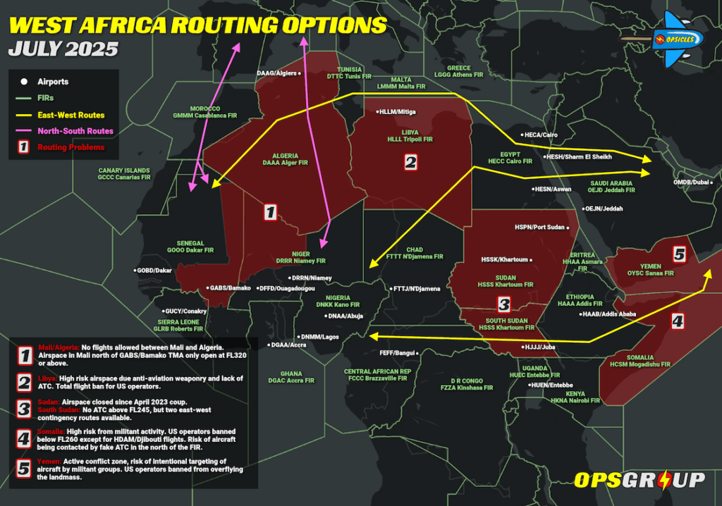
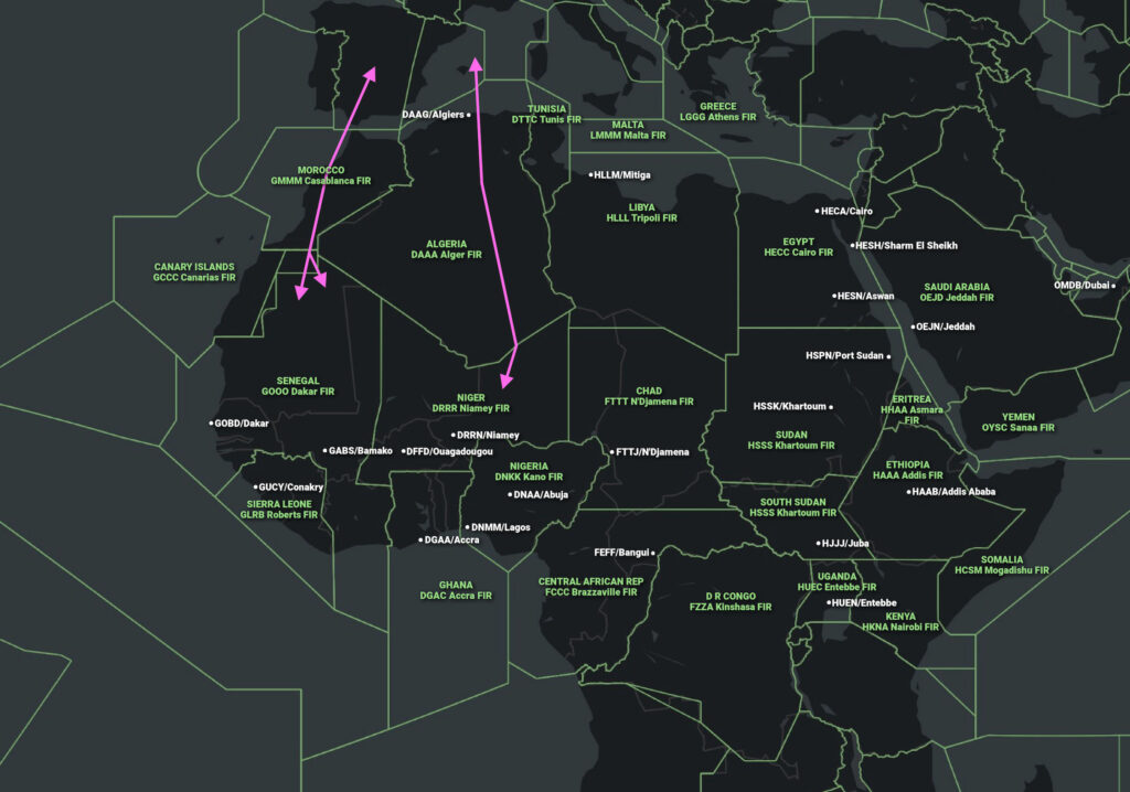
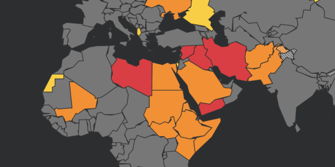
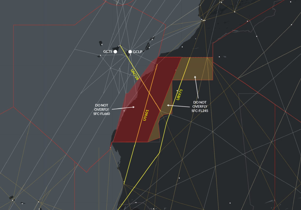
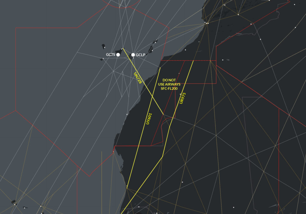
From an ATS perspective, Mali is split between two FIRs. Eastern Mali sits in the DRRR/Niamey FIR, and Western Mali in the GOOO/Dakar FIR. The danger exists in portions of this airspace that lie above Malian territory.
Here’s what this all looks like on a map:
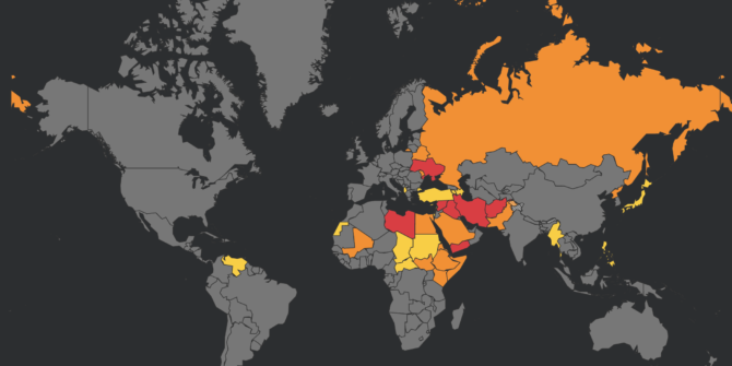
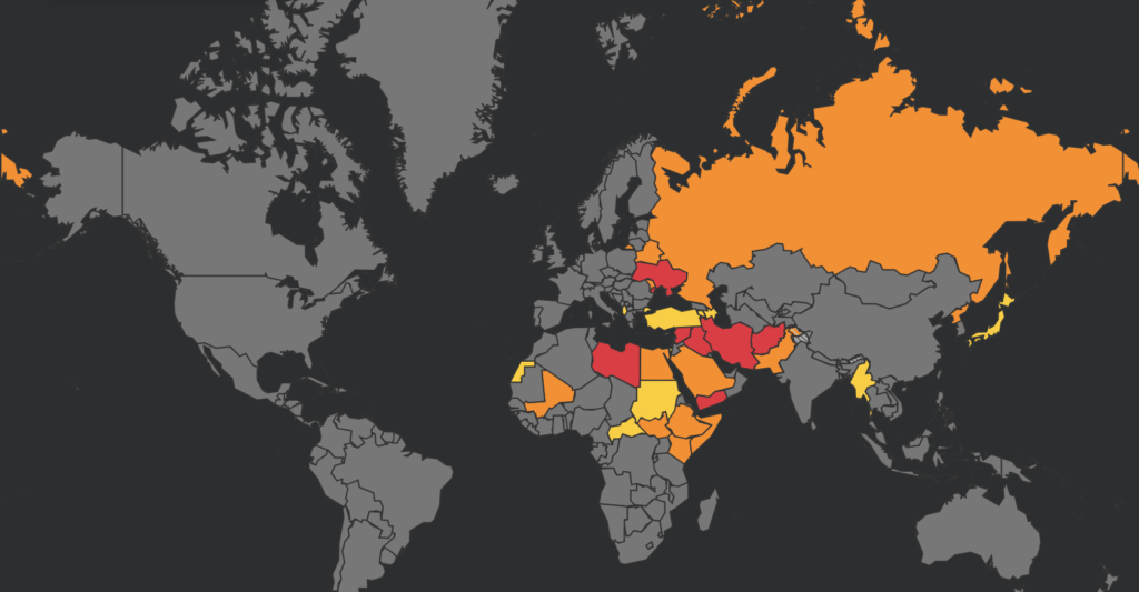
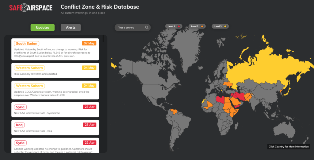
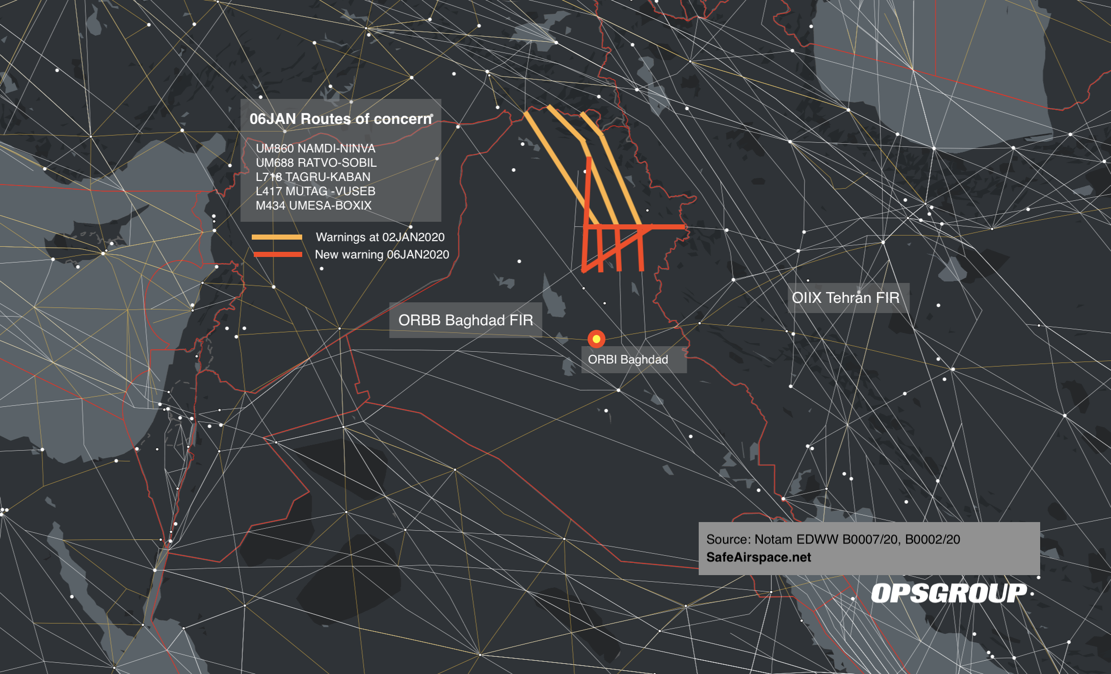
Airspace Warnings
Several states have issued new or updated airspace warnings for Mali in recent weeks, most of which remain in effect
Italy
LIRR Notam E0557/26
ITALIAN AIR CARRIERS AND CAPTAINS OF AIRCRAFT IN CHARGE OF AIR SERVICES OPERATED BY CARRIERS HOLDING AN OPERATING LICENSE ISSUED BY ITALY, WHETHER THEY ARE CONTRACTUAL CARRIERS AND/OR OPERATING CARRIERS, OR PERFORMING AIR SERVICES THROUGH A WET LEASE OR A CODESHARE AGREEMENT AS WELL AS FOR ANY FLIGHT MADE WITH AN AIRCRAFT REGISTERED IN ITALY ARE RECOMMENDED TO AVOID PORTIONS OF DAKAR FIR (GOOO) AND NIAMEY FIR (DRRR) WITHIN TERRITORY AND AIRSPACE OF MALI BELOW HEIGHT 25000FT AGL AND ACCORDING TO EASA SAFETY DIRECTIVES.
Plain English: Italian operators should avoid the airspace of Mali below 25000ft AGL.
United Kingdom
EGTT Notam V0019/26
SECURITY – HAZARDOUS SITUATION IN MALI. UK CIVIL AIR OPERATORS ARE RECOMMENDED NOT TO ENTER FIR NIAMEY (DRRR) AND FIR DAKAR (GOOO) WITHIN THE TERRITORY AND AIRSPACE OF MALI BELOW 25,000 FT ABOVE GROUND LEVEL (AGL). POTENTIAL RISK FROM ANTI-AIRCRAFT WEAPONRY AND HEIGHTENED MILITARY ACTIVITY. THIS SUPERSEDES THE ADVICE IN THE CURRENT UK AIP ENR 1.1. AR-2026-3729/01.
Plain English: Operators should not enter the portions of the GOOO/Dakar and DRRR/Niamey FIRs over Mali below 25,000 ft AGL due to risks posed by anti-aircraft fire and military activity.
Canada
CZUL Notam H2442/26
AIRSPACE SECURITY WARNING ISSUED BY THE DEPARTMENT OF TRANSPORT IN RESPONSE TO THE SECURITY SITUATION IN MALI. CANADIAN AIR OPERATORS AND OWNERS OF AIRCRAFT REGISTERED IN CANADA ARE RECOMMENDED TO MAINTAIN A FLIGHT LEVEL EQUAL TO OR ABOVE FL320 IN THE PORTIONS OF FIR DAKAR (GOOO) AND FIR NIAMEY (DRRR) LOCATED IN THE TERRITORY OF MALI DUE TO THE POTENTIAL RISK FROM MILITANT ACTIVITY AND ANTI-AIRCRAFT WEAPONRY.
Plain English: Canadian operators are recommended to remain at or above FL320 while in portions of the GOOO/Dakar and DRRR/Niamey FIRs overhead Mali due to risk of anti-aircraft fire and military activity.
France
LFBB Notam F1114/26
DUE TO SECURITY SITUATION IN MALI, FRENCH AIR CARRIERS AND CAPTAINS OF AIRCRAFT IN CHARGE OF AIR SERVICES OPERATED BY CARRIERS HOLDING AN OPERATING LICENSE ISSUED BY FRANCE, WHETHER THEY ARE CONTRACTUAL CARRIERS AND/OR OPERATING CARRIERS, OR PERFORMING AIR SERVICES THROUGH A WET LEASE OR A CODESHARE AGREEMENT AS WELL AS FOR ANY FLIGHT MADE WITH AN AIRCRAFT REGISTERED IN FRANCE ARE REQUESTED TO MAINTAIN AT ALL TIMES A FLIGHT LEVEL ABOVE OR EQUAL TO FL320 IN THE PART OF FIR DAKAR (GOOO) AND IN THE PART OF FIR NIAMEY (DRRR) LOCATED ABOVE THE MALIAN TERRITORY AND NOT TO SERVE OR IDENTIFY AS ALTERNATE BAMAKO MODIBO – KEITA AERODROME (GABS). THIS NOTAM SUPERSEDES THE RESTRICTIONS CONCERNING MALI ISSUED IN PARAGRAPH 3.11 MALI OF THE AIC NR A02/26 CURRENTLY IN EFFECT.
Plain English: French operators are advised to remain at or above FL320 in the portions of the GOOO/Dakar and DRRR/Niamey FIRs overhead Mali. GABS/Bamako should not be used at this time (including as an alternate) due to a deteriorating security situation.
What about the US FAA?
The FAA had already previously upgraded its airspace warning for Mali, since re-issued as (very lengthy) KICZ Notam A0023/26.
The warning expanded the scope of the threat. Previous guidance from 2022 focused mainly on risks below FL260. The concern then was mostly insurgent activity, indirect fire and possible MANPAD threats around airports in Northern Mali.
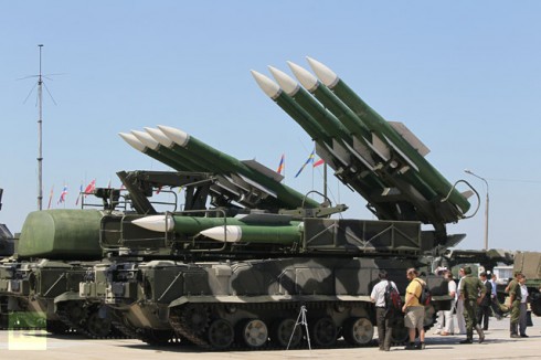
Then in 2025, several changes were made. The current advisory now warns US operators to exercise caution at all altitudes citing expanding foreign private military presence, and the introduction of an advanced air defence system.
The FAA later expanded on this in a background notice published in March this year.
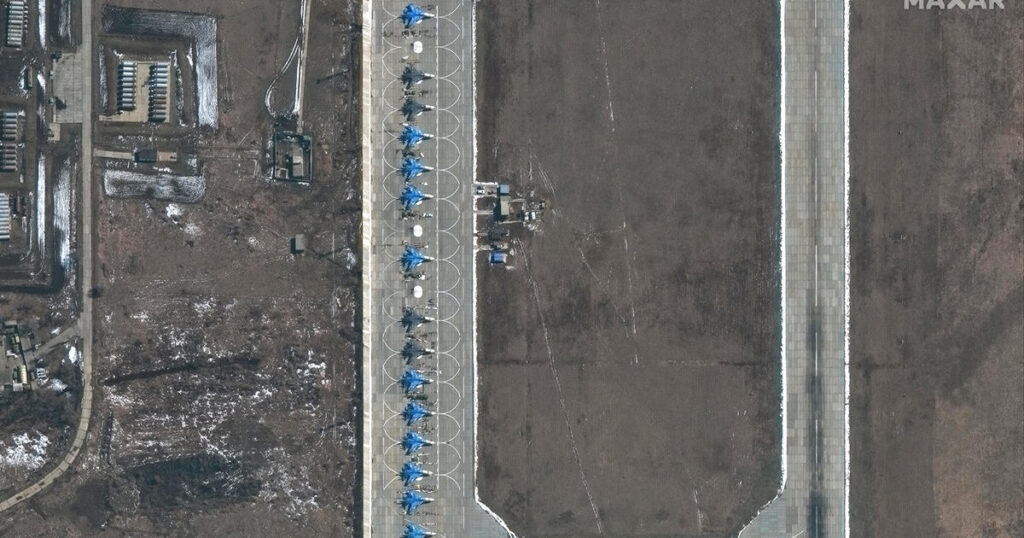
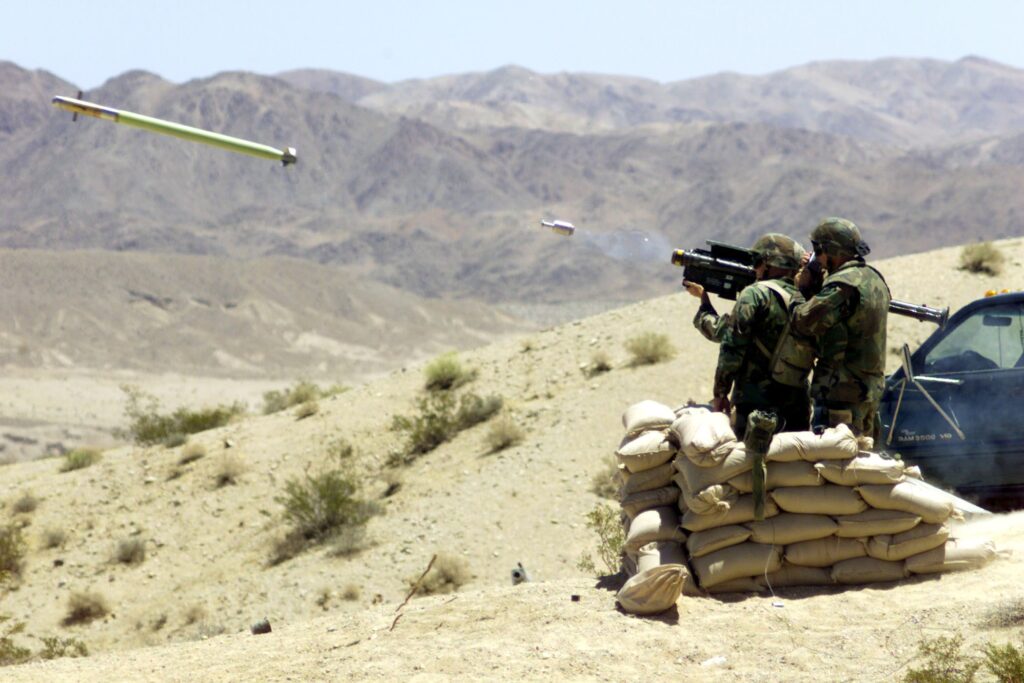
The FAA says Mali now hosts a state-run paramilitary force operating anti-aircraft weapons, helicopters, fighter aircraft, drones and electronic warfare equipment. That’s a notable shift from earlier guidance which focused mainly on low-level threats such as indirect fire and MANPADS.
Alternatives
Mali, and especially GABS/Bamako, used to be a fairly common BizAv tech stop. However in the past decade, many operators have become increasingly cautious about Mali because of terrorism, political instability, military coups and general risk.
The events of April have reinforced this – stops in Mali are currently dangerous.
If you’re looking for alternatives, Senegal (GOBD/Dakar) has become probably the most common option in West Africa for biz jets. It has sound infrastructure, is generally stable and relatively safe.
Other options include Cape Verde (GVAC/Sal) which is especially popular for Atlantic crossings, and Ghana (DGAA/Accra).
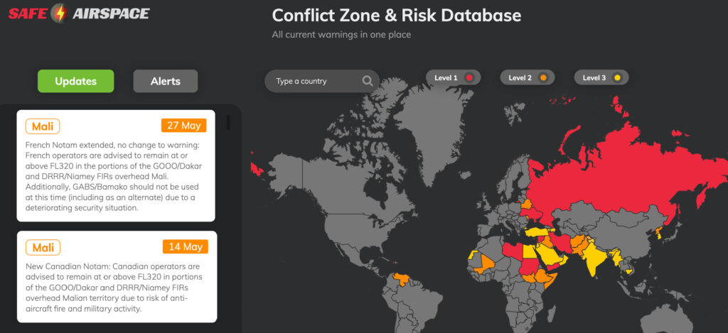
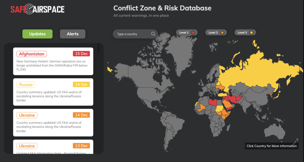
Safeairspace
Visit safeairspace.net for a full list of active airspace state-issued warnings for Mali, and all other countries.
 The primary risks to overflights are from misidentification or mis-targeting. The military air defence equipment present is advanced, and capable of reaching all levels.


 However, Chad is also one of the poorest nations in the world, with big problems around poverty, corruption and human rights, and with that came civil unrest.


 Germany
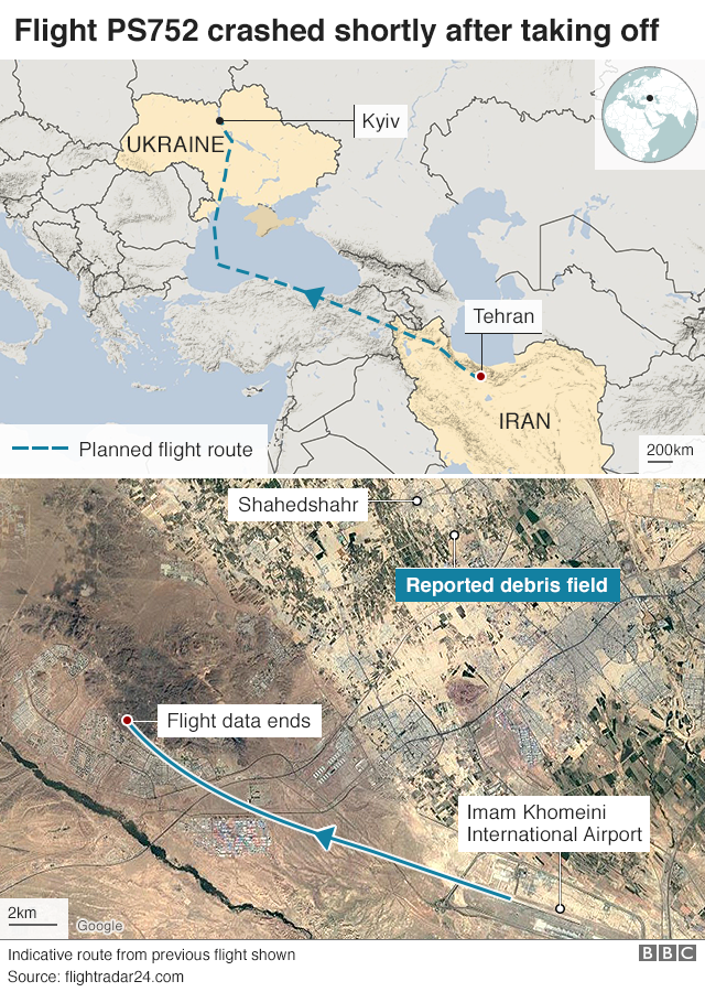
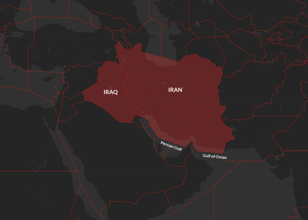
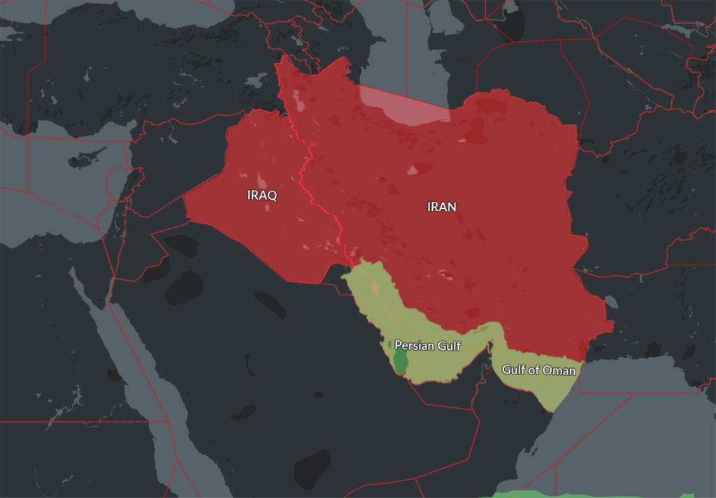 This new Notam represents a further loosening of the total airspace ban on the Persian Gulf and Gulf of Oman initially applied by the FAA shortly after the Iranian missile strike on US military bases in Iraq on Jan 8, which was quickly followed by the shooting down of Ukraine Int Airlines flight 752 in Tehran by the Iranian Armed Forces, having mistaken the aircraft radar return for an inbound missile.
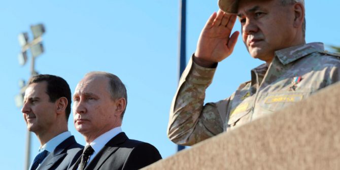
 Russia’s Ministry of Defense has since blamed Israel for the near-miss – at the time the incident occurred, the Syrian air defence systems had engaged four Israeli F-16s, and Russia claims that these fighter jets were using civilian aircraft as “cover” while conducting air strikes.