Key Points
- EASA has amended its Conflict Zone Information Bulletin (CZIB) for Libya. They no longer recommend against flights to “airports located on the coast” – as long as you approach from the sea, talk to ATC, and do a risk assessment.
- This new advice is curious, because it’s not clear there has actually been any reduction in airspace risk here. None of the Libya airspace warnings issued by other countries (US, Canada, Germany, France, UK, etc), have changed recently. Everyone says the same thing – there remains a high risk to civil aircraft in Libyan airspace (HLLL/Tripoli FIR), and it should be avoided.
- Read on for a 7-Step Idiot’s Guide to Libya – a look at airspace risk, with some maps, pictures, analysis, and advice for operators.
An Idiot’s Guide to Libya
I’m Dave, and I’m an idiot. It’s been 12 days since I last did something stupid.

Hi Dave.
I know almost nothing about Libya.
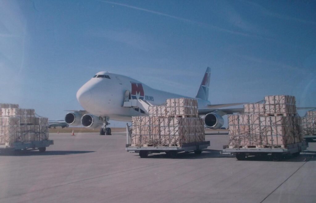
Back in the day, I worked for a cargo airline that did flights there. We picked up some cheap fuel in Tripoli before jetting off down to Entebbe to pick up fresh fish to take back to Europe.
God knows why. Fly to Uganda to get some fish to take back to the UK? A country literally surrounded by sea needs to send a plane to Africa to get some fish? Makes no sense, does it. But it never occurred to me – because I’m an idiot.
Just leave those pallets of fish out there in the sun, they’ll be fine.
I bashed out a few flight plans – Ostende to Tripoli to Entebbe and back again – and hoped for the best. And most times, things went just fine.
We stopped operating in 2010. No more Libya, no more Uganda, no more fish.
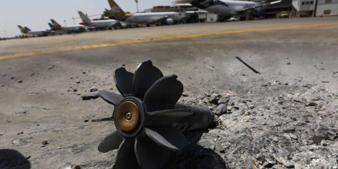
Good thing too, because four years later, Libya descended into chaos with the outbreak of a civil war that saw HLLT/Tripoli airport closed after clashes between rival militias destroyed most of the airport’s facilities. The airport remains closed to this day; most flights operate out of the city’s other airport – HLLM/Mitiga.
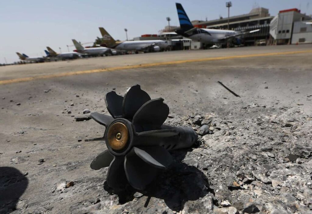
The Battle of Tripoli Airport, 2014.
All the standard “Do Not Travel” warnings followed soon after, and people stopped flying to Libya.
So here we are, ten years later, and EASA are now saying it’s probably OK to start flying to airports on Libya’s coastline again – as long as you approach from the sea, talk to ATC, and do a risk assessment…
Hmm, sounds weird, doesn’t it? Why on earth would we want to do that? Well, let’s have a look…
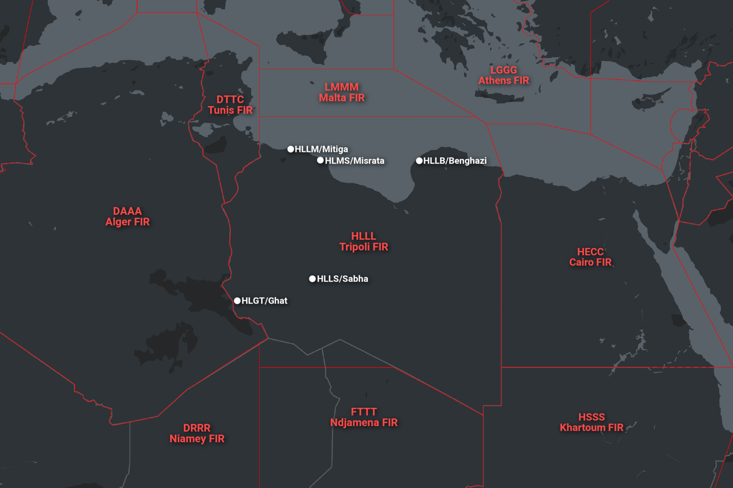
Step 1: Find Out Where It Is
Remember, this is an “Idiot’s Guide” where I know almost nothing about Libya. So this is where we start.
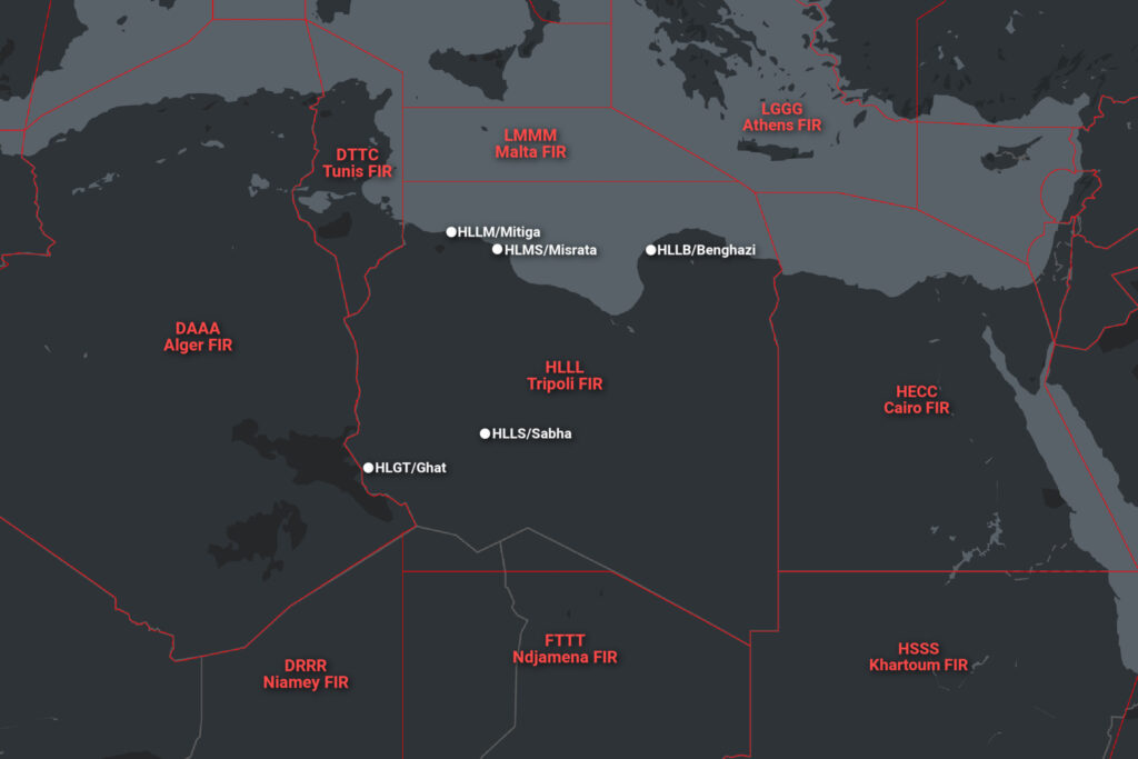
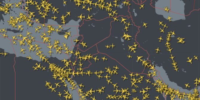
White dots = airports. Red stuff = airspace boundaries.
Step 1 complete!
Step 2: Find Out How Scary It Is
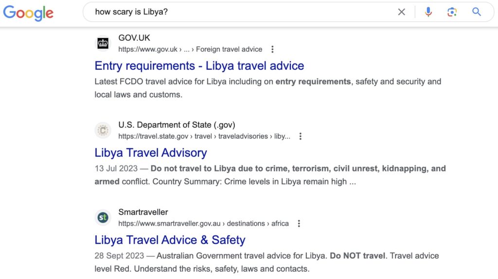
Not a great start.
Yeah but that’s travel advice for passengers. We’re pilots, so we want to know about airspace and missiles and stuff…
All the airspace warnings in one digestible, non-stop GIF.
Oh dear. None of that looks great either, does it?
Step 3: Actually Read The Warnings In The GIF
Just like the classic 80’s tv advert said: GIFs are for Christmas, Airspace Warnings are for life.
Or was it dogs? GIFs are for dogs, not just for Christmas? Christmas is for GIFs, not just for dogs?
Something like that. What I mean is – GIFs are hardly a solid basis for a risk decision of this magnitude. It’s worth taking some time to check out what the official airspace warnings actually say…
Step into our office…
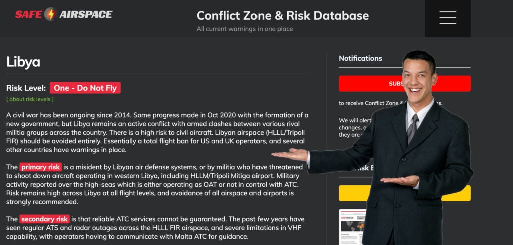
Safeairspace.net is our Conflict Zone & Risk Database. It will tell you what you need to know about airspace warnings.
The short story for Libya is this: Several countries have airspace warnings for Libya, and all say pretty much the same thing – operators should avoid Libya’s HLLL/Tripoli FIR entirely, due to the potential risk from anti-aviation weaponry and military operations. Libya remains an active conflict zone with armed clashes between various rival militia groups across the country, and there is a high risk to civil aircraft.
Starting to get the feeling like we’ve been here before? That’s because we have. We asked all these exact same questions back in 2022, and again in 2023, and decided that no, Libya probably wasn’t safe to fly to.
But anyway, that was then and this is now. On with the guide…
Step 4: Check The News
August 2023: Major evacuation of aircraft from Tripoli due to violent clashes and gunfire at Mitiga airport. More info.
Aug 2022: Militia air defense forces claimed to have shot down a US drone operating in the vicinity of Benghazi during a period of increased tensions and threats of renewed violence between competing militias vying for control of Tripoli.
June 2022: Failed attempt by militia to enter Tripoli to seize control of government offices, resulting in armed clashes and suspension of flights at HLLM/Mitiga airport.
Jan 2020: Multiple airstrikes targeting HLLM/Mitiga airport. Videos on social media showing planes landing at the airport as shells are falling in the background.
Nov 2019: Militia advancing on the capital, Tripoli, declared a no-fly-zone around the city, threatening to shoot-down civil aircraft attempting to fly to HLLM/Mitiga airport.
And that’s just the big-ticket aviation related stuff. For a full history of the endless horrors suffered by the poor people of Libya stretching back to 2011, check here.
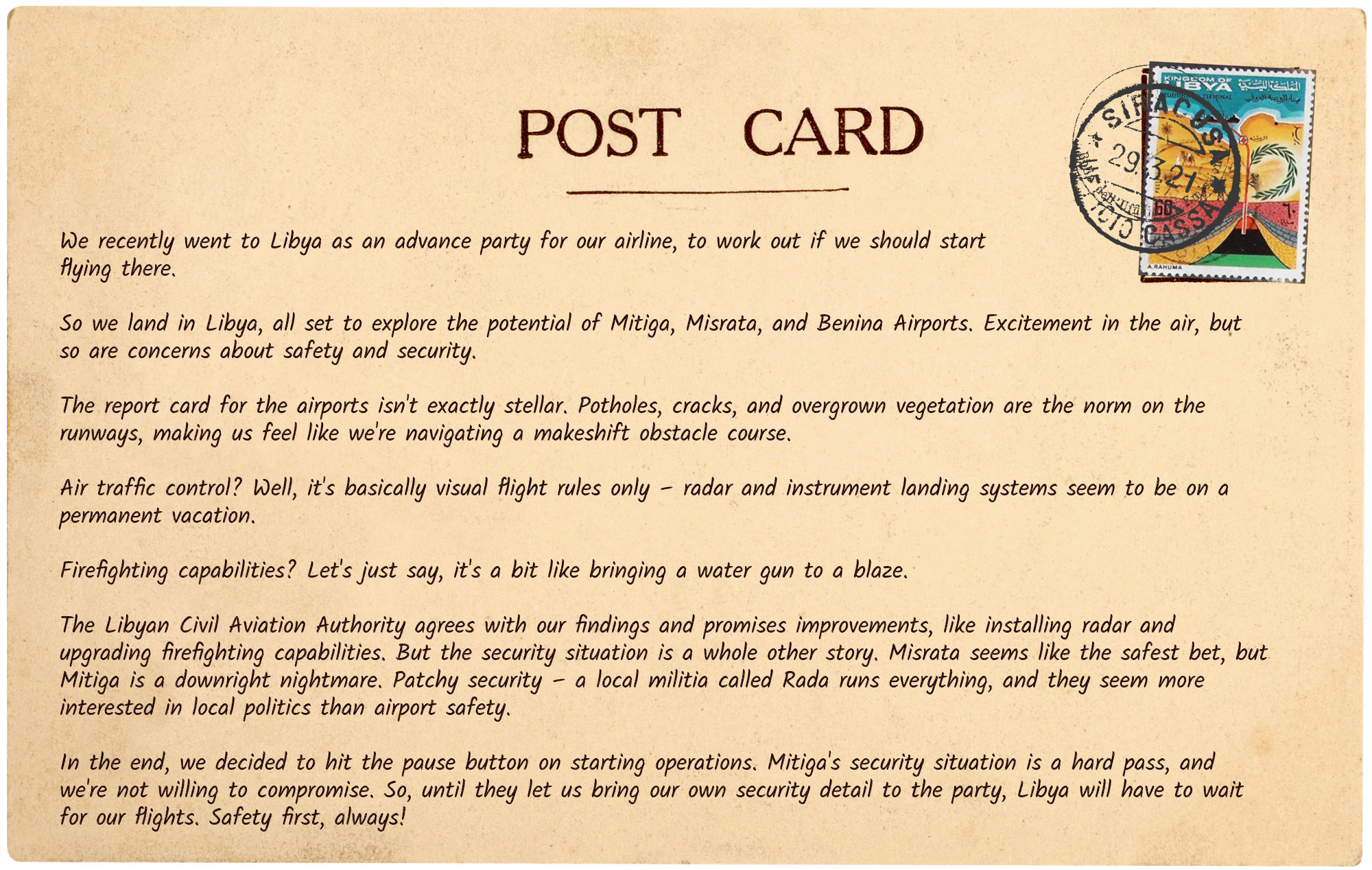
Step 5: Ask Someone Who’s Gone There
If in doubt, just look at what other people are doing.
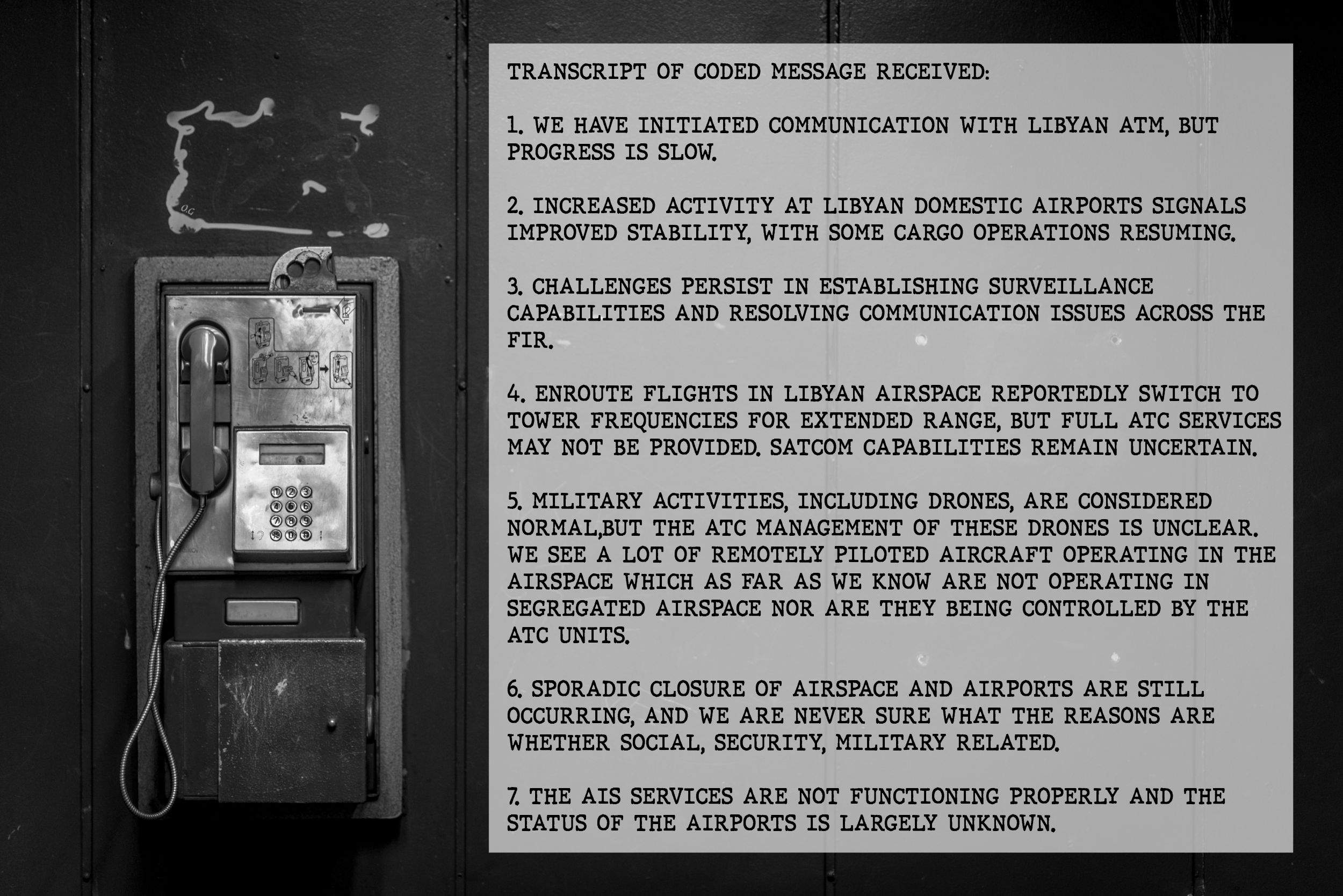
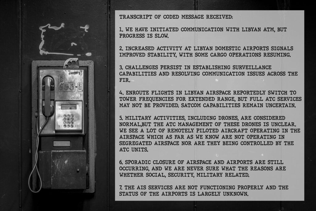
Here’s a report we recently received from an operator who went to Libya:
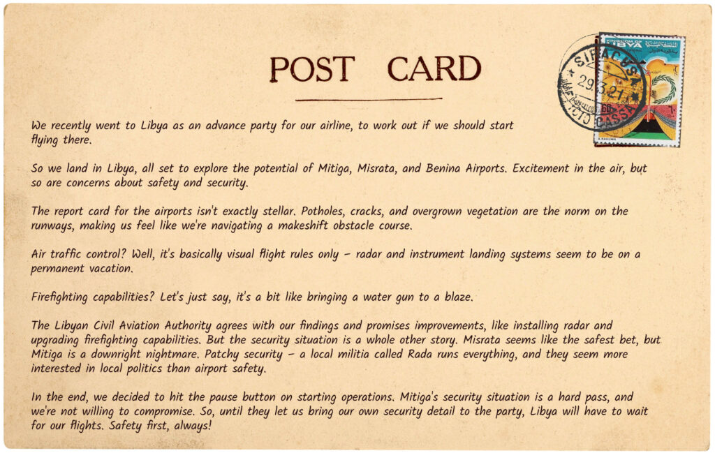
Sent via postcard on layover in Siracusa, Sicily.
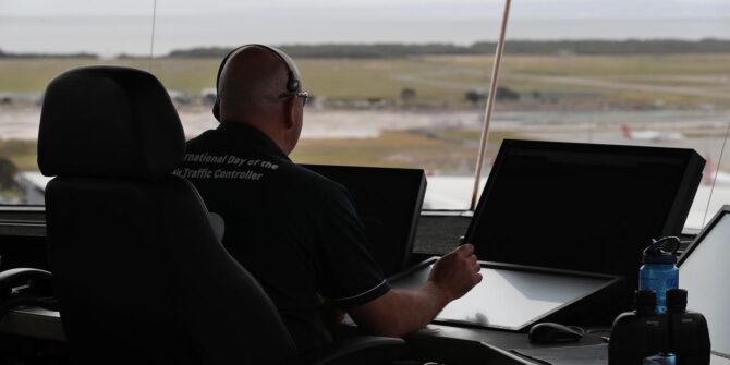
Step 6: Ask Someone Who Has To Deal With It ALL THE TIME
The ultimate shortcut to solving complex stuff you don’t know much about? Ask someone who knows a whole bunch about it.
Here’s a report from ATC in a neighbouring ACC to Libya:
OPSGROUP Listening Station, back alley of Lucky Star Chicken Restaurant, Berlin.
Step 7: Conclusion
The conclusion to this Idiot’s Guide to Libya? NO. Do Not Fly. Avoid.
If you need reminding, you can print out this helpful Opsicle, and take it with you in your flight bag.
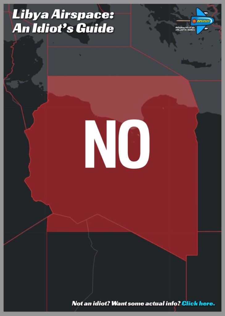
⬆️ You can click the image above to download the PDF.
Postscript: The Curious Case of the EASA CZIB
We mentioned this at the start. And in the middle. Now again here at the end.
In their amended CZIB, EASA are now saying it’s probably OK to start flying to airports on Libya’s coastline again – as long as you approach from the sea, talk to ATC, and do a risk assessment.
If you’re a European airline keen to resume flights to Libya, you might like this piece of news. Everyone’s risk appetite is different, after all.
Some history here: In July 2023, Italy cancelled its 10-year ban on flights to/from Libya, the idea being to resume airline flights between the two countries at some point. So aircraft are technically no longer banned from Italian airports and airspace if they want to fly from Libya (apart from Libyan operators, who are still banned from EU airspace). You still need to get special permission from the Malta CAA if you want to do this, as per the LMMM Notams.
Why is the amended EASA CZIB “curious”? Because there’s no evidence that there has actually been any reduction in airspace risk here. None of the state airspace warnings have changed, and EASA have not provided any of the reasoning behind the decision to ease their warning.
So for now, our advice remains the same: Libyan airspace (the HLLL/Tripoli FIR) should be avoided entirely.
See you again next year for another look at why you might want to avoid Libya!


 Better yet, share them with us on
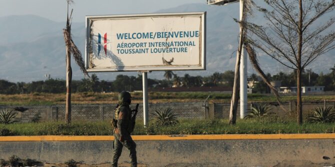
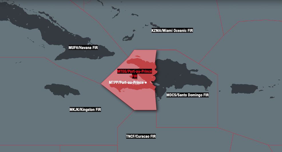 No restrictions on overflights have been published, with flight tracking still showing sporadic airline traffic overflying– although the bulk appear to be transiting further east over the Dominican Republic.
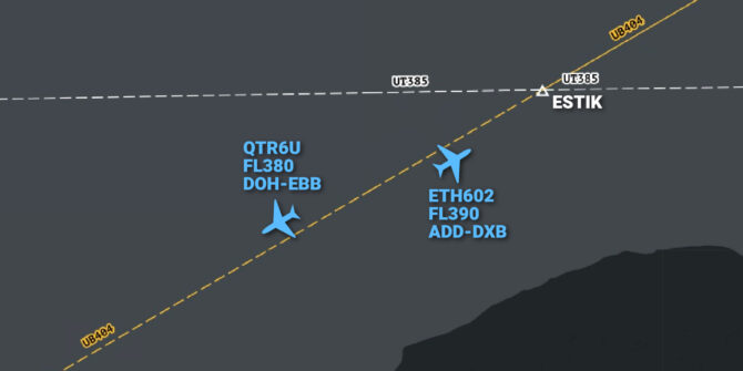
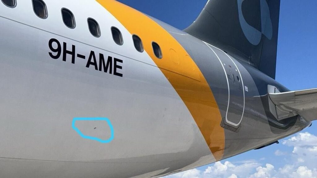
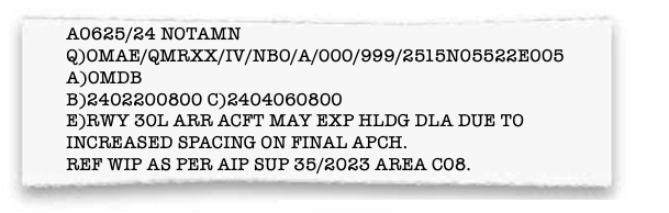 It was later re-issued (after-the-fact), somewhat sheepishly with an actual holding advisory …
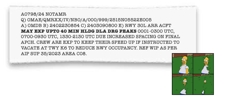 The good news is that you can easily access the referenced AIP SUP
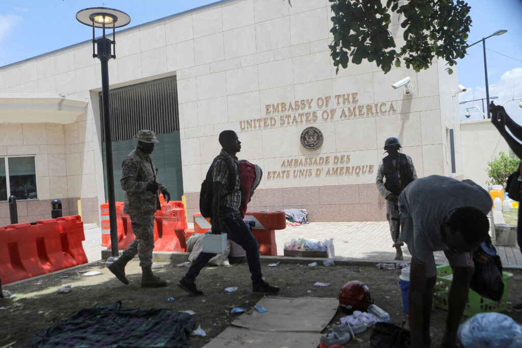
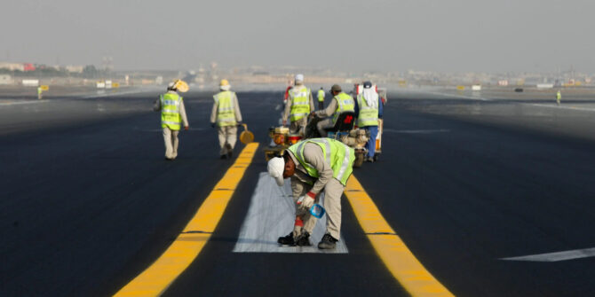
  During peak times, arrivals are stacking up.