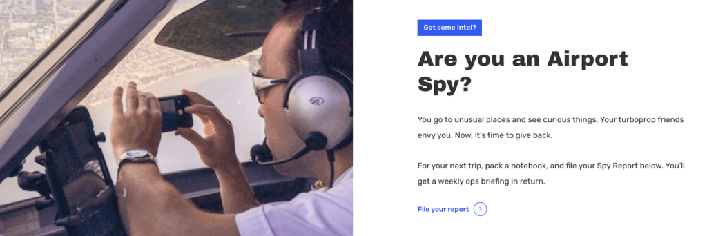
Is the Fuel Pool Drying Up?

From Laos to Lima there is a growing fuel shortage and while the shortages (and fuel price hikes) have mainly been impacting road users, the problem is beginning to be felt in aviation as well.
So we figured we’d take a look at the situation.
What’s causing it?
The Ukraine Russia conflict.
Russia is the third largest supplier of oil behind the USA and Saudi Arabia, supplying around 12% of the world’s needs.
The conflict is seeing oil prices zoom up, recently hitting $139 a barrel (a 14 year high). Spot prices in New York Harbour went over $7.30 a gallon which is double what it normally would be this time of year.
But why is the USA short?
Good question.
The USA gets its fuel from lots of places, predominantly domestically and from across the border in Canada and Mexico. What you might not realise though is it also sources almost 10% of its supply from Russia. It’s a big number when you consider 329 million people live in the US. Take into account that Europe is also feeling the pinch of this ‘tightening global energy market’, ‘ it’s no wonder prices are on the charge, and supply running thin.
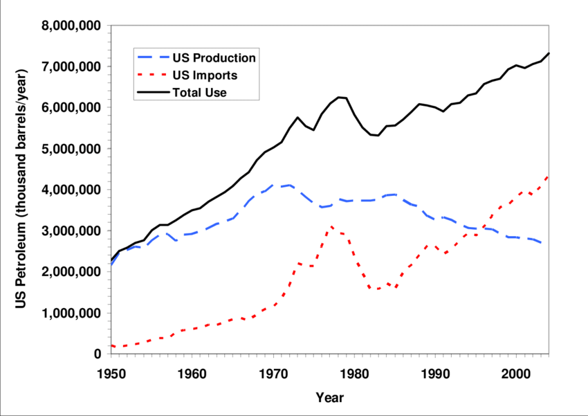
A particularly uninspiring graph
Back in 2021…
Back in 2021 the USA suffered fuel shortages at a bunch of airports. This was actually due to a bunch of reasons:
- There weren’t enough truckers to drive it around
- The pipelines had all been shifted during covid and hadn’t been shifted back again
- There was a cyber attack on one of the main pipelines disrupting the supply
- Some supplies were diverted away from leisure airports and to airports where wildfire fighting aircraft needed it
- Leisure routes were getting busier as Covid restrictions loosened
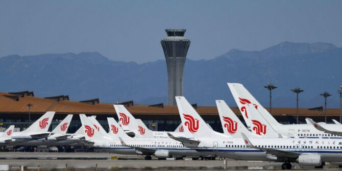
Fast forward to 2022 and while flying levels are around 95% of the peak 2019 levels, fuel production is still only around 80%. So there is, simply, a shortage.
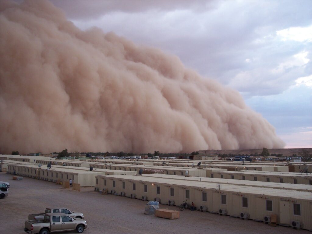
Let’s talk about the East Coast.
The East Coast has been particularly hard hit for two reasons:
- One, because the California refineries suffered some technology issues earlier in 2022 and couldn’t make as much,
- Two, because they receive their supply mostly from Texas and also Europe – and Europe ain’t sending much at the mo.
- Distallite PADD 1 imports (the stuff a quick google search showed me is used for Kerosene – Jet fuel) is down 60%.
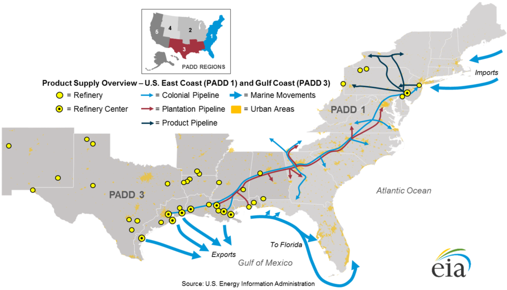
Where it comes from
What are we seeing, where?
- Smaller, regional airports are reporting shortages
- Leisure routes are being cancelled due rising costs
- International shortages/rising costs leading to security situations
- Uncertainty as to ongoing availability
- And of course, the rising costs globally…
In the USA
We have seen reports for several spots across the USA, and expect to see more particularly for the east coast airports.
- KEYW/Key West has reported rising costs
- KAUS/Austin has seen surge in passenger number and operators were asked to tanker where possible for at least the next few weeks.
- KSDL/Scottsdale had a report from member of fuel shortages. One FBO confirmed their supply was ok, but other FBOs were running low.
If you have visited an airport recently which has fuel supply problems, or where costs are rising significantly, please let us know.
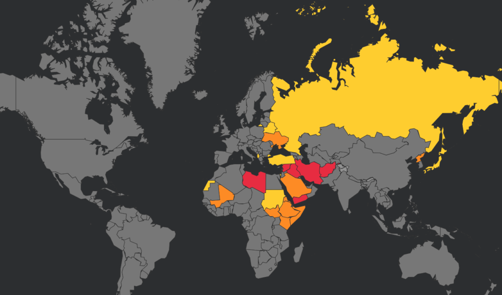
Elsewhere in the world
Nigeria and Russia have both had reports of aviation fuel shortages. The other countries on the list are seeing fuel shortages and rising costs leading to protests and security situations, however whether there is an impact on aviation fuel supplies is currently unknown.
- Russia started to see fuel shortages around the start of March.
Whilst Russia are a major oil producer, much of their supply may be getting redirected for military operations. One major operator cancelled flights to UUDD/Moscow due being unable to uplift. With the current situation and lack of operators heading in, it is hard to get any clear picture of the situation though.
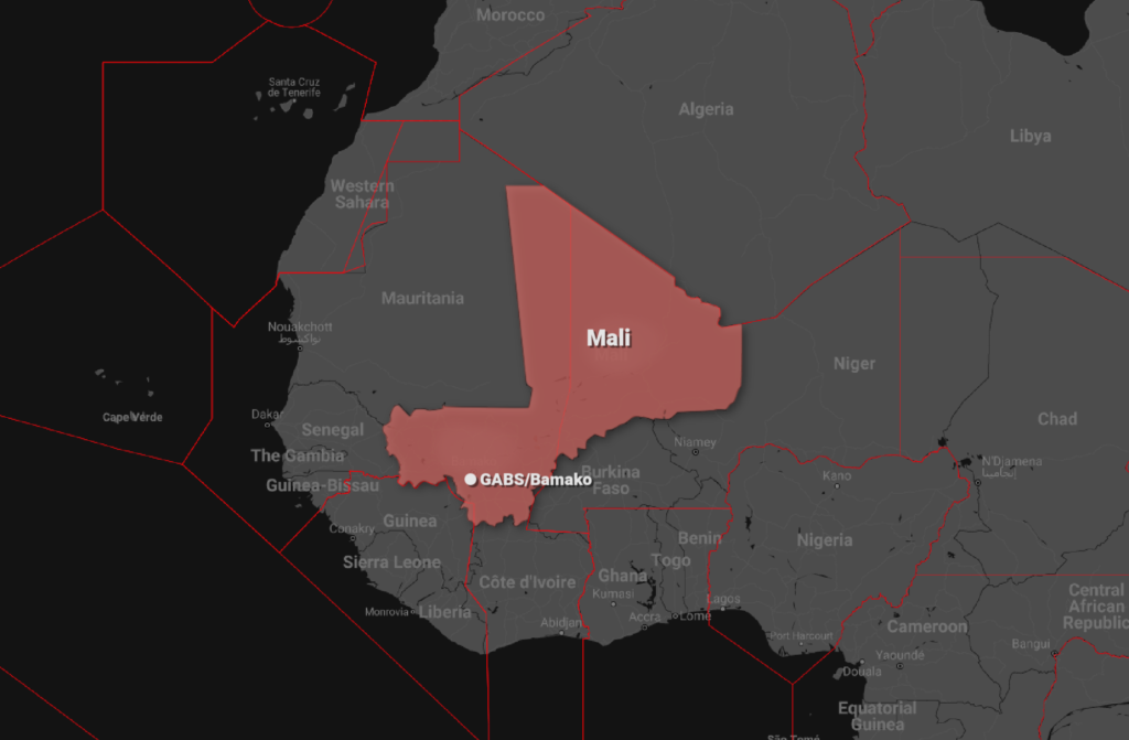
- Nigeria have a big, ongoing shortage.
Although initially due to a batch of poor quality fuel, the situation has been growing as the costs of buying in more keep rising. This has been impacting domestic and some Interational airlines for over a month now. We wrote about it here.
- Laos have a nationwide shortage but reports are not clear as to whether this impact aviation fuel as well.
- Peru have seen protests and strikes in the transportation sector over rising fuel prices. There are no reports of this impacting aviation yet.
- Sri Lanka has also been seeing an increase in protests over rising economic issues including fuel shortages. An FBO at VCBI/Colombo-Bandaranaike informed us that jet fuel supplies are good.
- Pakistan are seeing rising demand, but are struggling to buy in fuel from their suppliers as Europe call in additional supply.
- DRC has a shortage in ground transport fuel. No impact reported on aviation fuel, but significant security issues due protests.
- Sierra Leone have a notam advising Jet A1 only available for scheduled flights at GFLL/Freetown until at least April 20.
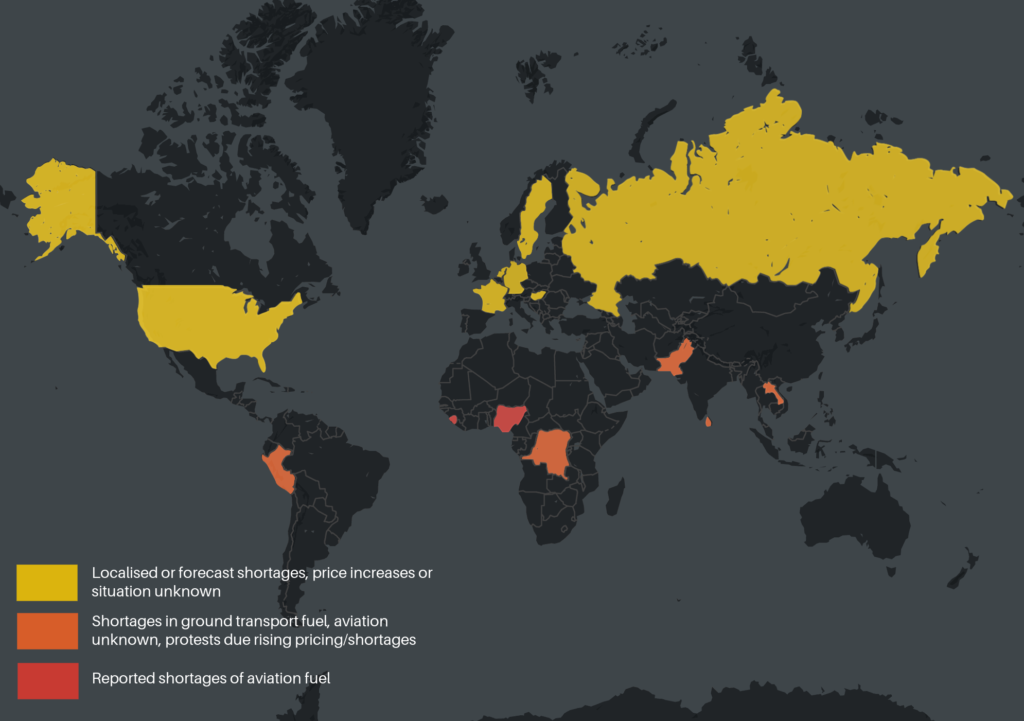
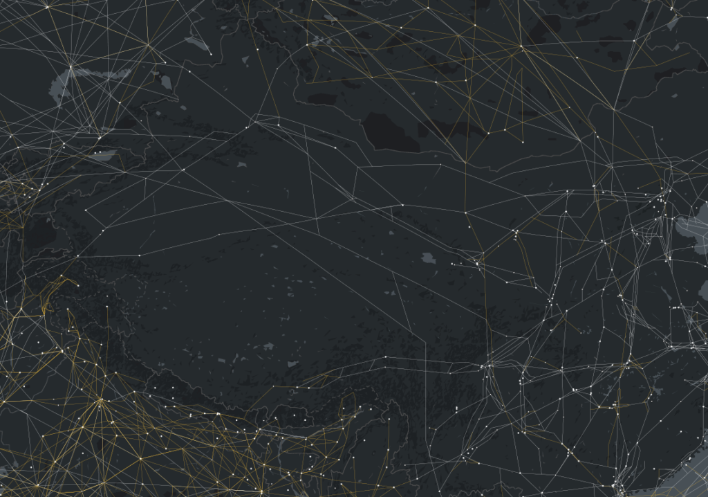
Fuel Shortage Map (12/4/2022)
What to do about it?
- Keep an eye on notams
- Confirm availability with agents prior to heading in
- Consider signing up to services such as AvHopper that can keep updated on fuel costs and availability
- Tanker where possible to maximise cost efficiency
- When planning alternates consider fuel availability
- Think about crew security on the ground if laying over, and crew transport issues
- Share it if you operate to an airport or region and experience fuel issues.
You can let us know about it on team@ops.group and we will post an alert so others know about it as well.


 Congratulations to our first ever winner!


 Give it to me in plain English.
 So let’s look at the schemes.


 Nothing technical, just human.


 What do you need?