Hi again members!
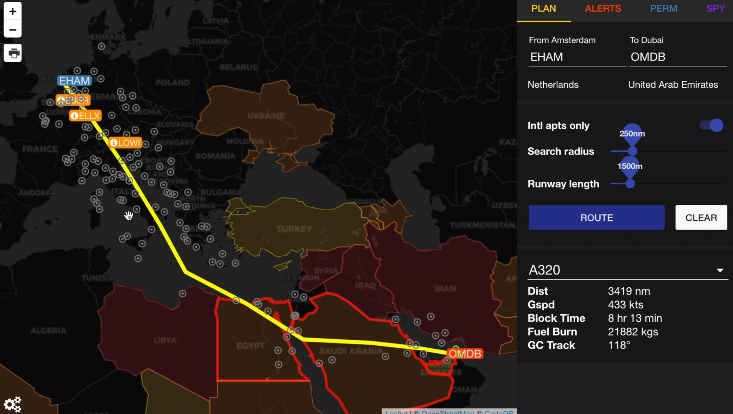
There’s a new version of GoCrow – the OpsGroup route analysis and planning map…
There’s some cool new stuff:
- SafeAirspace warnings are now on the map, you’ll see them very clearly. Click on a country for more info.
- All OpsGroup Alerts will show on the route
- Permit information is fed directly from the Permit Tool in your dashboard
- New underlays – all kinds of maps
- You can print a route briefing.
All of this is still in beta, there are still a few bugs and some design issues to work out, but it’s pretty solid. Have a play with it! Watch the video above to get a better idea of what it can do.
GoCrow is here: https://ops.group/dashboard/gocrow/
Comments welcome!
More on the topic:
More reading:
- Latest: FAA Warns on Runway Length Data and Overrun Risk
- Latest: EASA’s New Cyber and Data Risk Rule for Operators in Europe
- Latest: Airport Spy: Real World Reports from Crews
- Safe Airspace: Risk Database
- Weekly Ops Bulletin: Subscribe
- Membership plans: Why join OPSGROUP?






 Get the famous weekly