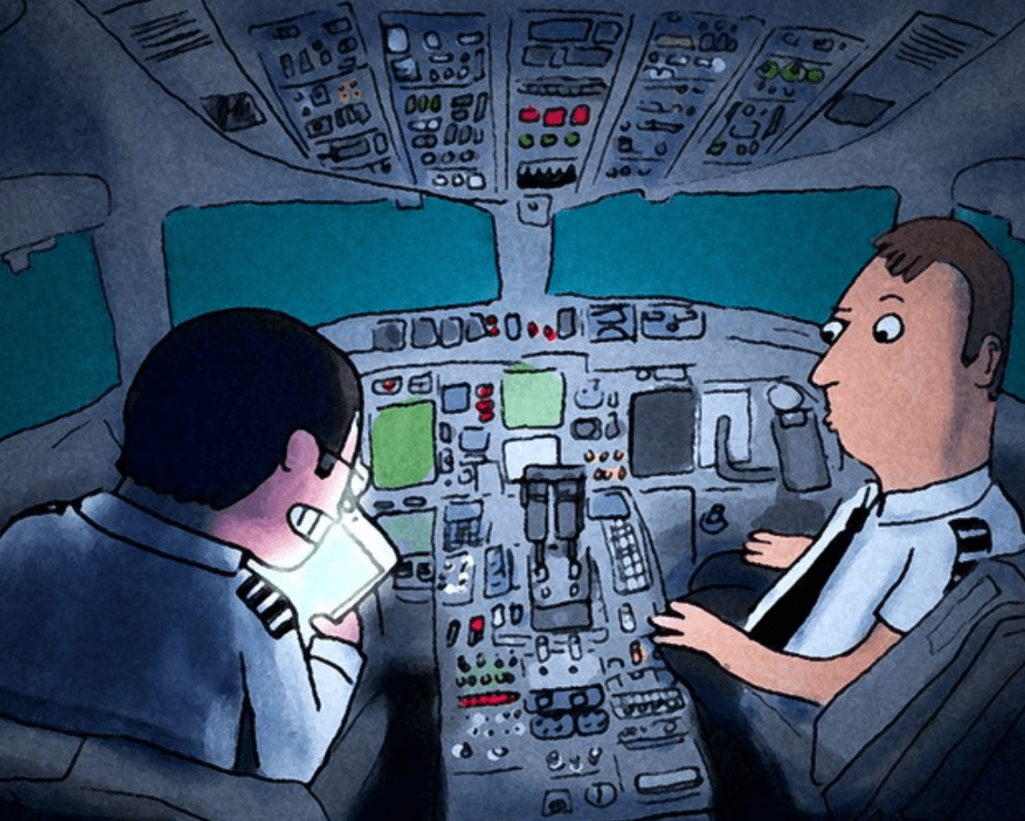
Winter is coming 09NOV With the clocks changing, it’s a reminder that we’re not far away from the snowstorms, deicing delays, cancelled flights, airport shutdowns, and those big invoices for de-icing fluid. Our new author Frank Young has an article.
Updated Canada requirements 09NOV From tomorrow, November 10, an eTA is now mandatory for flights to Canada (for most people), and there’s an update to flying to Canada with a previous conviction. Read the article.
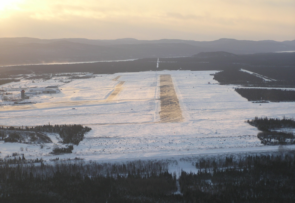
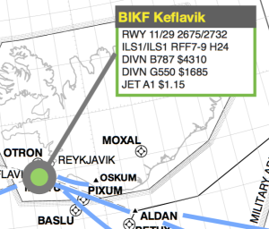
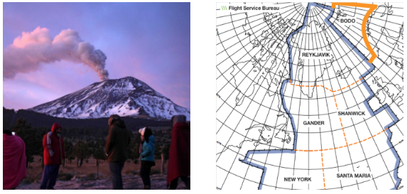
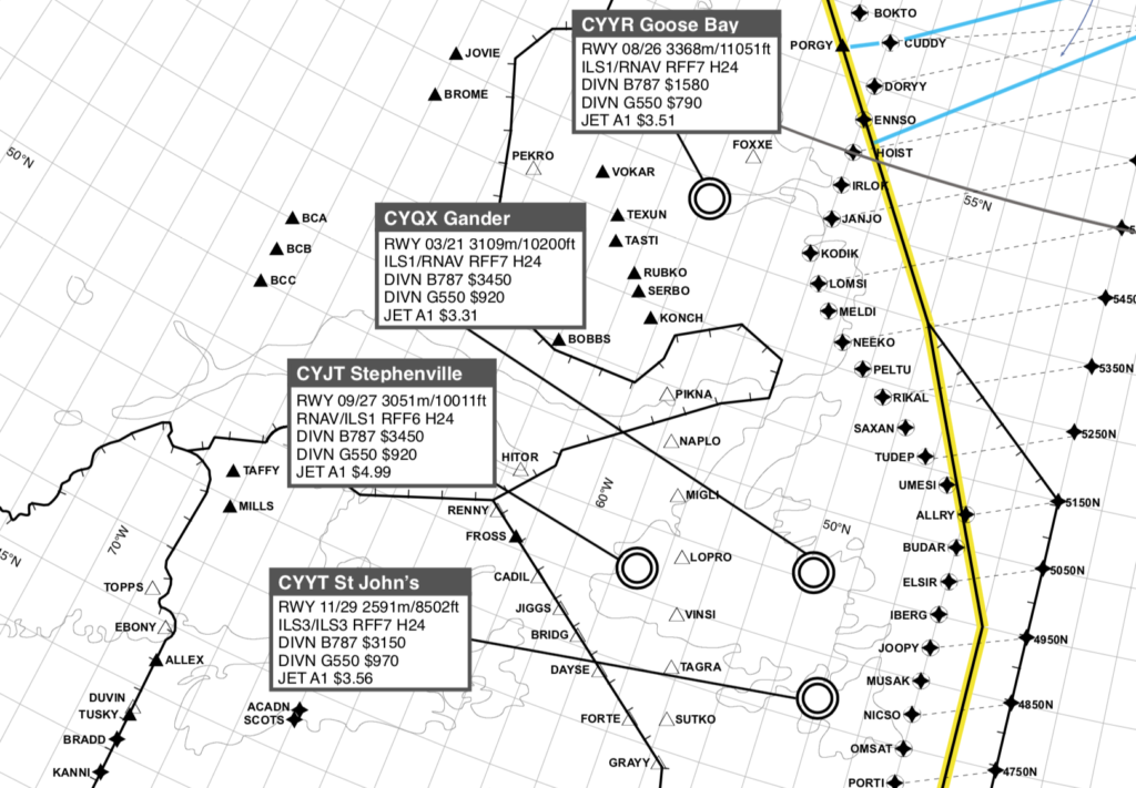
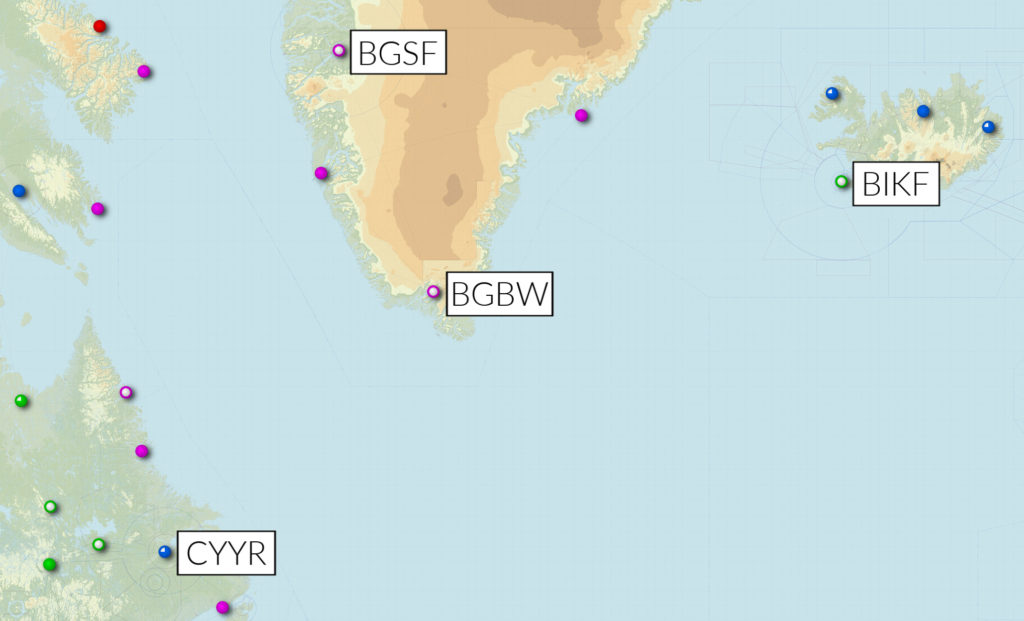
BIKF/Keflavik Long a destination for flight certification testing (because it’s cold and windy), will not accept test flights until February next year, thanks to runway renovation work.
ZZZZ/Worldwide Last week we ran a story about the new ICAO SID/STAR phraseolgies. In short, some countries are implementing, and others aren’t. We’re going to make a list of who’s doing what, so that you as an operator or pilot will have some idea. Can you help us? What is your country doing? Tell us at bulletin@fsbureau.org.
LTBA/Istanbul At about 0100 local time on 6 November, two people on a motorcycle opened fire outside Istanbul Ataturk International Airport, prompting a temporary closure. Reports indicate that authorities apprehended both suspects and did not find additional weapons or explosives on their persons. Officials briefly placed the airport on lockdown but reopened the facility at about 0130. The incident reportedly did not affect flights, and the gunfire harmed no civilians or police officers.
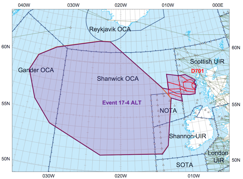
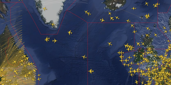
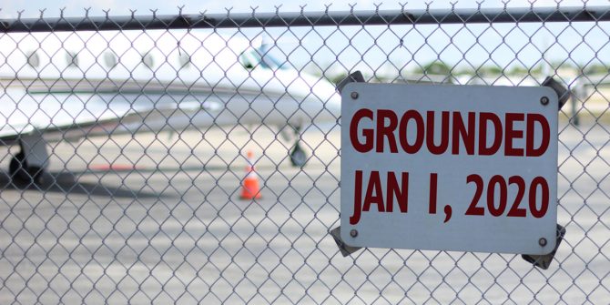
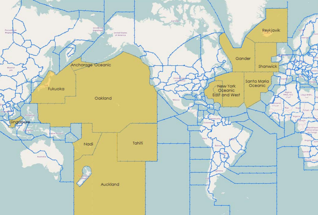
CZZZ/NAT Region The FAA has recently determined that time estimates provided by pilots in oceanic CTAs are less accurate than expected, particularly when adverse weather causes pilots to deviate from the planned course. These inaccurate estimates can compromise the separation of aircraft. Have a read.
YMML/Melbourne Be aware of recent hoax ATC calls. Someone with a handheld radio has been making “go-around” transmissions on the Tower frequency, and at least one aircraft has responded. Airservices says there have been 15 such transmissions in the last few weeks.
CZZZ/Canada The NBAA has issued useful updated info for flying to Canada with previous convictions – Canada is known for refusing entry based on DUI charges. Today, November 9, is also the last day that you can enter Canada without an eTA.
PWAK/Wake Island – an ETOPS alternate – is closed on 11NOV for Veterans Day. They do say they will attend with 30 mins notice, so maybe two ETOPS circles are required for that day. Check other US ETOPS alternates on this date also.
UCZZ/Kyrgyzstan Since 4 November, if you’re staying for longer than 5 days, you must register with the local authorities.
PKMJ/Majuro is downgraded to Cat 6 until November 23, which may affect some operators using this as an ETOPS alt.
EGNX/East Midlands airport has some weekend closures for the next six weeks.
VIZZ/India announced on 8 November that 500 and 1,000 rupee banknotes will cease to be legal tender as of 0000 local on 9 November 2016.
EVLA/Liepaja (one of Latvia’s three international airports) is now closed to all operations. They say they will be open again in Spring 2017. Fingers crossed.
LAZZ/Albania has been experiencing heavy rains, high winds and flooding throughout the country, causing road blockages, school closures, and disruptions in ferry services. The army has been mobilized for rescue and relief operations.
LFLL/Lyon If you’ve been using LFLL as an alternate at weekends, you’ll have to cut that out from December 10th, they don’t want weekend diversions of non-sched flights.
EGKK/Gatwick has advised of a new series of rail strikes that will run through to January next year.
MHTG/Central America FIR reminds operators that a CENAMER notification by AFTN is required for all flights planning to enter the airspace.
MTZZ/Haiti The US has published updated advice for Haiti: U.S. citizens are advised not to travel to the southern peninsula of Haiti, commonly referred to as the “southern claw.” The U.S. Embassy has currently banned unofficial travel to the southern peninsula and allows official travel only after consultation with its security office. There is widespread devastation throughout the southern claw with the most affected areas on the western tip of the peninsula. Travelers can expect difficult travel conditions with roads made impassable by landslides, damaged roads, and bridge failures. There is also widespread damage to buildings and infrastructure, including gas stations and cell towers, loss of electricity, and shortages of food and potable water. U.S. citizens who choose to travel to the southern claw in spite of these risks should carry sufficient water, food, fuel, and medicine to last longer than their anticipated stay. The security environment around the southern claw is fluid and uncertain.
LFOB/Paris Beauvais is closed overnight from 2200 to 0600Z, for 14-25 November inclusive, due to stuff.
HAZZ/Ethiopia On November 8, the Command Post – the body tasked with implementing Ethiopia’s state of emergency – lifted the restriction imposed on foreign diplomats, which restricted them from traveling more than 25 mi/40 km outside of Addis Ababa. The Command Post also lifted and revised several other state of emergency provisions; however, the changes are minor and are not likely to affect the current situation. The curfew and communication restrictions remain in place
NFTF/Tonga Fua’amoto (the main airport) has new operating hours – these are, in UTC: 1600 SUN TO 0530 MON, 1025 MON TO 0800 TUE, 1600 TUE TO 0530 WED, 1000 WED TO 0800 THU,0900 THU TO 1200 THU, 1600 THU TO 0530 FRI, 1600 FRI TO 0800 SAT. They’ll accept div traffic outside these hours, call +676 22 608 – but prefer no surprises on Sundays.
OMAA/Abu Dhabi will see heavy traffic for the Grand Prix on November 27, avoid if possible.
SBZZ/Brazil The office that processes Foreign Civil overlight and landing permits has updated hours of operation: Mon-Fri 1230Z-2230Z.
SBCT/Curitiba airport would like 4 hour PPR notice for non-scheduled flights, and request that you call them on 55-41-3381-1478 to arrange that.
SPJC/Lima, Peru has an upcoming APEC meeting 14-21 November, with a decent increase in traffic expected, and a few restrictions. They’ve also warned pilots to pay attention to radios and transponder codes to avoid them sending up the jets – good advice.
TVSV/ET Joshua Airport is closed due to flooding.
VECC/Kolkata Radio has a new HF frequency: 8861, with hours 1330Z-0130Z. Use this if 6556 or 10066 isn’t working for you.
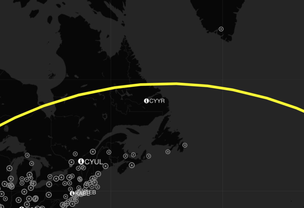
CZQX/Gander is going to auto-send you a “Confirm Assigned Route” message from 01DEC, on entry into their OCA – if you are FANS 1/A equipped. If you’re not sure how to feel about that, read our previous article.
LCCC/Nicosia There’s a good deal of mil activity – UN, and Russian – in the Cyprus region at the moment. Read the LCCC and surrounding FIR Notams carefully. Oh, and if you’re not up to date on your Greek-Turkish FIR dispute, add LGGG and LTBB to that. As 2016 draws to a close, enough regional history has been published for an entire novel. This weeks Notam series covers the 1923 Lausanne Peace Treaty.
NZZC/New Zealand published a change to SID procedures today, and our brain hurts. We’re not sure if this is related to the 10NOV ICAO SID/STAR changes, or .. something else. If you’ve got it deciphered, let us know. THE STANDARD INSTRUMENT DEPARTURE (SID) SPECIFIES IN BOTH DIAGRAMMATIC AND NARRATIVE FORM ANY OF THE FOLLOWING: THE DIRECTION OF TURN, HEADINGS, TRACK, DISTANCES, SIGNIFICANT POINTS AND ALTITUDE REQUIREMENTS. WHERE TRACKING TO OR FROM A NAVIGATION AID IS NOT POSSIBLE, DESIRED TRACKS ARE SHOWN AND DUE ALLOWANCE FOR WIND IS TO BE MADE. AIRCRAFT ARE TO CONTINUE CLIMBING THROUGHOUT THE SID UNLESS IN COMPLIANCE WITH PUBLISHED ATC MAINTAINS, DEPARTURE MINIMUM SAFE ALTITUDE (MSA) OR AS OTHERWISE INSTRUCTED. WHERE CONTINUOUS CLIMB TO THE END OF THE SID IS NOT REQUIRED A DEPARTURE MSA MAY BE DEPICTED ON THE RELEVANT CHART. THE DEPARTURE MSA REPRESENTS THE LOWEST ALTITUDE FOR OBSTACLE CLEARANCE ALONG THE ENTIRE DEPARTURE ROUTE (INCLUDING TRANSITIONS). IT REMAINS THE PILOT’S RESPONSIBILITY TO MEET SUBSEQUENT ENROUTE MSA/MINIMUM FLIGHT ALTITUDE (MFA)/MRA/MEA REQUIREMENTS APPLICABLE AFTER SID TERMINATION. DEPARTURE MINIMUM SAFE ALTITUDES DO NOT ENSURE CONTROLLED AIRSPACE CONTAINMENT.
OEZZ/Saudi Arabia has issued an extension of the policy that requires all aircraft with a destination in Yemen to first land in OEBH/Bisha – through to 08FEB next year. The only exceptions are the UN, Red Cross, and MSF.
VHHK/Hong Kong is going to move to a new ACC and ATC Tower towards the end of this month. There will be delays. The actual date hasn’t yet been notified, we’ll let you know when we hear.
View the full International Bulletin 09NOV2016

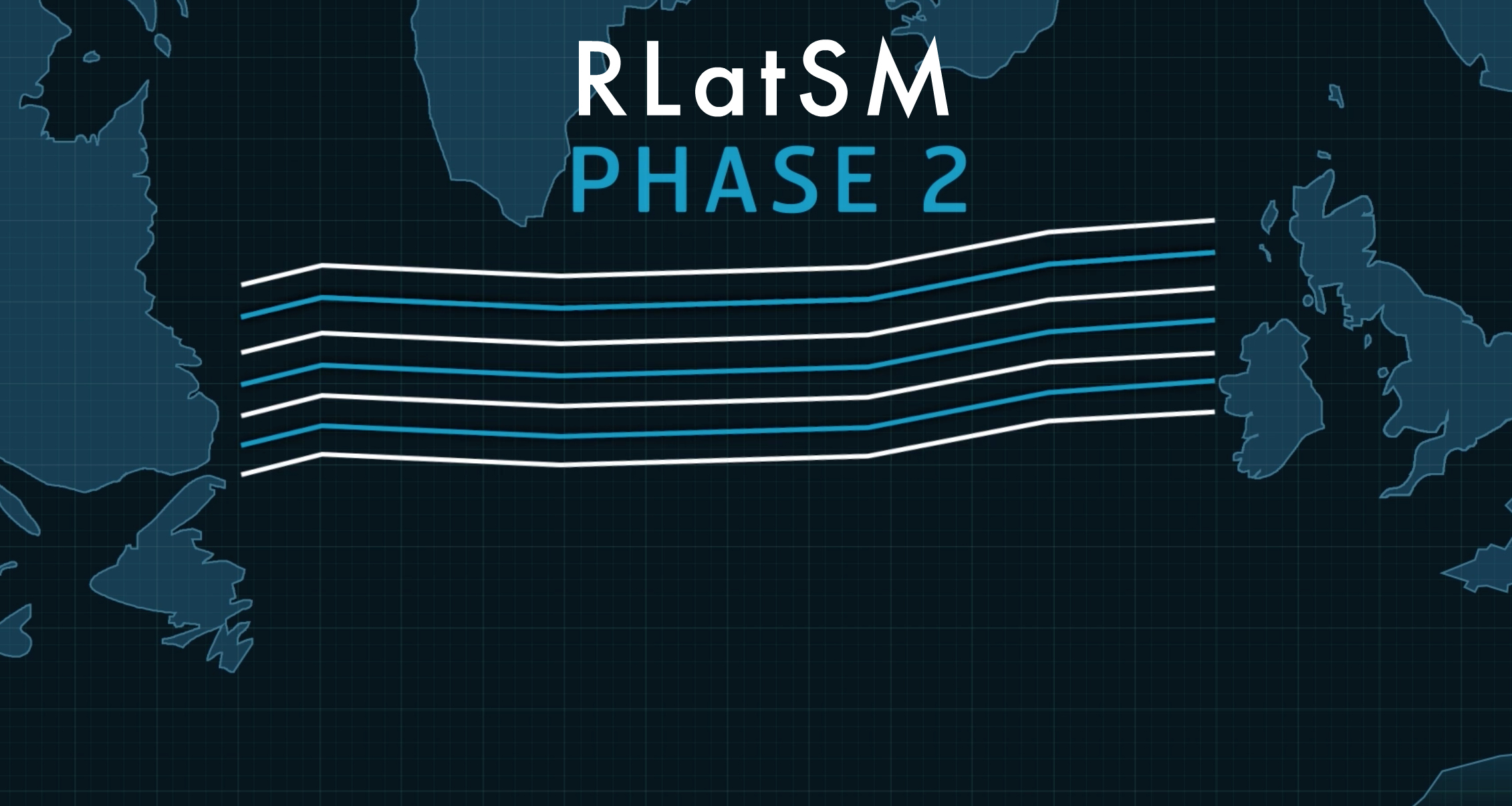
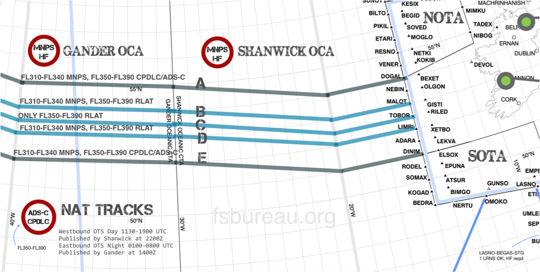
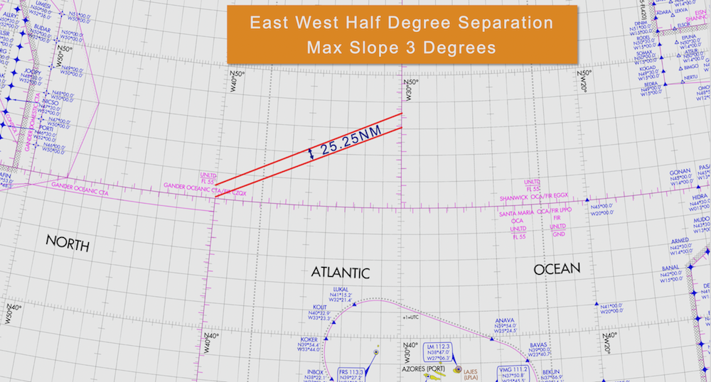
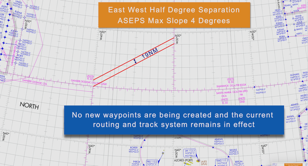
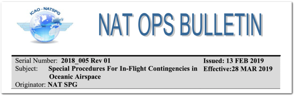
 GPS technology allows modern jets to fly very accurately, too accurately it turns out sometimes! Aircraft can now essentially fly EXACTLY over an airway/track laterally (think less than 0.05NM), separated only by 1000FT vertically. A risk mitigation strategy was proposed over non-radar airspace to allow pilots to fly 1-2 nautical miles laterally offset from their track, randomly, to increase flight safety in case of any vertical separation breakdown.
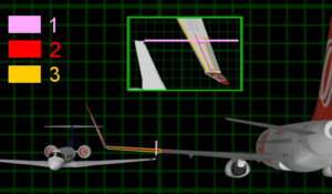 Here are some interesting
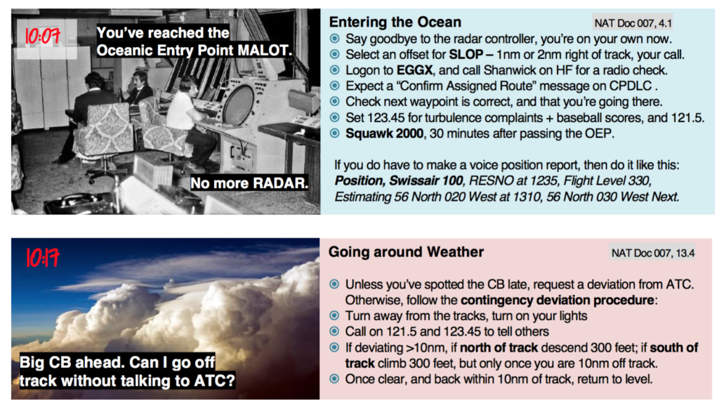
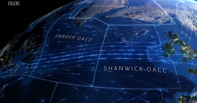
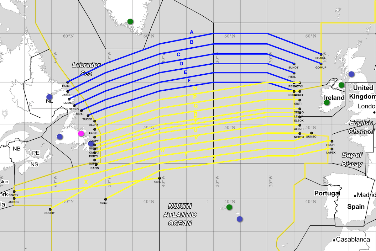
 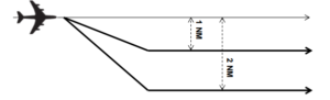 It was 2004 when SLOP was adopted in the most congested non-radar airspace in the world, namely the North Atlantic.
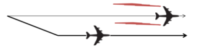 Consider some best practice advice:
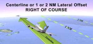 Our friend Eddie at


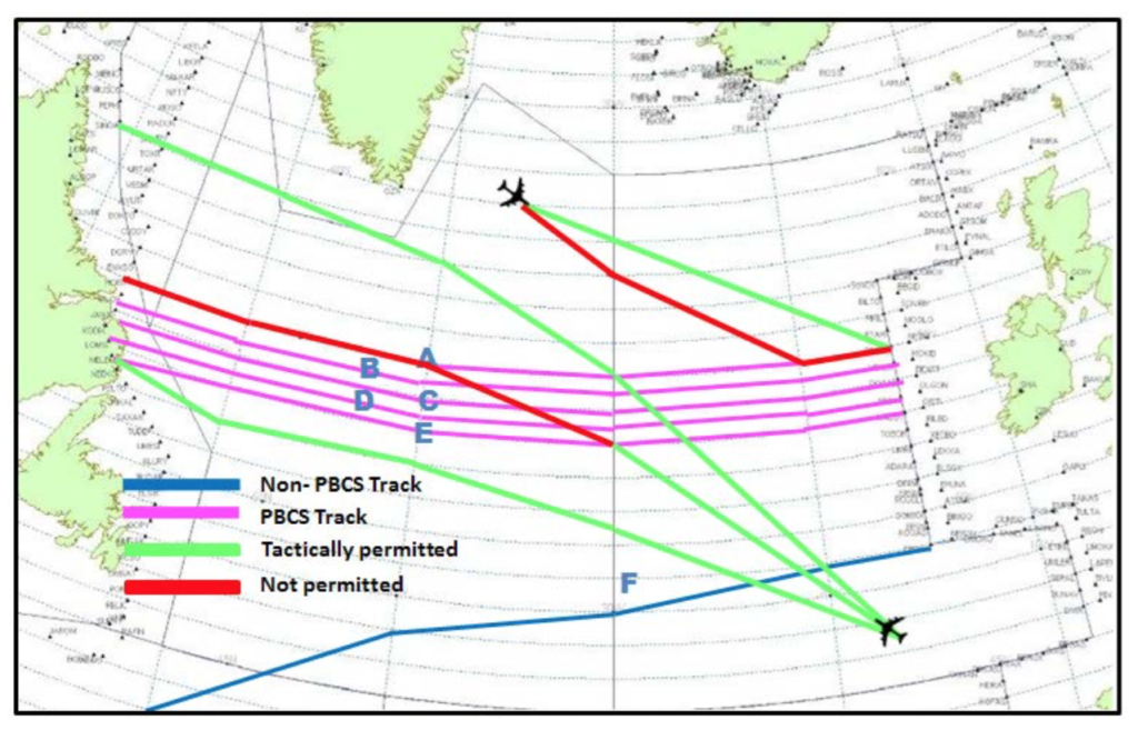
 There are two key buzz words, so let’s define them. They are interlinked with RNP – Required Navigation Performance.
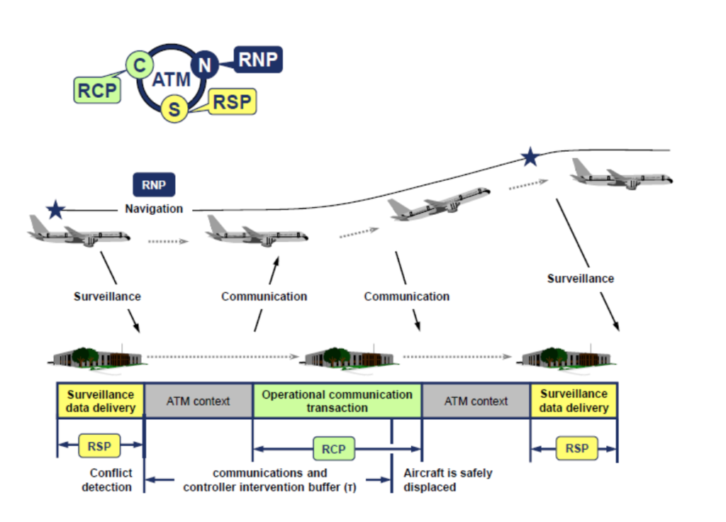
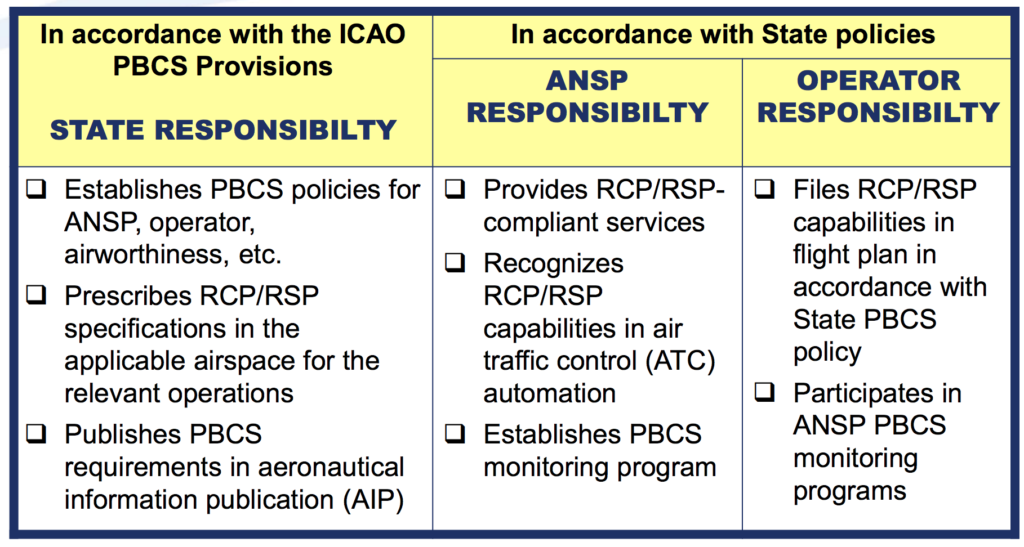
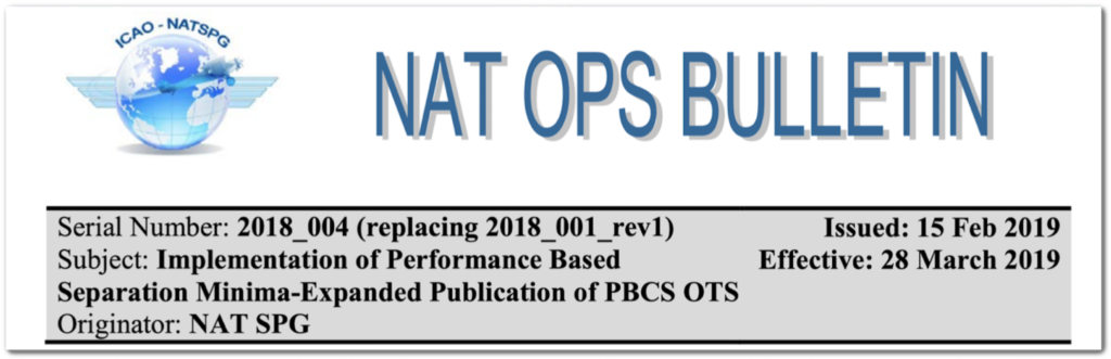
 Requirements vary from state-to-state on the exact procedure for obtaining approval. It’s important to note that not all aircraft are automatically PBCS ready (refer to your aircraft manufacturer and your airplane flight manual).
 Ok this is the funny part of this story. The short answer, probably not.
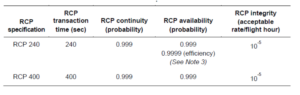
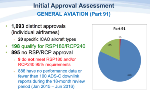 If you do not have RCP240/RSP180 approvals you will always have the larger separations, e.g. 10-min, applied, and not be eligible for the lower standards in cases where it may be beneficial.