2020 was a long, sometimes challenging, sometimes exciting, sometimes sad… and always very Covid filled year!
We wanted to take a quick look back at some of the things which really stood out to us over the past twelve months.
So we wrote a list…
The list became a little poem…
And then, as a logical next step, the poem turned into an ABC wall chart!
Here it is in all its glory!
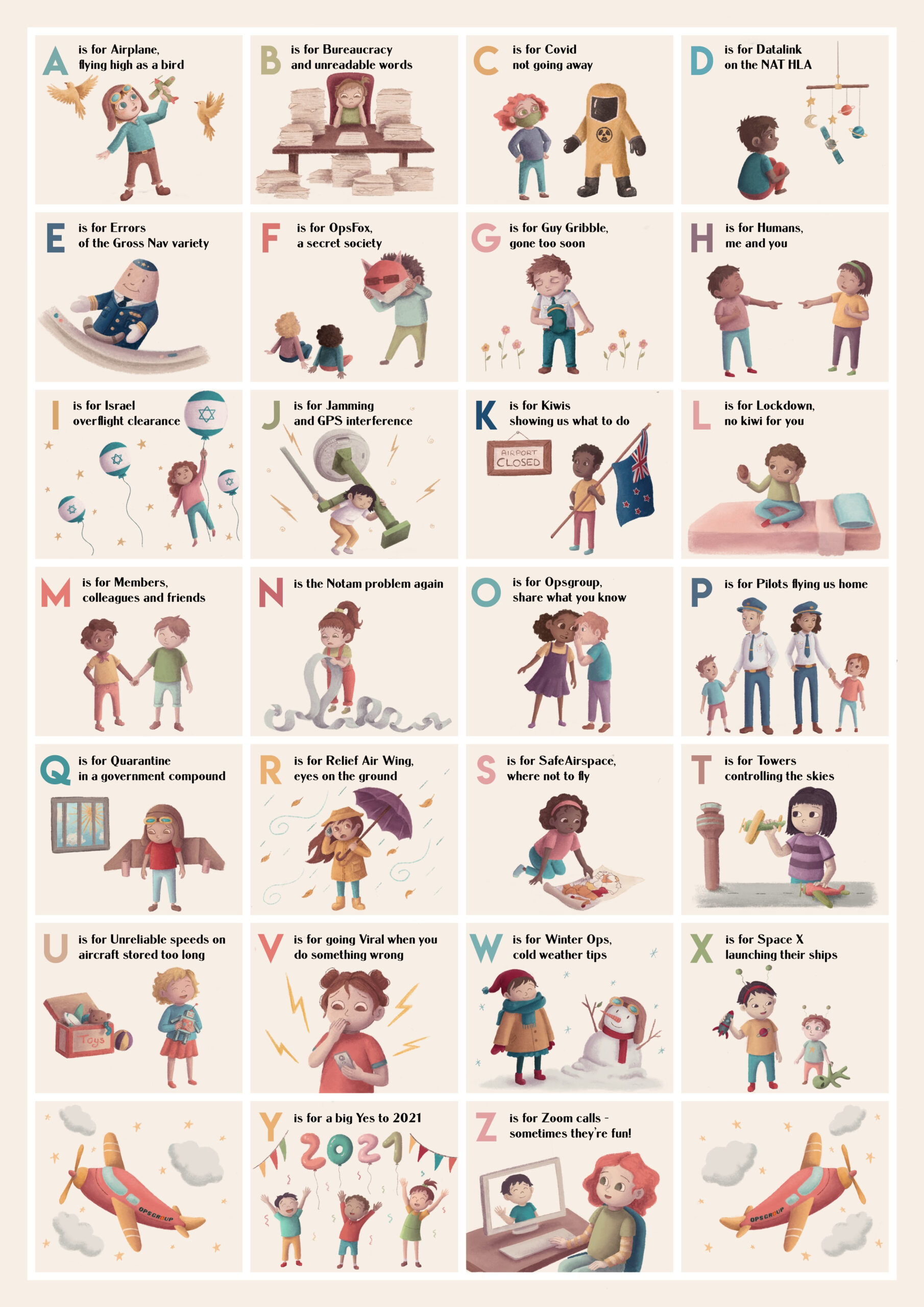
Click to download PDF
You can download a nice hi-res version by clicking on it. Print it out, stick it on your wall, send it to a friend – whatever you like.
The OPSGROUP 2020 Wallchart was designed by our wonderfully talented artist friend, Cecilia La Rosa, and you can see more of her amazing work here.
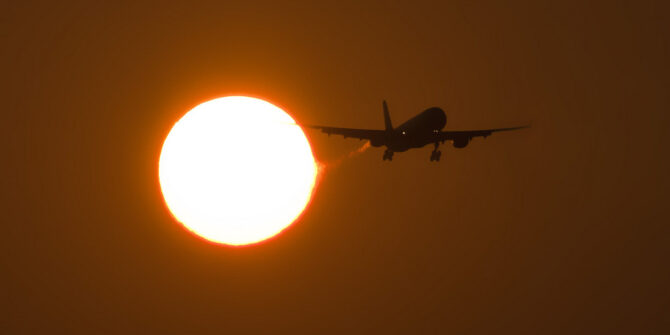
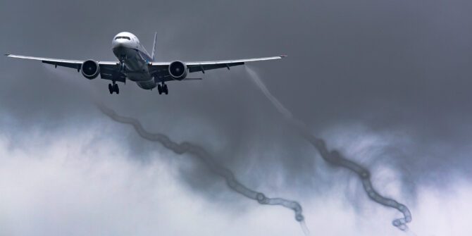
 A is for Airplane, flying high as a bird
As always, airplanes were on our mind. The safety of them, the places they are going, and the people flying in them.
 B is for Bureaucracy and unreadable words
Messy Notams, changes to charts, new regulations, old documents – we tried to keep you updated you on changes you needed to know about, mainly by writing things in an easier-to-read way.
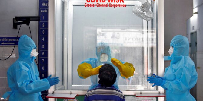
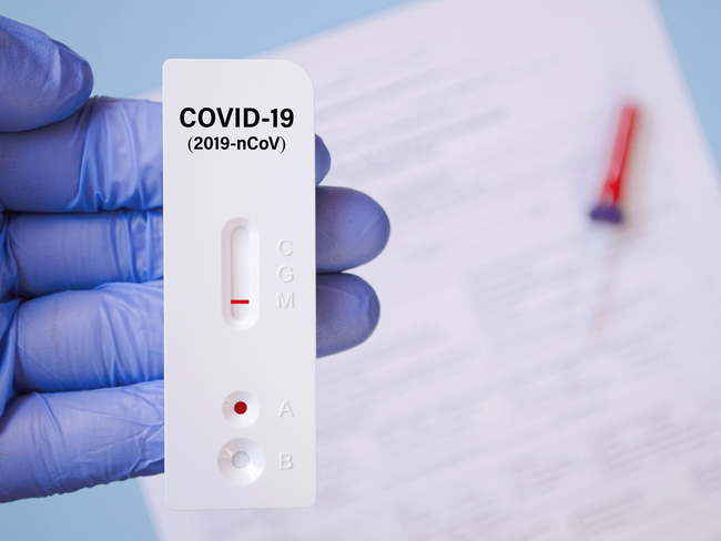
 C is for Covid not going away
No 2020 wall chart would be complete without a mention of Covid. Traffic across the world fell by almost two thirds. Then it started to improve, then it got a bit worse again, and then the vaccine came out – unfortunately, shortly followed by a new strain of the virus… Here’s hoping 2021 sees the end of it.
 D is for Datalink on the NAT HLA
The Great North Atlantic Datalink Mandate. It went into the final phase on 30 Jan 2020, and if you want to fly between FL290-FL410 you must be equipped with CPDLC and ADS-C… But then due to Covid this got delayed a number of times, with Shanwick saying it will remain suspended until 25 Feb 2021.
 E is for Errors of the Gross Nav variety
The FAA changed their definition of Gross Navigation Errors to mean anything more than 10nm. You used to have 25nm before you got into trouble (except for on the NAT HLA which was always 10nm).
 F is for OpsFox, a secret society
Business at the Lucky Star Chicken restaurant was up in 2020. Goat Curry (number 64 on the menu) proved to be a popular favourite. Join the secret society and submit your reports.
 G is for Guy Gribble, gone too soon
Our friend and colleague Guy Gribble passed away on 26th October 2020.
Guy joined OPSGROUP on Day 1 (some four and a half years ago), and was an ever-present contributor, collaborator, mentor and friend to us. If you’ve ever sent us an email with a difficult question and received a good answer, the chances are that Guy Gribble was the man behind the scenes who helped us figure it out for you. We lost count of the number of times Guy would post replies on Slack giving people advice and guidance.
The NBAA will have an award named after Guy for “Outstanding Contribution” – which tells you all you need to know about the impact he had on the industry.
Thank you Guy and Rest in Peace – your legacy continues.
 H is for Humans, me and you
Our mission is to make aviation human-friendly for us all.
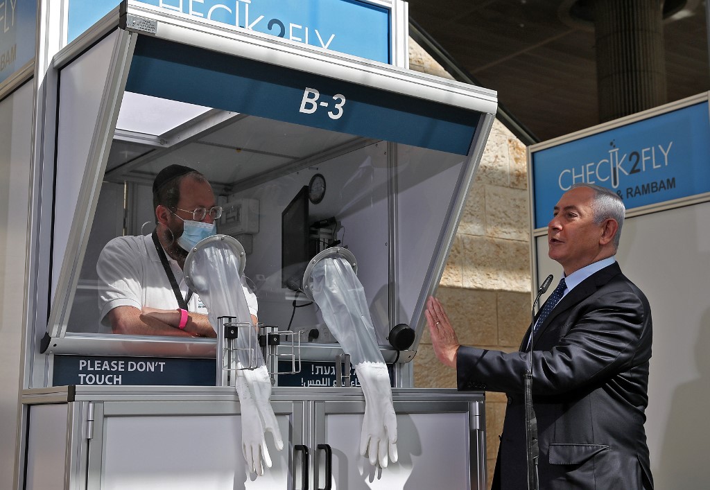
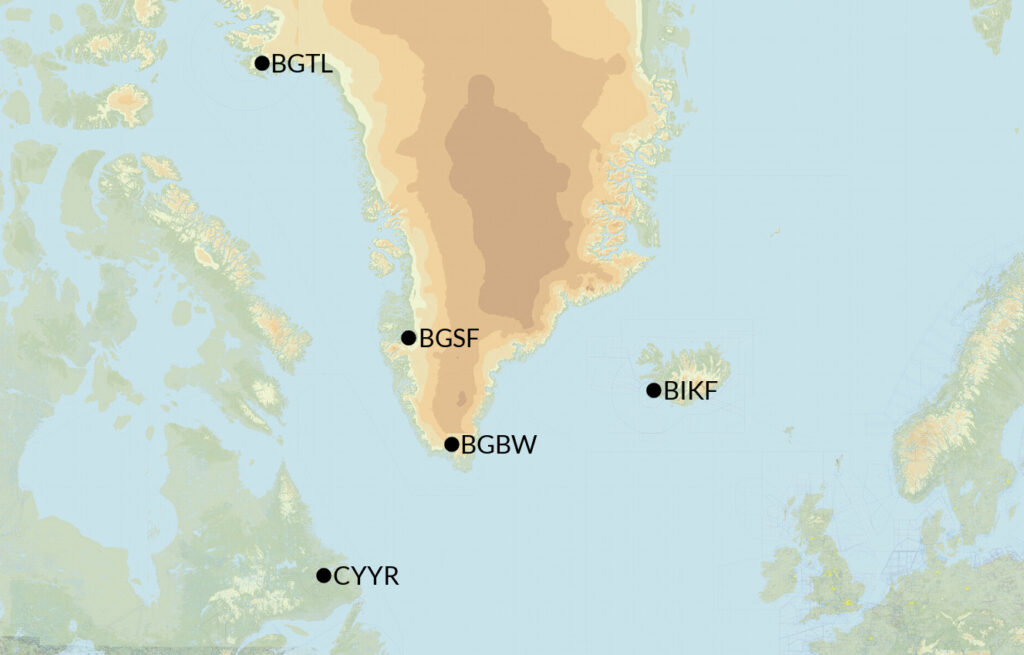
 I is for Israel overflight clearance
Big news from the end of 2020 as Israel rebuilt relationships with the UAE, and for the first time in decades we saw a flight between the two nations. Israel then opened their airspace for overflights, and Jordan allowed Israeli bound flights to pass through their airspace as well. The overflights mean shorter, more efficient routings, and it’s a highlight of the year that friendships are being rebuilt between Israel and neighbouring regions.
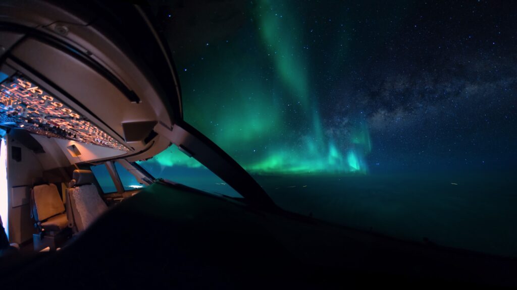
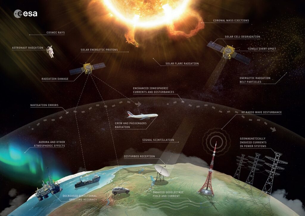
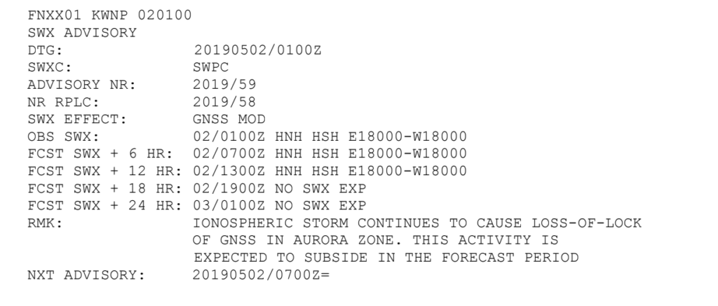
 J is for Jamming and GPS interference
GPS Jamming remained an issue, particular across Eastern Mediterranean, Middle East and Caucasus, with thousands of reports of jams through the year. The story is bigger than just the equipment issue though, it is a political and conflict related one too. We wrote this article on it to help give a bit more info on the issue.
 K is for Kiwis showing us what to do
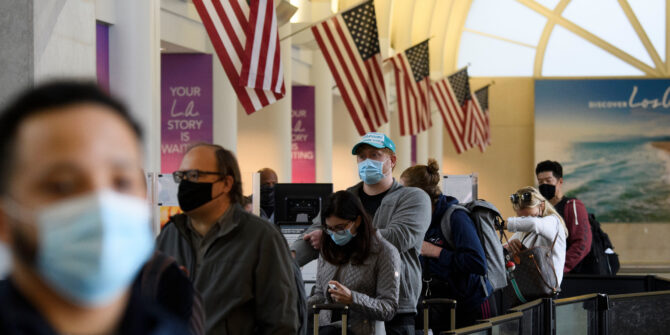
New Zealand led the way on how to deal with the Covid situation, managing to go nearly a month with no cases. They slowly started to reopen a travel corridor with Australia, but remain strict on their entry requirements.
 L is for Lockdown, no kiwi for you
Lockdown was (and still is) a big part of 2020. For some it was a difficult time away from family, but for others it allowed time for new skills to be learned, hobbies to be enjoyed, and a fair few Zoom quizzes to take place. We will keep reporting on the big Covid changes but are definitely looking forward to a day when no Covid alerts are required anymore.
 M is for Members, colleagues and friends
We’re grateful to everyone in the group for showing up, trading stories, experiences, and information, having regular chats, and in turn keeping us all safe and up to date.
 N is the Notam problem again
The Notam problem hasn’t gone away, but we are getting there…
 O is for OPSGROUP, share what you know
OPSGROUP is more than just the team working here – it’s all the members and the knowledge and information you all share.
 P is for Pilots flying us home
2020 was a tough year on pilots, and we think they deserve a big Thank You for continuing to fly our families and cargo safely around… but we also thank the cabin crew who looked after us onboard, the ATC controllers who kept the skies safe, the engineers who fixed the airplanes, the dispatchers and planners, handlers and airport workers, and everyone else affected by Covid and who kept working hard. So P is really for People.
 Q is for Quarantine in a government compound
Quarantine can be tough. Trying to work out a country’s Covid-related entry rules is one thing, but where you get locked up and how long for is quite another. So Q is for quarantine questions, queuries about Covid-cancelled flights, and all the queues of people who want to go flying again. Let’s hope 2021 is far Quieter on all things Covid.
 R is for Relief Air Wing, eyes on the ground
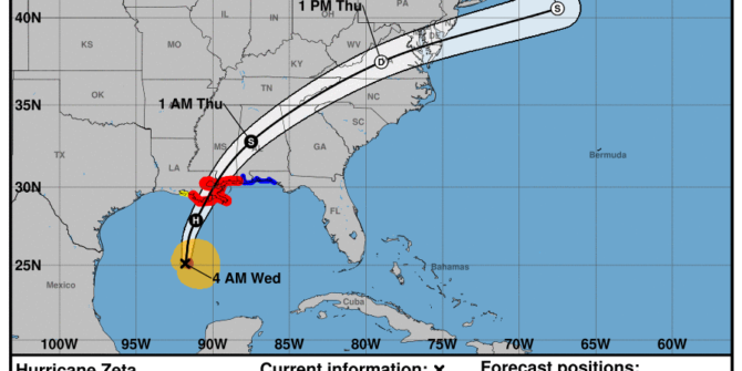
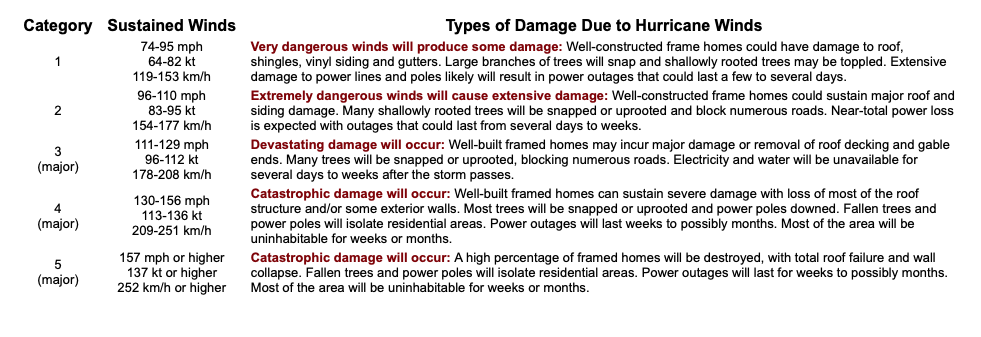
When a hurricane hits, the world responds. But before anyone can fly in to help, they need to know what things look like on the ground. After Hurricane Dorian devastated the Bahamas in September 2019, no information was available for several days. Relief aircraft were waiting, but critical information was missing. What airports are open? Is there fuel available? Is there ATC? Where is help best directed? Learning from the lessons of Hurricane Dorian, the mission of Relief Air Wing is to get that critical information, provide it to the first responders, and help to coordinate the aviation relief effort.
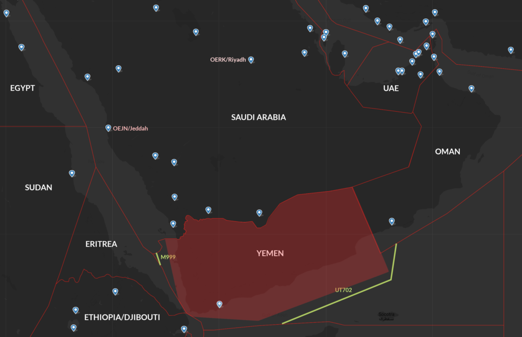
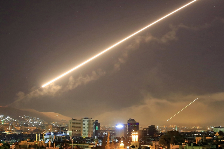
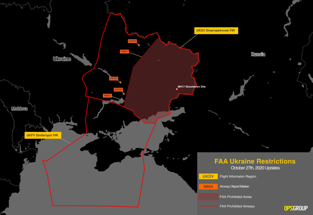
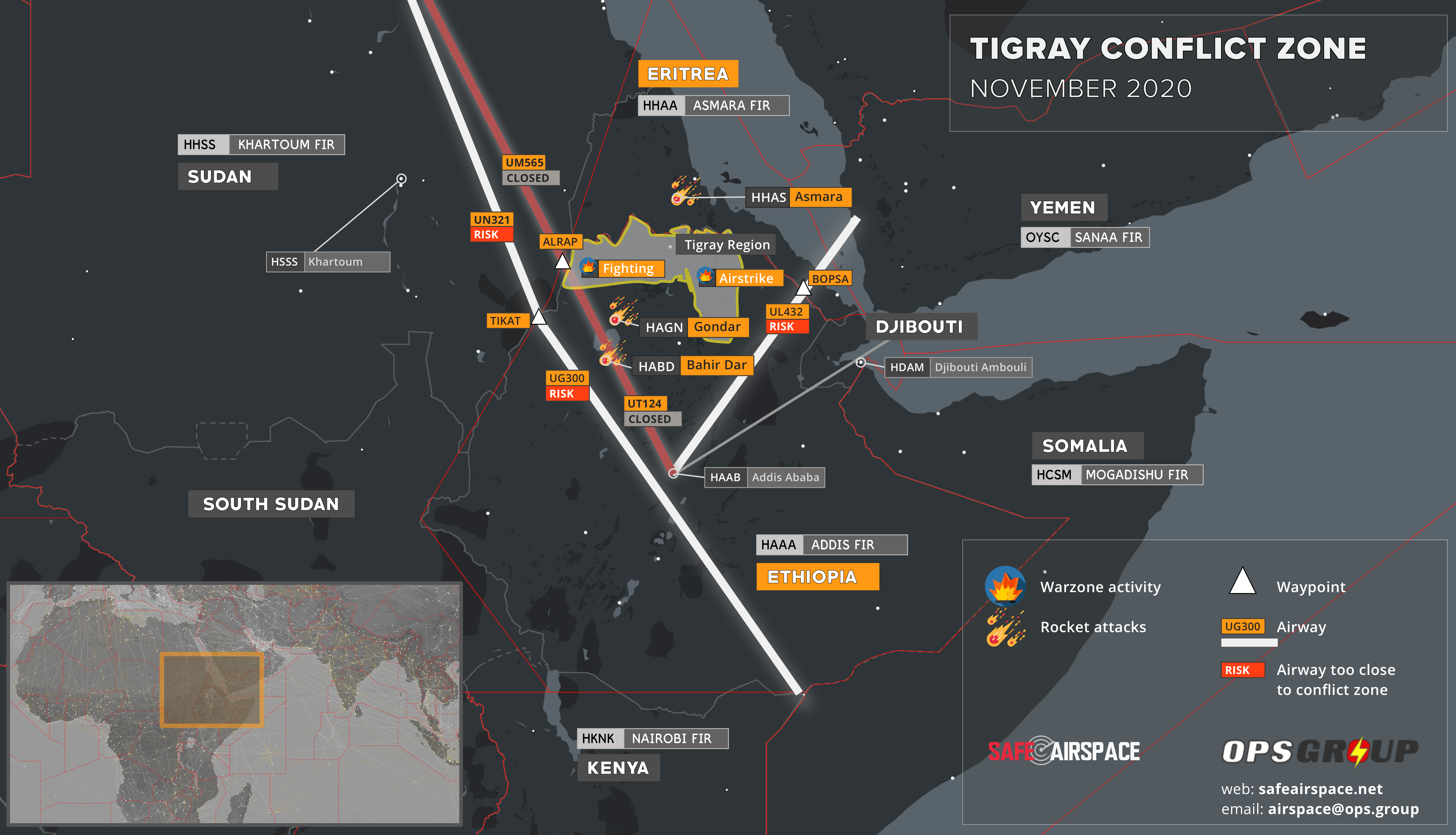
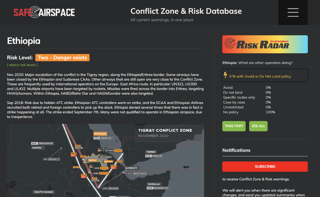
 S is for SafeAirspace, where not to fly
On 9th January 2020, we saw the tragic shoot-down of Ukraine Int Airlines flight 752 over Tehran by Iranian Armed Forces, having mistaken the aircraft radar return for an inbound missile. And just a month later, a passenger plane almost got shot down over Syria, after coming under fire from Syrian air defences.
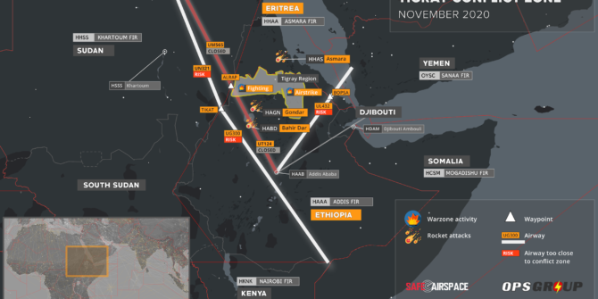
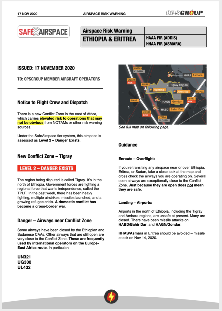
Throughout the year we’ve seen new conflict zones emerge, posing risks to overflying aircraft – from Saudi Arabia and Yemen, to Armenia and Azerbaijan, to Ethiopia and Eritrea.
Our sense of mission with Safeairspace.net is stronger than ever – to provide a single, independent, and eternally free resource for all airspace risk warnings, so that airlines and aircraft operators can easily see the current risk picture for unfamiliar airspace.
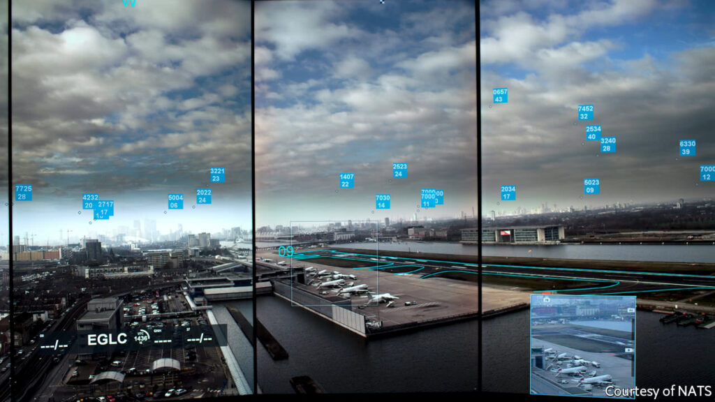
 T is for Towers, controlling the skies
Towers (and the ATC folk in them) controlled the skies splendidly this year. We also looked into what happens during “ATC Zero” events, particularly over the NAT HLA after we saw Gander East close briefly in December.
 U is for Unreliable speeds on aircraft stored too long
Unreliable airspeed incidents increased after bugs and beetles made nests in airplane probes – an unexpected consequence from Covid. And unreliable airspeed was not the only thing to look out for with long term storage.
 V is for going Viral when you do something wrong
From men on jet packs, to pilots drawing pictures in the sky, we laughed at some of the stories we saw this year. And not all were bad – the Don’t Rush challenge went viral as aviation communities from all over created their own Don’t Rush movies.
 W is for Winter Ops, cold weather tips
Winter is here – at least in the Northern Hemisphere. Here are 5 golden rules that could help you stay out of trouble during these colder months. Here’s a quick lowdown on freezing fuel problems as well.
 X is for Space X, launching their ships
We reported on a fair few temporary danger airspace areas through 2020, many of which were down to Space X and other rocket launches. The operational impact for earth flights kept us reporting, but we’re also a little excited at the developments in space flight. OPSGROUP GALACTIC might be a new idea for 2021…
 Y is for a big Yes to 2021
2020 has been tough – but we have faith that 2021 will be better. We hope borders open, vaccines roll out, Notams improve, airplanes get better, airspace gets safer, and aviation becomes more human!
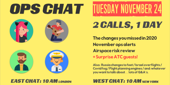
 Z is for Zoom calls – sometimes they’re fun!
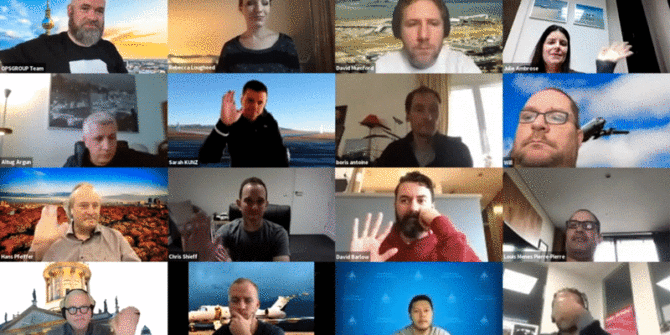
Our OpsChats were a big part of our year and we loved our 2-timezones-in-1-day Zoom call.
We look forward to seeing you all again in 2021!


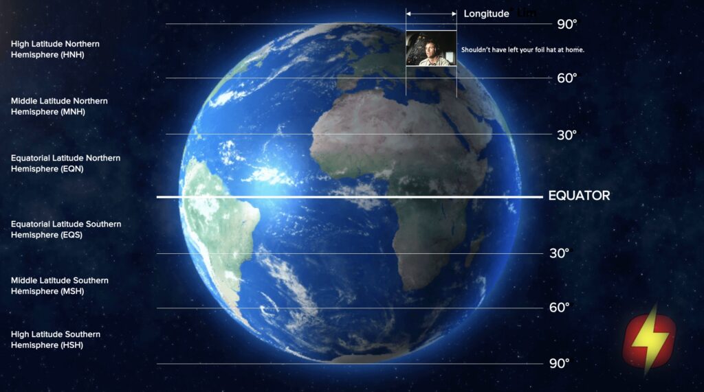
 So far they think the rule will remain in place until the end of January next year. Given the current

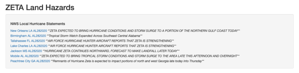
 Why does aviation hate them?
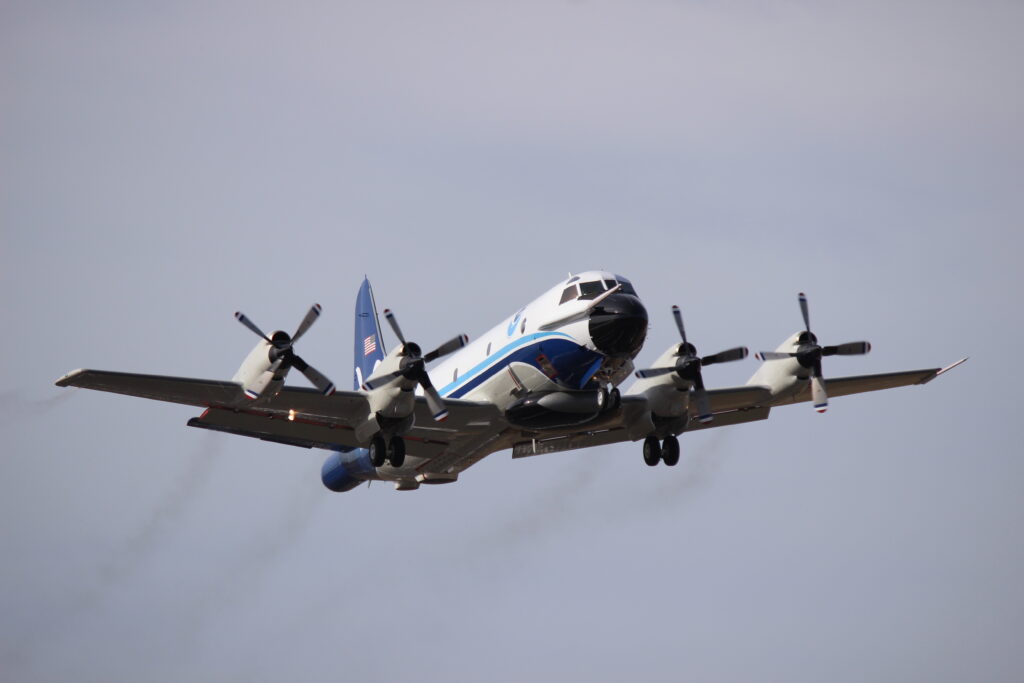 Satellites monitor storms as well, but mainly just send down horrifying photos of how massive they are.
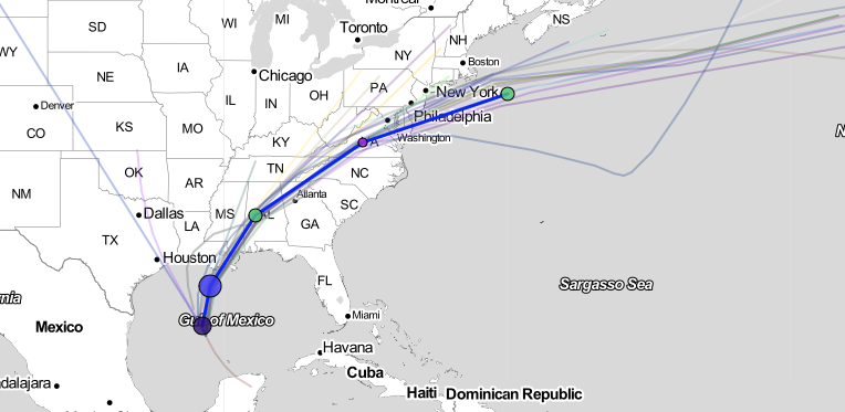
