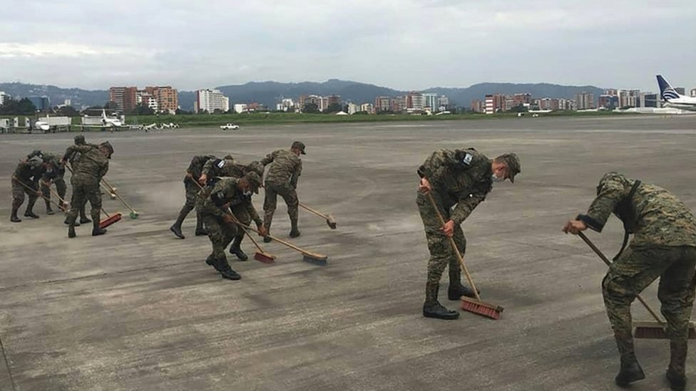
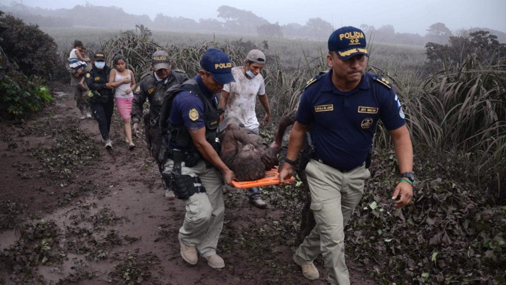
An eruption at Guatemala’s Fuego volcano on 3rd June resulted in the deaths of 25 people, and forced the temporary closure of MGGT/Guatemala City Airport. After the military cleared ash from the runway, the airport re-opened on 4th June, with the warning of delays due to ongoing runway inspections.
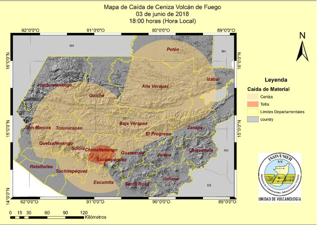
On June 3, Guatemala’s Institute for Vulcanology (INSIVUMEH) published a map showing the volcanic ash distribution (shown on the map as the area in orange, labelled ‘Ceniza’):
Further reading:
More on the topic:
- More: CENAMER Flight Planning Requirements
- More: North Atlantic Volcanic Threat
- More: Keep an eye on Shiveluch
- More: Tonga: Major Eruption in the South Pacific
- More: Honduras has a New Airport
More reading:
- Latest: Gander’s Bringing Back CPDLC Oceanic Reroutes
- Latest: EU Temporary Admission of Aircraft – Busting Myths
- Latest: US Ops Update: Speeds, Squawks and Slippery Runways
- Safe Airspace: Risk Database
- Weekly Ops Bulletin: Subscribe
- Membership plans: Why join OPSGROUP?