


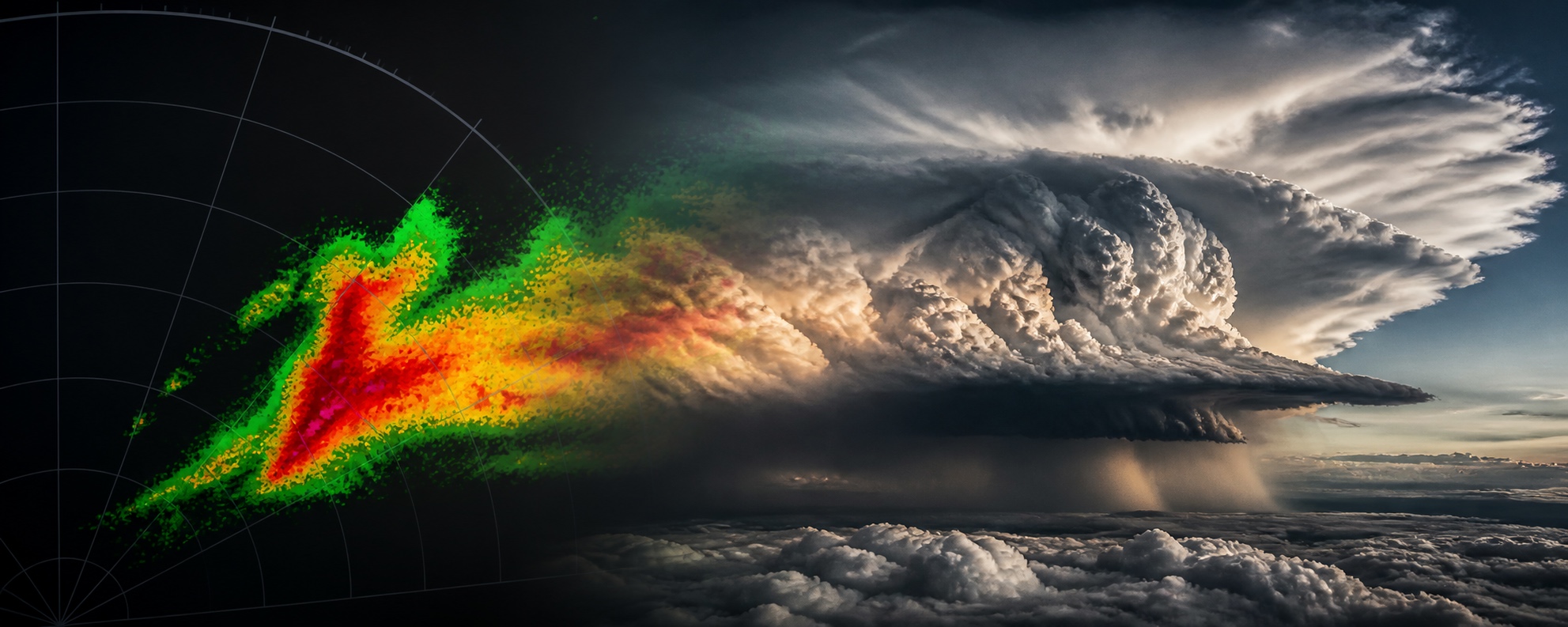

Five ways experienced crews still get caught out by weather that isn’t showing up the way they expect it to – and what we can actually do about each one.
- Radar attenuation can hide the worst cell behind the one you can already see, while rapidly building cells can outpace your radar scan even when you’re working the tilt correctly – as a recent Air France crew found out over Corsica.
- Dry microbursts and virga produce almost no radar or visual signature, and they’re a summer, high-desert, and monsoon-season problem as much as a classic thunderstorm one.
- Embedded convection inside a solid cloud layer can sit in the gap between two cells your radar simply can’t see through.
- Clear air turbulence and mountain wave give you no warning at all – no cell, no radar return, and sometimes nothing useful in the forecast.
- Supercooled large droplet (SLD) icing builds ice aft of your protected surfaces faster than de-ice equipment can clear it, which is why anti-ice needs to go on before you enter the conditions, not after.
Less than fifty seconds after the seatbelt sign came on, an Air France A320 descending into Corsica hit 31 seconds of turbulence and hail severe enough to break bones. The crew’s radar was working. They’d seen it building. They just ran out of time to do anything meaningful about what they saw. That’s the pattern behind every trap on this list – not equipment failure, not inexperience, but a hazard that doesn’t look dangerous until it’s too late to do much about it. Here are the five I brief for, and how I try to stay ahead of each.
1. Radar attenuation and shadowing – does the weather radar always tell the truth?
Let’s start with what actually happened to that Corsica crew, because it’s a near-perfect illustration of the first trap: attenuation, and its close cousin, tilt lag. Attenuation is the radar’s way of lying to you politely – your beam punches through a heavy rain shaft to reach the cell behind it, but the nearer cell eats most of the energy, and what bounces back comes home weak, green or yellow on your display when it’s actually a red core hiding behind a wall of rain. Tilt lag is the same trick played a different way: you’re working the radar exactly as you should, but a cell is building vertically faster than your scan rate and workload can keep up with.
If you’re flying with an old-school manual radar, make sure you bring tilt into your scan. A good rule of thumb is to start the tilt at around +5, and by the time you reach cruise, you want to be painting some ground returns past the 80nm ring. For my old jet, that would be around -1.
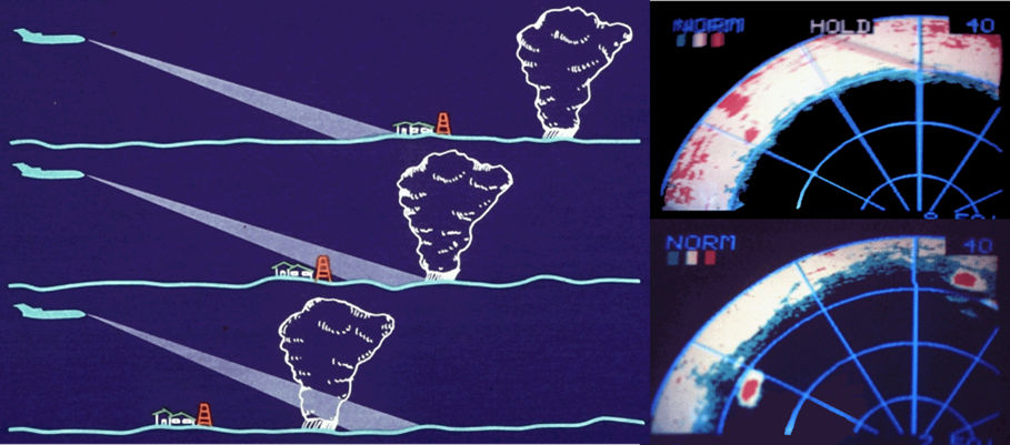
Some ground returns at 80nm will give you a clear picture of weather ahead.
For those of us using the fancier modern radars, don’t forget to use the vertical and lateral memory modes to paint the picture both ahead of you and to either side. This is particularly useful when navigating a squall line of storms – you get a better picture of how the weather is moving, which lets you make better tactical deviations.
The BEA’s inquiry into that Air France A320, descending into LFKJ/Ajaccio on August 20, 2025, found the crew were carrying a “relatively high” workload in the 15 minutes before the encounter (briefings, frequency changes, performance calculations, as well as a passenger needing pain relief in the forward galley) while a “favourable” forecast for the crossing may have dulled how closely they were watching a radar that needed regular manual tilt input. Around eight miles from the cell and descending through 29,000ft, they were tracking green echoes with the seatbelt sign already on. The captain lowered the tilt to identify a distant return; when he raised it again, the display went yellow, then red, then – in his words – “completely red”. The cell had been building for 45 minutes but stayed below 23,000ft until about six minutes before impact, and nobody (not the crew’s radar, not the airline’s weather app, not air traffic control with their own secondary system showing the cell) got word to the flight deck in time. Three cabin crew and two passengers came away with bone fractures.
So here’s the rule I hold myself to: a clean-looking picture on a routine sector gets the same suspicion as one on an obviously active day, because a benign forecast is exactly when tilt and gain management gets lazy. A return that looks suspiciously weak, or slow to build behind a stronger one, earns a harder look, not a sigh of relief. And on the newer jets, where the radar increasingly manages its own tilt, I still treat “automatic” as a reminder to stay engaged with it, not a licence to switch off.
2. Dry microbursts – the one that doesn’t show up on radar at all
A microburst doesn’t need much rain to be lethal, which is exactly what makes it such an unfair fight. High-based convection with a dry sub-cloud layer produces a downburst where the precipitation evaporates before it hits the ground – this is virga. The evaporative cooling accelerates the downdraft, but because there’s little or no rain reaching the surface, there’s often nothing on radar and nothing to see out the window – just a sudden headwind, then a violent shift to tailwind, right when you have the least altitude to recover from it.
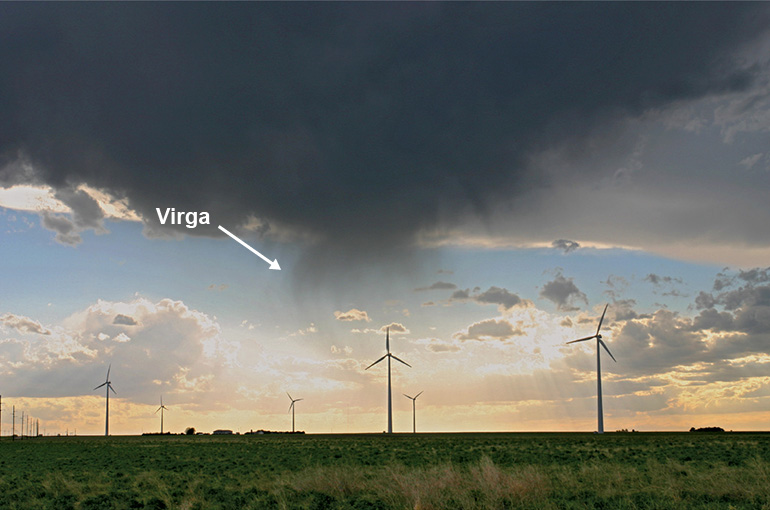
Dry Microburst – Virga.
When we are talking about Microbursts, Hong Kong has its own well-known case. On August 22, 1999, an MD-11 flown by Taiwan’s China Airlines came in to land as Typhoon Sam sat offshore, with gusty crosswinds and heavy rain across the field. The airline’s safety department blamed a microburst on short final; Hong Kong’s investigators focused instead on an excessive, uncorrected sink rate in the final seconds before touchdown. Either way, the outcome was the same – a hard right-gear touchdown, the number three engine striking the runway, the right wing separating, the aircraft flipping and catching fire. Three of the 315 on board died, and well over 200 were injured.
My rule here doesn’t depend on which version of events you believe: gusty, convective conditions on approach get a stabilised-approach discipline that doesn’t bend, and a real willingness to go around the moment the numbers move outside limits, not an attempt to rescue a landing that’s already gone soft. Most airports now carry Doppler radar that can pick up wind shear and microbursts even without much rain, with warnings on the ATIS or as an advisory from the tower – and I treat those calls as a genuine lifesaver, not a formality to talk your way around. Never conduct an approach into an airport where active microbursts are present – they build fast and dissipate just as quickly. We turn the seatbelt sign on when we see virga in the air, so why would you try to land when it’s present near the ground?
3. Embedded convection – the cell hiding in plain cloud
This is the trap that isn’t your fault, and it still gets you. Instead of one obvious cell, you’re looking at a broad, unremarkable cloud layer with genuinely severe convection buried inside it – sometimes sitting in the narrow gap between two cells that individually look avoidable. A flat scan across a layer like this will miss exactly the part you need to see.
Singapore Airlines Flight 321 is the case every crew should know. On May 21, 2024, the Boeing 777-300ER was cruising at 37,000 feet over southwestern Myanmar when it flew through the gap between two clusters of deep convective cloud (tops at roughly 55,000 feet) entering the second cluster only around eight seconds after leaving the first. Investigators found the radar simply couldn’t see through cloud that dense, and separately couldn’t rule out an undetected radar display fault on top of it. The aircraft dropped and climbed violently within five seconds. One passenger died of a heart attack, and the aircraft diverted to Bangkok with more than fifty injured on board.
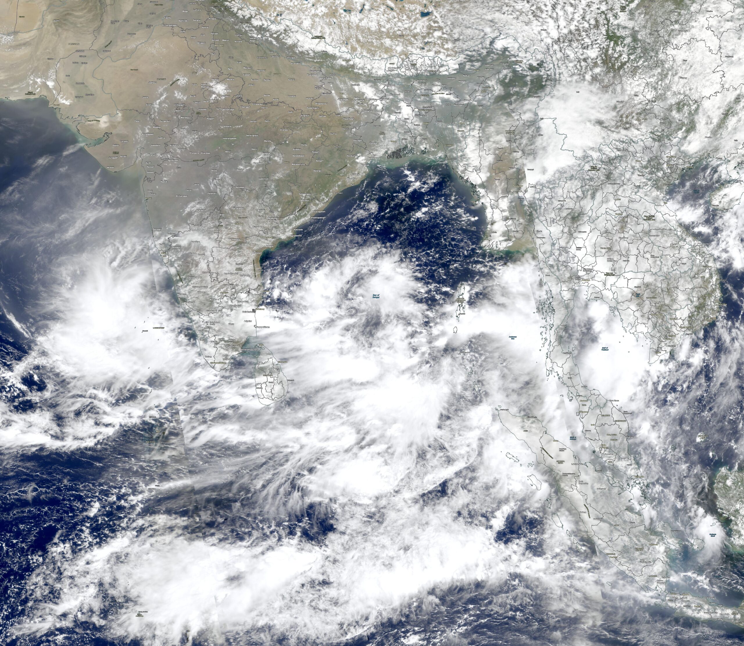
Cloud formations over the Bay of Bengal.
What I take from it: a radar picture that looks clear enough to route through isn’t the same thing as a picture that’s actually shown me what’s there, especially over places like the Bay of Bengal and Indochina, where towering convection builds fast most of the year. I treat any gap between cells as suspicious rather than inviting, and I make a point of actually understanding how my own radar processes the picture – the newer sets build a bank of scanned images rather than a single live sweep, so the old rules of thumb on tilt and gain don’t always translate directly. I always make it a habit to look at all the imaged in the radar’s memory – you may not get a paint at your level, but if there’s red below you or in the nearby vicinity, it’s going to be a bumpier ride than you’d expect.
4. Clear air turbulence and mountain wave – no cell, no warning, no excuse
CAT is the hazard with no manners. No cell, no radar return, often no PIREP until someone’s already been through it, and it can turn up nowhere near the jet stream boundary or mountain range you were trained to expect it at. Mountain wave is CAT’s close cousin, generated by strong flow over high terrain, and its effects can carry a surprising distance downwind and, in the right conditions, all the way up to the high flight levels. I’ve personally flown through moderate mountain wave turbulence at FL490 over the Rockies – higher doesn’t mean better. We stepped down to FL450 for more margin and thrust until we were clear of the area.
Continental Airlines Flight 1404 is the surface example worth knowing. On December 20, 2008, the 737 was accelerating for takeoff at KDEN/Denver when strong mountain-wave winds produced a sudden crosswind gust at ground level. The resulting crosswind gust hit roughly 40 knots – well beyond the aircraft’s limit and far beyond what the forecast had predicted. The aircraft departed the runway and caught fire. Remarkably, everyone on board survived, though several were injured.
There’s no radar fix for this one, so my approach to it is entirely procedural: I take mountain wave AIRMETs and SIGMETs seriously even well downwind of the terrain that generated them, brief for a possible late go-around at airports known for this kind of activity, and treat calm-looking conditions near high terrain with real caution. I also lean on ADS-B-based turbulence tools when I’ve got inflight connectivity – I’ve been running SkyPath for a few months now, alongside ForeFlight’s own forecast maps, and it’s paid for itself in smoother rides and better-informed seatbelt-sign calls.
5. Icing from supercooled large droplets – the ice your boots can’t reach
Ice doesn’t play by the rules your protection system was built for. Standard icing certification assumes droplets small enough that your leading-edge protection (boots, TKS, or bleed-air anti-ice) sheds them before they build up. Supercooled large droplets, typically freezing drizzle or freezing rain, are ten to a hundred times bigger. They don’t shed cleanly. They splash on impact and refreeze aft of the protected surfaces entirely, building ridges of ice on unprotected wing and tail sections your equipment was never designed to reach.
Roselawn remains the reference accident. American Eagle Flight 4184, an ATR-72, was holding in freezing drizzle aloft near Roselawn, Indiana on October 31, 1994, when ice built aft of the de-icing boots and formed a ridge that disrupted airflow over the aileron. The result was an uncommanded roll the crew couldn’t recover from. All 68 on board were killed, and the accident reshaped how regulators and manufacturers think about SLD icing certification to this day.
My own rule is simple: I’d rather run anti-ice a few minutes too early than a few seconds too late, because once SLD ice has built aft of a protected surface, cycling the boots or adding bleed flow doesn’t necessarily clear it – the ice is sitting somewhere the system was never built to reach. I switch it on below 10°C (50°F) with visible moisture around, and only relax once it’s reliably below -40°C (-40°F), when the risk of icing all but disappears – though that risk can climb again fast near thunderstorms. The automatic ice-detection probe on the nose is a good backstop, not a substitute for getting ahead of it.
Worth saying out loud
It’s worth remembering that none of these five traps are exotic. They’re all well understood, well documented, and are still catching professional crews on well-equipped aircraft, which is exactly why they’re worth briefing on purpose rather than assuming everyone already has them covered.
More reading:
- Air France A320, Ajaccio, August 2025 — BEA investigation, as reported by FlightGlobal, “A320 crew’s detection of violent convective cell too late for evasive action,” 12 August 2026
- Airbus Safety First — Optimum Use of Weather Radar
- Honeywell — Weather Radar Modes: Which Mode, When
- Honeywell — Understanding Weather Radar
- Honeywell — RDR-4000/RDR-7000 Radar Corner
- Honeywell RDR-4000 MultiScan — YouTube
- Honeywell RDR-4000 MultiScan — YouTube (Part 2
- FAA Lessons Learned — Delta 191 microburst accident, DFW

More on the topic:
- More: SE Asia Monsoon Season: What Are LSWDs and Why Will They Cost You Fuel?
- More: Microbursts: The clouds are gonna get ya!
- More: What’s the delay in the USA?
- More: 2020: A Record Breaking Hurricane Season
- More: The mystery of the missing Russian Weather
More reading:
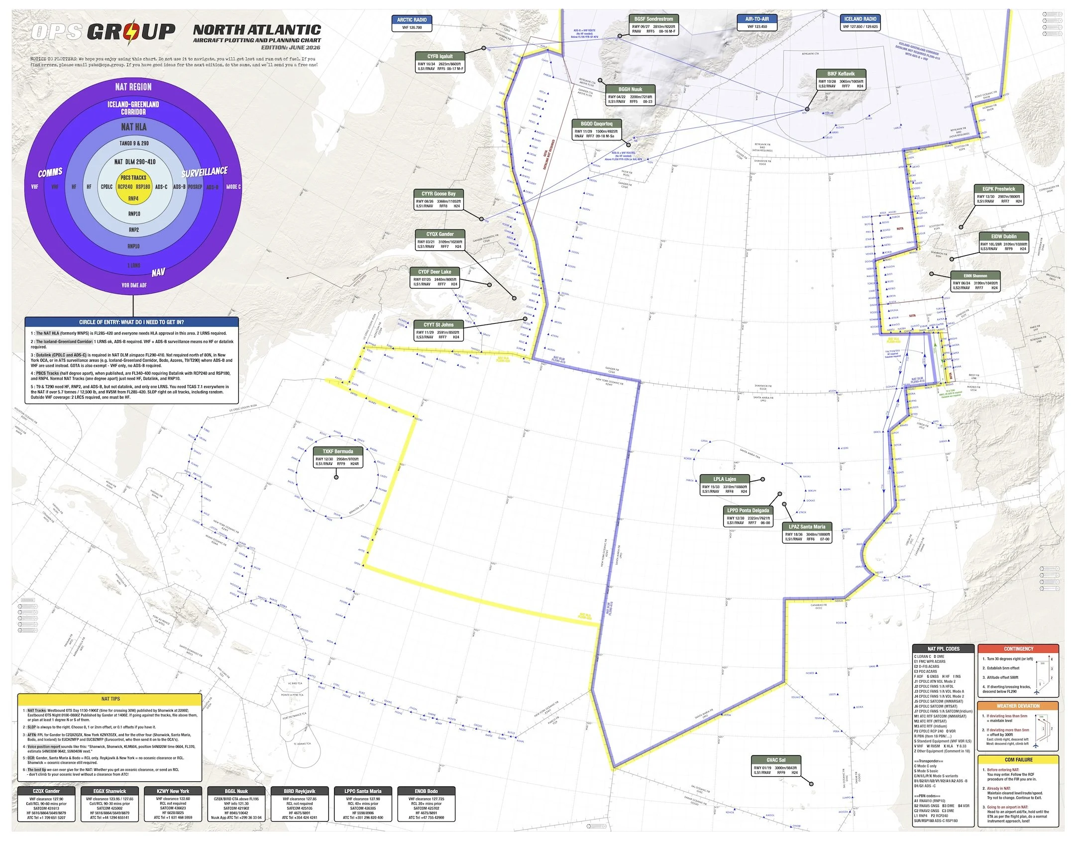
- Latest: NAT Pack 2026: All the North Atlantic goodies
- Latest: New 2026 NAT Oceanic Checklist
- Latest: The Bahamas wants your cash
- Safe Airspace: Risk Database
- Weekly Ops Bulletin: Subscribe
- Membership plans: Why join OPSGROUP?





 Get the famous weekly






This article makes for very interesting, useful reading indeed. Just as an add-on, it might be worthwhile to take a look at the most turbulent air routes in a 2025 survey. Top of the list is Mendoza (Argentina) to Santiago de Chile. A few days ago I learned about a flight in the opposite direction that lasted more than two hours, routed well up north, due to the strong Zonda wind present. https://www.skyscanner.com/flights/advice/most-turbulent-flight-routes
For more information on the Zonda wind: https://user.eumetsat.int/resources/case-studies/zonda-wind-carries-dust-across-bolivia-and-argentina
Javier A. Lifa
Buenos Aires, Argentina