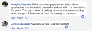
TAXIWAY CLOSED BETWEEN ORL180/08.5DME ORL181/08.6DME ORL181/08.65DME ORL180/08.65DME FROM 1829088020S to 1829190200S
What could be more clear than that?
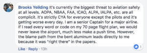
I wonder if a buried Notam ever did contribute to bent metal, injury, or death? I agree that the volume of nuisance notams is a real task to read through wether it be a long or short turn. However, nothing will be done till there is blood. That’s how the FAA works. Till then, its on us to be like aviation lawyers before every flight regardless of schedule.
Maybe we can get them in binary?
You have to go to binary first, then convert to Morse.
01010100 01000001 01011000 01001001 01010111 01000001 01011001 00100000 01000011 01001100 01001111 01010011 01000101 01000100 00100000 01000010
—– .—- —– .—- —– .—- —– —– —– .—- —– —– —– —– —– .—- —– .—- —– .—- .—- —– —– —– —– .—- —– —– .—- —– —– .—- —– .—- —– .—- —– .—- .—- .—- —–
For good measure they should be put through an Enigma machine, too. And the output formatted to wingdings
Yes. The NOTAM system is fucked. We have Notams about those solar arrays near Vegas in every flight plan. Yes, I see them. I want to know if the damn runway is closed. Why the weird coding? Is it to make pilots feel multi-lingual?
It’s funny, they seem to have every little f*ing detail about towers that are under 400 agl 20 miles either side of my route with one light bulb missing but I can’t get a god damn reliable source for f*ing TFRs. Even the piece of shit FAA website for TFRs is not a “complete and accurate source” but some guy in a FSS station is?????? Such complete and utter bullshit.
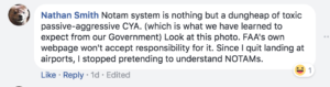
The reason nobody reads NOTAMs is because they are mostly garbage.
Why do I care that a crane that is 200 feet AGL ten miles from any airport is unlit? We can’t fly below 500AGL anyway.
Why do I have to decipher code that can easily be written as: From 20170608 1900Z to 20170610 0000Z CYYZ Taxiway L Closed
The system is broken and nobody cares to fix it.
I f*in’ love doing a flight from Newark to DC and getting notams about the North Atlantic Tracks. Motherf***r, if I end up on the tracks during that leg in a 145, the Notams are the least of my damn problems.
The biggest frustration for me is the NOTAMs don’t match reality. KAUS often NOTAMs a runway closed for several hours a couple days each week. Yet we get there and it’s open.
Or an airport will NOTAM an ILS out of service for the day. Show up at the airport and they’re using that ILS.
My home airport is KDAL. One of the PAPIs was out for three days before they NOTAM’d it out of service. Delta landing in front of me asked about it. Tower said they showed it on and asked me. I said, “Uh… It’s been out for several days. I thought y’all knew?”
Finally, my favorite: Surprise runway closures for routine runway inspections. NOTAM? Nah. BTW there’s a 150′ tower 15 miles away with a light out and there’s birds around the airport. Awesome.
I can honestly say that if it isn’t a runway closure or terminal closure then I don’t really care. The amount of closed taxiways at every airport is absurd. Not to mention many of them are closed year round with no intention of opening them again, just a permanent NOTAM.
Can only agree. It has been raised at the RAPACs, but no progress to date.
If I’m 5nm from the ARP at 150′ AGL, then I have more things to worry about than a crane without a red light…
Ass-covering gone mad. Really… a tree
OBST TREE 58FT AMSL
PSN 386M FM THR RWY 25 AND 183M LEFT OF RWY 25 CL
BRG 047 MAG 0.91NM FM ARP
FROM 01 310536 TO 03 300500 EST
My personal favourite is the “trigger notam” cross-referencing to yet another unfindable / unreadable pile of nonsense.
Just tell us what matters to an “Airman”; today and leave the grand plan, 12 month projection crap out of NOTAMS.
All of this so true, I imagine a world of technology and wonder (ozrunways/avplan/anything but airservices/casa))where we can quickly read a Notam and weather briefing without having to nut it out and do a slow-ass flight plan every time. 2017 and we still cant embrace all the tech.
I totally agree. The last thing any crew is going to be able to do when checking NOTAMs before departure is to magic up a way to access cross-referenced documents in various other publications. Especially when the departure point is not anywhere near base ops, or even any other operations centre.
B.S. NOTAMS….100% concur. Our whole world of aviation is being swamped by similar legal ass-covering paperwork. How can ANY pilot be expected to remember all the additional codicils that do NOTHING to improve safety of flight, but rather give an army of lawyers and providers more chances to fleece an already cash-strapped industry?…..Rant over!
Congratulations, its our industry, the users should be heard.
Start with a blank sheet of paper, what do we want to know in a “NOTAM” and how best to communicate it in a cockpit / in a flight briefing package. If the current format was frozen in 1924, the next system needs to be good for a couple of years.
This information ceased to be “NOTAMs” long ago. Today they are “NOTOLs”, Notice To Litigants. Thanks for making an effort to change this ancient system.
How many pilots out there actually read ever Head Office Notams or even daily Notams in meticulous detail? Few (if any). You sign on an hour before departure, there is simply not enough time to divulge all the ass covering crap that’s generated daily. Airline companies only want one thing, OTP; how a pilot goes about that they couldn’t care less as long as you don’t break any rules! NOTAMS = “None Other Than Aircraft Missing Slots”
You can bet your life, the one you needed to see at 3 in the morning was the one you missed! Any wonder…
Well said. Have you ever read “MEN AND EQUIPMENT NEAR THE RUNWAY: LANDING WITH CAUTION”?
So, If you don’t tell me that, I will land recklessly..
You are a mind reader.
You captured the issue perfectly and the historical context was excellent. While airspace and aircraft have all continued to develop our most basic system of communicating the status of an airport/airspace has not. I could take that further and say communication with ATC is still by AFTN for the most part.So now put yourself in the position of dispatcher/FOO working a series of long haul ETOPS Flight. You might have 20 or more departure /Take off alternate station notams, a whole galaxy of FIR/UIR Notams, not to mention all of the ETOP alternates and if you re-dispatch/re-analysis, you will get to do it inflight once again. Now do that 15-20 times depending on workload. Can you say human data saturation?
This article certainly illustrates the infrastructure issues we face, but it doesn’t come close explaining some of the processes and procedures we have had to put in place to ensure:
1. That we actually get NOTAMS.
2. That we get airport conditions as some countries don’t put them out as Series-S ICAO NOTAM versus Series-A (Yes, theses are the countries that haven’t fully adopted ICAO standards which were adopted in 1944 and ratified in 1947 by the Chicago convention).
Question: What is the current year?
I absolutely agree. My personal bugbear is those lists of co-ordinates …. do they think anyone actually plots them on a map? They might as well not be published at all.
What is clear is the professional approach to the information received: too many inputs, disorderly given, contextually irrelevant, redundant and unusable. A kind of “cry wolf” syndrome, making the pilot complacent about such a bullshit. The very day someone of us is caught in a legal battle for a system-induced mistake leading to a incident, overlooking the NOTAMs will not appear as an excuse. How to make these information valuable?
Yes… and why oh why are we still using the coded TAF language. We don’t have bandwidth issues anymore. We take plain English, code it, then decode it back to plain English. Surely a TAF written in plain English is not too hard a transition.
We train the pilots of tomorrow, they are inundated with everything the industry throws at them and the unintelligible Nonsense contained in some NOTAMS are just another accident waiting to happen. With all the technology at our disposal today, the filtering systems, electronics messages systems, integration tools and smart people to think about it, there is a solution out there. I suppose we just need to make enough noise in the right places to make a change. Oh well best we get started. hmmm, perhaps a NOTAM about change is needed.
And don’t forget about TFR’s that pop up. The one time I didn’t look at TFRs I got trapped having to divert from Chicago to an outlying airport even though we were part135 and even though we got an IFR clearance and the tower gave us takeoff permission. And center control for an hour just kept passing us on.
How about a change in the format of NOTAMS too, so we don’t have to wade through the whole lot in order to parse the relevant information. NOTAMS are removed when thy are no longer valid, so why cling to chronological order as an indexing system. How about putting them in order of critical relevance: Firstly, changes to airfield opening hours and services (fire, fuel etc). Secondly, changes to runway lengths/closures/etc. Thirdly, changes to approaches available. All the rest can be thrown into the mix at the end of the NOTAM.
Excellent analysis. My personal favorite is the NOTAM sort order which tells me that the REIL lights don’t work, the glideslope is out, the runway markings are non-standard, the localizer is out… ending with: runway closed. Tell me that first, all the other BS becomes irrelevant.
About two days before I saw this post, I’d sent a long email to my company telling them of the NOTAMs we don’t need to see. Then I saw this. Brilliant! I’ve just sent the link to this piece to the company to reinforce that opinion. I’m hoping our briefing pack will be several pages thinner the next time I go to dispatch.
I have come up with a name for this problem: “NOTAM Spam”. It’s a serious one, alright — ASRS Callback #426 brought it up in the context of the US NAS, and I’m sure it’s only worse for international operations. It sounds like ICAO needs to put out a recommendation or SARP about NOTAM spam control…
95% of Notam’s we read are not applicable, or nothing can be done about them. Oh great, I’ll pull out my chart and plot the 25 co-ordinates to see if this airspace will affect my flight -_- that’s one Notam example from plenty of the same type, in the same Notam briefing. Now add the other irrelevant Notam types as mentioned by others in the comments.
Thanks for the article. I shared it with my fellow dispatchers at AAL. We read pages and pages of BS notams on a daily basis and wondered if anyone else had similar feelings about the whole process.
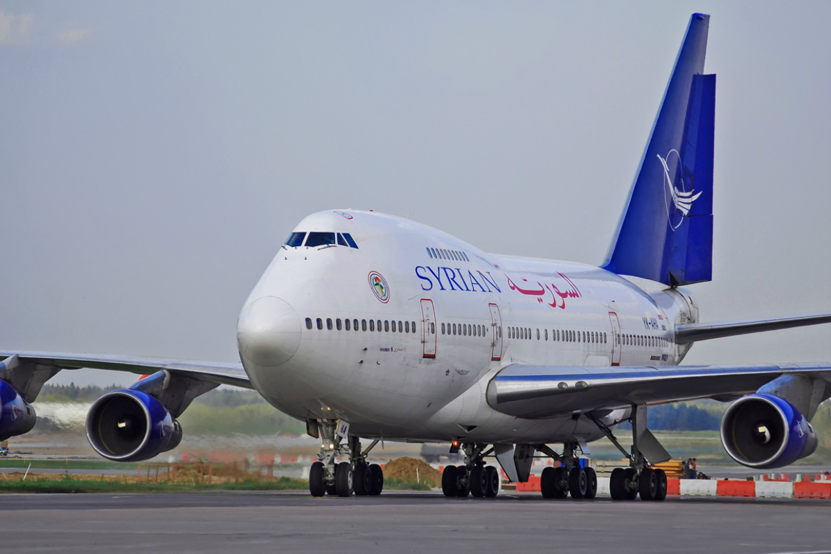
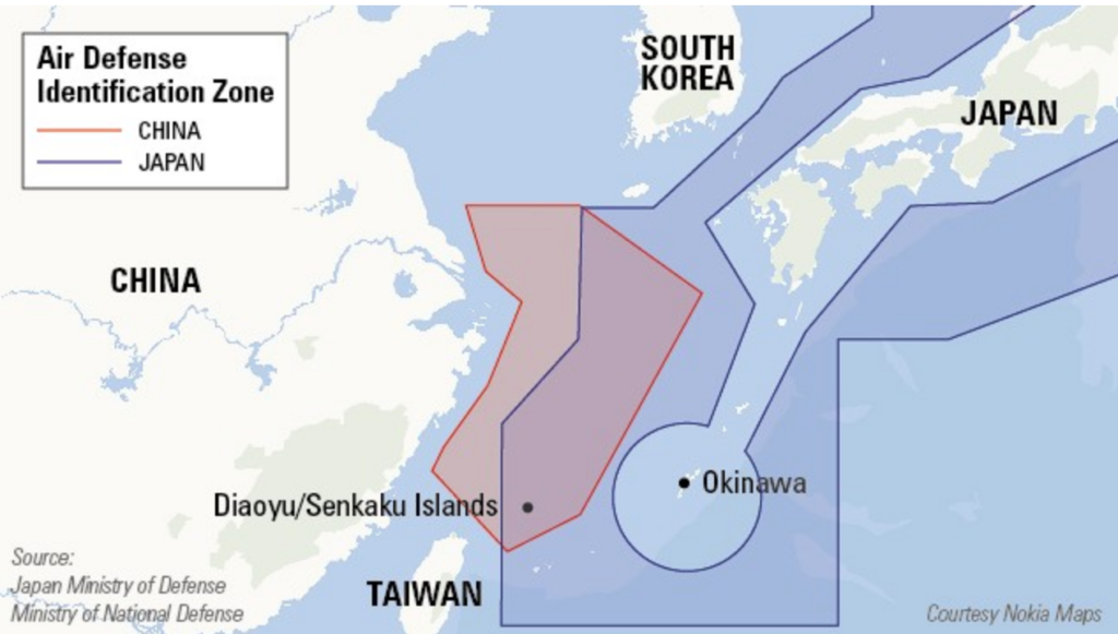
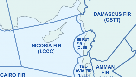
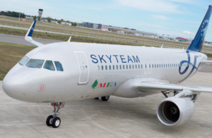 These MEA overflights are of interest. The airline is a member of the SkyTeam alliance and has codeshare agreements with several high-profile airlines (Air Canada, Air France, etc.) Despite the repeated warnings of the ongoing dangers associated with overflights of this conflict zone, the airline has chosen to schedule more than half-a-dozen flights over the airspace each day.
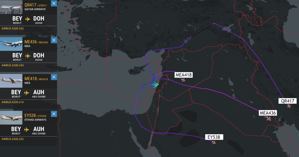
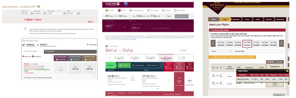


 According to
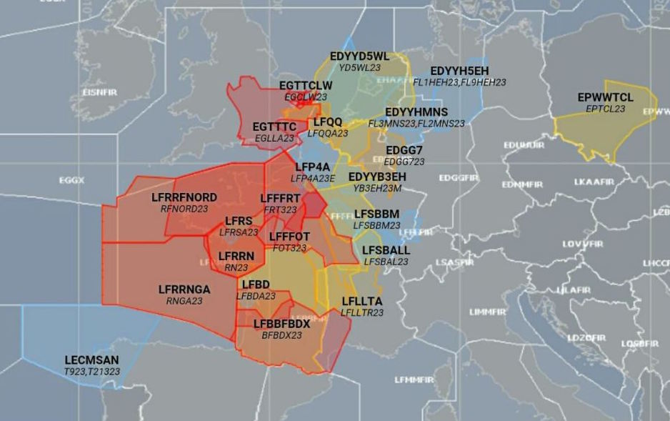
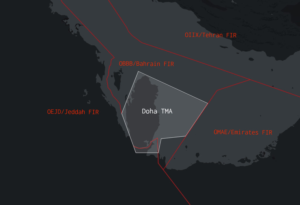
 The TMA is also complicated by significant terrain and regular adverse weather. Recent

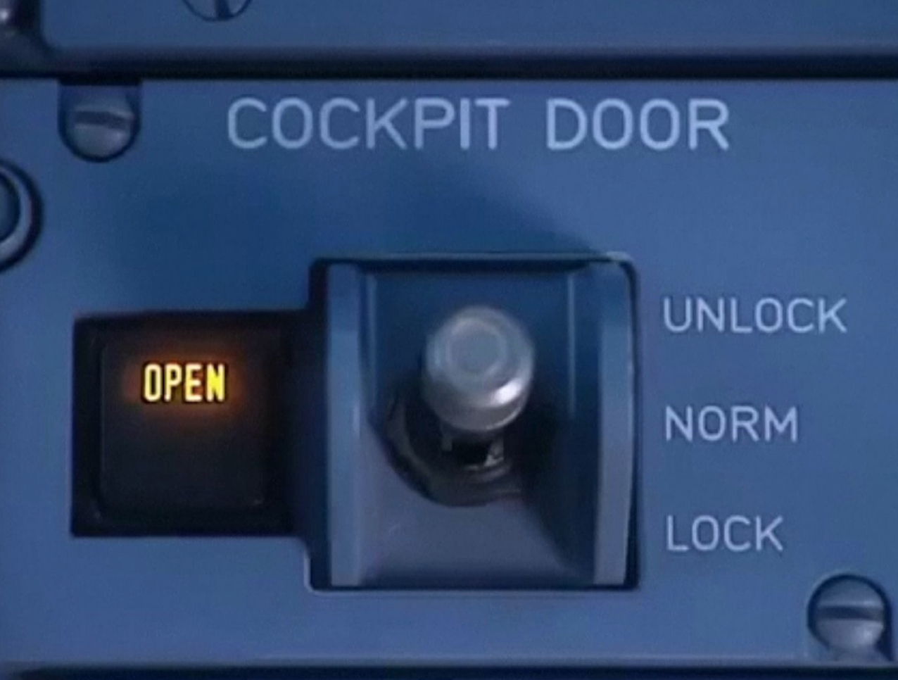
 In Short: Following a three-year effort from industry groups and aircraft manufacturers, the International Civil Aviation Organization (ICAO) will raise the weight threshold for requiring hardened cockpit doors for aircraft with 19 or fewer passenger seats from 45.5 metric tons (100,310 pounds) maximum certificated takeoff weight to 54.5 metric tons (120,152 pounds).
 The International Civil Aviation Organization (ICAO) has changed its weight rules regarding strengthened cockpit doors on business jets. Toughened doors are required for aircraft operating charter flights.


 The Maldives, a country known far more as a honeymoon hotspot in the Indian Ocean than as a hub of political crisis, is back to “business as usual,”


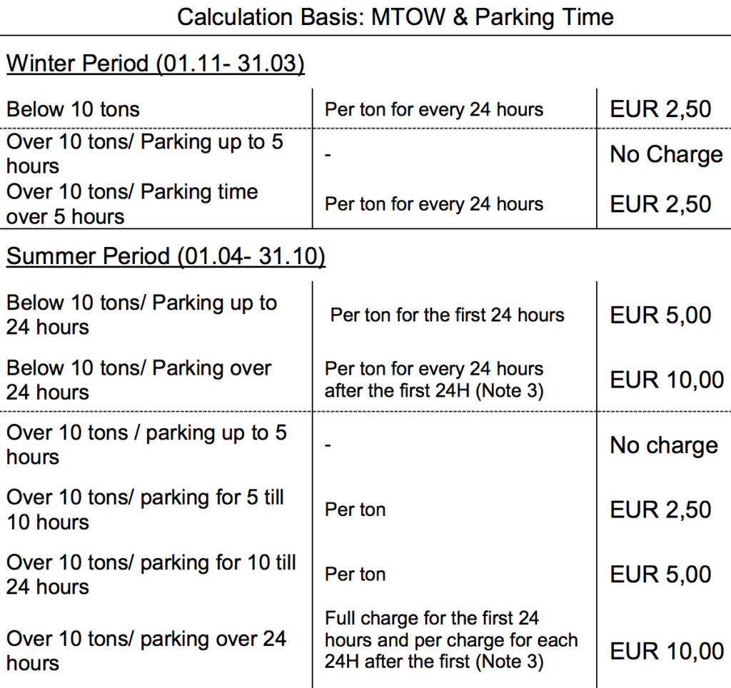
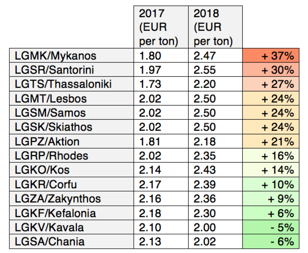
 Parking charges used to be simple here: at every airport, it was free for the first five hours, and then EUR 1.08 per ton (MTOW) for every 24 hours after that. That same price applied regardless of aircraft size.