PBCS – What, Where and How
In Short: The performance-based communication and surveillance (PBCS) framework allows for higher safety standards and more efficient airspace use. If your aircraft already has the equipment and you cross the Atlantic or Pacific Oceans often, it’s worth looking into getting your regulatory approval.
PB… what? It’s a good question. We have so many acronyms in aviation, it’s easy to forget what this one stands for and what it really means. So, let’s try and get to the bottom of it.
What is PBCS?
Official answer:
The ICAO performance-based communication and surveillance (PBCS) framework ensures that emerging technologies for communication and surveillance fully support ATM operations and are implemented and operated safely.
In plain speak:
With the technology already available on many aircraft and in the Air Traffic Control facility, aircraft can now fly closer than ever before, especially over non-radar oceanic airspace.
 There are two key buzz words, so let’s define them. They are interlinked with RNP – Required Navigation Performance.
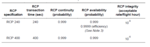
- RSP – Required Surveillance Officially known as “surveillance data delivery”, often stipulated in the Airplane Flight Manual. Basically, how often does the aircraft send its position to ATC/ground station. There are two specifications, RSP180 and RSP400. The numbers indicate the maximum number of seconds (180 or 400) for the transaction to occur.
- RCP – Required Communication ICAO has two specifications, RCP240 and RCP400. Again, the numbers indicate the maximum number of seconds (240 or 400), or “transaction time” taken for the controller to issue an instruction to the crew and for them to receive a response. This could be via CPDLC, HFDL, VDL or SATCOM.
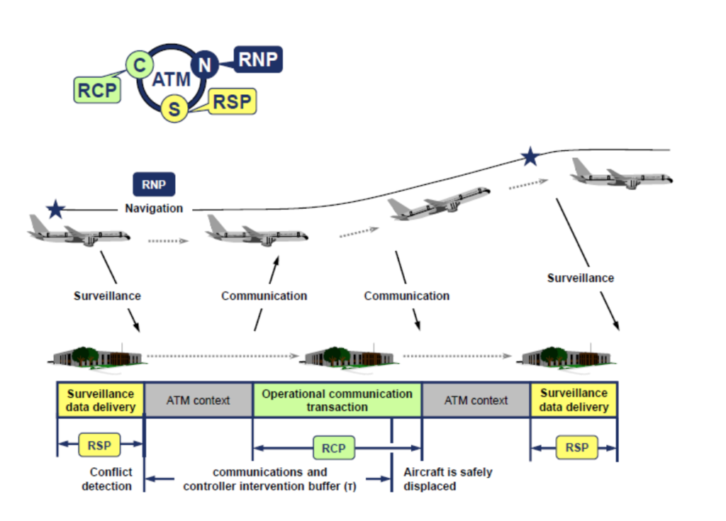
So, we have a loop here, C-N-S. Communication, Navigation and Surveillance. An aircraft sends surveillance information to ATC about where it is; the aircraft stays within confines of RNP navigation requirements and ATC communicates with the aircraft within the required transaction times. Pretty easy!
But why do we need PBCS?
The take away? If all given aircraft in a certain airspace have a lower RSP value and a lower RCP value, we can start putting these aircraft closer together.
Essentially – performance-based separation minima. This allows aircraft to be separated safely according to technological capability rather than “one-size-fits-all” prescriptive distances.
What are the differences from PBN?
They are similar but there are notable differences. In a simple sense, the PBN (RNP/RNAV) only requires that the operator obtains approval because it focuses on how the equipment works. PBCS (RSP/RCP) however requires the involvement and approval of the air traffic service provider because it’s a two-way communication and surveillance effort. There are dependencies and complexity with the equipment standards on both ends.
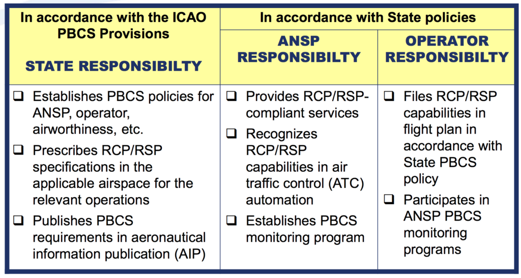
In this graphic you can see a high-level summary of who is responsible for what:
Where is it in place?
Currently PBCS is in effect in one form or another in the following FIR’s
- NZZC/Auckland Oceanic
- NFFF/Nadi
- KZAK/Oakland Oceanic
- PAZN/Anchorage Oceanic
- WSJC/Singapore
- VCCF/Sri Lanka
- NTTT/Tahiti
- RJJJ/ Fukuoka
- KZNY/New York Oceanic
- CZQX/Gander
- EGGX/Shanwick
- BIRD/ Reykjavik
- LPPO/Santa Maria Oceanic
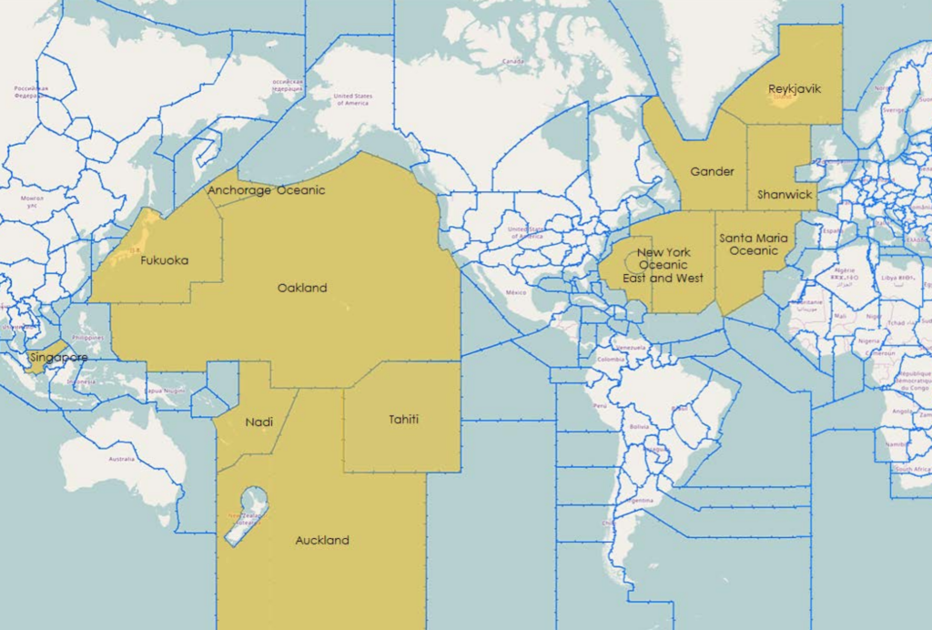
The Air Traffic Service providers of China, Brazil and Indonesia have also shown interest to introduce PBCS in the future.
Specifically, PBCS is being used between FL350 and 390 on certain “half” NAT tracks as we have written about before.
What do I need to do?
 Requirements vary from state-to-state on the exact procedure for obtaining approval. It’s important to note that not all aircraft are automatically PBCS ready (refer to your aircraft manufacturer and your airplane flight manual).
The FAA has outlined its approval process here and has a handy powerpoint document here.
An important element is to prove that you have signed the “PBCS Global Charter” which can be found at the FANS Central Reporting Agency (CRA) website.
When a PBCS authorization is obtained an operator is required to file both P2 (indicating RCP240) in item 10 and SUR/RSP180 in item 18 of the flight plan, in addition to the J codes for CPDLC and D1 or G1 for ADS-C in item 10.
The correct filing of these two codes will indicate to any ATM ground systems applying performance-based separation minima that the aircraft is eligible for these minima and that the crew have received the relevant training in order to safely operate using the reduced separations.
Will you notice that PBCS standards are being applied to your flight?
 Ok this is the funny part of this story. The short answer, probably not.
While it may be easier for RCP240/RSP180 approved aircraft to obtain optimal flight profiles, especially during high traffic periods, and particularly for NAT flights using the OTS, the application of these standards is generally tactical in nature for ATC. An aircraft may not have performance-based separation applied at all on an individual flight, or possibly may never have had it applied to any of its flights. Even if a you have RCP240/RSP180 approvals, if the aircraft nearby does not also have the approvals, the separation standards cannot be applied!
What if I don’t have RCP240 and RSP180 approval?
 If you do not have RCP240/RSP180 approvals you will always have the larger separations, e.g. 10-min, applied, and not be eligible for the lower standards in cases where it may be beneficial.
The only airspace that has implemented tracks that will require PBCS to file is in the NAT OTS. There are still non-PBCS tracks in the OTS for which PBCS approvals are not required.
All other airspace in which performance-based separation minima are currently applied will allow aircraft with and without RCP240 and RSP180 approvals to enter and use the airspace in a mixed-mode operation.
Will I be penalized if I don’t have it?
Probably not in the short term. In the future as more and more airspace corridors become PBCS only, then it is possible you may be subject to reroutes, delays or the requirement to fly outside of certain flight levels.
So, our conclusion?
PBCS is a great step forward in maximizing efficiency in a busier airspace environment thanks to the advent of better technology. If you fly the NATs often and have an aircraft capable of PBCS certification standards, then yes – do it! The approval process is not overly burdensome, and many modern transatlantic jets already meet most of the technical requirements.
Ultimately, reduced separation standards mean more great air-to-air views. So, pack your camera!

You were in a 4G inverted dive with a Mig 28? -Yes, ma’am. -At what range? -Um, about two meters. -Eh, lieutenant, what were you doing there? -Communicating. Keeping up foreign relations.
Did we miss something, or does something need more explaining? Let us know!
Extra Reading:
- The latest Nat Doc 007 North Atlantic Operations and Airspace Manual
- FAA-Performance-based Communication and Surveillance (PBCS) Monitoring
- FAA-PBCS FAQ
- FAA-PBCS: Operator Approvals
- FAA-Performance-based Communication and Surveillance (PBCS) Approvals and Monitoring
- FAA-PBCS Manual Doc 9869 Review
- ICAO-Operational Authorization Guide
- ICAO-PBS Overview
- NBAA -Revised Authorization Required for Performance-Based Comm, Surveillance Operations
- New Zealand -Performance Based Communication and Surveillance (PBCS) Implementation Plan
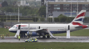
 New NOTAMS (pretty poorly written ones – but


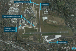 The pilot at the controls of a Beechcraft B200 Super King Air that crashed shortly after take off had the aircrafts rudder trim in the full left position for take off, the Australian Transport Safety Bureau (ATSB) has found.
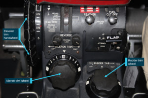 Approximately 10 seconds after the aircraft became airborne, and two seconds after the transmission was completed, the aircraft collided with the roof of a building.
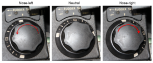

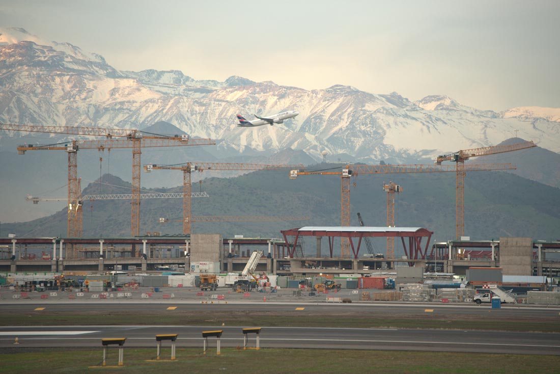
 With planned runway and terminal constructions, LIML/Milan Linate will be closing from July 27, 2019 until October 27, 2019. Work has already begun with

 We understand that this came about due to “much confusion” of the parking stand locations after aircraft land.
 5th September, update:
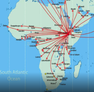 Here are some more updates since our last article:
 The ECAA also outlined that the national carrier, Ethiopian Airlines, has “
 Beijing is hosting the
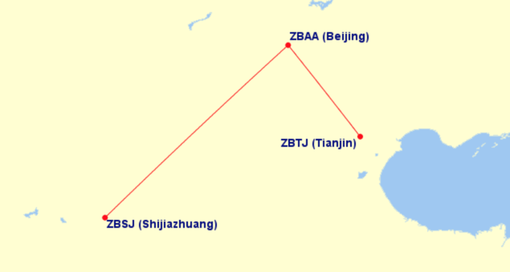

 As we outlined in our
  We are all about safety here. But to shutdown such a big chunk of airspace and totally suspended flying operations at 9am at such a big airport for a whole week seems particularly extreme. This is not a small isolated airport, this is a large 3 runway complex with A380’s coming and going.
 He finished by saying “this was inevitable as we are celebrating our Independence Day”.
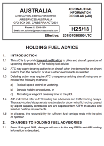 Australian traffic holding is a funny one; you can fly 16 hours directly from a place far far away, and then just before landing you get told to hold for 20 minutes – even though you have been in Australian airspace for sometimes 7 hours plus, they wait until the last few minutes to slow you down.
  A few other quick updates for operations around Australia that you might have missed.
 A few months back an
  We understand it’s a mix of things.


 Without stating the obvious,
 There have also been more than a few “incidents” of aircraft from

 Australian AIP flight plan requirements (
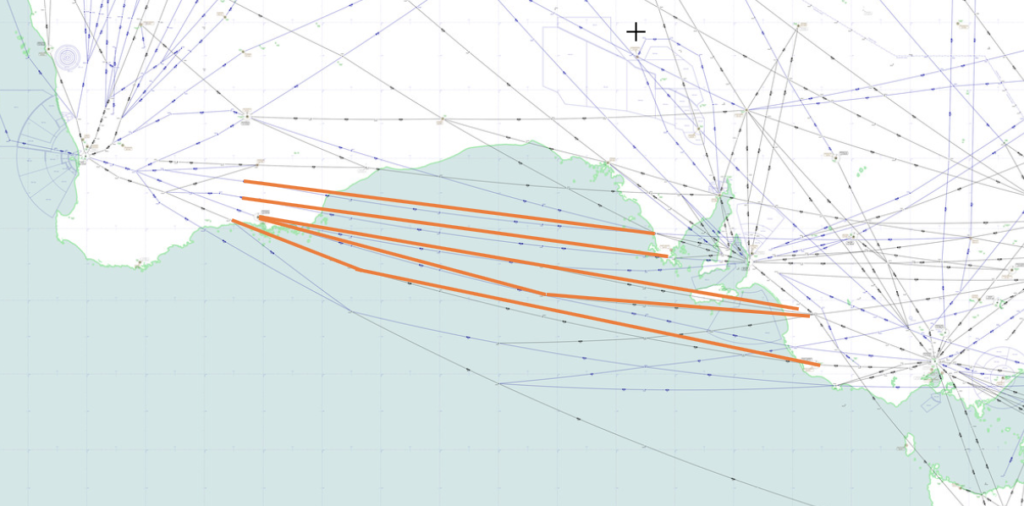

 It’s been a great few days on a sun-soaked Mediterranean island. Your passengers are onboard, you are about to close the door, and then you get told your Calculated Take Off Time (CTOT) is an hour from now! Sound familiar? You’re not alone! ?
 “Data from Eurocontrol shows that in the first half of 2018, Air Traffic Management (ATM) delays more than doubled to 47,000 minutes per day, 133% more than in the same period last year. Most of these delays are caused by staffing and capacity shortages as well as other causes such as weather delays and disruptive events such as strikes. The average delay for flights delayed by air traffic control limitations reached 20 minutes in July, with the longest delay reaching 337 minutes.”
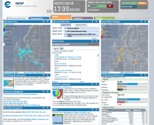
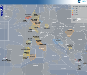 EDYY (Maastricht)
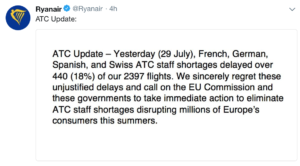
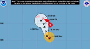
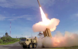 What are surface-to-air missiles, and who has them?
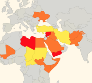 There is some evidence to suggest that more States are starting to provide better guidance and information to assist operators in making appropriate routing decisions, but we think this still has some way to go.
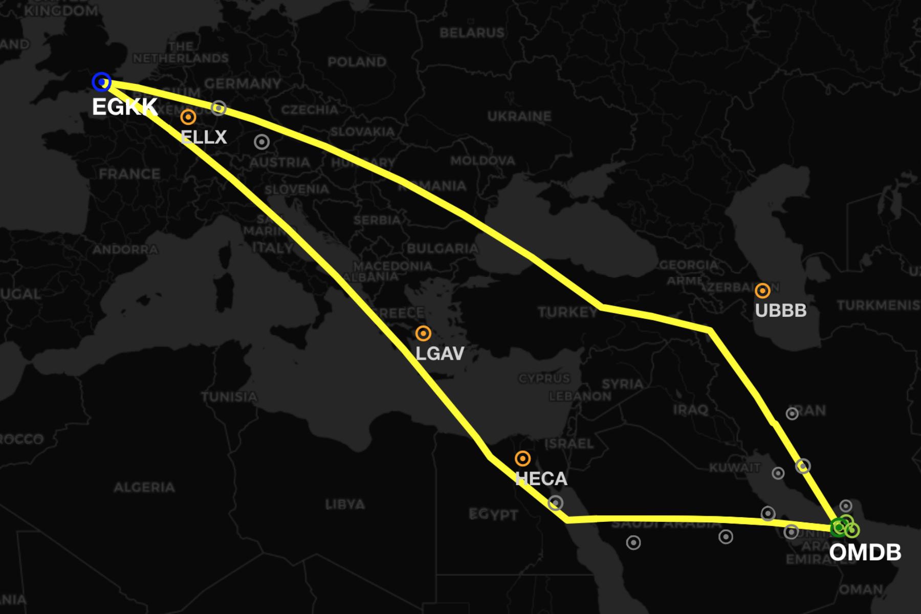
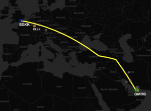
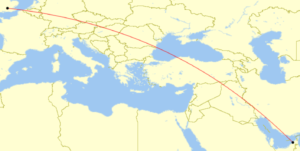 There are more business aviation operators flying between the Middle East and Europe than ever before. So we took the time to look over the route options between the two regions. For our example we will be using a flight from Dubai to London, but similar operational considerations are valid for the plethora of route combinations through this whole region.
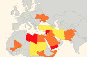
 Safety: Both
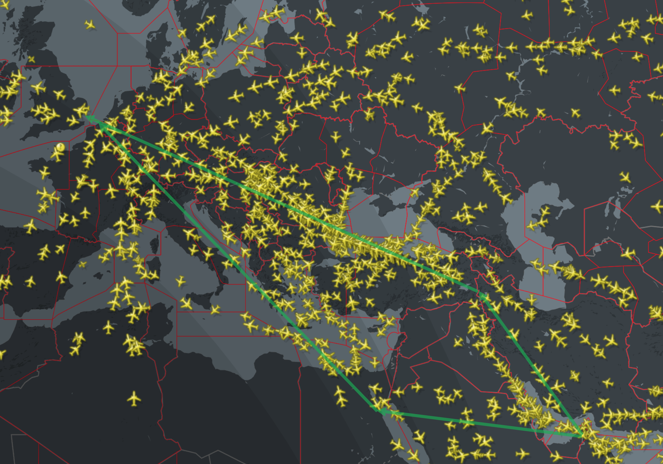
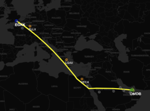 Safety: In terms of airspace warnings and risk, this route is slightly better. We have rated
 opean Aviation Safety Agency (
 The regulation that a plane coming from a non EU country must have a
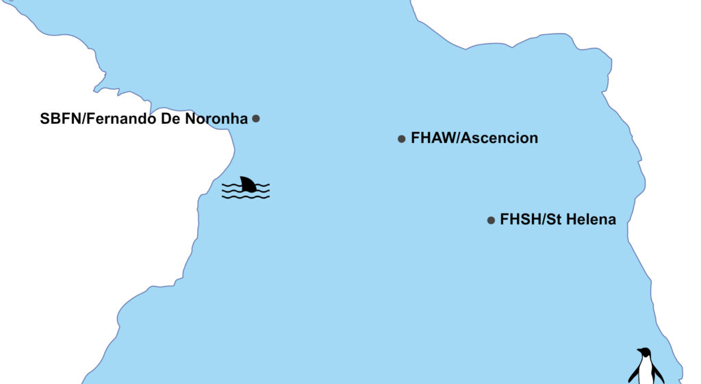
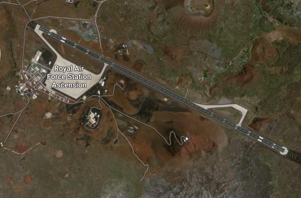
 Wideawake Airfield (FHAW) is a military facility operated jointly by the USAF and the RAF. Under the terms of the joint agreement, only state aircraft are authorized to land at Ascension. A monthly RAF flight arrives from the UK and weekly USAF C17 movement occurs.
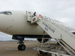 As we have reported in the past, it can be
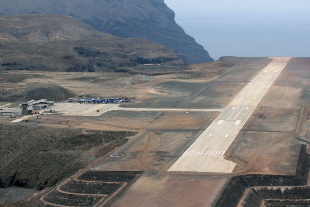


 Best up-to-date information:
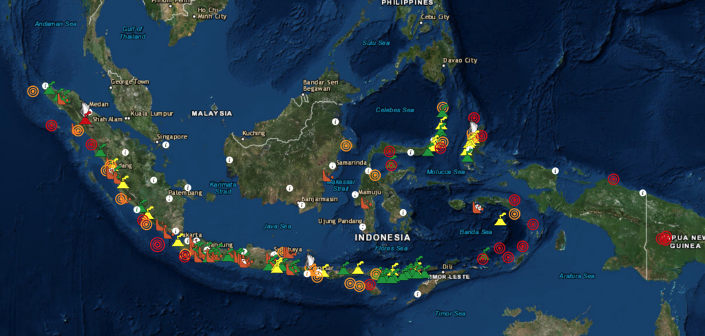
 Mount Sinabung – located in Medan, Indonesia is also
 We love new airports … and we have a cool one tell you about in Giza, Egypt – known as Sphinx International Airport (SPX, HESX)!
 Parking spots are well equipped and overnight parking is possible. The airport is only seeing a handful of movements at present and is not busy.
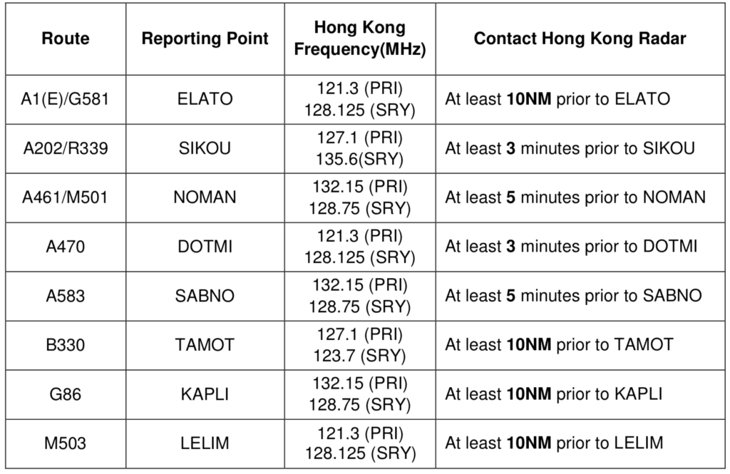
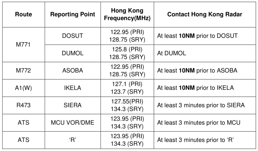
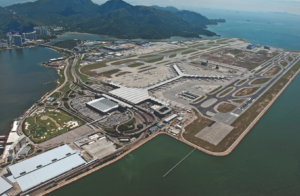
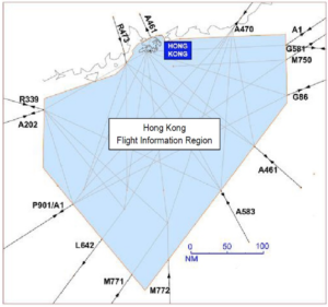 Pilot shall report the aircraft callsign, position (with reference to reporting point), level (including passing and cleared levels if not maintaining the cleared level), transponder code, and other pertinent information (e.g. speed assigned by last ATC, tracking if it differs from the flight plan route) in the initial call before entering Hong Kong FIR.
 This week