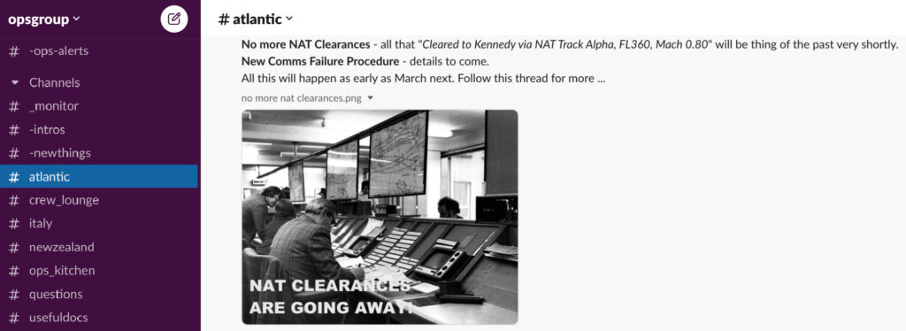
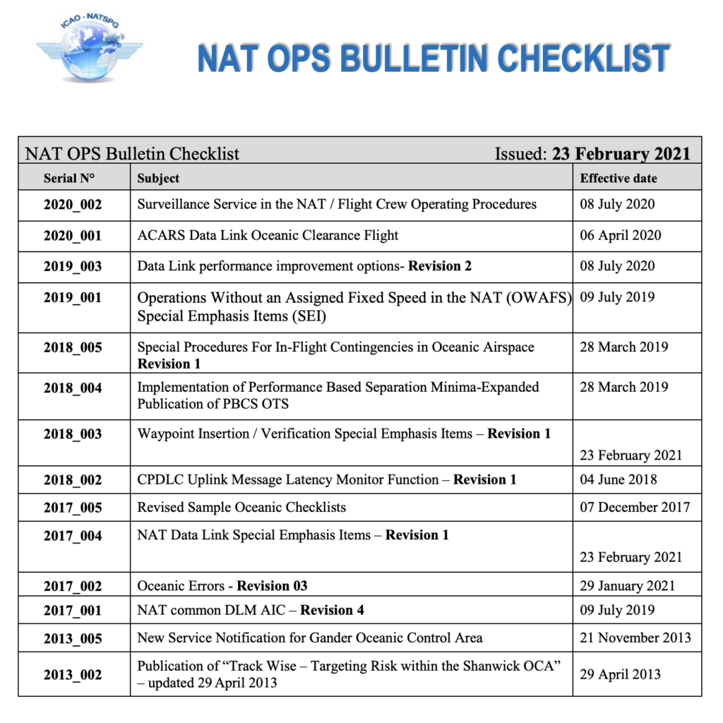
Ah, NAT conundrums! We love them so much, we’re into our third Volume already!
Volume I covered the following three conundrums:
1. To SLOP, or not to SLOP?
2. What’s the difference between the NAT Region and the NAT HLA?
3. Can I fly across the North Atlantic without Datalink?
Volume II covered these additional three:
4. Do you need to plot on Blue Spruce Routes?
5. Do we still fly Weather Contingency Procedures on Blue Spruce routes?
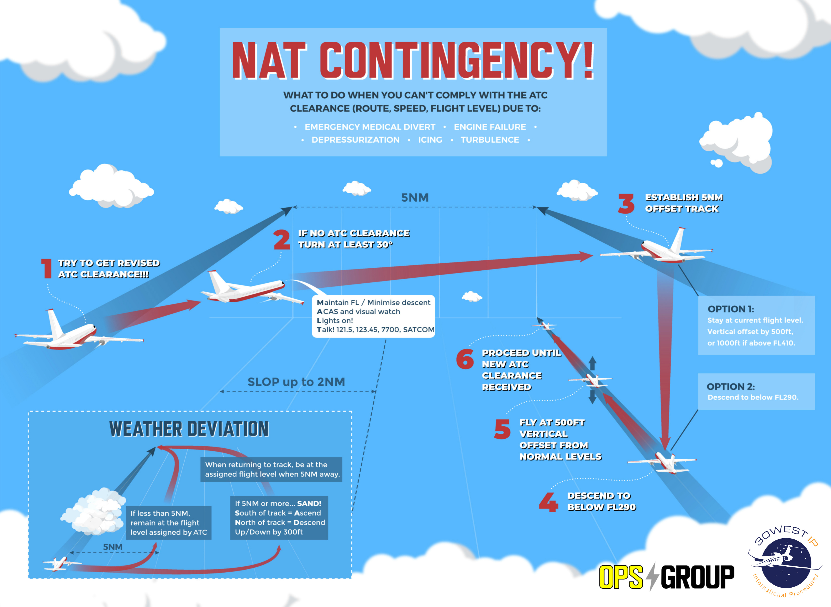
6. When can we disregard an ATC clearance and follow the contingency procedure instead?
And this post, Volume III, looks at GOTA airspace. It’s such a juicy topic, it gets an entire Volume all of its own.
So here goes…
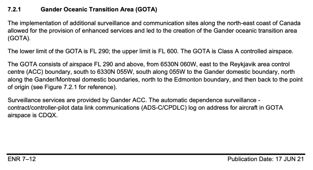
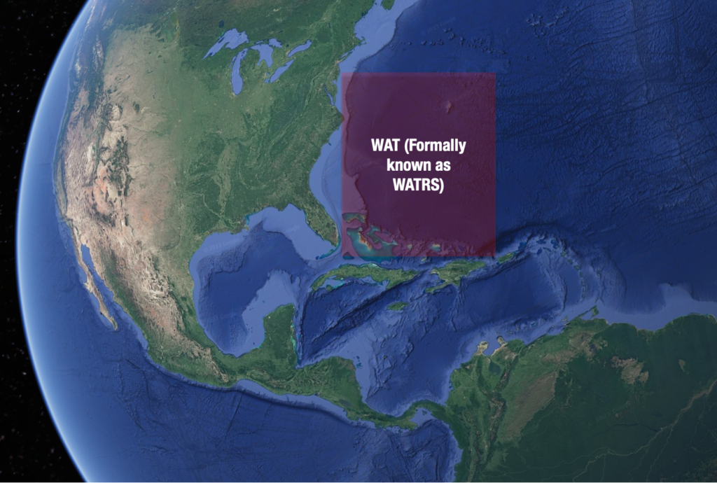
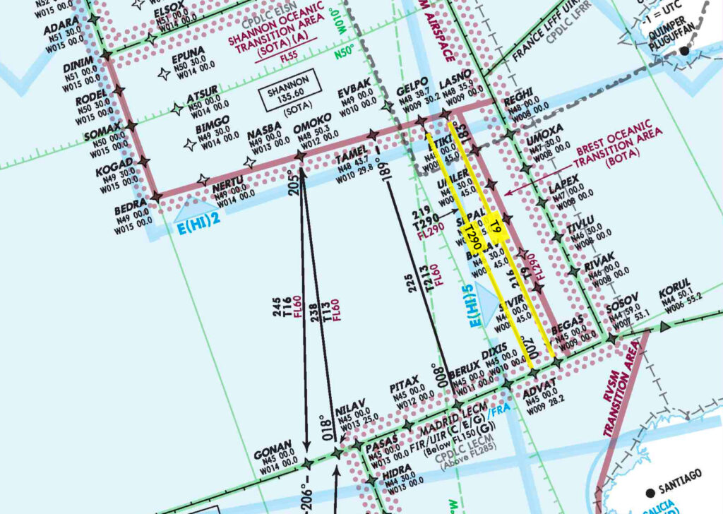
Where is GOTA airspace?
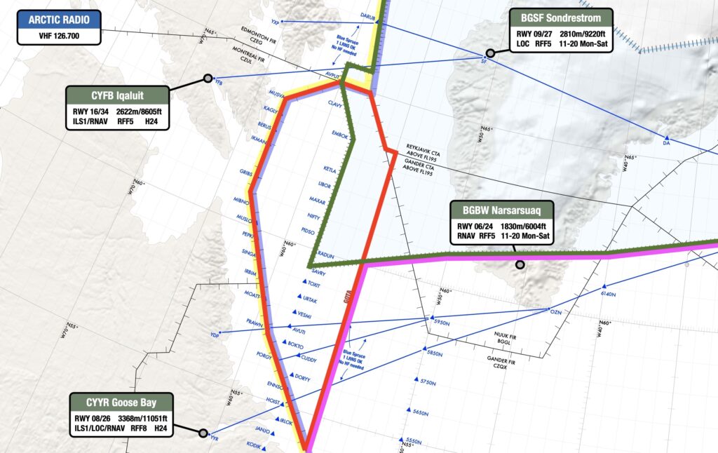
This section of airspace is found off the coast of North-eastern Canada, FL290 to FL600 inclusive.
Here it is, outlined in red:
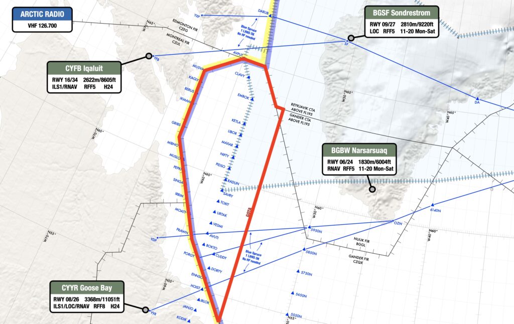
Red = GOTA.
Why are we talking about it?
Because lots of aircraft transit this area when flying across the North Atlantic. Also because the requirements here were very tricky for us to track down on “paper” (i.e. the Canada AIP, NAT Doc 007, etc), and were only really made clear after speaking with a real human being at Transport Canada. We like human beings!
So here’s what we discovered…
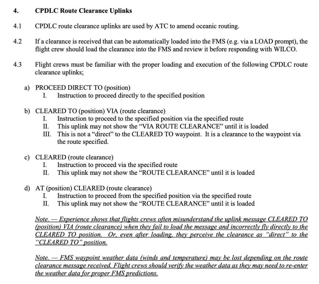
You don’t need datalink in GOTA airspace
No, you don’t. We thought you did, but we were wrong.
When we sat down to update our North Atlantic Plotting chart last year, we wanted to draw nice clear lines on the map to show where datalink was required. But we were bamboozled by GOTA.
The ICAO NAT Doc 007 says that you don’t need datalink in:
“Airspace where an ATS surveillance service is provided by means of radar,
multilateration and/or ADS-B, coupled with VHF voice communications as depicted
in State Aeronautical Information Publications (AIP), provided the aircraft is
suitably equipped (transponder/ADSB extended squitter transmitter).”
It then says to check in State AIPs to see if any of their airspace fulfils this criteria.
So that’s what we did. But checking in Canada’s AIP brought up this for GOTA:
And this for Data Link Mandate (DLM) Airspace:
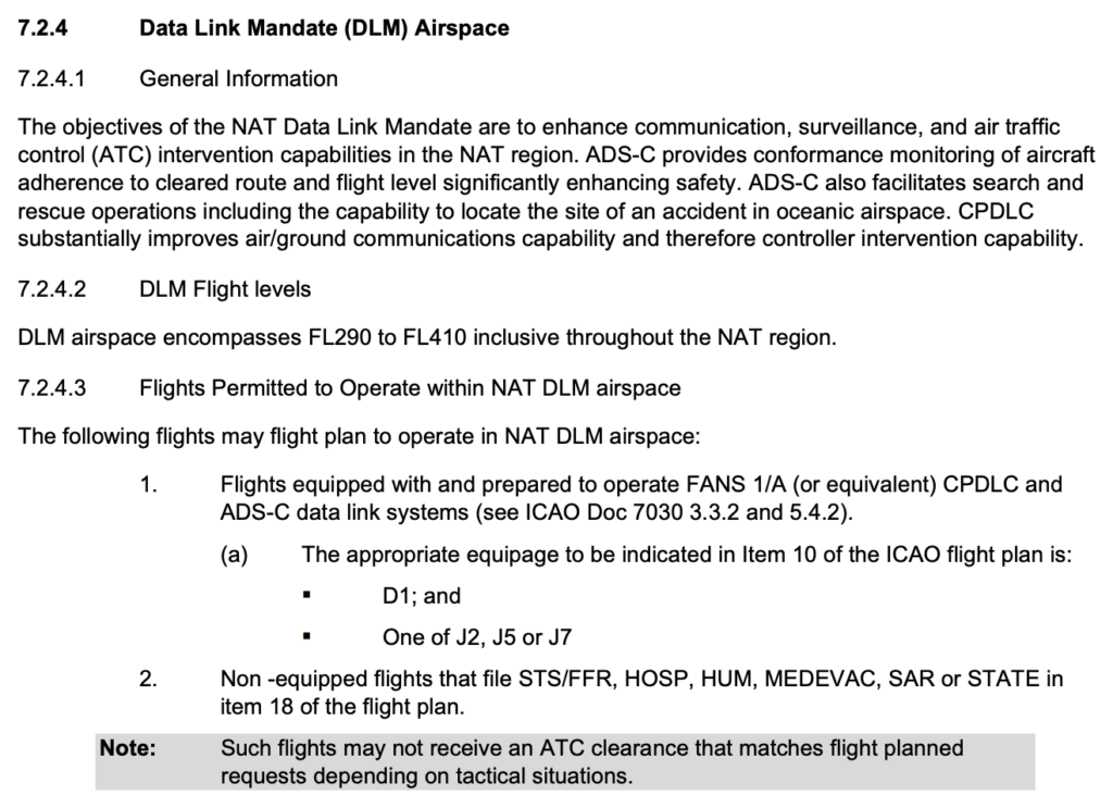
So none of that really answered our question of whether or not you need datalink in GOTA airspace. The trail went cold…
via GIPHY
Our chat with Transport Canada in 2021:
Deep in the doldrums of lockdown, we sent Transport Canada (TC) some emails asking them the question directly. Here’s a massively paraphrased transcript of that email exchange:
Us: We have been trying to determine if the GOTA requires datalink? It appears to meet the definition of ATS Surveillance Airspace but we can’t identify anywhere in the Canadian AIP which specifically states this.
TC: The GOTA is in fact DLM airspace.
Us: Really? So operators without datalink must cap their flight below FL290 through the GOTA airspace until they reach that datalink exempt airspace over Greenland, at which point they can climb to the higher levels?
TC: Yes. Well… flights equipped with ADS-B may operate at DLM levels within the GOTA.
Us: Oh. Now we’re confused. Oh well, it’s Christmas now. Chat next year!
TC: Merry Christmas.
Our chat with Transport Canada in 2022:
Us: We have been trying to determine if the GOTA requires datalink? It appears to meet the definition of ATS Surveillance Airspace but we can’t identify anywhere in the Canadian AIP which specifically states this.
TC: Didn’t you ask this exact same question last year?
Us: Yep. But then… you know… Christmas…
TC: Ah yeah. Ok. As long as you are HLA Certified (MNPS & RVSM) and you have ADS-B, transponder and VHF you wouldn’t require all the DLM equipage. GOTA is technically Gander Oceanic airspace (NAT HLA airspace), but as they have Ground based Radar sources, space-based ADS-B and VHF coverage in the area it has been delegated to Gander Domestic. Due to this, the airspace is considered Class A surveillance airspace and follows the similar regulations as you would in other Canadian domestic Class A airspace.
Us: What about that ADS-B requirement?
TC: Well, technically ADS-B isn’t required as it is considered class A surveillance airspace. So lack of ADS-B wouldn’t prevent you from entering the GOTA area. That said, ADS-B equipage is preferred by many of the controllers. This is because the ground based radar isn’t always guaranteed to the outer limits of the GOTA airspace. This makes identification and separation easier for the domestic controllers when the aircraft have ADS-B.
Us: So tell us again, what do you need in GOTA airspace?
TC: Required equipment for GOTA airspace is transponder, automatic pressure-altitude reporting equipment and VHF. As soon as you leave that airspace you would need other equipment depending on what airspace you enter.
“As soon as you leave that airspace…”
Yes indeed, a good point, worthy of further investigation! Because no-one just zips around solely in GOTA airspace, do they?
So here’s a look at the airspace adjacent to GOTA, and what you need where…
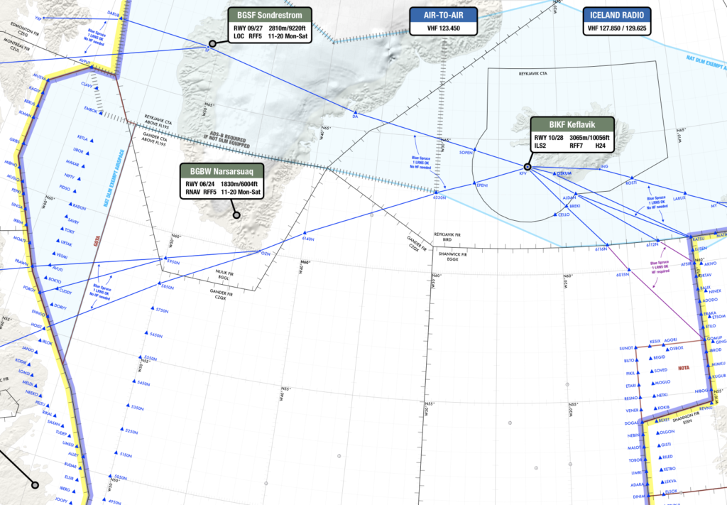
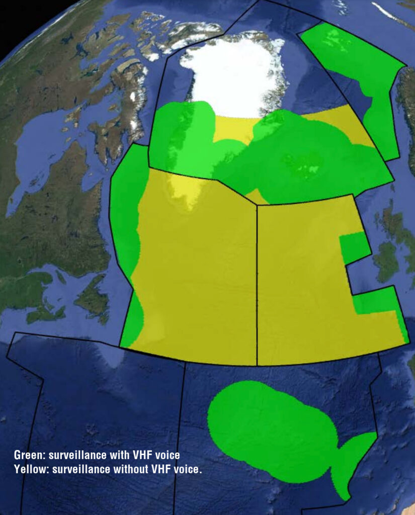
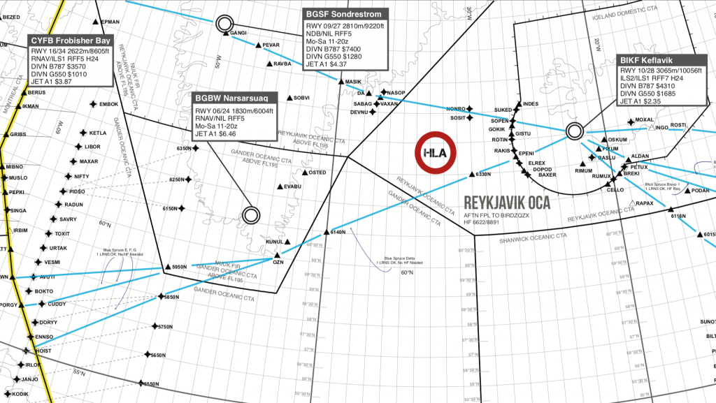
Datalink Exempt airspace over Greenland, Iceland, and a bit of Gander Oceanic
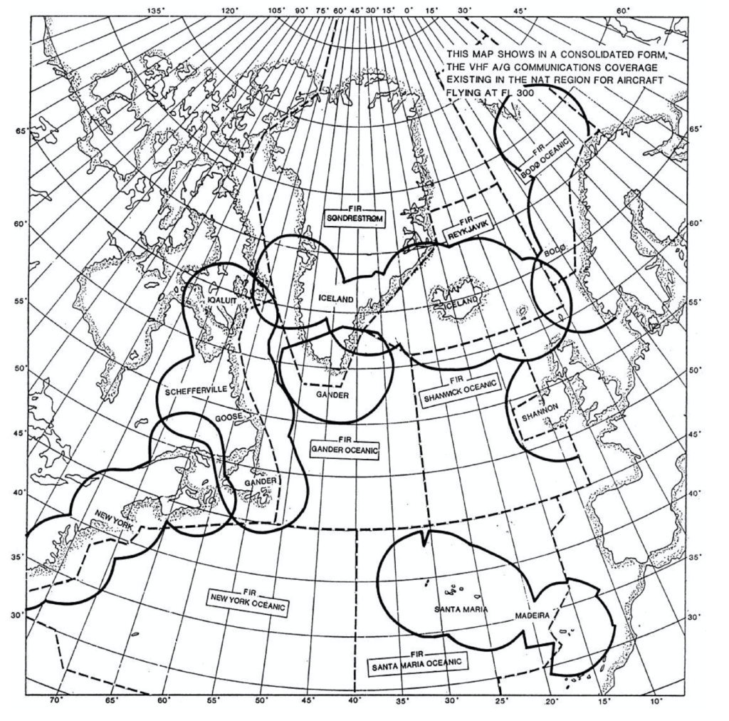
There’s an interesting picture in the NAT Doc 007 doc that looks like this:
 This the datalink exempt ATS Surveillance airspace over Greenland, Iceland, and a bit of Gander Oceanic where you can still fly if you don’t have datalink.
This area is bounded by the following:
Northern boundary: 65N000W – 67N010W – 69N020W – 68N030W – 67N040W – 69N050W – 69N060W – BOPUT.
Southern boundary: GUNPA – 61N007W – 6040N010W – RATSU – 61N020W – 63N030W – 62N040W – 61N050W – SAVRY
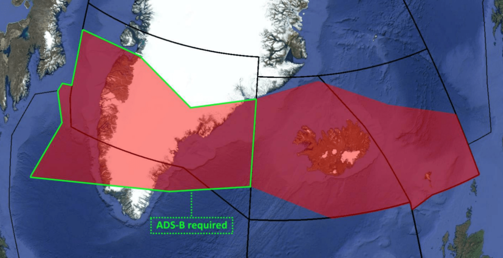
So, putting that on our nice NAT Plotting Chart, it looks like this (outlined in green):
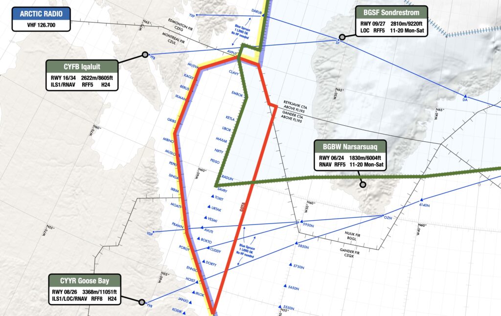
Red = GOTA. Green = Datalink exempt airspace.
Us: What are the requirements for this airspace?
TC: HLA Certification (MNPS & RVSM), ADS-B & VHF.
Us: Nice.
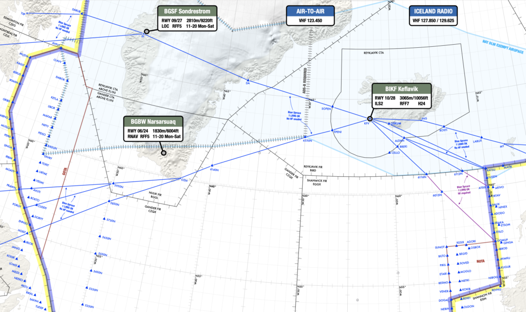
HLA airspace
So now we’re talking about the bit to the south of the datalink exempt airspace, outlined here in fruity pink:
Red = GOTA. Green = Datalink exempt airspace. Fruity Pink = NAT HLA.
Us: What are the requirements for this airspace?
TC: HLA Certification and full DLM certification, FANS 1/a (ADS-C(D1) & CPDLC(J2, J5 or J7)). Depending on the route of flight and the tracks that day there may be other requirements as well (ie. PBCS Certification for PBCS tracks).
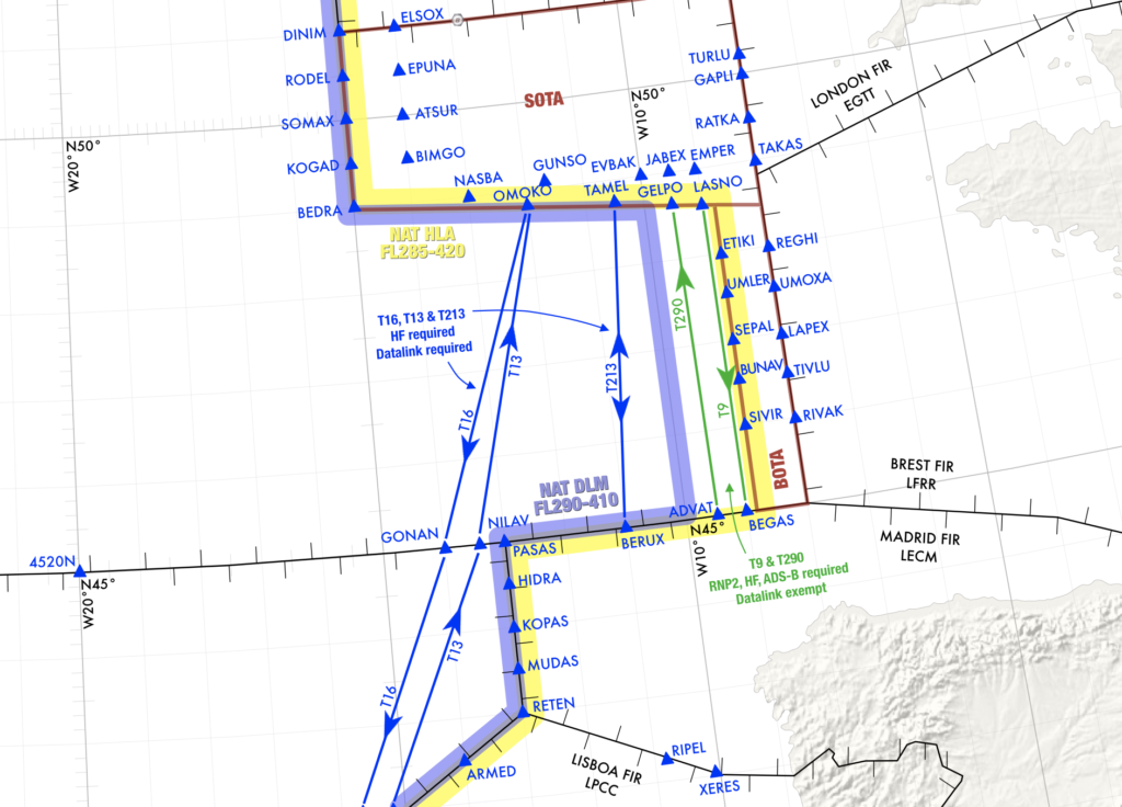
The Blue Spruce Routes
So here’s what we said in a previous post on these…
The Southerly ones: These go over Greenland linking Canada with Iceland via waypoint OZN, and are not fully contained in the exempted airspace. So if you’re flying these southerly Blue Spruce routes you will have to meet the NAT DLM requirements or fly outside of the vertical parameters of DLM airspace (i.e. below FL290 or above FL410). In other words: you need datalink to fly on the southerly Blue Spruce routes between FL290-410.
The Northerly ones: These are the ones going overhead BGSF/Sondrestrom airport. These do fall within the exempted area of airspace – so datalink is not mandatory if you’re flying here.
Only the northerly Blue Spruce routes are datalink exempt.
Us: All that stuff we told people in our previous post… did we get that right?
TC: Yeah, pretty much. The primary purpose of Blue Spruce routes is for aircraft with only one long range navigation system. This would normally exclude them from the exemption area anyway, as they are usually kept below HLA airspace (FL280 or below) as they would normally need state HLA approval to fly a blue spruce route with one long range navigation system at FL290 and above.
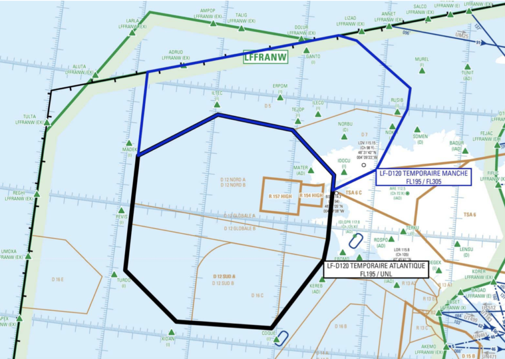
Gander’s datalink exempt airspace won’t be datalink exempt for much longer!
You: Hold on… which bit of airspace are we talking about now??
Us: This bit, outlined in black. It’s the bit of airspace in the datalink exempt area which is controlled by Gander Oceanic.
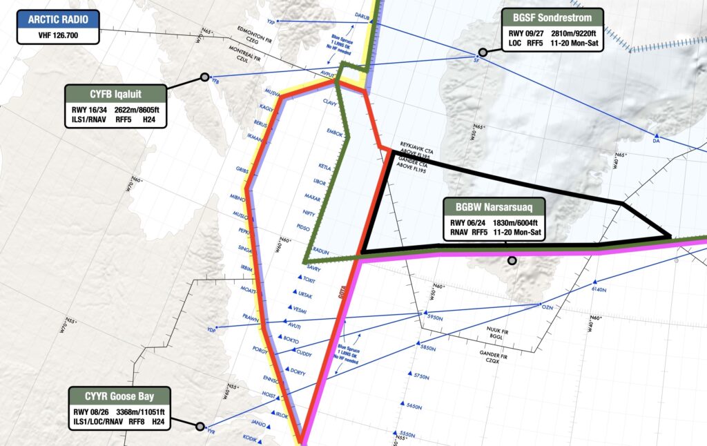
Red = GOTA. Green = Datalink exempt airspace. Fruity Pink = NAT HLA. Black = Gander Oceanic airspace that won’t be datalink exempt for much longer.
So, this is where the plot thickens!
Us: Can you tell us why the plot has thickened, exactly?
TC: Yes, we can. Do you guys actually know anything, or do just come to us for all your answers?
Us: We only know how to massively paraphrase email exchanges.
TC: Okay. So here’s the deal. As we are decommissioning the VHF and ground based ADS-B sites in southern Greenland we will no longer have the datalink exempt area in the northern portion of Gander oceanic HLA airspace. At that point, all Gander oceanic airspace will become DLM airspace. Although GOTA will stay datalink exempt.
Us: Decommissioning VHF and ground based thingies, you say?
TC: That’s right. Nav Canada put out a circular last year and updated it again this year advising that the ADS-B and VHF sites in that area will be decommissioned. The current circular is AIC 15/22. The tricky part is, it discusses just the ADS-B and VHF sites, but many people don’t make the connection from that to the exemption area. When the VHF sites are decommissioned we won’t have the equipment to qualify for DLM exemption in that area. Nav Canada is keeping one frequency until December 29, 2022 to enable users to continue to use the area for this year, but that final one will be decommissioned at that time. The 127.9 frequency will continue to be used by Gander IFSS for the Blue Spruce Routes. When it gets closer to that date, there should be an ICAO NAT Ops Bulletin out and NAT Doc 007 will be amended. So just to clarify, barring any major unexpected changes, that airspace will become strictly DLM airspace on December 29, 2022. At that point it will follow the same regulations as the rest of the NAT DLM airspace.
Us: Bonza.
So, to recap…
- Datalink Airspace: Remember, NAT DLM airspace only applies from FL290-410. Below or above that, you don’t need datalink in the North Atlantic.
- If you have full datalink (CPDLC and ADS-C): You can go where you like, and you didn’t really need to read this post.
- For GOTA airspace: You need a transponder, automatic pressure-altitude reporting equipment and VHF. If you have ADS-B, that’s helpful for ATC.
- For the Blue Spruce Routes: You need datalink for the southerly ones, but not the northerly ones. (If you’re flying on these then you’re probably doing so below FL290 anyway, in which case you’re below NAT DLM airspace and don’t need datalink).
- For the datalink exempt airspace over Greenland, Iceland, and a bit of Gander Oceanic: You don’t need datalink, but from 29 Dec 2022 you will do in the bit controlled by Gander.
Questions
Just send us an email at news@ops.group and we’ll try to find out the answer.


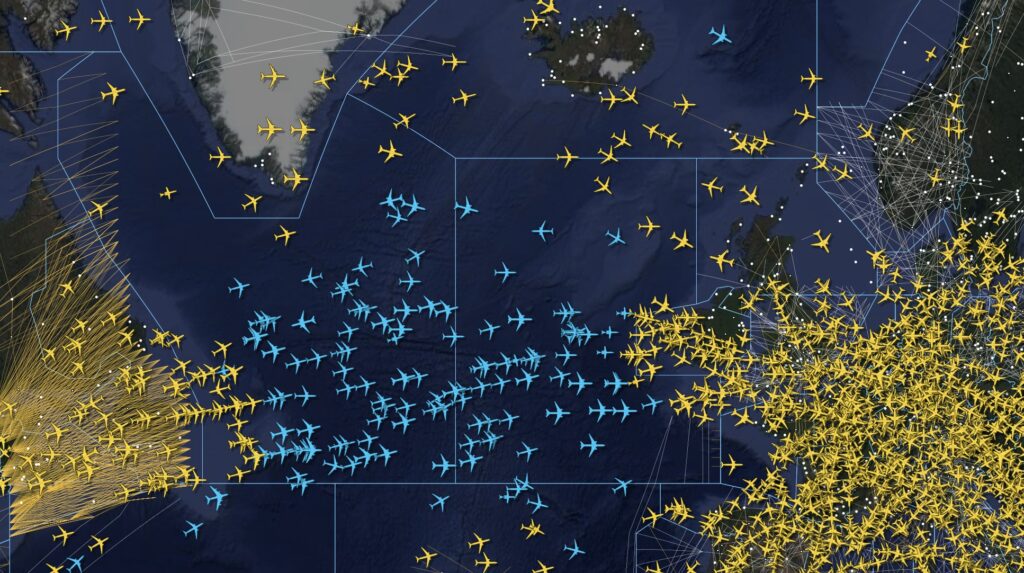
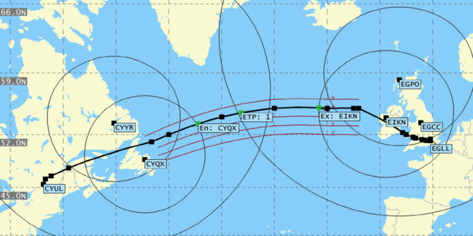
 All traffic crossing the NAT or operating over Western Europe right now should be keeping a close eye on this one.
 Ah, NAT conundrums! We love them so much, we’ve published three entire Volumes already!


 But there’s a problem on the NAT…
 Nav Canada has confirmed to us that this will indeed will be the case. An AIC will soon be published, which is due out in September.


 What do you need?
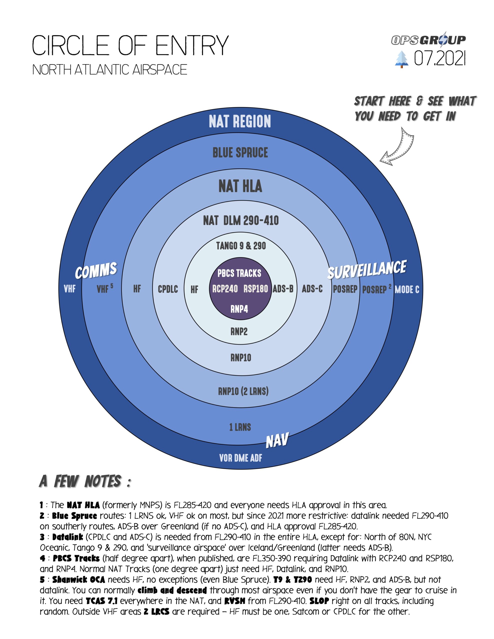


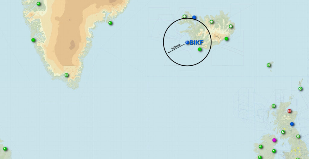
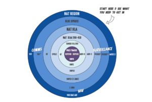 Confused? We don’t blame you. Here’s something that might alleviate some misery though – our NAT Airspace Circle of Entry. OPSGROUP members can download the full hi-res PDF version


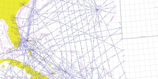
 As far as chart validity dates go, many charts do not have expiration dates; rather that dates published are based upon the measurement of variation. “You may have to go to the manufacturer’s website to see if a new chart is available,” Gribble says. “If you download it on an iPad, they are updated automatically.”
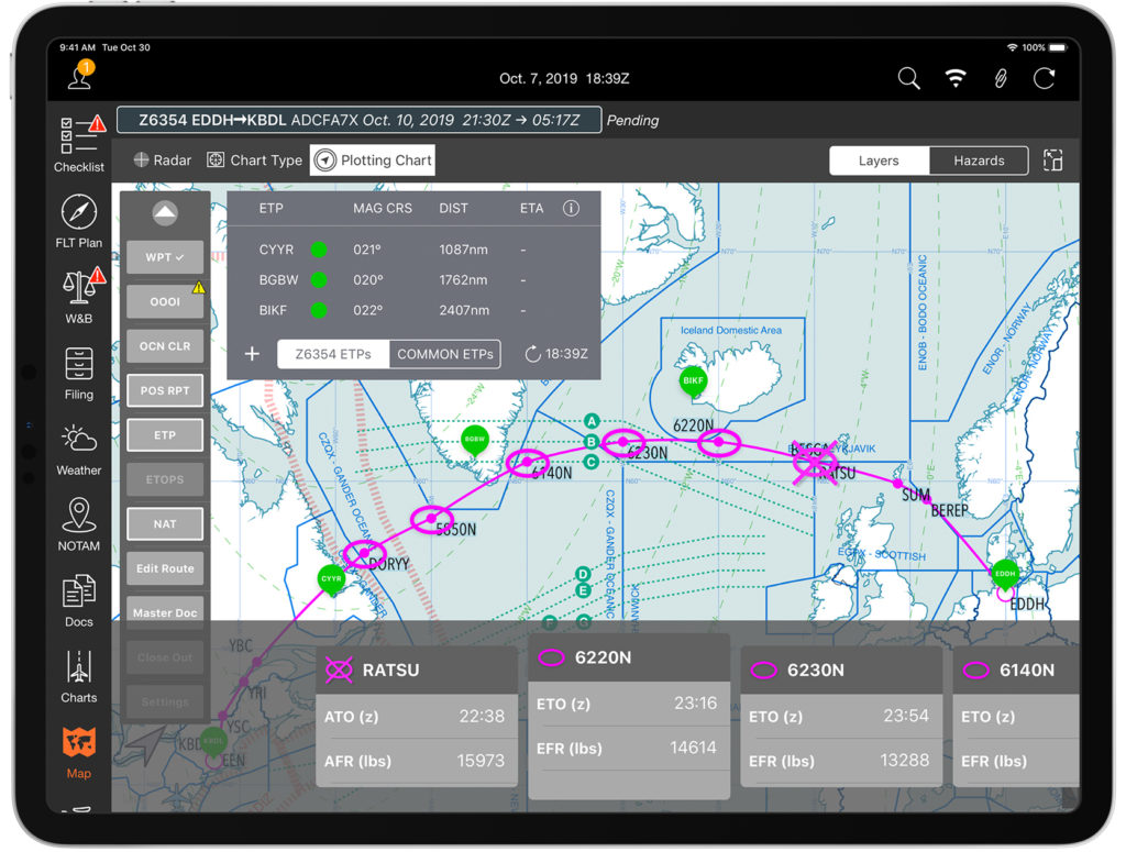 Mitch Launius, from