


GPS interference is becoming more of a regular problem on the North Pacific routes between Asia and North America. We’ve had several member reports over the past few months, and last week I flew through the affected areas myself.
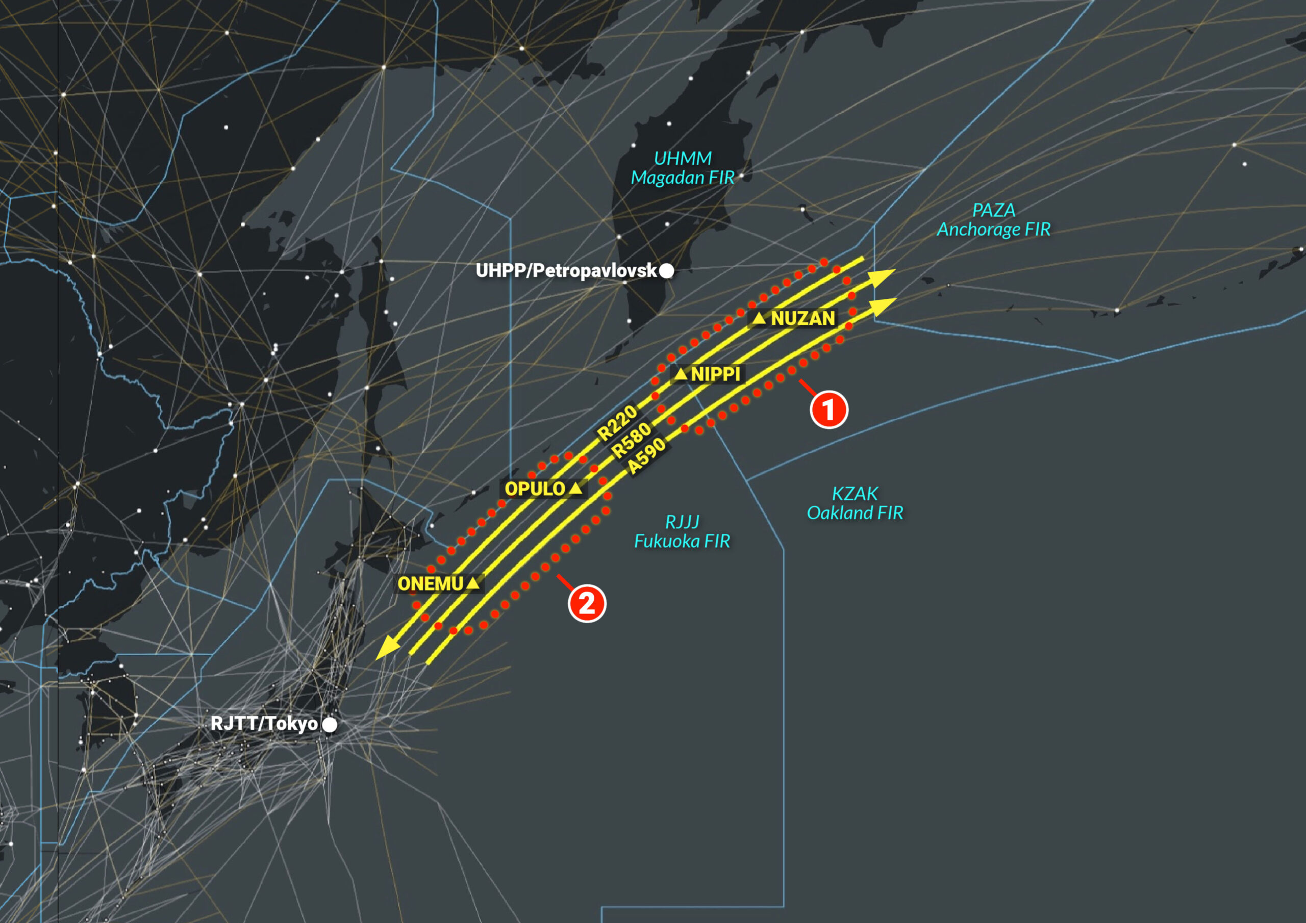
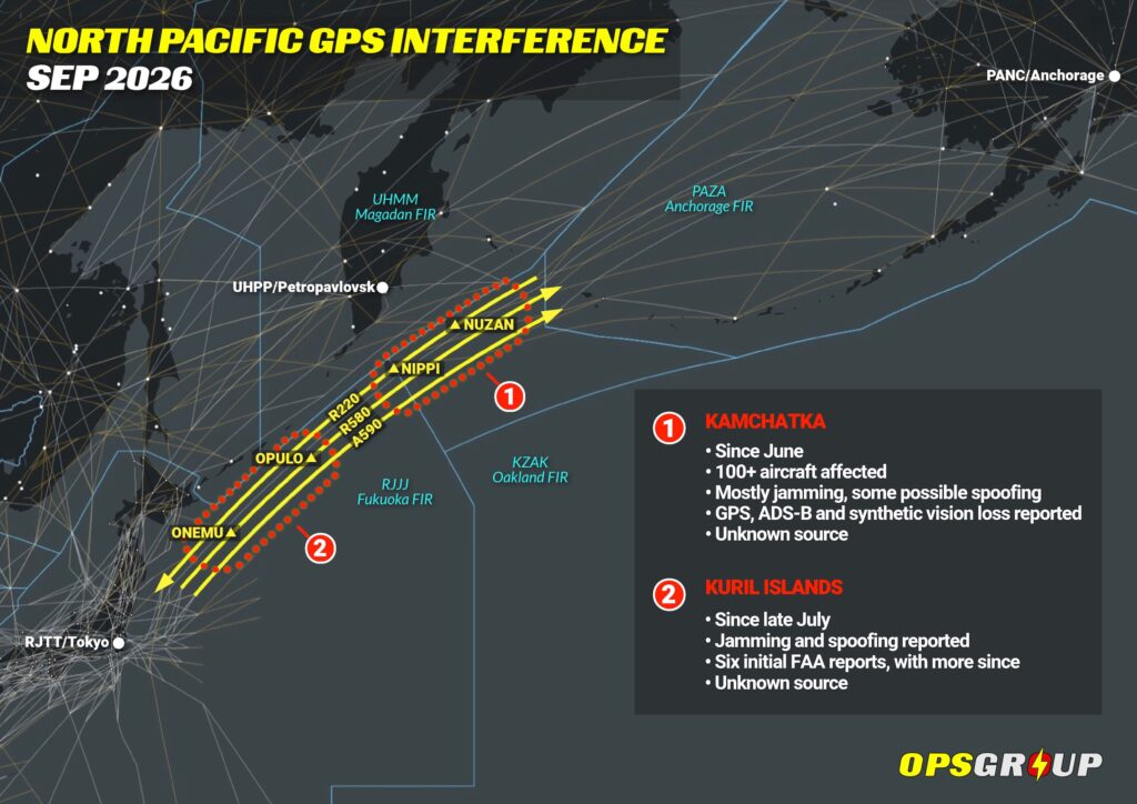
Here’s a map of what’s going on:
Click for PDF.
The first area – Kamchatka
The first reports started around Kamchatka in June. The FAA reckons an unknown jammer has affected more than 100 civil aircraft around NUZAN since then. The affected area stretches across the Anchorage Oceanic and Magadan West FIRs.
Most crews reported GPS jamming – at least four reported possible spoofing. One of our members was westbound on R220 in a G650 when they lost GPS completely between NUZAN and NIPPI. ADS-B and synthetic vision disappeared with it. When the GPS returned, it appeared to be spoofed, with incorrect altitude and time. The whole event lasted almost 50 minutes.
The second area – Kuril Islands
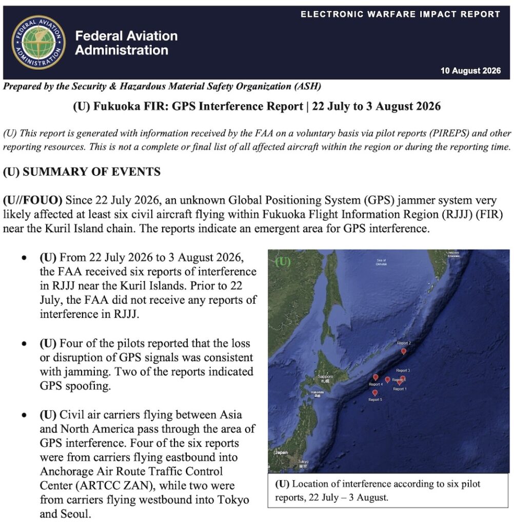
In late July, reports started appearing further south around the Kuril Islands, in the northeastern part of the RJJJ/Fukuoka FIR.
Between July 22 and Aug 3, the FAA received six reports here – four jamming and two spoofing. Four aircraft were eastbound towards Anchorage, while two were westbound towards Tokyo and Seoul. The FAA called it an “emergent area” for GPS interference.
Click for PDF.
We’ve had more reports since then. R580 has been affected from around 100nm north of ONEMU through OPULO, with aircraft on R220 reporting problems too.
On Sep 10, one of our members was flying to Japan on R220 when they got intermittent GPS interference between NUZAN and NIPPI. They were at FL400 at the time.
So whatever is going on up here, it hasn’t gone away.
We flew through it last week
I flew R580 through the area last week in a G700. Knowing about the previous reports, we briefed the expected interference area on the ground and marked it on our flight plan package.
I also put fix rings around the expected entry and exit points in the FMS.
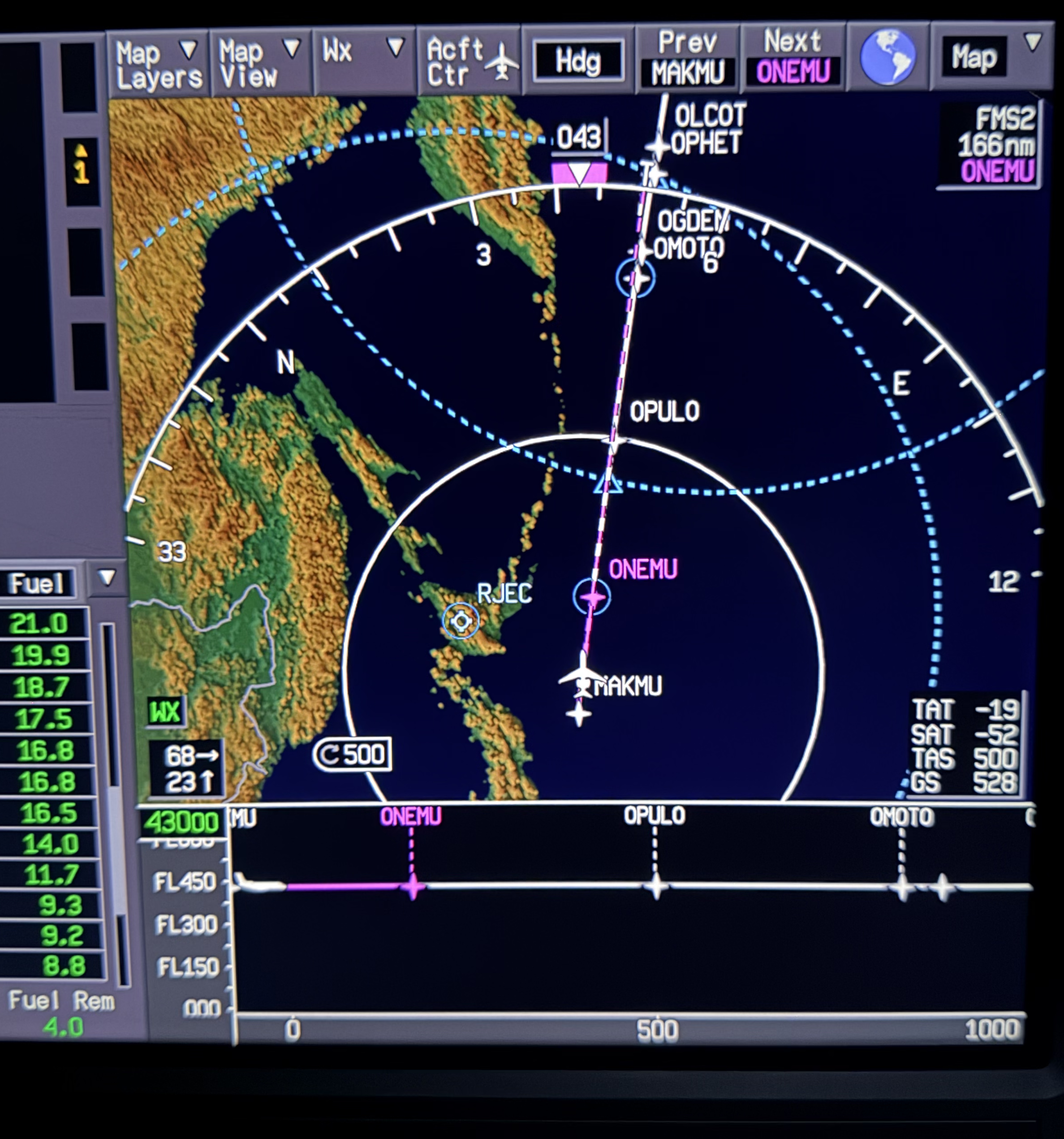
As we passed through, we monitored the GPS status page closely for any degradation or loss of satellites – but we saw… nothing! We had no problems in either direction. I’ll be back through there again next week, and we’ll do exactly the same thing.
Not much warning
Up til the other day, Anchorage Oceanic had this single Notam about GPS interference – not actually saying it was happening, but asking crews to report it if they were affected by it:
A1136/25 NOTAMN
Q) PAZA/QXXXX////000/999/
A) PAZA
B) 2509121800
C) 2609112359
E) ATTENTION ALL FLIGHT OPERATORS. FLIGHTS THAT EXPERIENCE OR SUSPECT
GNSS INTERFERENCE ENROUTE TO THE ANCHORAGE OCEANIC ENTRY POINT MUST
NOTIFY ANCHORAGE ATC. NOTIFICATION SHOULD BE VIA CPDLC, SFO RADIO,
OR SATCOM, CONFIRMING DEGRADATION OF NAVIGATION STATUS AND DETAILS
OF ONGOING LOSS/IMPACTS TO THE AIRCRAFT SYSTEMS AND CAPABILITIES.

EXAMPLES OF NOTIFICATION:
GNSS INTERFERENCE RNP10 ONLY
NO DATA LINK
DEGRADED NAVIGATION NO GNSS

IN ADDITION, AIRLINE DISPATCHERS CAN DIRECTLY INFORM THE ANCHORAGE
OCEANIC SUPERVISOR TO MAKE THEM AWARE WHEN ONE OF THEIR FLIGHTS HAS
BEEN IMPACTED BY GNSS INTERFERENCE BY CONTACTING 907-269-1930.
F) SFC
G) UNL
That Notam has now expired, and there’s currently no replacement yet in the Anchorage Notams.
And when the FAA published its report in August, there were no GPS interference Notams for RJJJ/Fukuoka or any nearby Russian airspace either.
We also spoke to the team at GPSwise. They don’t have any reliable data from this area either, so for now it’s a bit of a black spot.
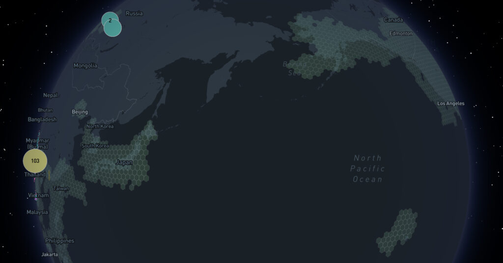
Live interference map from GPSwise.
So if you’re flying the NOPAC routes, particularly R220 or R580 around Kamchatka and the Kurils, it’s worth briefing the known areas before departure. And if you get hit, please do send us a report!

More on the topic:
- More: 2026 Updated FAA Oceanic Guides
- More: Crossing the Quiet South: From Australia to Argentina
- More: Delhi GPS Interference: New Pilot Reporting Procedure
- More: Where is the spoofing today? Two maps to help
- More: GPS Spoofing Update: Map, Scenarios and Guidance
More reading:
- Latest: GPS trouble on the North Pacific routes
- Latest: The Luton Noise Trap
- Latest: India puts a three-aircraft limit on permits
- Safe Airspace: Risk Database
- Weekly Ops Bulletin: Subscribe
- Membership plans: Why join OPSGROUP?






 Get the famous weekly