Update 18 July 2022: The FAA has postponed the final phase of its ‘Northeast Corridor Atlantic Coast Routes Project.’ A whole bunch of new and modified routes along the East Coast were meant to become active from Nov 3. This has been pushed back until 20 April 2023 to avoid the busy summer and winter peaks. The new procedures will still be published in September, but will not be authorized for use until then.
Where are we talking about?
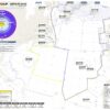
The Airspace: All along the Atlantic East coast of the US.
The Airports:
- KBWI/Baltimore Washington
- KIAD/Dulles
- KDCA/Ronald Reagan
- KHEF/Manassas
- KADW/Joint Base Andrews
- KPHL/Philadelphia
- KEWR/Newark
- KTEB/Teterboro
- KLGA/La Guardia
- KDOV/Dover Air Force Base
- KWRI/McGuire Air Force Base
- KCHS/Charleston
- KJZI/Charleston Executive
- KATL/Hartsfield-Jackson
- KRDU/Raleigh-Durham
What’s changing?
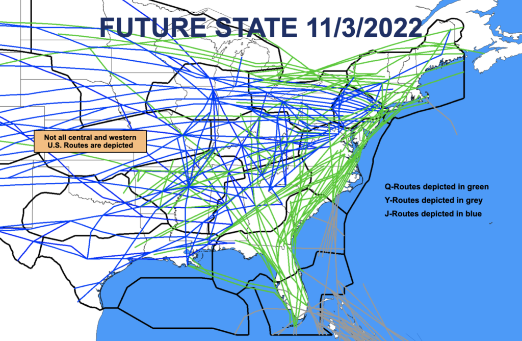
Q, Y and J Routes are changing – some have been amended, some have been deleted and some are brand new. There are also someone SIDs and STARs. Basically, the whole airspace is getting PBN-ed up!
The main change is a large number of new or modified routes (more than 150 in fact) which will replace the existing high-altitude route structure up and down the East Coast. Basically, J Routes are out, new or amended Q and Y Routes are in.
Why? Because PBN (less ground-based Navaids).
This will include super high sector routes (that’s FL400 and above). The full details of the Sector 30 super high sector routes are not yet known but we are expecting:
- 09 DIW Ultra High from FL360-390.
- 50 YKT Ultra High between FL360-390.
- 30 MSN Super High FL400 and above.
Tell me the specifics.
22 Q-Routes (including 9 new ones) and 4 Y-Routes are getting amended.
If you want the full list, go check out the official FAA presentation which you can download via the NBAA site.
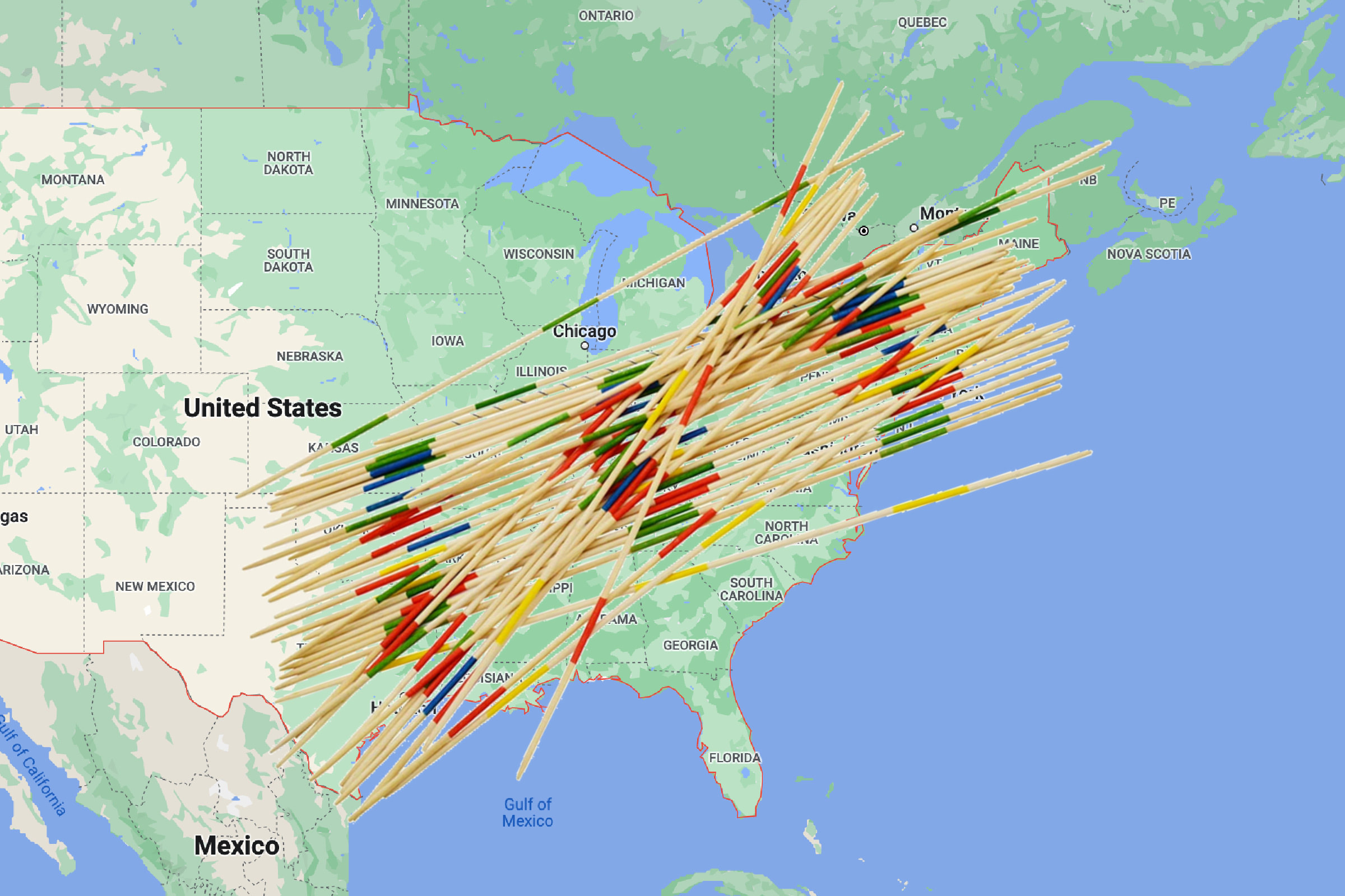
The FAA map… or an extremely complex game of Pick Up Sticks?
What does it all mean for folk flying there?
It means much more efficient ATC as it will help reduce their workload, and also the messiness of the current route structure. This means time and fuel savings for the operators operating in this region, as well as increased safety!
What has happened so far?
You’re going to have been seeing a lot of this already, it’s been going on since 2019 with 106 route changes implemented so far.
- In May 2021 two Q-Routes (Q75 and Q475) were amended.
- Through the rest of 2020 a large number of J-Rouete were deleted, and modified Q-Route were brought in.
- AR7 and AR25 were removed.
- There was also the whole Florida Metroplex stuff, which we mentioned before here.
- And a bunch of new, amended, deleted SIDs and STARs at the major airports along this region
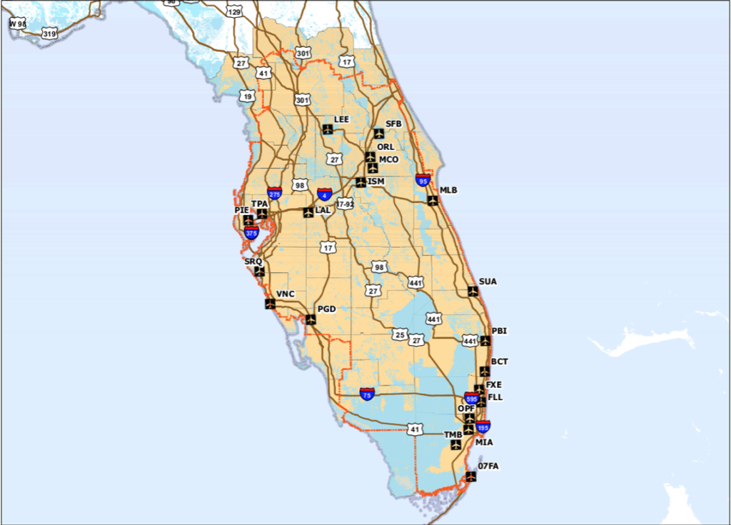
The Florida bit of the project.
So what do you really need to know?
The route changes will be published September 8. They will go active 20 April 2023. If you do absolutely nothing else, just be aware that if you file a flight plan from that date you’re going to be filing the new Q-Routes, and you’re also going to be PBN-ing a lot more.
Where can you go for more info?
The official FAA presentation is probably the best spot to find the answers to your questions. Here the link (to the link) is again.
And here is some other stuff on NAS changes like the Northwest Corridor.
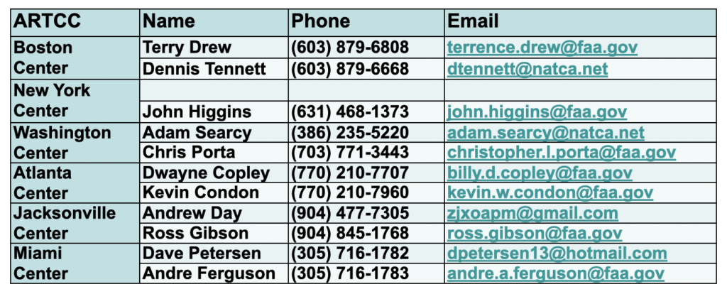
You can also ask folk directly, depending on where you are/which area you want to know about, or contact the lead FAA people on the project: paul.m.withers@faa.gov /joseph.b.tinsley@faa.gov
More on the topic:
- More: US Ops Update: Speeds, Squawks and Slippery Runways
- More: FAA Warns on Runway Length Data and Overrun Risk
- More: US Shutdown Ends and FAA Lifts Flight Restrictions
- More: Updated FAA Oceanic Guides
- More: FAA Housekeeping: Foreign Instrument Procedures, Approach Chart Clutter
More reading:
- Latest: Gander’s Bringing Back CPDLC Oceanic Reroutes
- Latest: EU Temporary Admission of Aircraft – Busting Myths
- Latest: US Ops Update: Speeds, Squawks and Slippery Runways
- Safe Airspace: Risk Database
- Weekly Ops Bulletin: Subscribe
- Membership plans: Why join OPSGROUP?