US Ops Update: Speeds, Squawks and Slippery Runways

The last few weeks have thrown up some interesting US ops stories.
We’ve looked at new FAA guidance on when pilots can exceed 250kts below 10,000ft, dug into a tricky question about the 200kt restriction beneath Class B airspace, followed reports of a curious transponder issue around Denver, and heard about the NTSB’s call for a review of runway condition reporting.
Here’s a quick round-up of what you may have missed in our ops alerts recently.
Going fast below ten
On June 12, the FAA published a new Information Note on exceeding 250kts below 10,000ft.
This wasn’t a rule change. It was really the FAA clarifying how an existing exception should be applied.
We know the basic rule: no more than 250kts below 10,000ft. But there’s an exception when an aircraft’s minimum safe airspeed exceeds 250kts.
Some heavy aircraft do require speeds above 250kts in certain situations. But if the aircraft can be safely configured to comply with the speed limit, then that’s what the FAA expects operators to do.
In short: the exception applies when the aircraft genuinely cannot safely operate at or below 250kts – not as a way around the speed limit.
200kts below Class B
While we’re on the topic of speed, here’s an interesting question that came in from an Opsgroup member flying the HURCN 4 SID at KOPF/Opa Locka.
The issue involves the 200kt speed limit that applies beneath shelves of Class B airspace. The SID contains a chart note instructing aircraft to accelerate to 250kts until leaving 10,000ft. So which speed wins?
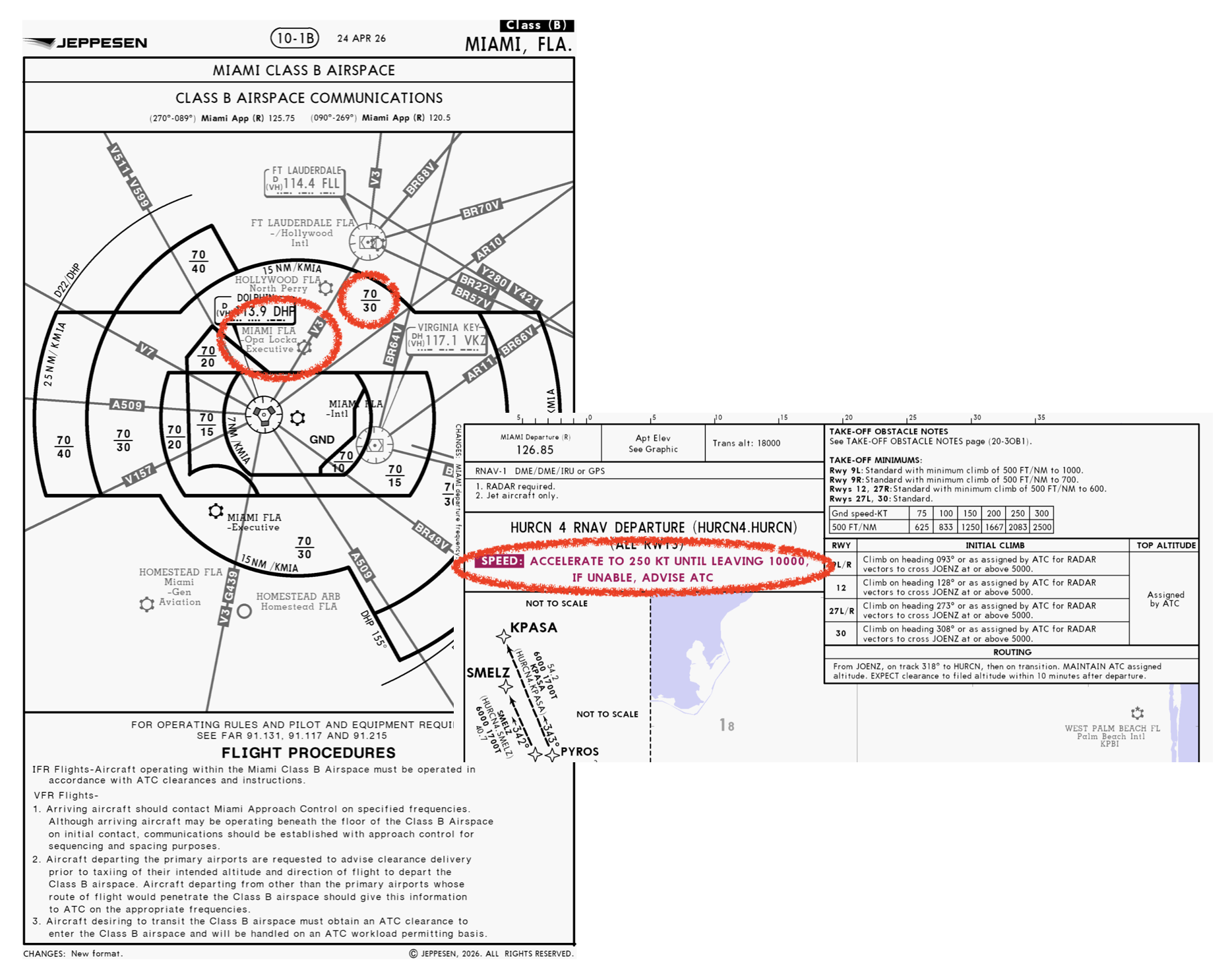
Our reading is that the chart note does not override the regulatory speed limit. In this case, 200kts would apply until entering the Class B at 3,000ft, after which an acceleration to 250kts would be allowed.
A similar question came up at KSJC/San Jose on the LOUPE1 SID, where part of the procedure runs beneath a Class B shelf even though the SID itself contains a charted speed of 230kts.
It’s not just departures either. Another member asked about descents into KTEB/Teterboro, where aircraft are often kept at 250kts until relatively low altitude while being vectored for the RNAV 19 approach.
A highly-experienced Opsgroup expert and local operator told us this had come up before. While ATC may want aircraft to keep their speed up, controllers are generally careful not to assign speeds that would require pilots to exceed 200kts below the Class B.
One practical tip is to keep ATC informed. For example, if assigned a descent to 2,000ft where the Class B floor is 3,000ft, consider adding “slowing to 200 below the Class Bravo” to your read back.
If you’re an ATC controller and have experience with this issue, we’d love to hear from you at blog@ops.group.
Weird transponder issue at Denver
This one’s still a mystery!
Last week an Opsgroup member pinged us on WhatsApp, saying that ATC had advised a G550 crew of reports that some aircraft were unexpectedly reverting to transponder code 1200 and STBY without any pilot action. The issue had reportedly been observed on aircraft equipped with both Honeywell and Collins avionics, suggesting it wasn’t limited to just one type.
Sure enough, on departure from KBJC/Rocky Mountain the next day, the crew experienced exactly that. The transponder reverted to 1200 STBY without any associated CAS message.
We reported this to the group, and we’ve since received reports from other operators, including a Falcon 2000 LXS that experienced the issue on two separate transponders, along with an Embraer 175. All reports so far have one thing in common: the Denver area.
We still don’t know what’s causing it.
One possibility is an avionics or software issue. The fact that both the transponder code and mode appear to change points towards something system-related.
There is some precedence for this type of behaviour. Eurocontrol previously documented a Honeywell Primus/Mode S interface issue that could result in a transponder unexpectedly reverting to standby. But this was associated with code entry, not these specific circumstances.
Another possibility is some kind of GPS-related disruption. The Denver area has a well documented history of military GPS and interference testing. Work carried out by the Opsgroup GPS Spoofing Work Group in 2024 illustrated how closely interwoven a transponder is with ADS-B Out, GPS position and FMS.
A GPS failure should not cause a transponder to select standby by itself, but weird system interactions can’t be ruled out. We know that some systems can enter fault modes or stop transmitting ADS-B when position is lost.
A ground-based issue seems less likely. ATC sometimes see transponder anomalies that the crew may not, but this doesn’t really explain a change in both mode and code.
Then there is a remote possibility of electromagnetic interference or some other malicious cause. While not impossible, there is currently no evidence that points in that direction.
If you’ve experienced this issue yourself, especially in the Denver area, please reach out to us on blog@ops.group.
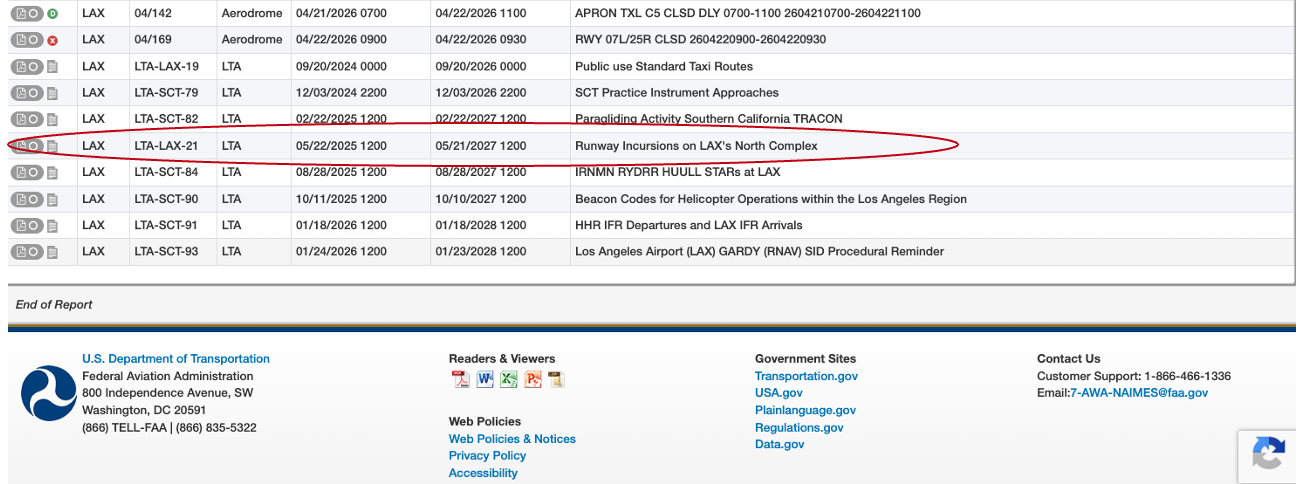
The NTSB say runways may be more slippery than reported
Last one for this update.
The NTSB is pushing for changes to runway condition reporting after determining that the current RCAM system may underestimate the loss of braking action experienced during extreme rain.
The issue is that today’s system can still classify a runway as “wet/good” even when rainfall intensity is high enough to significantly reduce braking performance.
The NTSB reviewed eleven runway overruns between 2008 and 2022 involving wet runways. In nine of them, investigators found that moderate-to-heavy rainfall likely reduced braking more than the RCAM model would predict.
In other words, not all wet runways are equal. Crews may be using perfectly valid wet-runway landing calculations based on friction values that are too optimistic. The practical takeaway – when the rain gets heavy, be conservative!
Have something to add?
Let us know! Most of our content comes from you – our members and readers. If you’ve spotted something unusual, we’d love to hear about it. We’d welcome additions to this article or ideas for future updates. Email us at blog@ops.group.


 Want to see the approach in action?
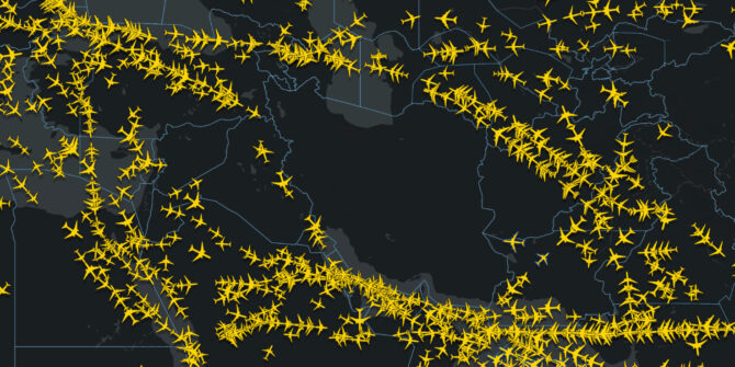
 Roughly twenty percent of the world’s supply moves through the Strait of Hormuz every day. Even the threat of the route being disrupted will have a direct impact on oil prices. This is because traders immediately start pricing in the possibility that shipments may be disrupted.
 Shortages not expected


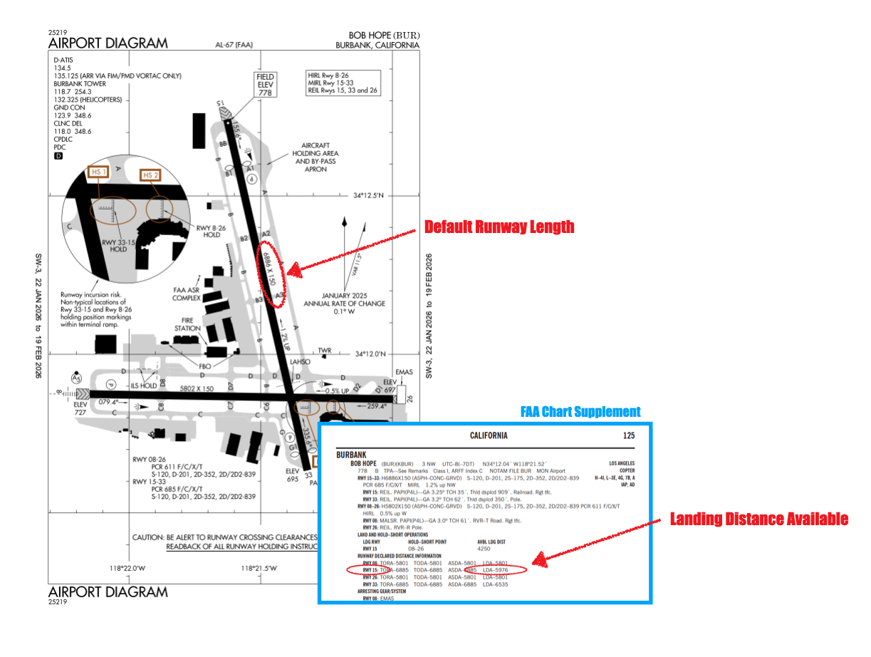
 Under the FAA regs, these distances are the authoritative performance numbers. They override any single runway length shown elsewhere. That’s the key point.