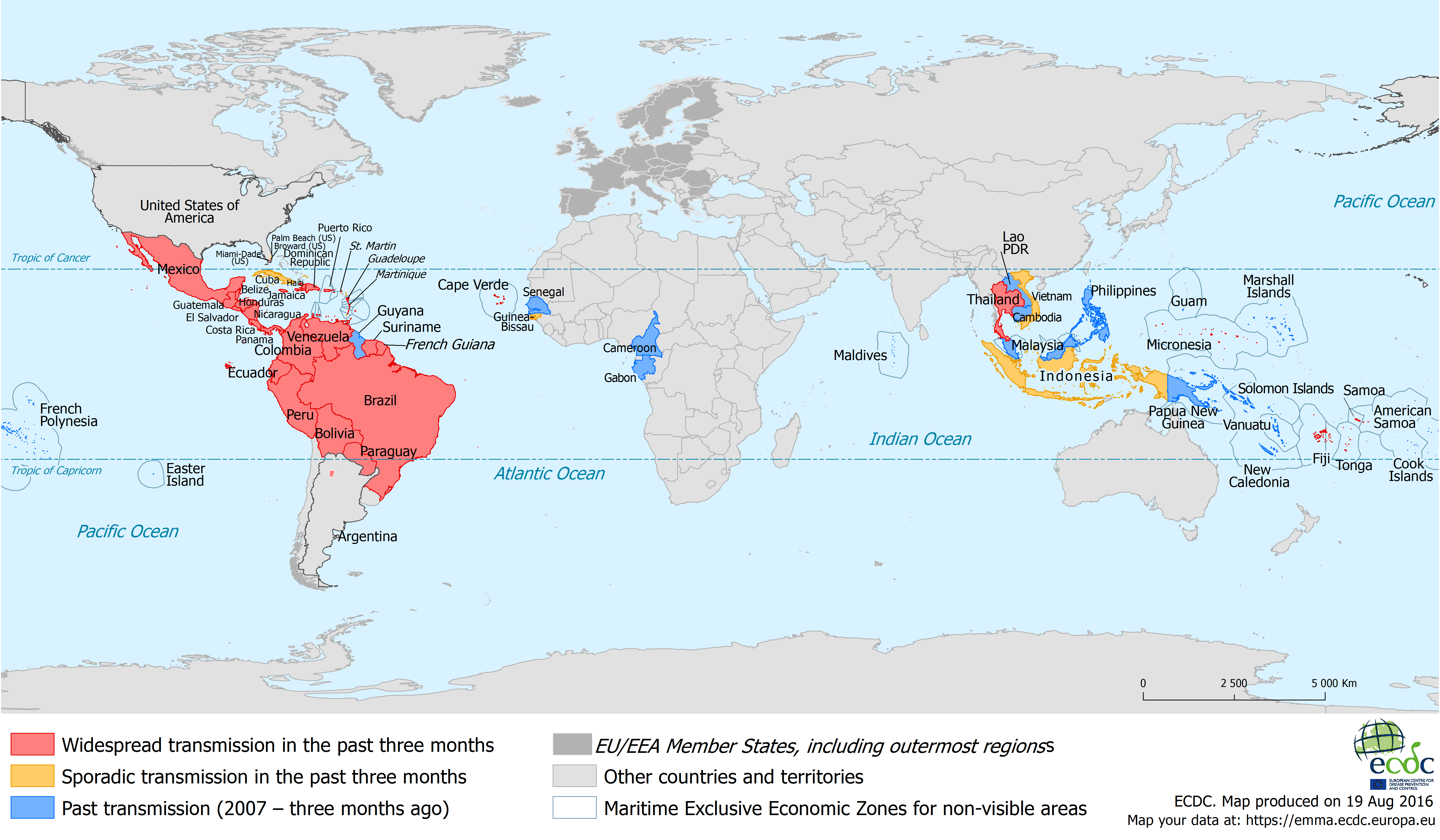
We just came across this – and it’s a very useful, current map, of where the Zika virus has been found. A few weeks back, we reported that Zika was on the decline, thanks to winter in South America and a declining mosquito population. Turns out, that optimism was premature.
This map shows where Zika is, as of 19 August 2016.
 Sporadic transmission: No more than 10 locally transmitted cases have been reported in a single area within this time period.
 Increasing or widespread transmission: More than 10 locally transmitted cases of Zika virus are reported in a single area, OR at least two separate areas report locally transmitted cases of Zika virus, OR Zika virus transmission is ongoing in an area for more than 3 months.
 Past transmission: Local Zika virus transmission has been reported since 2007 – but not in the past three months. –
References:
More on the topic:
- More: Guided Visuals: What they are, and why they’re so useful
- More: Singapore Ops Update: Two New Rules to Know Before You Go
- More: EU-LISA: The BizAv Guide
- More: Crisis in Iran: Elevated Airspace Risk
- More: Greece Winter Runway Closures
More reading:
- Latest: Guided Visuals: What they are, and why they’re so useful
- Latest: Singapore Ops Update: Two New Rules to Know Before You Go
- Latest: EU-LISA: The BizAv Guide
- Safe Airspace: Risk Database
- Weekly Ops Bulletin: Subscribe
- Membership plans: Why join OPSGROUP?


 Get the famous weekly


