If you have a Russia trip coming up soon, then keep a close eye on those charts. The whole feet-meters conversion/QFE/”Descend to height” carry on is going to start disappearing effective February 2017.
Way back in 2011, we told you about Russia’s transition to using Feet instead of Meters, for enroute traffic – above the transition level. Ever since then, we’ve kind of been waiting for the same change at Russian airports.
And now, it’s happening.
- As of February 2017, ULLI/St. Petersburg will be the first Russian Airport to start using feet and QNH – chosen because it’s pretty close to sea level. And one of the more ‘western’ Russian airports.
- Descent clearances will be to an altitude in feet, based on QNH
- The ALT/HEIGHT conversion chart will disappear from charts
- You’ll get “Descend altitude 3000 feet QNH” instead of “Descend Height 900 meters” from ATC.
- After the St. Petersburg ‘trial’ is complete, the rest of Russia will slowly follow suit. We don’t yet have a firm date for further airports within Russia, but will update this page when we do (or we’ll tell you in the bulletin).
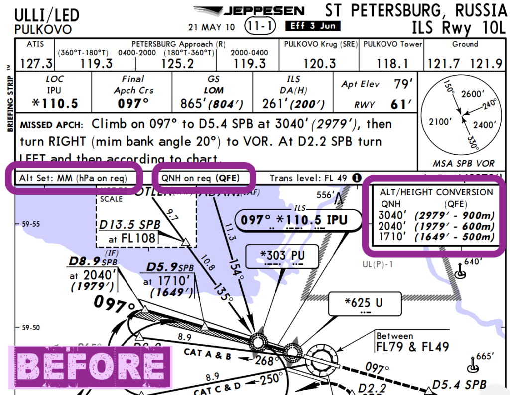
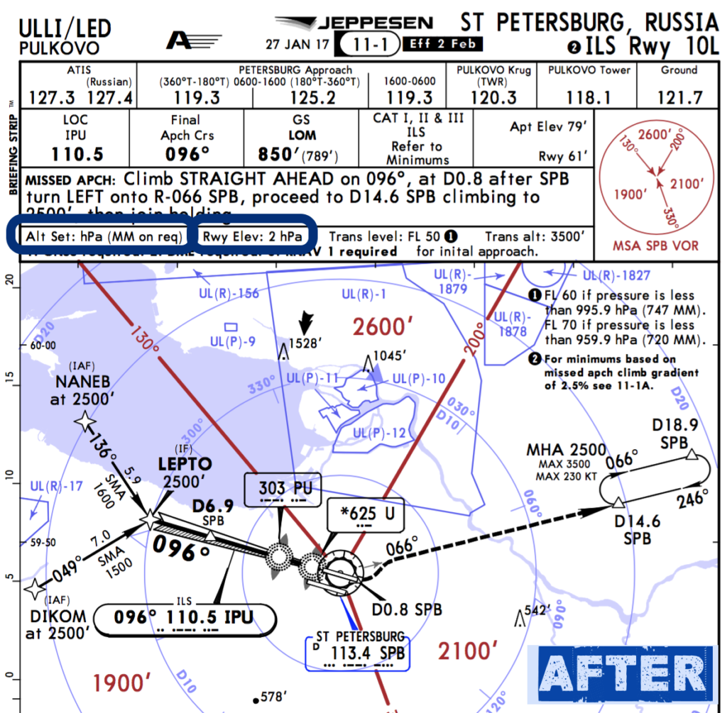
Quick example for ULLI ILS 10L, so you get the idea:
- The ALT/HEIGHT conversion box is gone
- The “Alt Set” or Altimeter Setting box shows hPA (Hectopascals) instead of MM (millimeters), which means a QNH-based approach
- Previously charts showed QFE in bold which meant that was the preferred altimeter setting, now it’s QNH.
References:
- Official Russian announcement (in Russian, but you know what to do).
- The AIC for ULLI with a summary of the change.
- Read more on metric altimeter settings at Code7700.com
More on the topic:
- More: Beware Below: New Warning on QNH Errors
- More: Airspace Violations: Spillover Concerns in Eastern Europe
- More: Russia: Aircraft Shot Down, New EASA Airspace Warning
- More: Ukraine-Russia Spillover Risks: Nov 2022
- More: Is the Fuel Pool Drying Up?
More reading:
- Latest: FAA Warns on Runway Length Data and Overrun Risk
- Latest: EASA’s New Cyber and Data Risk Rule for Operators in Europe
- Latest: Airport Spy: Real World Reports from Crews
- Safe Airspace: Risk Database
- Weekly Ops Bulletin: Subscribe
- Membership plans: Why join OPSGROUP?




 Get the famous weekly