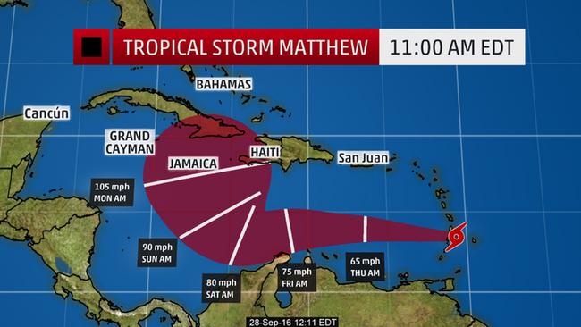
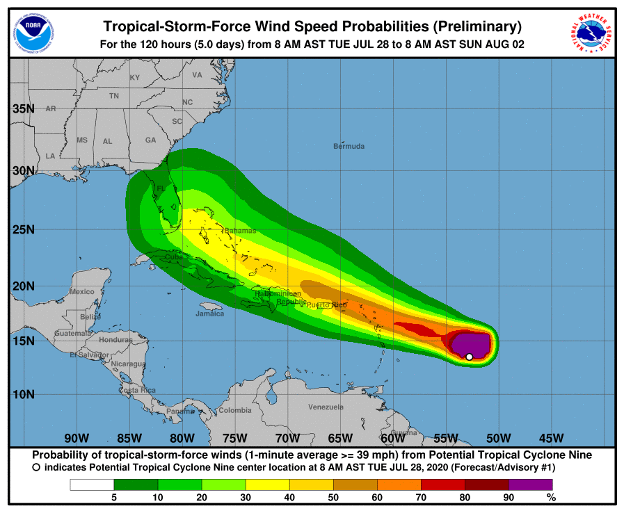
We’re tracking this developing storm in the eastern Atlantic, which is forecast to become a tropical storm (named Isaias) in the next 24 hours – and quite possibly develop into Hurricane Isaias.
There is a huge problem this year in relief efforts: Covid. It will mean that as little as 20% of the normal relief resources are available. We want to help, and we have a request…
If you are willing to share your expertise as a volunteer, we’re looking for flight planners, dispatchers, schedulers, pilots, ops specialists, and anyone that can offer a small amount of time to help out. Very simply, there’s stuff you are good at, and it can be extremely useful in a hurricane relief situation.
Volunteer to help
Relief Air Wing: OPSGROUP helping in disaster relief
We’re making a very specific plea for help today. OPSGROUP is capable of great things, and we are focusing on how we can assist families and individuals affected by major hurricanes in the Caribbean and the Atlantic seaboard this season.
It might be next week, it might be in a month, or two – but this is already an extremely active season. Sea temperatures are extremely high – and this is the fuel for hurricanes. 2020 is already setting records, but the worst is yet to come.
The depth of knowledge, experience, wisdom, and compassion in this group is huge. I think we all want to help, if only we knew how. So that’s what we’re working on.
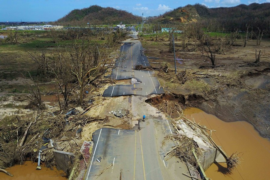
This year more than ever, the Caribbean and the Atlantic seaboard will need real help. Covid is changing the relief landscape. Relief workers will have a tough time getting in to affected countries. Many may simply not be able to travel. Priorities have shifted. For families and individuals hit by a hurricane, help will not come as easily and quickly as normal.
So, we have set up a dedicated relief organization called Relief Air Wing. Why?
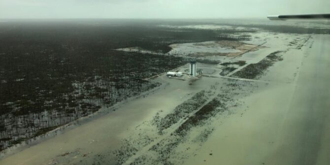
Because in Hurricane Dorian, as you might remember, OPSGROUP got involved in a big way. We were able to help, but we also saw a lot of big problems how aviation worked. It was a dangerous, chaotic mess. Airspace became saturated, and there was little ATC (pilots called it the “Wild West”). Rogue pilots flew dark. Little information was known about airports. Permits were hard to get. There were streams of small aircraft, individually helpful, but overall contributing to bottlenecks and preventing larger aircraft and the USCG from doing their work. Few knew how best to help, and many just flew in based on their own assessment. There was little communication between different agencies.
Volunteer to help
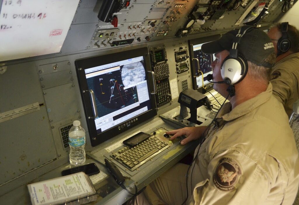
One of the great mysteries of Hurricane Dorian, Warlock 48.
The simple net result: Relief flows far more slowly than it needs to. Supplies are wasted. People devastated by the hurricane suffer longer than they need to. Pilots and aircraft at put at risk.
So, how can I help?
Please sign up with Relief Air Wing and volunteer your time and expertise.
We thought of some basic ways that OPSGROUP members can help, and these are below, but you may have ideas too, and we would love to hear them. Here’s what we’ve got so far:
Overflight and Landing Permits
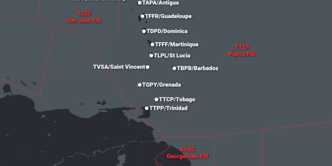
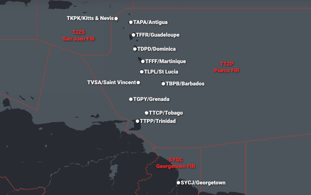
Make a list of the most overflown countries and FIR’s inbound to the hurricane area. For example, if it’s Dominica, relief operators from the US might need to overfly Cuba, Jamaica, Dominican Republic, Puerto Rico. What are the rules? What are the current contacts? What documents are needed? Aim: create a briefing sheet for overflight and landing permits to get in.
Operating permission
The local CAA will set up rules around what’s required for a permit to operate in the affected area. Get this information, prepare a briefing, so that crews know how to get a permit.
Security risks
Assess the situation on the ground. What risks – new or existing – exist for relief operators. Are airports secure? What is happening locally? Aim: A set of notes highlighting risks for relief operators.
Flight Planning routes
Build flight-plannable routes to and from affected countries and airports. Look at airway restrictions, talk to ATC create routes that can be used by relief aircraft to get in and out. From this we can publish clear lists of how to flight plan in and out. This saves time and effort, and means relief can come faster.
Travel restrictions
Once it becomes clear what country is affected, we need to act quickly to create a clear briefing on how to get in. The more we can do before the storm, the better. What are the Covid entry rules? Are there exceptions for relief workers? Can you make contact with the Ministry of Health, Foreign Affairs? The CAA?
Listen in on Hurricane Telcons
The FAA and other agencies often have hurricane telcons a few times a day when big storms are approaching, and we need someone to join those calls and make notes of pertinent info to share.
Hunt down airport situation updates
Call the airport, email them, fax them, AFTN them. Try ATC. Find the airport manager on LinkedIn. Look through twitter hashtags. Ask a friend. Ask a friend to ask a friend. Whatever it takes.
Analyse situation PIREPS
Best info comes from those that have flown in. Use your network to ask crews for PIREPs, so we can tell other relief agencies what the picture at the airport is. We have a standard PIREP form for relief operations, you can help by analysing those pireps, fact check as much as possible, and add the report to the list.
Weather analysis
Track potential hurricanes, monitor their progress, alert the group when you think it might be a big one that will hit land. Monitor for further bad weather post-hurricane.
Use Tech
Maybe you know places we don’t. Secret satellite feeds. Apps, tools … wherever you think tech can help, suggest it and work on it.
Offer an Aircraft
Your owner, company, or operation may have an aircraft that you wish to offer for relief operations. Especially useful are freighters, large capacity aircraft, helicopters, and floatplanes.
Coordinate
Help to manage the relief efforts in Relief Air Wing. Take charge of specific items, and direct and guide volunteers.
Contactors
Reach out to people on our list of relief organizations. Find out who is responding. What flights are planned. What they know. What their needs are.
Local Networks
Lead a WhatsApp group of local people. We’re setting up small local networks, connecting ATC, Airports, FBO’s, Fuellers. The aim: Get the information on the local situation out … . Help them to report on critical info: is the airport open, what are the runways like, is there fuel, is there ATC, what are traffic levels like, what frequencies are working. More about Local Networks here.
Administration
Keep the info documents, maps, spreadsheets up to date. Add new information as it comes in. Filter and remove information that is not useful. Keep things simple.
What else?
You might have ideas of other ways that our OPSGROUP community can help. There are 7,000 of us. 75% are pilots. Even with a low average of 2,000 flying hours TT, that means we have a minimum of 10.5 million flight hours of experience in the group. How do we leverage that? We also have dispatchers, flight planners, ATCO’s, tech gurus, agencies, organizations. How else can we provide support? Ideas please!
Volunteer to help
How will it work?
1. We have a dedicated Slack group for Relief Air Wing. Here, we can all talk to each other, discuss, share information. This is the hub of our work. Specific channels for flight planning, permits, weather, airport status.
2. We set up international groups to coordinate with relief agencies responding (WhatsApp)
3. We set up local networks to bring aviation contacts together on the ground (WhatsApp)
4. We will prepare simple briefings for relief operators flying in.
5. We will coordinate between relief organizations, host nation government, CAA, and the relief operators to determine where help is needed.
6. We will help to match empty seats, capacity, and offers of aircraft with relief organizations that need it.
How do I sign up and get involved?
1. Start by reading Lessons from Dorian: aviation problems in relief, and read the story of Relief Air Wing
2. Sign up to volunteer here, and your details will be added to our list of volunteers.
3. You’ll get an invite to join the Relief Air Wing slack group. Post a quick intro.
4. When a storm looks like it will hit, we’ll contact you.
5. If you’re free and available, jump in and take part. Choose the area you can help in best, and get stuck in. We’ll guide you on how to best help.
Volunteer to help
In advance, thank you for your kindness, help, and generosity. There’s no obligation to take part when the time comes if you’re not able to, but if you are able to help at all in any way, we will be very grateful to get your volunteer registration.
Also, if you know of someone that might like to get involved, it doesn’t matter if they aren’t an OPSGROUP member – the more hands we have on deck, the better. Please share, or forward this post.