SafeAirspace: 2021 Update

2020 was a heck of a ride. But therein lies the risk – what else might you have missed amongst all the Covid-related noise? Sadly, conflicts and their risks to civil aviation have not taken a break during the pandemic.

As it’s a new year, we thought a summary of Airspace Risk was called for. Here’s what’s making headlines at the moment:

Saudi Arabia & Yemen

Houthi rebels in Yemen are regularly firing explosive drones and rockets across the border into Saudi Arabia, and these usually target airports in the south such as OEAH/Abha and OEGN/Jizan. Their latest attack was on OYAA/Aden airport in late December which resulted in mass casualties.

Saudi Arabia continues to retaliate with airstrikes. The latest was in the capital Sanaa just weeks ago, where multiple munitions landed near the airport.

The risk to aviation is that overflying aircraft may get caught in the crossfire or might be misidentified by Saudi air defences. Active terrorist groups in Yemen may also use anti-aircraft weaponry to target foreign interests.

The FAA prohibit all US operators from entering most of the OYSC/Sanaa FIR at any level. Only two airways are allowed, and they are well off the coast – UT702 and M999.

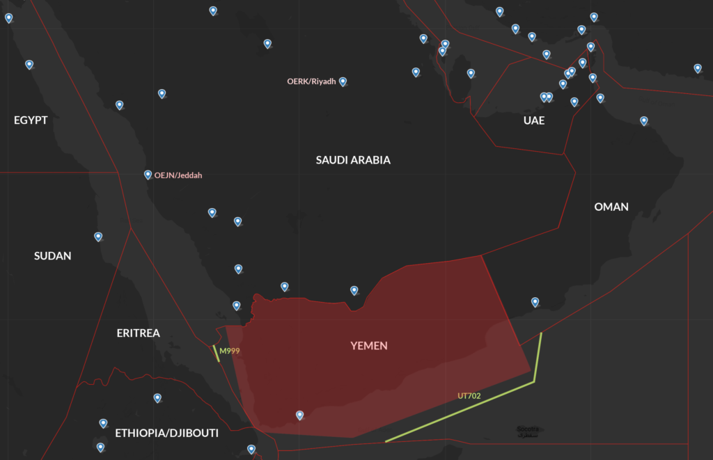
Only two available airways for US operators near Yemen and both are well off the coast.

There are no restrictions on Saudi Arabia but use caution in the southern regions. France and Germany have issued their own warnings.

SafeAirspace Yemen page – click here.
SafeAirspace Saudi Arabia page – click here.

Iraq

Rocket attacks on military interests at airports have become a common occurrence. They are generally fired by local militia without warning. ORBI/Baghdad is frequently targeted, along with other airports including ORER/Erbil. There is a clear risk to aircraft at low levels.

US relations were further strained through 2020 with multiple attacks on the US embassy in Baghdad. The tensions escalated to a point where the US considering closing it.

Foreign aircraft continue to be at risk from armed militia who have access to portable anti-aircraft weaponry, while misidentification by the air defence systems of multiple foreign forces in the country is also possible.

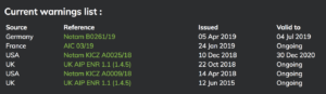
The FAA has extended its ban on US operators entering the Baghdad FIR at any level. Even though the SFAR says you can enter above FL320, the long-running Notam KICZ A0036/30 says otherwise.

SafeAirspace Iraq page – click here.

Syria

There have been several recent Israeli airstrikes on targets throughout Syria. In late December there are reports that Israeli fighters transited Lebanese airspace at low level causing alarm in Beirut before attacking targets in Western Syria. Just weeks ago, several sites around Damascus were targeted by Israeli missiles.

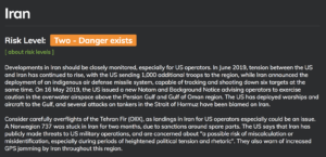
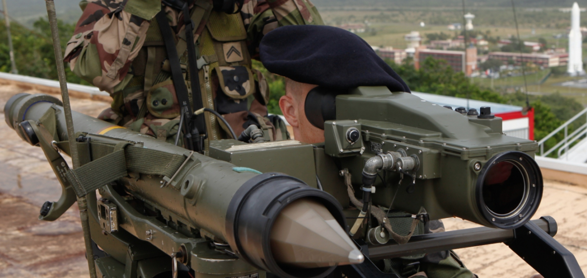
The primary risk is that aircraft may be misidentified by Syrian air defence systems which are regularly activated. Civil operators may get caught in the crossfire as missiles may erroneously lock on to the wrong aircraft.

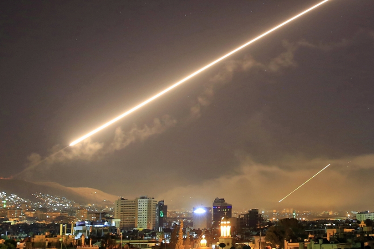
Syrian air defences in action in 2019.

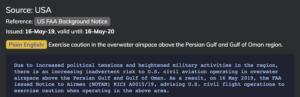
The FAA are taking no chances – the ban on US operators entering the OSTT/Damascus FIR at any level has been extended a full three years to 2023.

SafeAirspace Syria page – click here.

South Sudan

Just this week ICAO issued a concerning warning about the risk to aircraft operating below FL245 in the HSSX/Khartoum FIR over South Sudan, or flying in and out of HSSJ/Juba. They are ‘gravely’ concerned about ATC disruptions, a lack of contingencies, inadequate training of controllers, limited info about equipment outages and a lack of co-ordination with other ATS units.

SafeAirspace South Sudan page – click here.

Emerging Conflict Zones

2020 saw three new conflict zones emerge, here is what is happening with them now.

Ethiopia

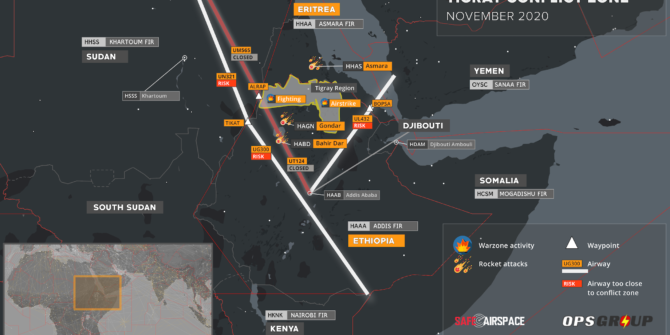
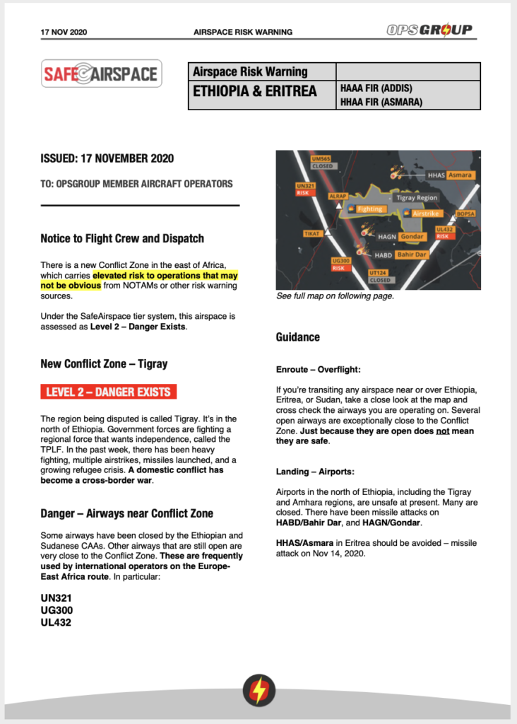
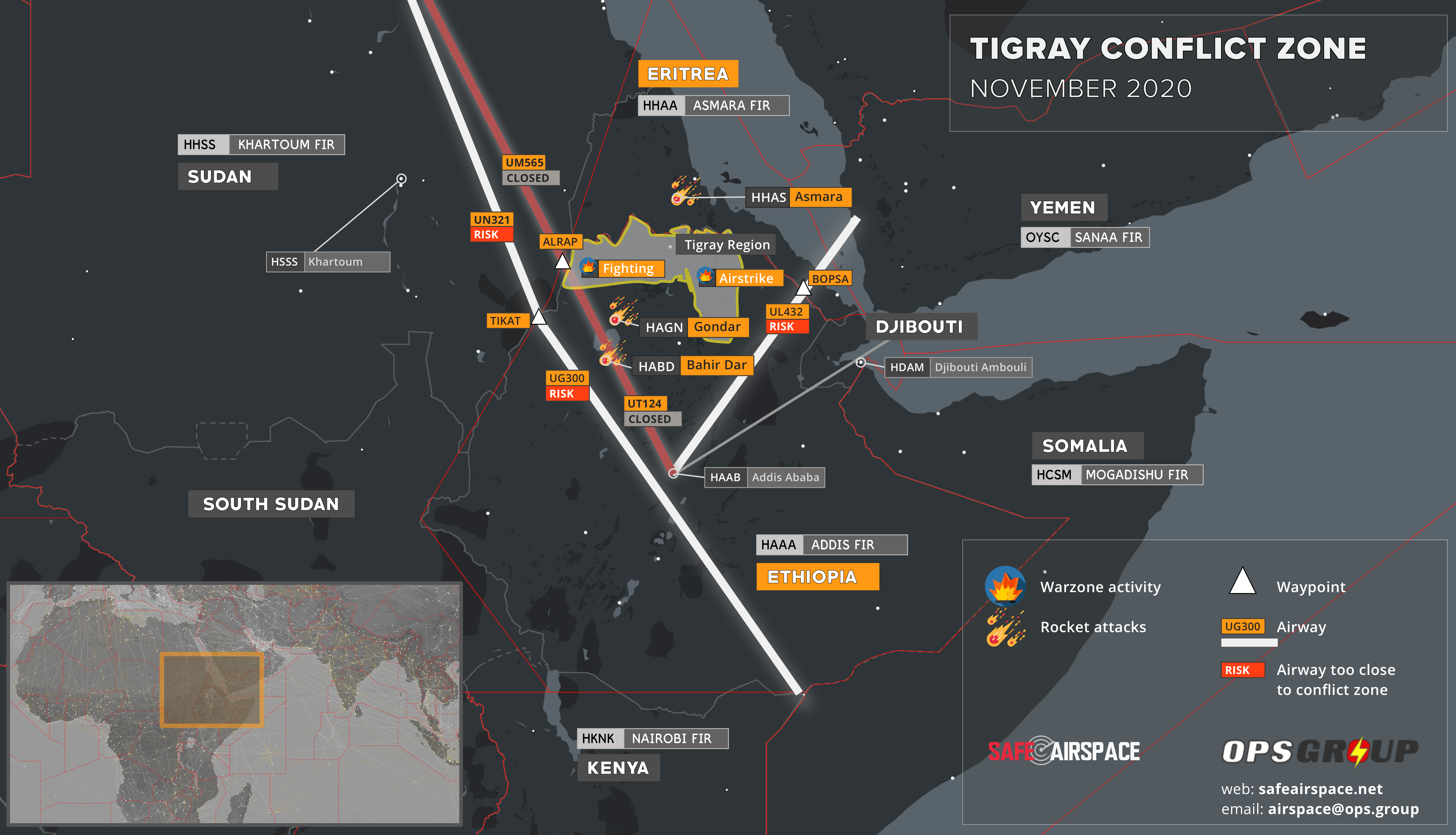
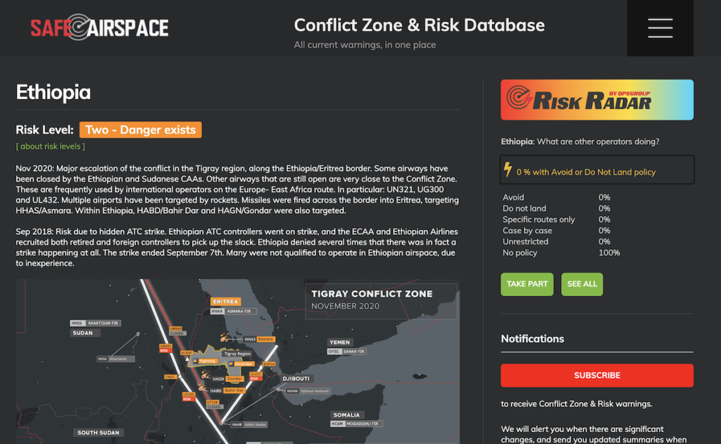
A civil conflict erupted in October last year in the Tigray region of Northern Ethiopia. The government went to war with the TPLF – a regional force seeking independence.

The region’s airports were closed and TPLF showed an intent to internationalise the conflict by attacking aviation interests. They fired rockets into Eritrea targeting HHAS/Asmara, and also attacked multiple airports to the South of the Tigray region.

Two airways were closed (T124, and M308) with no explanation of the risk.  Other airways remained open but uncomfortably close to the fight – especially UG300, UN321 and UL432. No airspace warnings were issued despite the dangers.

What’s the latest?

In late November Ethiopian forces captured the region’s capital Mekelle and regained control. Remaining TPLF forces have retreated leaving behind a humanitarian disaster and a vow to continue the fight. Since then, the airway closures have been removed and things have gone quiet, but an airspace risk remains – armed militia continue to be active in Northern regions and may be looking to make a statement. Be wary of operating in the area.

Western Sahara

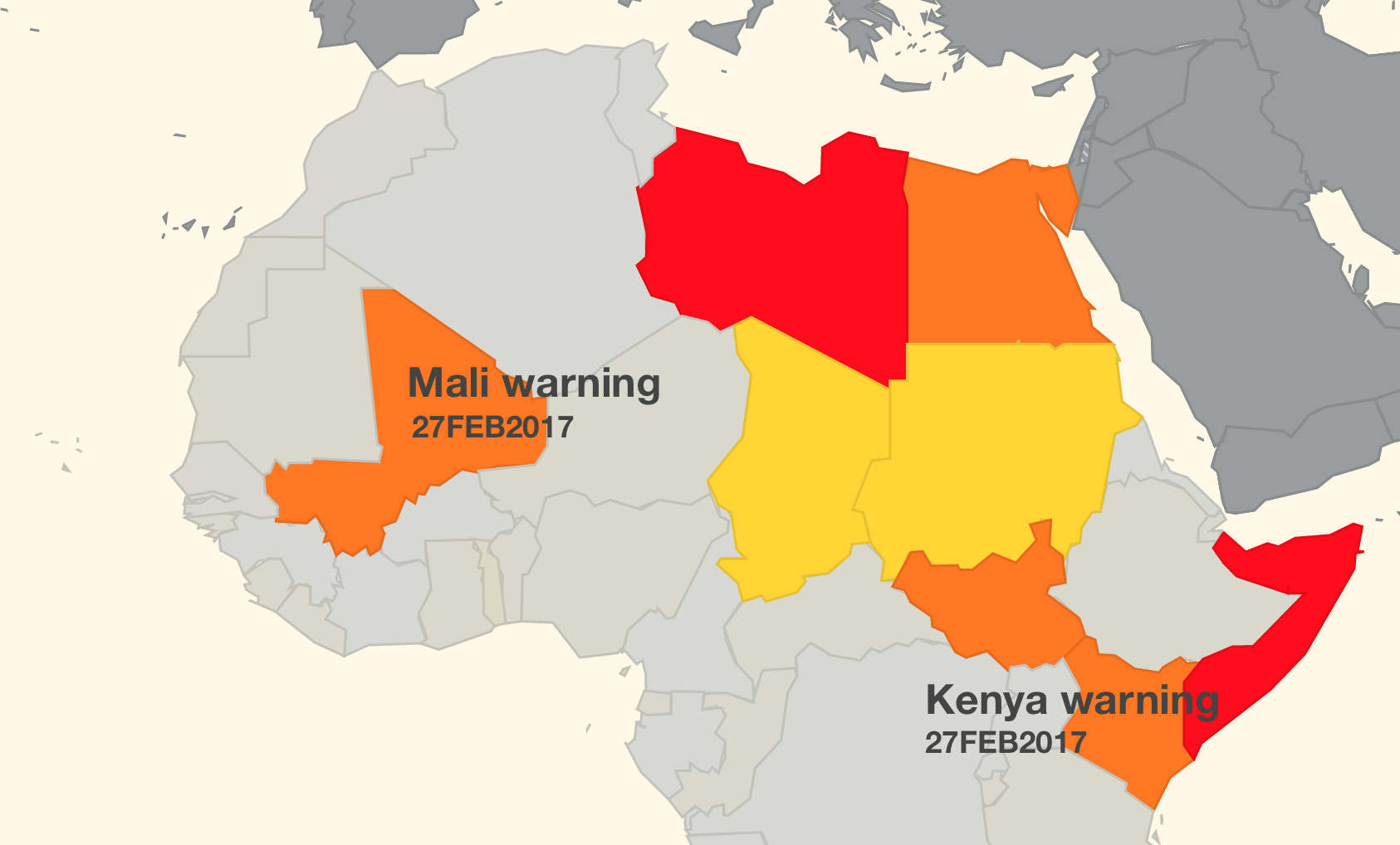
Late last year the region’s independence movement (the Polisario) declared war on Morocco for breaching a ceasefire agreement. The FAA published a warning that the Polisario might have access to anti-aircraft weaponry left over from previous conflicts.

The Western Sahara region

What’s the latest?

It is still an active conflict zone.  The fight has reached the international stage after the US declared their support for Morocco. The Polisario have indicated they are willing to at least talk, but so far have not put down their weapons. So, it is a wait-and-see type deal.

The risk to overflying aircraft remains. The GCCC/Canarias FIR keep extending a Notam advising operators to not fly below FL200 on the following airways: UY601, UN728 and UT975.  However, the reason is still missing: because of the risk of anti-aircraft fire. The GOOO/Dakar FIR haven’t issued any warnings despite the threat. Take care if operating in the area.

Armenia-Azerbaijan

In September last year, an ethnic conflict erupted over a disputed territory in Western Azerbaijan – Nagorno-Karabakh. The fight was between Azerbaijan and Armenia.

As a major air corridor for en-route traffic, there were significant flight disruptions. Azerbaijan swiftly closed all but one west/eastbound airway and routed traffic via Georgia. Armenia asked aircraft to take extra fuel and expect re-routes. The conflict was short but intense, with heavy artillery fire from both sides. The conflict eventually spread beyond the contested regions with longer range weapons. The entire border region posed a risk for civil aircraft.

What’s the latest?

For once the news is good. In November a ceasefire agreement was signed with the help of Russia. Armenia effectively lost and withdrew from the region and the conflict was officially over. Armenia removed its airspace warning, while Azerbaijan re-opened the affected airways and a large section of airspace near the border.

With the conflict now over, and no new reports of significant fighting since the peace agreement in November, direct crossing traffic between the two countries is now technically possible again.  However, most East-West flights are currently still electing to go further north instead, connecting between Azerbaijan and Georgia’s airspace, avoiding Armenia.

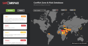
What about Safeairspace.net?

Our conflict zone and risk database is updated constantly. We assess risk with official sources and build a simple picture for you of those need-to know-places.

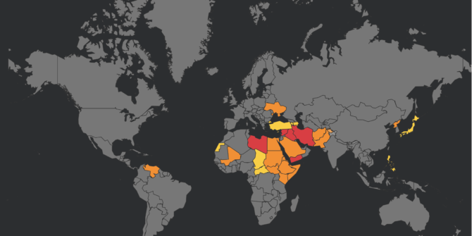
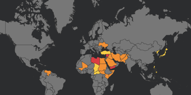
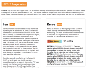
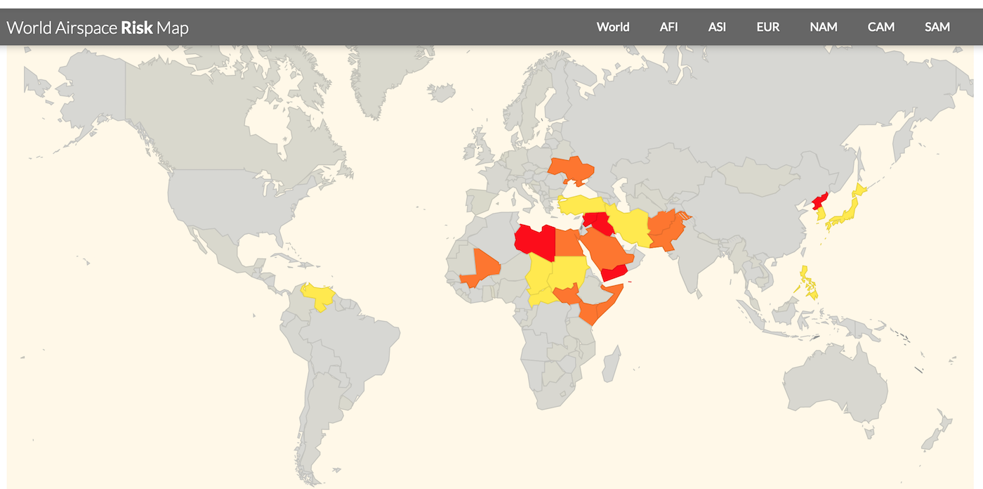
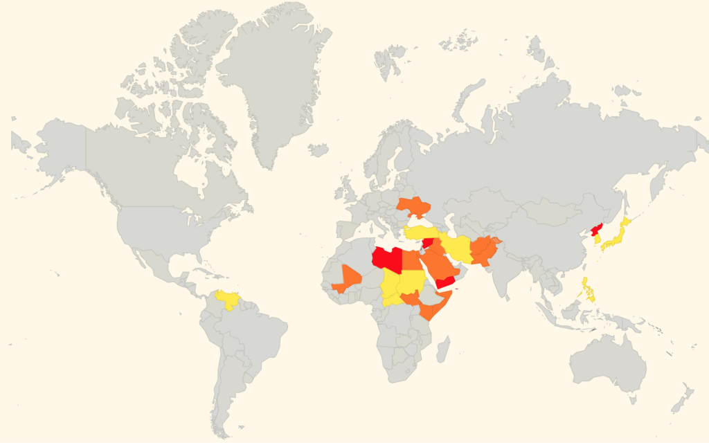
There are currently 5 regions which are assessed as a Level 1 Risk – No Fly. These are: Iraq, Iran, Yemen, Libya, and Syria.

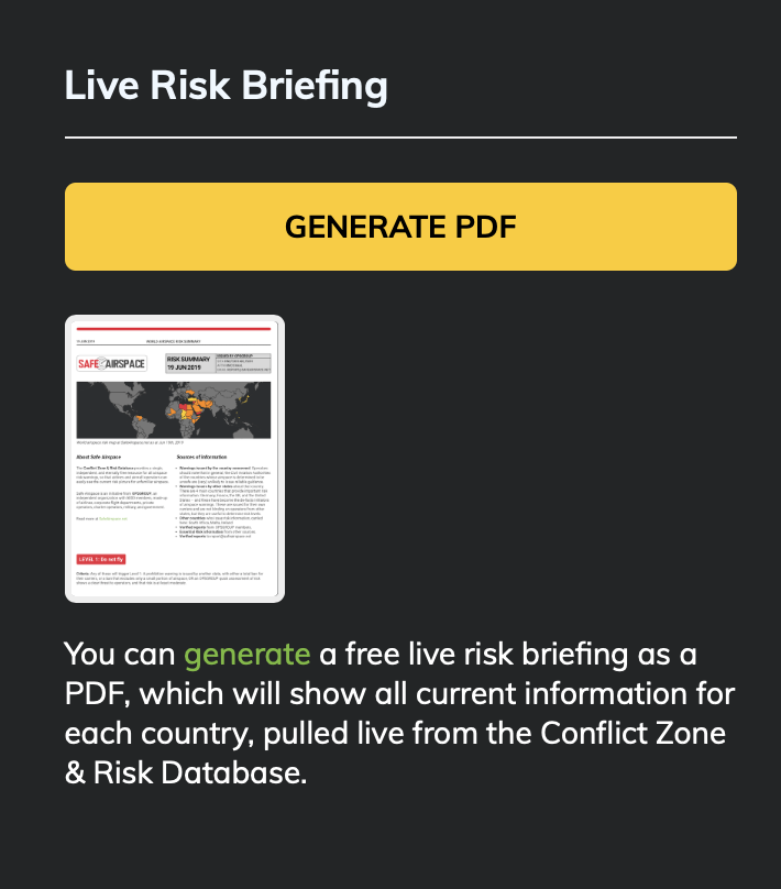
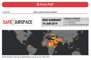
Head over to safeairspace.net and click this button for a full airspace risk briefing.

Head over to SafeAirspace.net and take a look. With a single click you can download a risk briefing of the entire world in just a few pages of nice simple English.

The mission of SafeAirspace is this: to provide a single, independent, and eternally free resource for all airspace risk warnings, so that airlines and aircraft operators can easily see the current risk picture for unfamiliar airspace. If you know of a risk not listed on the site, or you have anything else to add, please get in touch with us at news@ops.group


Airspace Risk Warning – Ethiopia and Eritrea

There is a new Conflict Zone in the east of Africa, which carries elevated risk to flight operations that may not be obvious from NOTAMs or other risk warning sources.

Some airways have been closed by the Ethiopian and Sudanese CAAs. Other airways that are still open are very close to the Conflict Zone. These are frequently used by international operators on the Europe- East Africa route. In particular: UN321, UG300 and UL432. We are concerned that operators may be using these routes without being aware of the risk.

OPSGROUP has today issued an Airspace Risk Warning to its members.

Download OPSGROUP Airspace Risk Warning – Ethiopia/Eritrea (PDF)


Download Hi-Res version of this Conflict Zone map


Situation

The region being disputed is called Tigray. It’s in the north of Ethiopia. Government forces are fighting a regional force that wants independence, called the TPLF. In the past week, there has been heavy fighting, multiple airstrikes, missiles launched, and a growing refugee crisis. A domestic conflict has become a cross-border war.

Our Concerns

There are many warning flags that point to previous shootdown incidents – not least MH17 and PS752. These are the reasons we are particularly concerned about the risk to civil aviation in this region:

Local NOTAMs are misleading
The NOTAMs issued by the Ethiopian CAA to close airways in the conflict zone (UM308, UT124) do not say why they are closed. NOTAMs issued to reroute traffic to adjacent routes (UN321, UL432) do not say why they are rerouted. The same applies to NOTAMs issued by the Sudan CAA to close airways and reroute traffic. Flight crews and aircraft operators are therefore not alerted to any conflict in the area by NOTAM.

Arbitrary Reroutes
Traffic is being rerouted to other airways by ATC, but it’s not clear, or likely, that there has been any risk assessment. European flights are now using UN321/UG300, and UL432 – all of which come exceptionally close to the conflict zone. As we’ve learned from MH17 and PS752, just because airspace is open and available, does not mean it is safe.

Previous shootdowns
The Ethiopian Army shot down an Embraer 120 in May 2020, in Somalia. The Ethiopian Air Force shot down a US Learjet in August 1999 in the Eritrean border region. Both were misidentified.

No guidance to operators
No aviation authorities or official sources have issued any guidance or warnings to date via normal channels.

Rapid Escalation of Conflict
The situation has intensified rapidly, and is extremely unpredictable and unstable. The impact on aviation has not been widely reported.

Guidance

Enroute – Overflight:
If you’re transiting any airspace near or over Ethiopia, Eritrea, or Sudan, take a close look at the map and cross check the airways you are operating on. Several open airways are exceptionally close to the Conflict Zone. Just because they are open does not mean they are safe.

Landing – Airports:
Airports in the north of Ethiopia, including the Tigray and Amhara regions, are unsafe at present. Many are closed. There have been missile attacks on HABD/Bahir Dar, and HAGN/Gondar. HHAS/Asmara in Eritrea should be avoided – missile attack on Nov 14, 2020.

Information Sources

The Conflict Zone & Risk Database at SafeAirspace.net contains all current published warnings and alerts for Ethiopia and Eritrea.

The countries that issue the most relevant updates for unsafe airspace are:

• US (FAA) – through Notams and SFARs
• UK (DFT) – by Notam and then AIP
• Germany (BMVI) – by Notam
• France (DGAC) – by AIC

Note: Operators should not rely on EASA Conflict Zone Information Bulletins (CZIB)’s as a primary source of information. These serve only as pointers to the above sources, and often are not issued until several months after updates, if at all. Note that the Civil Aviation Authorities of the countries whose airspace is determined to be unsafe are unlikely to issue reliable guidance.

Group effort

This information is compiled from OPSGROUP member input, information, intelligence and analysis. If you have additional information to share, please send it to report@safeairspace.net.

Members: More information

OPSGROUP Members: More information in the discussion in the Forum about Ethiopia/Eritrea:
Forum > International Ops > New Conflict Zone Ethiopia/Eritrea

All links to further resources are there.


The Threat Of A Civil Aircraft Shootdown In Iran Is Real

As we know by now, at 23:35Z last night (June 19, UTC), Iran shot down a US UAV on a high-altitude recon mission in the Straits of Hormuz. This was no small incident. The UAV was a $200 million aircraft, weighing 32,000 lbs, with the same wingspan as a 737.

Although Iran and the US have slightly different versions of the position of the shooting down in the media, the approximate area is very clear, and marked on the map below, which shows the airspace picture at 2335Z, the time of the shootdown.

A high-res version of this map is available here.

For civil operators, the Straits of Hormuz have always been an area of high military activity, so it’s tempting to mark this as ‘more of the same’.  However, over the last few weeks tension between the US and Iran has heightened, and the launching of a surface to air missile by Iran represents an escalation in the current situation that crosses a threshold –  warranting a very close inspection by airlines and aircraft operators overflying, or using airports like Dubai, Abu Dhabi, Ras Al Khaimah, Muscat, and Fujairah.

As we approach five years since MH17, we should remember the build up to that shootdown took several months, and there are the warning signs here that we must pay close attention to. In the lead up to MH17, 16 military aircraft were shot down before MH17 became the 17th. Look closely at the map. Civil aircraft were very close to the site of this incident.

This morning, we sent this out to our members in OPSGROUP:

OIZZ/Iran Earlier today, a large US military drone was shot down by Iran over the Strait of Hormuz. The US say it was over international waters, Iran say it was within their FIR. Either way, it means that SAM missiles are now being fired in the area, and that represents an escalation in risk. It appears a 787 was very close to the missile site this morning. Avoiding the Strait of Hormuz area is recommended – misidentification of aircraft is possible. If you are coming close to Iran’s FIR, it’s essential that you monitor 121.5, as Iran uses this to contact potentially infringing aircraft. Local advice from OPSGROUP members says ‘Even if the operator/pilots think they will come close or penetrate Irans Airspace they should contact Iran Air Defense on 127.8 or 135.1’. If the Iranians have an unidentified aircraft on their radar and not in contact with them they will transmit on guard with the unidentified aircraft coordinates, altitude, squawk (if there is one), direction of travel and then ask this aircraft to identify themselves as they are approaching Iranian ADIZ. Monitor safeairspace.net/iran for the latest. 

Last September, when Syria shot down a Russian transport aircraft, we published an article on that risk, and noted “50 miles away from where the Russian aircraft plunged into the sea on Monday night is the international airway UL620, busy with all the big name airline traffic heading for Beirut and Tel Aviv. If Syria can mistakenly shoot down a Russian ally aircraft, they can also take out your A320 as you cruise past.” That same risk of misidentification exists here in the Straits of Hormuz.

Apart from the misidentification risk, is the risk of a problem with the missile itself. The missile used by Syria in September was a Russian S-200 SAM, which was the same missile type that brought down Siberian Airlines Flight 1812 in 2001. The missile can lock on to the wrong target, and this risk is higher over water. The missile system used by Iran last night was a domestically-built Raad Anti-Aircraft system, similar to the Russian Buk that was used against MH17. Any error in that system could cause it to find another target nearby – another reason not to be anywhere near this part of the Straits of Hormuz.

Bear in mind that as an aircraft operator you won’t be getting any guidance from the Civil Aviation Authorities in the region. As we saw with Syria, even when an aircraft had been shot down on their FIR boundary, the only Notams from Cyprus were about firework displays at the local hotels. It won’t be any different here. You need to be the one to decide to avoid the area.

A further risk, if you needed one, is retaliation by the US. It seems probable that the US will at least try to find an Iranian target to make an example of. If you recall the Iran Air 665 tragedy, back in July 1988, which occurred in the same area, the US mistakenly shot down that aircraft thinking it was an Iranian F-14.

Bottom line: we should not be flying passenger aircraft anywhere near warzones. That’s the lesson from MH17, and that’s the lesson we need to keep applying when risks like this appear on our horizon.

The Iran risk is being monitored at Safe Airspace – the Conflict Zone & Risk Database. The Iran country page also has more information on further overflight considerations in other parts of the Tehran FIR.

Further reading:


Sources for this article:


New features – Conflict Zone & Risk Database

To make it even easier to get a current risk picture for International Flight Ops, we’ve added a bunch of new features to the Conflict Zone & Risk Database at SafeAirspace.net.

Thank you to all OPSGROUP members – all our airlines, aircraft operators, pilots, dispatchers, and industry colleagues who’ve made this possible. Now we have a simple, single source of information for all risk warnings, analysis, that includes our Risk Radar project (so for the first time we can see what other operators are doing), all state warnings, and the ability to auto-generate a live Summary PDF of the current situation.

Start at SafeAirspace.net, where you have the current risk map, and feed of Updates and Alerts:

On each country page, you will now see Risk Radar information like this:

For each country, you’ll see the current list of warnings, both from the country concerned and other states:

Scrolling down, you’ll get the current Notam/AIC/AIP reference and a copy of the text:

For each country, there is a Summary and Analysis, so you get some background on why these warnings exist:

A new feature is the ability to generate a live summary into a PDF, so you can print out everything into one document to share with your crew, dispatchers, and security team:


You can download an example of the PDF, generated on June 19th, 2019, here:

PDF Summary – World Airspace Risk at SafeAirspace.net


Download PDF, 800kb

You can generate your own live PDF here.

About the Conflict Zone & Risk Database

The Conflict Zone & Risk Database provides a single, independent, and eternally free resource for all airspace risk warnings, so that airlines and aircraft operators can easily see the current risk picture for unfamiliar airspace.

Safe Airspace is an initiative from OPSGROUP, an independent organisation with 5000 members, made up of airlines, corporate flight departments, private operators, charter operators, military, and government.

The Conflict Zone & Risk Database was launched in September 2016 as the lifespan of the ICAO CZIR was coming to a close, keeping the work ICAO did on the project alive, and providing the autonomous platform needed to make the concept work.

Objective – one single source

A single source for all risk warnings issued about an individual country, independent of any political or commercial motivation, so that a pilot, flight dispatcher, security department, or anyone responsible for flight safety can quickly and easily see the current risk picture.

Oversight and independence

The CZ&RD is managed by OPSGROUP. Because we are outside the chain of government, we are responsible only to our member airlines and aircraft operators, and more importantly, to the people ensuring a safe flight operation, and to the passengers that fly on our aircraft. For this reason, all information pertinent to a country can be assured to be carried here.

Eternally free

To remain completely independent of any bias, and to ensure that everybody has access, the Conflict Zone & Risk Database is completely free of charge. We have no commercial interest in publishing this information, it exists as a public service because our members care deeply about flight safety.

Contacting us

We rely on your input. If you have information to add, please email report@safeairspace.net. You can also use this address to discuss any content here. The collaborative effort is our focus. We’re still a team of humans, and we miss stuff. If you see something missing here, please tell us!

All submissions are anonymous, and our only concern is for the safety of all airspace users – the crew and the passengers. We appreciate your help.


New Unsafe Airspace Summary and Map

March 20, 2018: One of our biggest missions in OPSGROUP is to share risk information and keep operators aware of the current threat picture. The latest Unsafe Airspace Summary is now published, and available to members here as a PDF download (Unsafe Airspace Summary 20MAR2018, edition LIMA).

The main changes since the last summary are below. For a current risk map, refer to the Airspace Risk map in your member Dashboard.

The situation in Afghanistan remains similar. On March 13, Germany added wording to maintain FL330 or higher,  still recommending against landings at Afghan airports.

Germany also issued updated NOTAMs for Mali, Iraq, and South Sudan. All warnings remain as previous, unchanged from the prior NOTAMs.


Fresh warnings as FAA clarifies weapons risk in Kenya, Mali airspace

Feb 27th, 2017: The FAA has issued fresh warnings for Kenyan and Malian airspace, warning US operators of the potential dangers in operating through both the Nairobi and Malian FIR’s.

Published on Feb 26th, the new advice also adds new language with clarification of the type of weapons and phases of flight that the FAA is concerned about, specifically:

  • fire from small arms,
  • indirect fire weapons (such as mortars and rockets), and
  • anti-aircraft weapons such as MANPADS.

The scenarios considered highest risk include :

  • landings and takeoffs,
  • low altitudes, and
  • aircraft on the ground.

The FAA uses the same wording for both Kenya and Mali. Additionally for Mali, the Algerian CAA has concurrently published airspace closures along their southern border due to the conflict, and the FAA’s background notes on the Mali conflict still stand.

The updated guidance is intended for US operators and FAA License holders, but in reality is used by most International Operators including EU and Asian carriers, since only four countries currently provide useful information on airspace security and conflict zones.

The Notams both use FL260 as the minimum safe level, though we would suggest, as usual, that a higher level closer to FL300 is more sensible.

These updates have been notified through SafeAirspace.net, a collaborative and information sharing tool used by airlines, business jet operators, state agencies, military, and private members of  OPSGROUP.

This is the new wording in the latest FAA Notams on Mali and Kenya:

POSSIBILITY OF ATTACKS ON CIVIL AVIATION BY EXTREMISTS/MILITANTS.
AIRCRAFT MAY ENCOUNTER FIRE FROM SMALL ARMS; INDIRECT FIRE WEAPONS,
SUCH AS MORTARS AND ROCKETS; AND ANTI-AIRCRAFT CAPABLE WEAPONS,
INCLUDING MAN-PORTABLE AIR DEFENSE SYSTEMS (MANPADS).SUCH WEAPONS 
COULD TARGET AIRCRAFT AT LOW ALTITUDES, INCLUDING DURING THE ARRIVAL
AND DEPARTURE PHASES OF FLIGHT, AND/OR AIRPORTS AND AIRCRAFT ON THE
GROUND.

The NOTAMs in full are on our Kenya and Mali pages respectively.

References:

  • Kenya country information page at safeairspace.net
  • Mali country information page at safeairspace.net
  • OPSGROUP collaborative project


What altitude is ‘safe enough’ to overfly a Conflict Zone?

Most conflict zone guidance from Aviation Authorities is based on the risk posed by MANPADS – Man Portable Air Defence Systems, or more descriptively – Shoulder Launched Surface to Air Missiles (SAMS).

Large-Unit SAM attacks on aircraft are uncommon – MH17, removed from the sky by a Russian-made Buk missile, was the first aircraft to be shot down by a large SAM unit since a Siberia Airlines Tupolev in 2001. These large units – requiring a radar system as part of the mechanism – have never been used by terrorists. Almost all incidences involving large-unit SAMs have involved misidentification. There is no safe altitude from a large SAM.

MANPADS, on the other hand, represent a greater threat to aircraft in 2017. These shoulder-launched systems are very portable, and far more likely to fall into the wrong hands. Common ranges are in the 10,000 – 15,000 ft range. The most dangerous is the FIM-92 Stinger, which has an operational ceiling of 26,000 ft (and there is concern that these have reached anti-government rebels in Syria)

The internationally promulgated standard safe altitude for overflight has now become about 25,000 ft AGL. Most CAA/State guidance is issued based on this number. There are two important points for aircraft operators to note:

    • That is 25,000 feet Above Ground Level. A missile could easily be launched from a mountain, or higher ground, so if you take 25,000 feet as your safety margin, make sure to add the terrain elevation beneath. In South Sudan, for example – Juba is at 2,000 feet – most of the country is at about this height. So 27,000 feet should be the minimum safe level, and you can work with FL270.
    • This is based on the assumption that we’re not worried about Stingers. Especially in the Middle East, a higher safe altitude might be better. FL300 seems like a good place to start.


References: