Battleships: Updated Risks on the South China Sea

Increasing military activity in the disputed South China Sea has been making headlines for civil aviation again recently.

We’ve seen reports of unauthorised clearances being issued over VHF, along with instances of GPS jamming. Here’s what we know, why it’s happening, and what pilots can do about it.

What’s your vector, Victor?

On March 2, IFALPA put out a new safety bulletin  – at the same time, several major carriers began to publish their own internal memos too.

There have been recent cases of civilian aircraft being contacted by Chinese military vessels on 121.5 or 123.45 and given vectors to avoid airspace above them. This has been happening not only in the South China Sea, but also the Philippine Sea and far eastern areas of the Indian Ocean.

In the eyes of aviation law, this is a big no-no. Unauthorised ATC transmissions are not only illegal, but highly dangerous because they can reduce your separation with other aircraft or lead to airspace busts. In this case the military vessels involved have no jurisdiction (or business) to be controlling aircraft in open airspace over international waters.

Military vessels have reportedly been broadcasting unlawful clearances to civilian aircraft on 121.15 and 123.45.

All the wrong signals

Then on March 20, reports emerged of another issue. Aircraft operating off Australia’s Northwestern coast have been encountering GPS jamming, purportedly from Chinese naval vessels in the area. This is unusual for the region.

The same problem has also been recurring over in the Western Pacific, and of course in the South China Sea itself.

Unfortunately, as we have seen in other parts of the world such as the Eastern Med, GPS signals are commonly interfered with in areas of high political tension as it makes it harder for the opposition to locate and gather whatever intelligence they are looking for.

It appears this region is no different.

Quit staring at me

So why is this happening?

We’ve written about the South China Sea dispute in detail in the past, and so this article may be a good place to start. But here is the thirty second version.

It may come as no surprise that the South China Sea is heavily disputed. Several states have staked some sort of claim on the region.

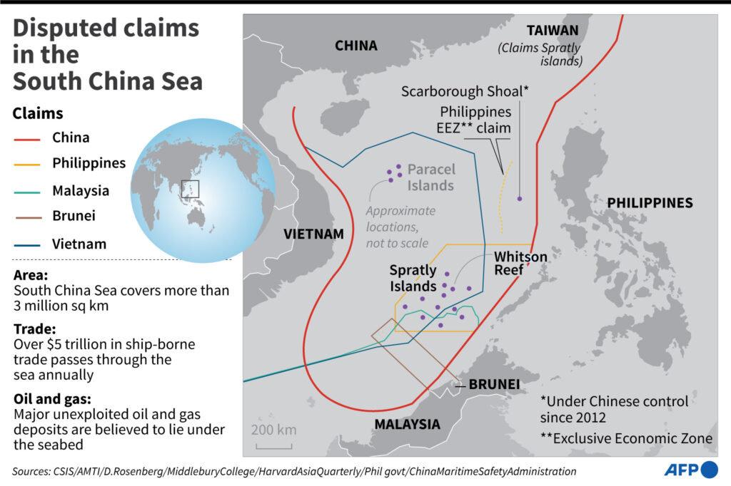
Disputed regions in the South China Sea. Map courtesy of AFP.

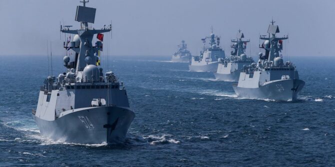
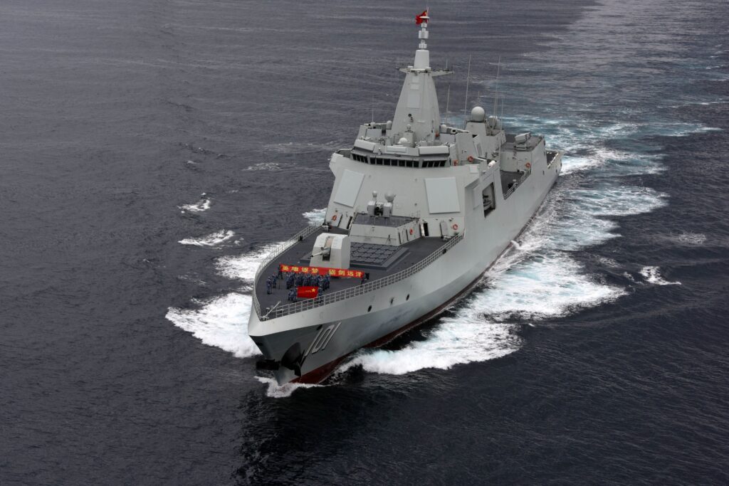
Attracting the most noise (and perhaps the most powerful claimant) China, has been steadily increasing its military presence in recent years including the construction of man-made islands, air bases and military warships.

All this activity attracts international attention, and the US military along with other countries have been keeping a close eye on what is going on – predominantly through aerial surveillance.

Herein lies the problem.

China maintains that under international law, foreign militaries cannot conduct intelligence gathering activities like surveillance inside its exclusive economic zone (or EEZ for short).

On the other hand, the US argues that under the UN Convention of the Law of the Sea (think of it as a legal rulebook for all marine and maritime activities), that freedom of movement through EEZs should be universal. And that essentially means that countries should not be required to provide notification of their military doings.

It’s worth pausing here – an EEZ is not the same thing as a country’s territorial waters. In the same document, the UN explains it is just a sovereign right to what is beneath the surface. The important part is this: the surface itself is still international water.

The result is lots of people looking, and some that don’t want to be seen which is why we are seeing interceptions, signal jamming and now unlawful clearances becoming more of a problem.

GPS Jamming is common elsewhere, but unusual in the Eastern Indian Ocean.

What can we do about it?

Essentially – protect yourself as best you can. These risks don’t look like they’ll go away anytime soonn, despite their disregard for civilian air traffic.

In their safety bulletin, IFALPA explains that IATA and ANSPs all recommend ignoring any unauthorised contact on the radio. Essentially, give them the silent treatment and continue on your cleared route. It is also important to let controlling ATC know immediately, and also to file a report.

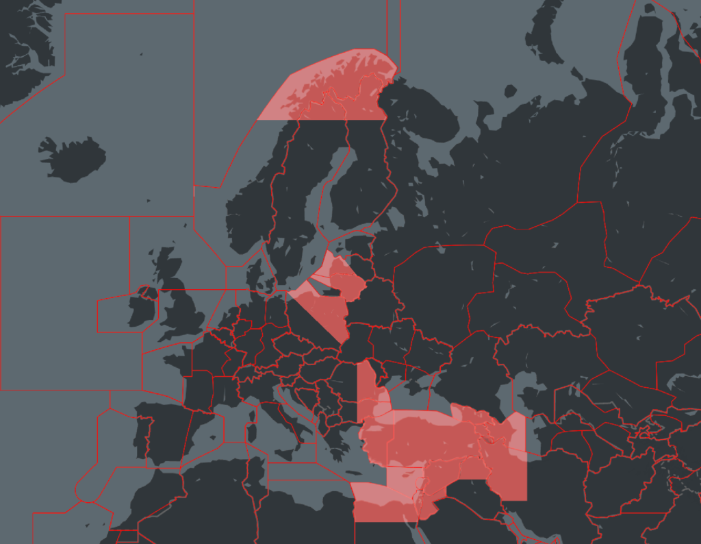
Likewise, if you encounter GPS jamming it is also essential to let people know. You can read a little more about this issue here.

Let’s not normalise the risk

A recent high-profile interception in the region was described by a military official as just ‘another Friday afternoon on the South China Sea.’

These issues are no secret. But for civil aviation it is important we keep an eye on these trends and developments as our safety may depend upon it. The more present a risk is, the more comfortable we tend to become with it. We can’t allow that to happen.

OPSGROUP will continue to keep you updated with changes, along with our free conflict zone and risk database safeairspace.net.


GPS Jamming (again)

This whole GPS jamming thing is really starting to G-PS us off! Unfortunately, it isn’t something that can be resolved at the source anytime soon.

While they can’t fix it, EASA have come along with a nice new SIB to help us deal with it though.

What’s the (new) story?

There isn’t really anything new, but there is a slightly updated list of places where you can most expect to ‘get jammed’.

SIB 2022-02R1 was issued on Feb 17, and you can read it here.

It lists the most common spots that pilots are reporting jamming occurring:

  • The Black Sea area:
    • FIR Istanbul LTBB, FIR Ankara LTAA
    • Eastern part of FIR Bucuresti LRBB, FIR Sofia LBSR
    • FIR Tbilisi UGGG, FIR Yerevan UDDD, FIR Baku UBBA
  • The southeastern Mediterranean area, Middle East:
    • FIR Nicosia LCCC, FIR Beirut OLBB, FIR Damascus OSTT, FIR Telaviv LLLL, FIR Amman OJAC northeastern part of FIR Cairo HECC
    • Northern part of FIR Baghdad ORBB, northwestern part of FIR Tehran OIIX
    • Northern part of FIR Tripoli HLLL
  • The Baltic Sea area (FIRs surrounding FIR Kaliningrad UMKK):
    • Western part of FIR Vilnius EYVL, northeastern part of FIR Warszawa EPWW, southwestern part of FIR Riga EVRR
  • Arctic area:
    • Northern part of FIR Helsinki EFIN, northern part of FIR Polaris ENOR

We made a map:

This map is quite possibly not ‘anatomically’ correct. It is just a ‘sort of around there’ map. Also, I definitely think that bit of land between Poland and Lithuania gets its fair share of jamming.

Anyway, the SIB also contains some really handy information on what to look out for (signs you’ve been a-jammed), and what to do about it if you think you have. We aren’t going to list all of that though, you’re better off checking out the SIB.

There is also a new poster

Here is it:

We like it a lot. Of the man who made it, you might say that ‘EASA’ great sense of humour 🙂

We liked it so much, we wanted to make our own one too…

So here it is:

Yes, we did take it way too far and realise that now.

We have mentioned GPS jamming before.

That we have. You can find the previous posts here:

Filled with lots of juicy, jammy information so help you become a ‘Jammin Dodger’:

Probably one only Brits will get


GPS Outages: The Hotspots

We are talking about it again. Satellite signal disruptions. Jamming. Issues with your navigation equipment…

IFALPA have just released a new “watch out for it” paper so we thought we’d have a mini recap on what it is, where it is and what you can do about it.

Here’s what we said earlier about the problem.

The Big Problem

A big rise in GNSS radio frequency interference occurred in 2018 and since then (with voluntary reporting) there has been a 2000% increase sustained ever since.

A Eurocontrol Think Paper published in March 2021 suggests that 38.5% of European en-route traffic operates through regions intermittently but regularly affected by RFI, and 5% of these needed special assistance, which doesn’t sound like much until you check out the number of en-route traffic to Europe each day!

The Big Hotspots

The big hotspots remain around the Mediterranean, Middle East and Caucasus where they see, on average, 3,500 outages or so a year. Traffic routing along the UM860/688 airways in Iraq, and en-route crossing borders in Turkey/Iraq/Iran or close to the Syrian border are the most commonly reported areas of issue.

Reports from aircraft overflying regions near major Turkish airports have also reported signal jamming, while aircraft operating into LCLK/Larnaca or airports in the Egypt/Israel/Jordan and Lebanon areas have reported jamming during the climb, descent and approach phases.

Back in 2019, LLBG/Tel Aviv Ben Gurion airport was seeing a high number of issues with their RNAV departures and arrivals. Or rather, issues with aircraft not having the internal accuracy required (due to jamming through the Tel Aviv FIR) for them to fly RNAV procedures. Crew were advised to plan for alternatives.

IFALPA also reported on issues in Central Mexico, particularly in the area around MMLO/Guanajuato airport. The issue was further compounded by a lack of any Notams warning of potential signal disruptions. A heads-up so you know to watch out for it is always helpful.

Other spots to watch

US Military tests on systems designed to block enemy signals are unfortunately indiscriminate in what they block – and so they often impact commercial aviation as well, sometimes affecting signal as far as 400nm and up to FL400. While Notams are issued for these tests, they often cover large areas and are overlooked by crew because of this.

A test back in 2019 in Washington state highlighted the big impact these can have – the possible area affected covered 67 airports including KSEA/Seattle-Tacoma.

The FAA is working with the military to find a solution to this. They previously made 25 recommendations including a requirement that Notams be issued at least 120 hours in advance. Here is what we mentioned on this before.

What to do if it happens to you

Your aircraft is going to have checklists covering it, but in a nutshell, if you think your aircraft’s ability to accurately fly an RNAV procedure has been impacted then plan for another approach and let ATC know.

IATA and ICAO both have GNSS Interface Reporting Form which you can send to help them track areas of significant anomalies, and follow up with authorities to try and mitigate the problems. 

If you experience an issue in FAA airspace then use their dedicated reporting site.

And keep up to date with outage areas here.

Any final thoughts?

The range of RFI jamming is a lot bigger than folk realise. While it is usually centered around conflict zones, it seems to go “well beyond simple military mission effectiveness.

A cigarette light powered (illegal) personal privacy device is enough to disrupt the signals in an aircraft if the device is relatively nearby.

Thankfully ICAO, Eurocontrol, the FAA etc are on the case but until solutions are found, it will remain with the pilots to stay safe when signals are disrupted.


GPS U/S in the US

We have written a fair amount on worldwide GPS Jamming issues. Here is what we said about it in ‘GPS Jamming: All the Wrong Signals’. But there is another GPS problem though which is a little closer to home (if your ‘aviation’ home is in the US anyway).

What’s the deal?

Let’s take a step back to 2017, when the NBAA and a bunch of other stakeholders took part in the 2017 RTCA tactical operation committee. That’s the Radio Technical Commission for Aeronautics and they are great – they try and help find compromises amongst the competing interests on critical aviation modernization issues.

One of these very issues is with GPS.

The FAA’s NextGen modernization program is using more and more GPS ‘stuff’. Stuff that is critical for commercial flight operations safety and efficiency. The US Department of Defense on the other hand is sort of doing the opposite – they are running GPS Jamming tests which are critical for National Security and the big problem with this is that the jamming tests often interfere with the GPS signals civil aircraft are using.

What was the 2017 outcome?

After they talked about it in 2017, the compromise was that the DoD will notify the FAA at least 120 hours before any planned tests. This should give the FAA time or put out Notams to warn crew and operators.

Problem solved?

Unfortunately not. The 120 hours notification is given, but the information which filters down to the pilots and operators who need to know about it often not sufficient. One of the difficulties is that the Notams have to provide information on different outage locations and this means loooooooong Notams filled with lots of Lat and Longs and times and dates. And this means critical information can sometimes get buried inside and makes it difficult or confusing for the crew to find it, extrapolate it (or even be aware of it in the first place).

What’s the plan now?

Well, the NBAA have reported on this, and say that the FAA are taking their concerns onboard. They plan to revisit the idea of producing visual representations of the outage areas. These will be much easier to digest than lines of lat and longs, and would hopefully enable crew to use them in conjunction with planning apps in the future.

There has also been a reminder issued to crew asking them to report outages and issues. If you find yourself in a jammy area, let ATC know. Tell them what you have lost so that they can warn other aircraft in the immediate area. The reminder has been sent to ATC as well because in the past, when aircraft have made these reports, the information has not always been shared out to other operators in the near vicinity.

What do you need to look out for?

What an outage means, practically, is interference to the GPS signals which your navigation system is using. The result can be a degradation in accuracy, or a full loss of the system (GPS primary).

If you are enroute, let ATC know your capability has been degraded so you can get the support you need to continue navigating safely.

Some aircraft are particularly sensitive to disruption in the GPS signals, and it can lead to you losing that system until it is reset on the ground. This means RNAV/RNP approaches might not be flyable anymore. Having an awareness of what this means for your aircraft is important. Think about your plan B for approaches in case you do loose GPS navigation capability.

Notams are out there and it might be frustrating picking out the areas which could impact you, but knowing about the outage spots in advance will help.

Where can you look for info?

The 5G Update

We thought we’d throw in a little update in on this as well.

Last year we saw increasing concerns about possible interference from 5G networks because they operate on the same slice of radio spectrum usually reserved for Radio Altimeter signals (the 3.7-3.98 GHz band).

The big concern here is that interference could result in degradation of accuracy from spurious emissions, or outright failures in the radio altimeters. Not sure how much of a risk that means? Well, Turkish Airlines TK1951 crashed in EHAM/Amsterdam Schiphol in 2009 and one of the primary factors was attributed to a malfunctioning radio altimeter which sent an erroneous -8ft reading to the autothrottle system, commanding it to idle.

The NBAA are fronting a campaign here as well. Twenty organizations have joined forces to send the FAA a letter raising their concerns over this, in response to a report issued on March 3 that they don’t feel addresses the threat with enough analysis.

You can read the letter here.

Military aircraft and UAVs are also at risk here. Their radio altimeters use the same C-band frequencies, but they tend to fly a lot nearer the ground a lot more often. A very good summary of the issue can be found here.