North Atlantic Volcanic Threat

Key Points
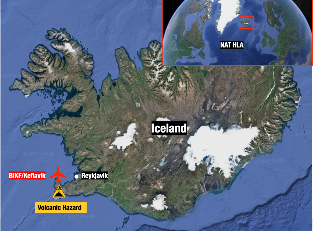
  • One of Iceland’s volcanoes (10nm southwest of BIKF/Keflavik) is showing signs it’s about to erupt.
  • If it does, NAT crossing traffic is likely to be affected at short notice.
  • ICAO have a Contingency Plan ready to go if it does erupt (PDF below).
  • Pilots and Operators: There is a list of things to watch out for if you do fly through volcanic ash, and a recommended procedure to follow.

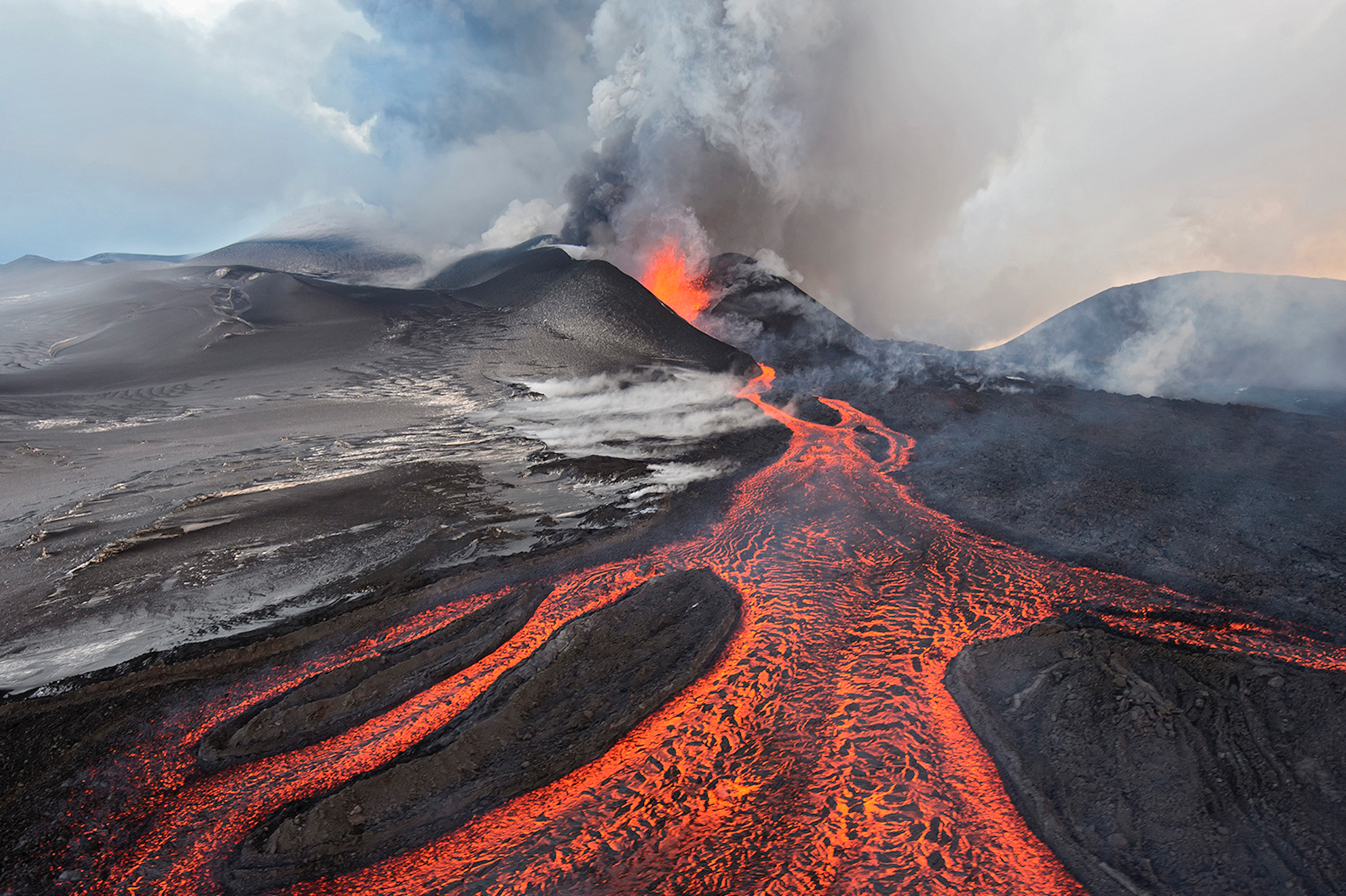
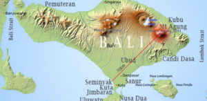
Iceland is on high alert for an imminent eruption at one of the volcanoes on the Reykjanes Peninsula – a stone’s throw southwest of Keflavik. If it does erupt, it has potential to seriously impact North Atlantic traffic.

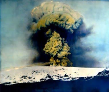
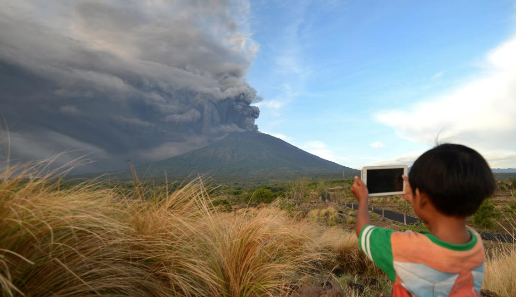
The last time this happened in 2010, the (try pronouncing this one) Eyjafjallajökull volcano closed almost every country’s airspace in Western Europe in the weeks that followed. Nearly 100,000 commercial flights were grounded.

One of the few flights not to be impacted by the volcanic ash in 2010.

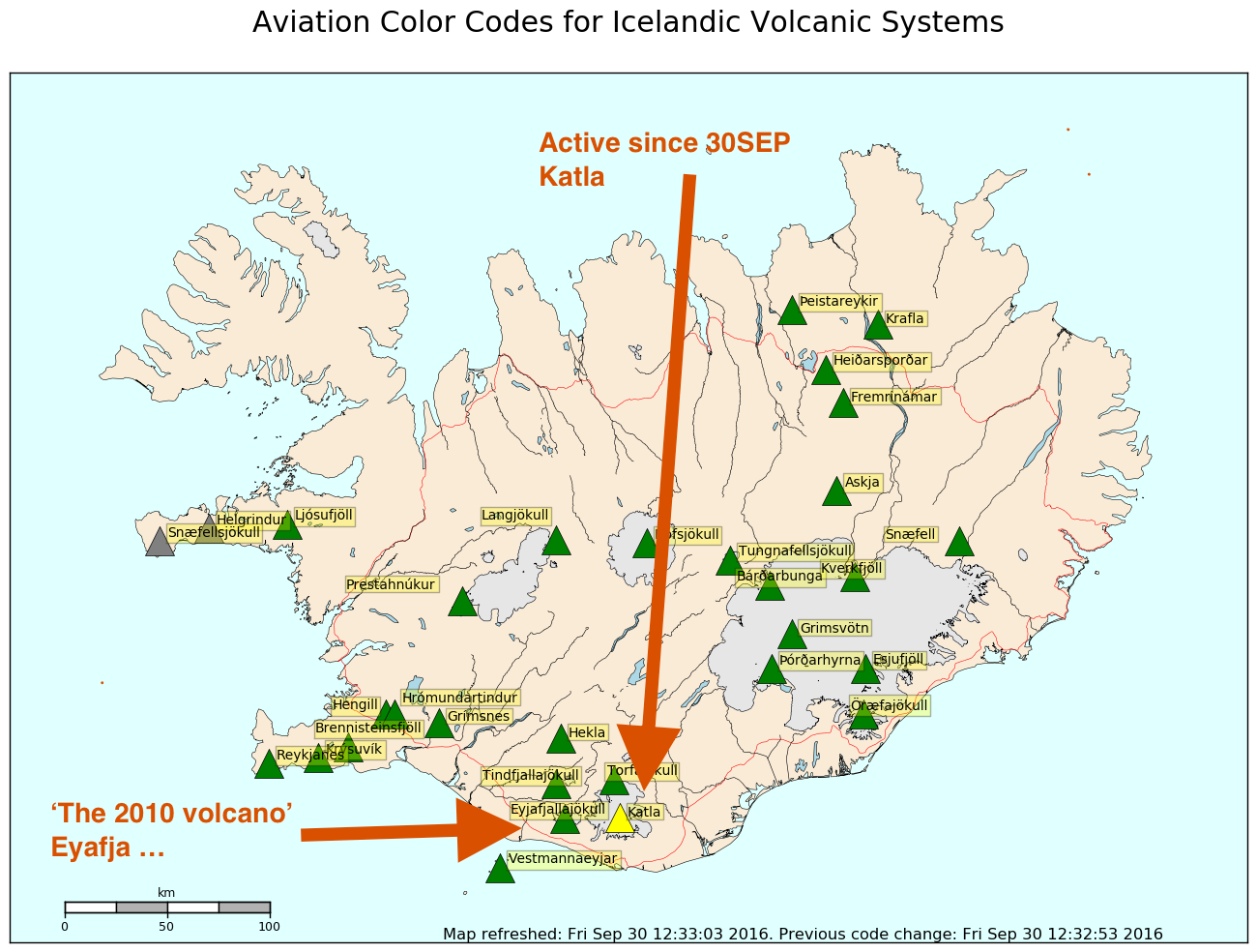
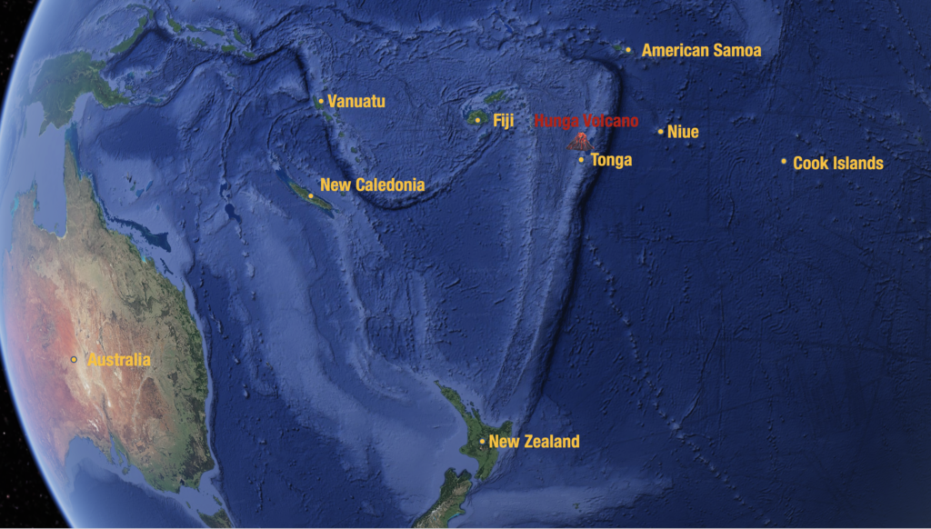
Where are we talking about?

What happens if it erupts?

So far, it’s just a warning. But it’s credible enough for Iceland to declare a state of emergency. Recent earthquakes in the area are an ominous sign. If it does erupt, there are several possible scenarios that could affect air traffic.

  • BIKF/Keflavik may close. Unlike previous eruptions, this one is just 10nm away from the airport and a little further from the Icelandic capital, Reykjavik. Aside from being a major airport in its own right, BIKF is a commonly used ETOPS/EDTO alternate for traffic crossing the NAT.
  • Part of the NAT HLA may become unusable depending on the spread of ash. More southerly routes than usual may become a requirement which means extended flight times and more fuel.
  • Major airspace closures could occur for an extended period of time.  The European mainland may once again be in the firing line, thanks to the mid-latitude westerlies.

Yeah but what ACTUALLY happens?

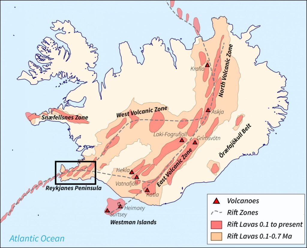
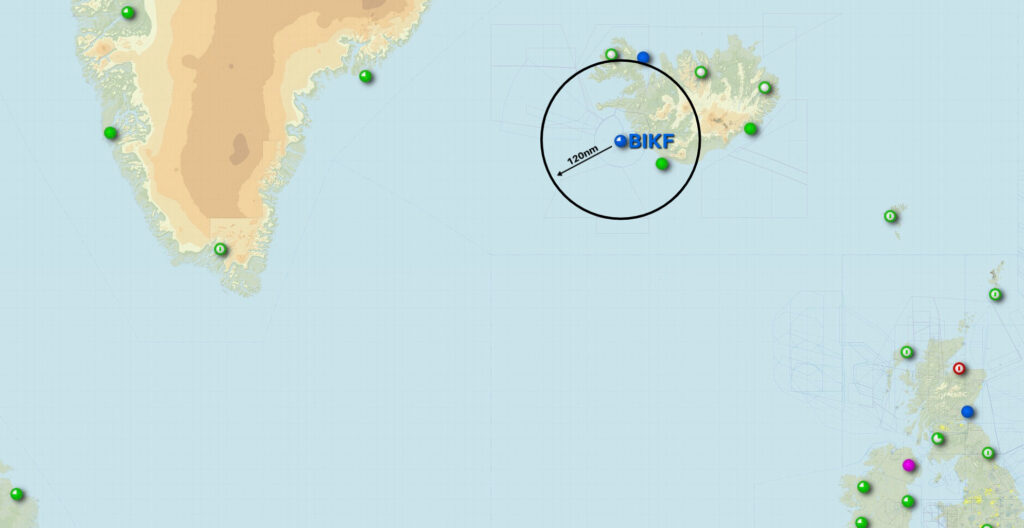
If the volcano warning goes to code RED (it’s currently code ORANGE), that basically means an eruption has started. In this case, the airspace within a 120nm radius will close, until they confirm there’s no ash cloud. They currently think there is a 15km long line where magma is flowing and moving towards the surface – an eruption could happen anywhere close to that line.

120nm of closed airspace around BIKF/Keflavik airport (remember, the volcano is just up the road) would look something like this:

There’s also a thing called the Volcanic Ash Contingency Plan that ICAO put together. This doc is the one you want to read – there are a few more scattered around online, but they’re all older versions of this one.

Where was ICAO when the Westfold fell?

This doc sprang from the misery caused by the eruption in 2010, and aims to set out what actually happens if a big volcano erupts.

Essentially, it goes like this:

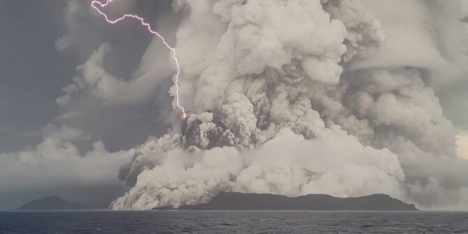
  1. Volcano erupts. There’s ash all over the place.
  2. Volcanic ash people issue a volcanic ash warning.
  3. Notam people issue a Notam.
  4. Pilots/Operators read the Notam and don’t fly into the ash. ATC help them.

All volcano walking tours are cancelled.

What should I do if I fly through ash?

Don’t fly through ash.

But if you do, then do this:

  1. Reduce thrust.
  2. Do a 180 degree turnback.
  3. Put masks on.
  4. Declare MAYDAY.
  5. Panic a bit as you do whatever emergency tasks you need to do.
  6. Divert somewhere pronto.

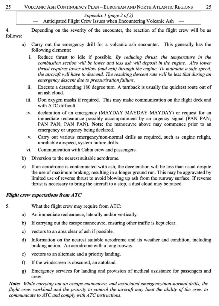
Or as it says in more official language in the Contingency Plan:

If I do fly through ash, how scary will it be?

Very scary. Don’t do it. Here’s a list of nightmarish things that will probably happen if you do:

  1. Smoke, fumes or dust may appear in the cockpit. Get those masks on.
  2. Engine malfunctions, stalls, over-temperature, thrust loss, engine failure.
  3. Reduced visibility due to the abrasive effects of ash on windshields and landing lights.
  4. Pitot tubes may become blocked, so airspeed indications may become unreliable.

Advice: disconnect the autopilot, set engine thrust to an appropriate value and maintain the aircraft’s pitch attitude manually. This will keep the aircraft at a safe speed, but will probably result in difficulty to maintain the assigned altitude. Increased separation is required (above and below).

Another thing that might happen – SPIDERS.

Advisories and Warnings

The London Volcanic Ash Advisory Center (VAAC) is responsible for issuing any ash advisories for this region. You can access those here.

Senior staff meeting at the London Volcanic Ash Advisory Center.

The current alert level is Orange. Verbatim, this means that the volcano is ‘exhibiting heightened unrest with increased likelihood of eruption; or that an eruption is underway with minor ash emission…’ Or in other words, it may be about to erupt.

If you’re not familiar with the volcanic alert scale, here’s how it works:

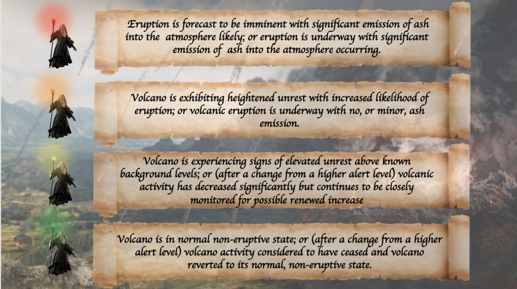
All traffic crossing the NAT or operating over Western Europe right now should be keeping a close eye on this one.

What’s the latest at BIKF/Keflavik Airport?

We’ve had a couple of reports from members who have been through there recently. If you’ve got anything to add, please file a report at Airport Spy! For info from the airport, you can contact the local handlers at jetcenter@icelandair.is or ops@southair.is.

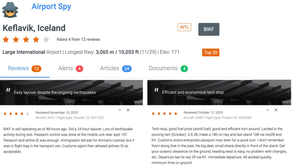
Click image for full reports at Airport Spy homepage.


Keep an eye on Shiveluch

Shiveluch is a 70,000 year old volcano with quite a bad temper. We thought we might introduce you to this hot headed fellow because it might have an impact on aviation in the not too distant future.

It has been reported as ‘extremely active’ since November 20, and an eruption is expected imminently.

Say hello to Shiveluch.

Or Шивелуч to give him his Russian name since he is, after all, Russian.

Shiveluch lives on the Kamchatka Peninsula (the far east bit of Russia that sticks out into the Pacific Ocean, and the Sea of Okhotsk). Shiveluch and Karymsky are the most active volcanoes on this bit of land.

What’s the eruption history?

He’s been blowing his top for about 10,000 years, but the current eruption period started in 1999 and he’s kept it up with a fair few explosions, frequent ash cloud spitting along with ‘incandescent block avalanches, and lava dome growth’ since then.

In February 2015 the ash cloud (which is really the bit we’re worried about in aviation) shot up to 30,000′ and crossed the Bering Sea and into Alaska.

In June 2022 it hocked up a dense ash plume which reached about 7 km in altitude.

Where will a big ash cloud potentially affect?

Unfortunately this is dependant on how much ash he coughs up (historically quite a lot), and which way the wind blows:

  • UHPP/Yelizovo Airport (Petropavlovsk-Kamchatsky)

This airport lies south of the volcano, on the peninsula, and is popular fuel/tech stop for BizAv aircraft but is currently not available anyway due prohibitions against operations into Russia airspace.

  • Alaska

Alaskan airspace was affected back in 2015 and more recently in April 2022. Ash reached 32,000′ and moved across the Pacific Ocean, impacting traffic routing over the northeast region and the Gulf of Alaska.

PANC/Anchorage could be affected, along with smaller airports such as PADK/Adak and airport along the Aleutian Islands currently used as fuel/tech stops while Russian airports are unavailable.

  • North Pacific/Bering Sea

Aircraft heading between the USA and Asia utilise routings here which may be impacted by large ash clouds.

  • Japan

Winds don’t predominantly blow this way, but ash could potentially still disrupt airports and airspace in this direction.

Keep an eye on him.

You can read his full history here. They post regular bulletins and reports on the ongoing action.

The Tokyo and Anchorage VAACs monitor this volcano. You can find links to their sites here.

Volcano Discovery also provides some handy info on volcanoes and their current action.

Look out for ASHTAMs and SigWx information for the North Pacific and Alaska region.


Tonga: Major Eruption in the South Pacific

On January 15, there was a major volcanic eruption in Tonga – an island nation in the South Pacific.

It was perhaps the most explosively violent eruption of the 21st century to date. Since then, the volcano has continued to produce ash as high as FL630 and has potential to continue to cause major flight disruptions throughout the region.

Here’s what you need to know.

Where is it?

The Hunga-Tonga-Hunga-Ha’apai volcano, or just Hunga Volcano for short, is found approximately 30nm north of Tonga’s capital, Nuku’alofa. You won’t find it on maps because it is hidden underwater. It is nestled squarely within the Tonga Trench, and is part of the Pacific’s infamous Ring of Fire – where eruptions and earthquakes come with the territory.

Because it is submerged, the risk to airports in the region is actually two-fold – from ash, and from tsunamis caused by seismic activity under the sea.

What has been happening?

The Hunga Volcano has been stirring for a while. In December there were small eruptions which produced ash and disrupted flights at Tonga’s main airport, NFTF/Fua’amotu. Then on January 15, there was a much more violent eruption.

Hunga produced a large ash plume, 150 nm wide and extending up to FL630 well west of Tonga.  The remnant of this cloud is currently over New Caledonia. The current VAAC forecast is good, with ash emission expected to stop.

NFTF/Fua’amotu is currently closed due to ash on the ground, and is expected to re-open at 0630 local on Jan 21 (1730z on Jan 20) but this may well be extended.  Airports nearby – especially in Fiji, New Caledonia and Vanuatu have so far escaped major disruptions.

Over the weekend, widespread Tsunami warnings caused by Hunga were issued for coastlines as far away as South America, the US and Japan. These have since been lifted, however Tonga itself was badly impacted by waves. It remains in a state of emergency and is still cut off from the world as internet and phone services are reportedly down. Reports of damage are still coming through.

The majority of major airports in the South Pacific Islands are at or near sea-level which leaves them especially vulnerable to this threat. They are also very remote. If Hunga erupts again, widespread closures could happen with little notice.

Outlook

While things have started to subside since the eruption, it’s not clear whether this was a one-off, or if we are in the middle of an ‘eruptive sequence.’ In other words, there may be more to come.

Stay Updated

VAAC Wellington handles volcanic alerts for the South Pacific region. You can view new advisories as they are issued, here.


Eruption in the Caribbean: The La Soufrière Volcano

A tiny island in the Southern Caribbean has made headlines this week after a volcano, dormant for decades, suddenly erupted on Friday almost without warning. It ejected ash as high as FL440.

The La Soufrière volcano is found on the main island of Saint Vincent and the Grenadines, a small country nestled amongst the southeast Windward Islands of the Lesser Antilles. It is neighbours with Saint Lucia to the north, Barbados to the east and Grenada to the South.

The volcano first made headlines on Thursday when scientists detected large seismic tremors – an ominous sign that the La Soufrière volcano was stirring. It had last erupted back in 1979.

Evacuations began for people living near the volcano which is found only 10nm north of the country’s main airport, TVSA/Argyle. Scientists believed an eruption was imminent.

Then on Friday La Soufrière literally exploded back to life with several violent eruptions producing massive amounts of ash. Since then, sporadic eruptions have continued. The latest was on Monday, and scientists believe there is no end in sight. It may continue to erupt (and produce ash) for weeks.

What’s the current operational impact?

The initial VAAC advisories indicated a large ash cloud extending up to FL440 and moving in an easterly direction away from land and into the Central Atlantic:

However, the most recent VAAC Advisory, dated 1358z on April 14, only shows a small area still affected by volcanic ash up to FL280, forecast to dissipate by 1930z:

Two main airports have been shut down by the eruption:

TVSA/Argyle has been closed until further notice having been coated in thick ash. TVSA Notam A0591/21 has that info and is due to expire at 00z on April 15 however it is very likely to be extended.

Further east, winds carried ash toward Barbados closing down TBPB/Bridgetown. It is due to reopen at 1600z on April 16, but further disruptions are possible (TBPB Notam A0585/21 refers).

Outlook

The La Soufrière Volcano remains at Aviation Colour Code Red, meaning a major eruption is underway with significant ash emissions.

The amount of ash it produces depends on the strength of each eruption which is difficult to predict. So far they have been many and varied.

Airports in neighbouring Saint Lucia and Grenada have remained open but may be impacted by further eruptions depending on prevailing winds. Disruptions and closures are possible throughout the South-Eastern Caribbean.

Scientists have seen no sign that the volcano is slowing down and it appears to be following the same patterns as previous eruptions that lasted for extended periods of time – so things may get worse before they get better.

More info

  • You can view the latest VAAC advisories for La Soufrière here.
  • For the dangers of flying in volcanic ash along with operational advice, see our recent article here.


Ongoing Bali volcanic threat – update

Update June 29, 2018:

Following the volcanic eruption on Jun 28 at Bali’s Mount Agung, the airport has been closed all morning today, Jun 29, and only just reopened at 1430 local time (0630z). Over 500 flights have already been cancelled as a result. Big delays expected all day and into the weekend. Further closures due to volcanic ash are still possible.

Per latest report from Darwin VAAC, there is a volcanic ash cloud observed up to FL160 in the area, but they predict winds will carry the ash southwest toward Java, Indonesia’s most densely populated island.


In Short: Continued vigilance required for operations to Bali; The alert level for Mt Agung eruption remains at 3 (on a scale of 1-4). Last ash plume on 26 March rose to at least an altitude of 11,650 ft.

When Mount Agung erupted in November 2017, airlines faced travel chaos as flights were cancelled due to the lingering ash cloud. Since then, visitor arrivals have dropped by more than 70 percent. Facing $1bn in lost tourist revenue, the Indonesian government is trying to lure tourists back to the holiday island.

The 3,000metre high volcano sits roughly 70 kilometres away from the tropical paradise’s main airport and popular tourist areas.

In a Volcano Observatory Notice for Aviation (VONA), Volcanological Survey of Indonesia (PVMBG) reported that at 1009 on 26 March an event at Agung generated an ash plume that rose at least to an altitude of 3.6 km (11,650 ft) a.s.l. and drifted NW. The Alert Level remained at 3 (on a scale of 1-4) and the exclusion zone continued at a 4-km radius.

Best up-to-date information:

The current one to watch:

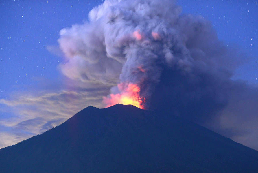
Mount Sinabung – located in Medan, Indonesia is also very active at the moment (last spewing ash on Friday April 6) and may disrupt air operations to Malaysia and Singapore.

Current Aviation Color Code: RED, Eruption with volcanic ash cloud at 09:07 UTC (16:07 local). Eruption and ash emission is continuing. Ash-cloud moving to west – south. Best estimate of ash-cloud top is around 23872 FT (7460 M) above sea level, may be higher than what can be observed clearly. Source of height data: ground observer.”

We will keep an eye on this one.

Mount Sinabung roared back to life in 2010 for the first time in 400 years. After another period of inactivity it erupted once more in 2013, and has remained highly active since.

If you have travelled through the region lately and can provide members with more of an update, please get in touch. 


Guatemala’s Fuego volcano disrupts ops

An eruption at Guatemala’s Fuego volcano on 3rd June resulted in the deaths of 25 people, and forced the temporary closure of MGGT/Guatemala City Airport. After the military cleared ash from the runway, the airport re-opened on 4th June, with the warning of delays due to ongoing runway inspections.

On June 3, Guatemala’s Institute for Vulcanology (INSIVUMEH) published a map showing the volcanic ash distribution (shown on the map as the area in orange, labelled ‘Ceniza’):

Further reading:


Bali – Airport Status

Volcanic eruptions from Bali’s Mount Agung earlier last week forced the closure of WADD/Denpasar and WADL/Lombok airports, as volcanic ash spread across both islands.

Here’s the current situation at the airports on Dec 4:

  • WADD/Bali: Re-opened on Nov 29. (Although the airport will be closed for runway repair from 18-23z daily [except Saturdays] until Dec 31).
  • WADL/Lombok: Re-opened on Nov 30. 
  • WARR/Juanda: Open and operating. So far has not been affected at all by the volcanic ash. (Although the airport will be closed for runway repair from 16-22z daily until Jan 06).

Although Mount Agung has now stopped emitting ash, another large eruption is still likely. The local monitoring agency are registering powerful and continuous tremors, and authorities have ordered locals and journalists within 10km of the volcano to evacuate. Further intermittent airport closures are possible, depending on wind direction.

We will keep this page updated with the latest news as we get it.


Iceland Volcano alert – Katla

Icelandic volcano Katla has been raised to colour code Yellow by the Icelandic met office.

Katla lives beside Eyjafjallajökull, the volcano that closed much of Europe’s airspace for a week or so in 2010.

Colour code yellow means that there is increased activity, but no eruption … as of yet. 

volcano_status

It doesn’t mean that an eruption is ‘expected’ either, but given the proximity of Katla to the site of the major eruption in 2010, there may be correlation. Icelandic scientists have also said that an eruption of Katla is overdue.

For now, keep an eye on updates at http://en.vedur.is/weather/aviation/volcanic-hazards/


Monday Briefing: North Atlantic OTS Changes, Indonesia Volcano Eruption

North Atlantic OTS Changes this week 09NOV This Wednesday (12NOV) sees the implementation of the new NAT Track OTS, marking the first change to the lateral structure since the tracks were introduced in 1965. New requirements include RNP4, and 24 new Oceanic Entry Points come into effect. See below for further.

Indonesia Volcano Eruption 09NOV Operations into WADD/ Denpasar, Bali continue to be disrupted due to ongoing eruption of Mt. Rinjani on Lombok Island. Also affected are nearby WARB/Blimbingsari and WADL/Lombok.


EINN/Shannon FIR CPDLC service is withdrawn on the evening prior to implementation of the new NAT Track system, voice service only from 1715Z onwards on 11NOV.

LGGG/Athens FIR Strike of Greek Radio Operators (thereby including AFTN messaging, and AFIS) announced this morning for 12NOV. Overflights will not be affected. Full details here.

HESH/Sharm el-Sheikh remains open but subject to multiple advice notices from international Authorities. Many airlines have cancelled operations into the airport after increasing suspicions that a bomb was loaded here onto the A320 which crashed into the Sinai Desert.

HLLL/Tripoli FIR Libya has issued updated advice regarding airport availability – HLLQ, HLTQ and HLZW are only available for international arrivals, daylight hours only. PPR and Permit is required prior operations.

SCFZ/Antofagasta ACC, Chile. Crews on Airways UL780 and UL302 are requested to inform ATC of any speed changes greater than .02 Mach; if unable on VHF, use HF 10024. The procedure is to ensure separation between succeeding aircraft operating on CI speeds.

SBXX/Brazil The Brazilian Grand Prix takes place 13-15NOV making Sao Paulo operations at SBSP/Congonhas, SBGR/Guarulhos, and SBKP/Campinas busier than usual.

RPLL/Manila, Philippines APEC 2015 Summit being held 17-20NOV. Check restrictions, many commercial flights have been suspended during this period. Parking at a premium. Consider quieter alternates such as RPLC/Clark.

YXXX/Australia Australian Border Force strike commencing midnight 09NOV across Australian airports. As a result, departure and arrival processing at Australian airports may take longer then usual.

WADD/Denpasar, Indonesia Operations here continue to be disrupted due to ongoing eruption of Mt. Rinjani. Also affected are nearby WARB/Blimbingsari and WADL/Lombok. For updates monitor http://www.bom.gov.au/products/Volc_ash_recent.shtml

LIXX/Italy Possible ATC strike on 14NOV 1200-1600Z announced.

KXXX/US Airport Runway closures: BWI-RWY 10/28 CLOSED SEA-RWY 16C/34C CLOSED LAS-RWY 7L/25R CLOSED

KLAS/Las Vegas NBAA 2015 will take place 17-19NOV limiting airport capacity.

HECC/Cairo FIR, Egypt Point PASOS (LCCC FIR) is again available in both directions for flight planning. Please be aware flights departing OLBA via LCCC must file via VELOX-PASOS. Also see HECC NOTAM 1A277/15 and 1A278/15 for flight planning guidance.

VHHH/Hong Kong Arrival and Departure delays up to 30 minutes can be expected due to a flight check and maintenance on RWY 07L/25R on 09NOV 0530-0100 and 10NOV 2300-0100.

Caribbean Tropical Weather Advisory Shower and thunderstorm activity is showing signs of organization in association with a low pressure system located just north of the Turks and Caicos and the southeastern Bahamas. A tropical depression or a tropical storm is likely to form on Monday while the low moves west-northwestward to northwestward near or over the central and northwestern Bahamas. For further details see National Hurricane Center

KLAX/Los Angeles Due to military operations of the coast of LAX there is a risk of arrival delays and reroutes during the overnight periods until Nov 12th.

MWCR/Grand Cayman may be forced to shorten the runway at Owen Roberts International Airport (MCWR/GCM). The runway, which was extended to accommodate long-haul flights, may have to be shortened in order to accommodate a 400 ft/124 m safety area. An extension of the runway cannot be further extended, and the airport authority is examining all options.

CYYQ/Churchill has amended opening hours 1200-2200Z M-F.

PKWA/Bucholz has revised ATC hours from 01NOV, 0800-1230 and 1330-1600LT.

NWWW/Tontouta has a main runway closure 09-12NOV at various times, some daytime. Check NOTAM 1543/15.

EGPF/Glasgow is closed overnight 22NOV-11DEC for runway and taxiway repairs.

DRRR/Niamey Ouagadougou ACC is now operational H24 again; the previously implemented contingency plan for traffic operating outside ATC service hours is withdrawn.

View the full International Operations Bulletin for 09NOV2015.