The risks posed to civil aircraft by surface-to-air missiles

In Short: Worldwide the SAM threat is deemed to be “low” by ICAO with the caveat that this can change quickly when flying over or near conflict zones. The best risk mitigation is centred around which airspace you are operating over and what information you have access to. As we have explained before: There is no safe altitude from a large SAM.

What are surface-to-air missiles, and who has them?

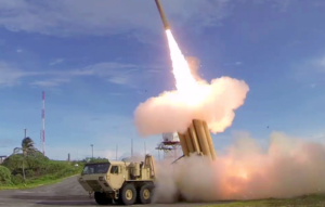
Surface-to-air missiles (SAMs) are large, complex units, with the capability of reaching aircraft at cruising levels well above 25,000 ft, and they are designed to be operated by trained military personnel.

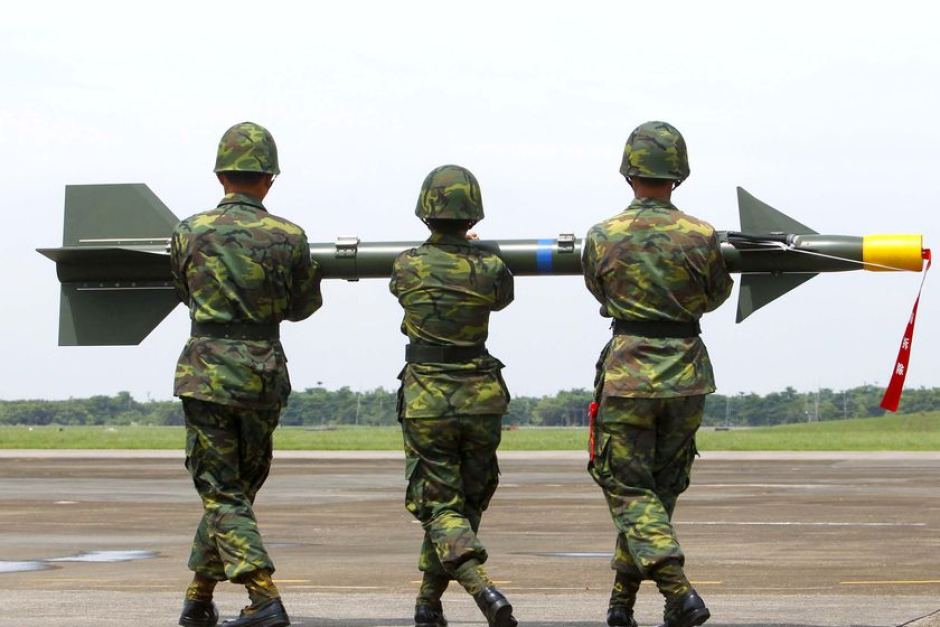
They are distinct from Man Portable Air Defence Systems (MANPADS), which are the smaller, shoulder-launched systems, the most dangerous of which being the FIM-92 Stinger which has an operational ceiling of 26,000 ft.

SAM systems vary but they are all designed to track and destroy military targets in flight. Due to the size and predictable flight paths, civil aircraft represent easy and highly vulnerable targets.

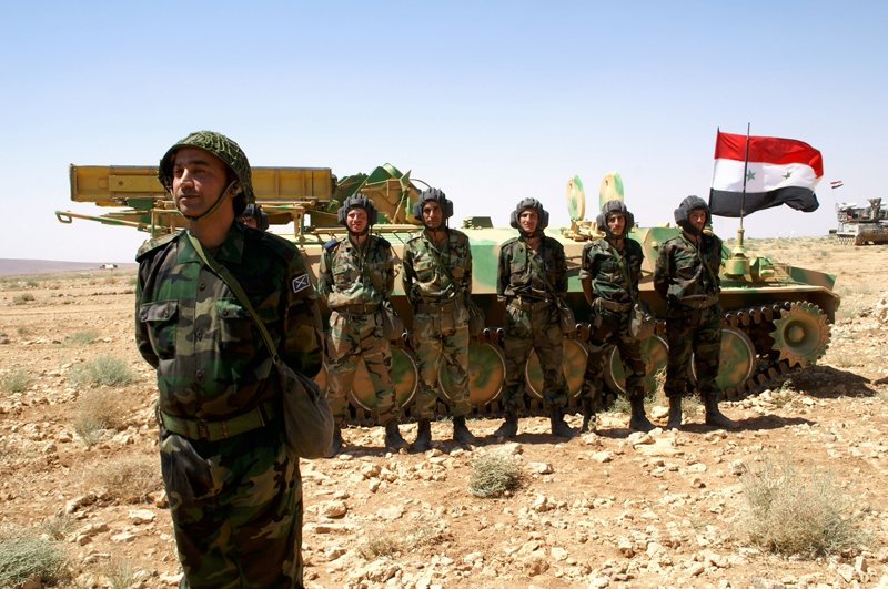
Many SAMs are mobile and can be moved quickly between locations. Many are located on warships. It is estimated that more than 70 States around the world have acquired SAMs as part of their military capability. A small number of non-State actors (i.e. militant groups) have also reportedly acquired SAMs, but as they require a radar system as part of the mechanism, they may not have the technical capability to use them. To date, SAMs have never been used by terrorists.

What has happened in the past?

There have been three documented occurrences where aircraft destruction has occurred due to SAM attacks.

The risk of intentional attack

To date, no documented case of intentional SAM attack on a civilian aircraft has been identified. In the case of MH17 and Iran Air, both occurred during periods of military conflict or high tension, whilst Siberia flight 1812 was shot down during a military training exercise.

ICAO say that “with regard to the States and non-State actors that currently do have access to SAMs, there is no reason to believe that the intent currently exists to target civil aviation deliberately.” And with regards to terrorist groups (as opposed to militarized forces), they say that “even where intent may exist there is currently no evidence of capability (in terms of hardware and trained personnel).”

Overall, the current risk to aviation from intentional SAM attack is therefore currently assessed to be low, the key caveat being to avoid overflying airspace over territory where terrorist groups tend to operate – normally areas of conflict where there is a breakdown of State control.

The risk of unintentional attack

Past events show us that the higher risk to civil aviation is from unintended and unintentional attacks when flying over or near conflict zones – missiles fired at military aircraft which miss their target, missiles fired at civil aircraft which have been misidentified as military aircraft, and missiles fired by State defence systems intended to shoot down other missiles.

Areas where there are armed conflicts going on clearly present an increased risk of an unintentional attack. But when assessing the risk of overflying a particular conflict zone, here are some more specific questions to consider:

Are there increased levels of military aircraft flying around in the region?

This could be anything from fighter jets being operated in a combat role, or for hostile reconnaissance; remotely piloted aircraft; or military aircraft used to transport troops or equipment. If military aircraft are one of the most likely targets for intentional attacks, then the chances of civil aircraft being mistakenly targeted increases in those areas where there are lots of military aircraft zipping around.

Are there likely to be a bunch of poorly trained or inexperienced personnel operating SAMs in the region?

This may be difficult to evaluate, but the risk is likely to be highest where SAMs may have been acquired by non-State actors. The risk is also likely to be higher in places where there is less of a robust command and control procedure for launching missiles, thus increasing the risk of misidentification of civil aircraft.

Is the territory below the airspace fully controlled by the State?

If not, and there are some areas controlled by militant or terrorist groups, the information on the presence and type of weaponry in such areas, as well as the information on who controls them, may not be readily available. In such regions, the information promulgated by the State about the risks to airspace safety may therefore not be 100% reliable.

Does the route pass over or near anywhere of particular importance in the context of the conflict?

These could be areas or locations that may be of strategic importance or sensitivity in the conflict, such as key infrastructure or military sites, which might be considered potential targets for air attack and would therefore be more likely to be guarded by SAMs.


Ultimately, risk mitigation is centred around which airspace you are operating over and what information you have access to. But as has been reported in the past, history has shown us that badly-written information published by the State often does little to highlight the real dangers posed by overflying conflict zones.

There is some evidence to suggest that more States are starting to provide better guidance and information to assist operators in making appropriate routing decisions, but we think this still has some way to go.

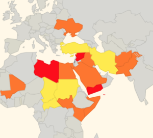
That is why we have been running our safe airspace map to provide guidance to assist operators in determining whether to avoid specific airspaces around the world.


Extra Reading:


US updates its Syria airspace warning

Following the US, UK and French airstrikes on Syria on April 14, the US FAA say there is now a risk posed to civil aviation within 200 nautical miles of the country due to increased military activity, GPS and comms interference, and the potential for more long range surface-to-air missiles in the area.

In the updated US FAA conflict zone Notam and Background Information for Syria, US civil aviation continues to be prohibited from operating within Syrian airspace, but has also now been instructed to “exercise caution” when operating within 200 nautical miles of Syria’s OSTT/Damascus FIR.

As they say in the Background Information doc, here’s why this updated guidance has been published:

“Heightened military activity associated with the Syrian conflict has the potential to spill over into the adjacent airspace managed by neighboring states and eastern portions of the Mediterranean Sea. Military operations may result in the risk of GPS interference, communications jamming, and errant long-range SAMs straying into adjacent airspace within 200 nautical miles of the Damascus Flight Information Region (OSTT FIR). These activities may inadvertently pose hazards to U.S. civil aviation transiting the region. This concern stems from the Syrian military response to previous airstrikes on 10 February 2018, which included Syrian forces launching long-range SAMs. Some of the Syrian SAMs flew into adjacent airspace and landed in Lebanon and Jordan, according to media reporting. GPS interference and communications jamming in the region may also occur associated with the military activity. Some U.S. air carriers have reported GPS interference in portions of the eastern Mediterranean Sea in the period following the 10 February airstrikes, and the interference may have originated from the Damascus Flight Information Region (OSTT FIR) as a defensive response.”

The US FAA haven’t provided a map to show where boundary would lie for 200 nautical miles from the border of Syrian airspace, but we think it would look something like this:

The 200 nautical mile zone would include the entire airspace of Lebanon, Jordan and Israel; half of Turkey and Iraq; and a portion of airspace over the LCCC/Nicosia FIR that covers the whole island of Cyprus!

The area may seem vast, but the possibility of further US, UK and French strikes against Syrian targets does still exist, as well as the Syrian military using surface-to-air missiles in response to any attacks.

During the airstrikes on April 14, the Syrian military reportedly used Russian-made missile systems to attempt to counter the strikes – these included missiles which have the capability to engage aircraft at altitudes well above FL900 and at ranges of around 190 miles.

While there is likely no intention to target civil aircraft, with all the missile defence activity going on in Syria and the spillover into neighbouring countries there still remains a risk of misidentification – and that’s what the 200 nautical mile warning seeks to address.

Amidst continued heavy military air presence in the region, almost all airlines are now avoiding Syrian airspace entirely. Lebanon’s Beirut based MEA has now also re-routed all of their flights to avoid Syrian Airspace (was using it post recent attacks). Only local operators Fly Damas, Charm Wing Airlines, Syrian Air and Iran’s Mahan Air continue to use the airspace.


Here’s what the Pentagon had to say about the airstrikes on April 14:

  • 105 missiles were launched in the strikes against Syria. They included 30 Tomahawk missiles fired from the USS Monterey and seven from the USS Laboon in the Red Sea. Another 23 Tomahawk missiles were launched from the USS Higgins in the North Arabian Gulf.
  • A submarine, USS John Warner, fired six Tomahawk missiles from the eastern Mediterranean and a French frigate in the same area fired another three missiles.
  • At least one US Navy warship operating in the Red Sea participated in airstrikes, as well as US B-1 bombers.
  • The air assault involved two US B-1 Lancer bombers, which fired 19 joint air to surface standoff missiles. The British flew a combination of Tornado and Typhoon jets, firing eight Storm Shadow missiles, while French Rafale and Mirage fighter jets launched nine SCALP missiles.
  • Four Royal Air Force Tornado GR4’s were used in the strikes, launching Storm Shadow missiles at a “former missile base — some 15 miles west of Homs,” according to the UK Ministry of Defense.
  • Syria fired 40 surface to air missiles ‘at nothing’ after allied air strikes destroyed three Assad chemical sites.
  • The United States remains “locked and loaded” to launch further attacks.
  • United States and Allies maintain positive posture of force in the region, especially in the air.

105 missiles launched from multiple locations in the region.
Over 40 Syrian surface to air missiles fired “at nothing”.

Further Reading:

A0454/18 – INFORMATION TO AIRSPACE USERS

THE DEPARTMENT OF CIVIL AVIATION OF THE REPUBLIC OF CYPRUS IS CONTINUOUSLY MONITORING THE GEOPOLITICAL DEVELOPMENTS IN THE REGION AND WILL NOTIFY THE AVIATION COMMUNITY IF AND WHEN ANY RELEVANT AN RELIABLE INFORMATION IS AVAILABLE THE DEPARTMENT OF CIVIL AVIATION IS TAKING ALL APPROPRIATE ACTION TO SAFEGUARD THE SAFETY OF FLIGHTS. 12 APR 15:25 2018 UNTIL 12 JUL 15:00 2018 ESTIMATED. CREATED: 12 APR 15:26 2018

If you have anything to share that we’ve missed, please tell us by email bulletin@fsbureau.org


Qatar airspace update – military jets intercepting civil flights

In short: The situation is volatile and constantly changing, even by the hour. Military interception has been reported so the best advice is to be vigilant with sticking to assigned routes for all operations around the region.

The airspace blockade of Qatar has been ongoing since June 2017 with little end in sight.

But over the past few months, tensions have been escalating;

Here is the latest operational information we have:

A reminder that Qatar does not have its own FIR. It sits entirely within the Bahrain FIR- you will find Qatar airspace NOTAMs under OBBB. The Doha TMA extends SFC to FL245. Above this sits the Bahrain UIR.

Bahrain and Egypt have relaxed some of their initial restrictions. Saudi and UAE have not.

The current state of play as of 6 April 2018.


_________________________________________________________________________

Have you been through the region recently? Can you provide an update?

Extra Reading:

Some fascinating reporting about what this whole blockade is all about.

  • How a ransom for Royal falconers reshaped the Middle East” – New York Times
  • What the falcons up with Qatar?” – NPR Podcast


International Bulletin: B767 shot on approach to Rio, Updated SafeAirspace Map

B767 Shot on approach to Rio 

18JAN A B767-300 was fired on last night during approach to Runway 15 SBGL/Rio de Janeiro. One 7.62mm bullet lodged in the left wing. Read the article.

Updated SafeAirspace Risk Map 

18JAN We have updated SafeAirspacewith information for Aircraft Operators on The GambiaNorth KoreaBrazilUkraine, and Turkey.


GBZZ/The Gambia State of emergency declared on 17th January. Foreign citizens being evacuated. Banjul International Airport (GBYD/BJL) and land borders remain open, for now. More at safeairspace.net/information/the-gambia.

UKZZ/Ukraine Flight Service Bureau has issued an updated summary for Ukraine’s airspace. There are two risk issues in Ukraine. First: arms fire. Including MH17, multiple aircraft (the others all military) have been shot down since the beginning of the Donbass region war in 2014. The 10th ceasefire was declared in December 2016, but not holding. This risk is contained within the Dnipropetrovsk FIR – UKDV. The second issue affects the Simferopol FIR which is Disputed Airspace. (Ukraine:UKFV, Russia:URFV). In March 2014, Russia annexed Crimea. The ATC Center is in Simferopol, Crimea, and is now run by Krymaeronavigatsiya. Russia claims the airspace. Ukraine refuses to recognise the change, and asks crews to talk to Ukrainian controllers in Dnipro/Odesa ACC instead of Simferopol ACC. Four routes are approved by EASA through the high seas portion of the airspace.

KIAD/Washington and area airports – guaranteed busy during the Presidential Inauguration this Friday, Jan 20. Updated restrictions here. Departure slots required for aircraft departing IAD between Friday, Jan. 20 and Sunday, Jan. 22. Departure slots can be obtained through an IAD FBO of choice (Ross Aviation or Signature Flight Support). Slots will be divided equally between the two FBOs at IAD.

VZZZ/Southeast Asia Lunar New Year holiday season, which falls on 28th Jan. Travel-related delays and government office and business interruptions will peak 27 Jan to 01 Feb, and could last longer in Taiwan, Vietnam and China, where the holiday will be celebrated through 02FEB.

BGBW/Narsarsuaq A seasonal reminder that if you’re planning to use Narsarsuaq as a destination, alternate, or enroute alternate outside of the operating hours (MON-SAT 1000-1900z daily until 03APR), you must contact the airport in advance to apply for them to stay open for you:
Email: bgbw@mit.gl. Also make sure you file your ATC FPL including the AFTN address: BGBWZTZX.

EKCH/Copenhagen A copy of the AOC must accompany fuel release or expect an MOT charge of approximately $1.70 USD to be charged. Next destination must be shown on the fuel release or expect delays.

EGPH/Edinburgh, Scotland Until Apr 1st, you will need PPR to operate to Edinburgh, due to reduced parking capacity.

RPLB/Subic Bay will be closed for maintenance bewtween 0100-0800z until January 20th.

SKZZ/Colombia New Tower and ACC for Bogota. From 16th Jan – 15th Feb moving of Bogota’s ACC will take place. ATS/AIS/COM/MET/ATFM services transition process should not affect operations, however, due to the large change extent foreseen, some failures might occur in the process.  AIC 1/17 outlines contingency procedures in place

SVZZ/Venezuela has closed its land borders with Colombia and Brazil periodically in the last 12 months. Border closures occur frequently, often with short notice. The Venezuelan government will withdraw the 100 bolivar note (VEF 100) from circulation as of 20 January 2017.

LYBA/Beograd If you have any outstanding navigation fees in Serbia, better get them paid, or they’ll add a 9.88% interest charge.

HSSS/South Sudan Flight Service Bureau has issued an updated summary for South Sudan’s airspace: Conflict Zone. South Sudanese Civil War since 2013. The security situation in Juba has been relatively calm since the July 2016 crisis. Daily reports of fighting throughout the rest of the country. The security situation is especially unstable in the Equatorias in the south. MANPADS risk to overflights. In addition, the South Sudanese army has declared intention to shoot down Aircraft without permits. Most Authority guidance recommends min FL260. We think FL300 is a better minimum for overflights.

ZKKP/North Korea Flight Service Bureau has issued an updated summary for DPRK North Korea’s airspace: The level of tension on the Korean peninsula can change with little notice. Multiple missile launches in 2016, increasingly without prior notice to ICAO. The range of these has increased – previously safe airways B467 and G711 are now at risk. Over 1000 reports of GPS jamming issues reported by operators in the vicinity of the North/South Korean border. SFAR79 prevents US operators from operating west of 132E, other Authorities restrict operationseast of that line.

ZZZZ/Worldwide How have you been getting on with the new ICAO SID/STAR phraseolgies? In short, some countries are implementing, and others aren’t. What is your country doing? Tell us at bulletin@fsbureau.org.


View the full International Bulletin 18JAN2017