How much radiation are we getting zapped with as crew?

How much radiation are we getting zapped with as crew, and what sort of levels should we be concerned about?

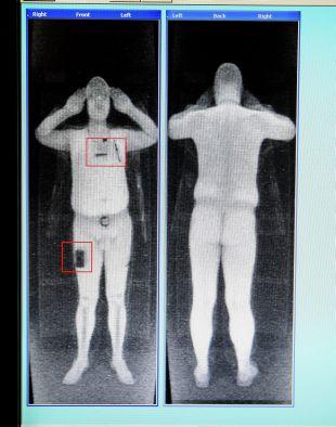
The Airport Security Scanner

Most pilots have probably experienced rather overzealous security scanners in an airport. You know the ones – when you go through, it beeps. You remove the watch you forgot to take off. It beeps again. You take your jacket, shoes, tie off. It still beeps. Now you’re wondering if you’ll need to strip down like this South African Airways pilot did…

More concerning than any radiation levels

Anyway, it is frustrating, but it is not really a big deal radiation-wise. One dose of the airport scanner is 100,000 times lower than the average annual dose we get from natural background radiation and medical sources. It actually delivers around 0.1 microsieverts per scan which is 100th what a standard chest x-ray delivers.

For comparison, every banana you eat contains around half a gram of potassium-40 (an ionising radiation source) which means eating it is the equivalent of 1000th of a chest X-ray in terms of the radiation dosage. The granite counter top you prepared your lunch on is also dosing you. While if you live in the UK you are getting about 2.7 millisieverts of radiation annually just by being there because it is one giant granite counter top under your feet.

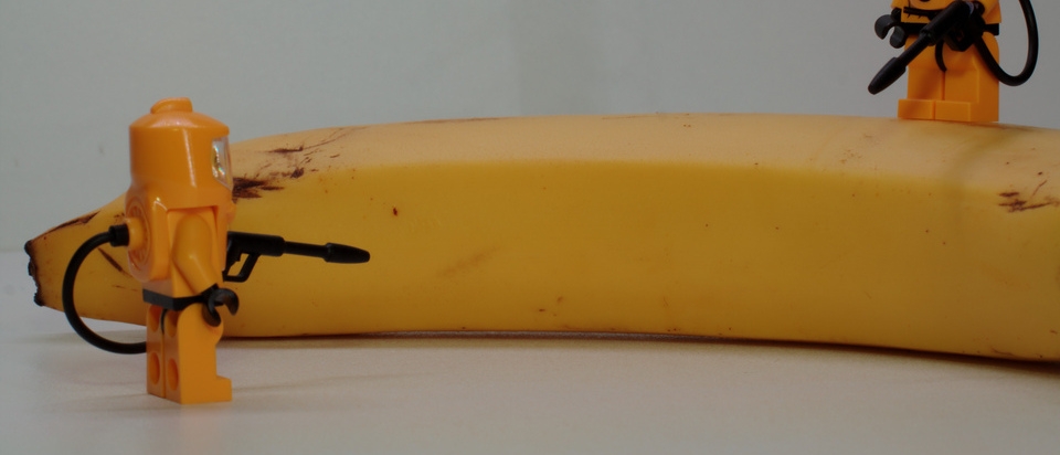
Bananas are a great source of (radioactive) energy

So, no, we shouldn’t be worried about radiation from airport scanners. But given that every minute on an airplane is equivalent to one airport scan, should we be worried about that?

Flight Risk

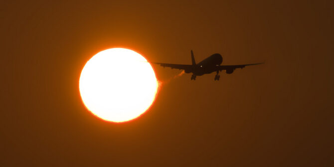
When you fly you are exposed to low levels of radiation – from some of the onboard equipment, to the fact you are way nearer space and all the cosmic and UV rays swilling about up there. 

UV radiation is what we protect ourselves against by not destroying our friend, the Ozone Layer, and with all the SPF suncream we slather upon ourselves. The ozone layer sits around 10-15 miles above the ground (so our airplanes stay below it), and it blocks out a good whack of UV-B, all of UV-C and some UV-A.

Now, that *some is the reason why we should be slathering more sunblock on ourselves when we fly, because the ozone layer and our windscreens help, but not enough. A study showed that the amount of UV radiation the pilot seat (and you in it, presumably) gets smacked with when flying for under an hour at 30,000 feet is equivalent to a 20 minute tanning bed session.

Studies also show the rates of skin cancer in pilots and cabin crew are significantly higher than the general population. So, you need to be careful. Plus it makes you wrinkle more.

  • Wear sunblock (decent UV-A and UV-B ones)
  • Get decent sunglasses with UV protection lenses because your eyeballs are damaged by it too! Polarized sunglasses help reduce glare, but don’t necessarily provide more UV protection (and they mess with the screens).
  • Check them moles (if you’re a moley sort of person) – it isn’t just areas exposed to direct sunlight which can be at risk.

In fact, going back to the sunglasses point, IFALPA have a very handy handout on the ‘Ocular Hazards of UV Exposure’. It is basically ‘scary stuff, bad stuff, scary stuff’ and then a “get sunglasses that have a UV absorption up to 400nm/ 100% absorption’.

There is no evidence of people sunburning in airplanes

Cosmic Vibes

Cosmic radiation is high-energy charged particles – x-rays and gamma rays which come from stars, like our very own sun. It differs to UV radiation in that it is higher energy and ionising.

We don’t like ionising radiation because it causes damage to our squidgy little insides.

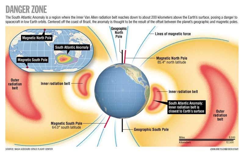
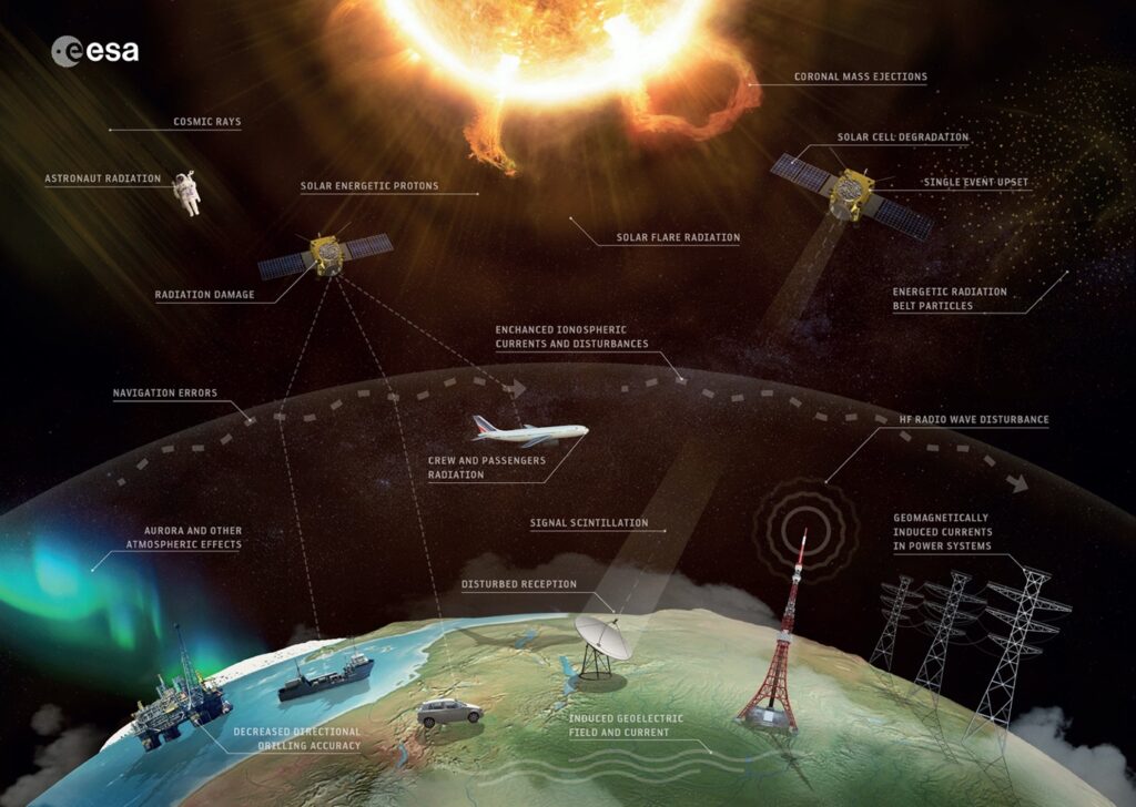
The closer to space we get, the more cosmic radiation we are exposed to, and the higher the latitude the more we get as well, which means those high altitude, Polar flights are the ones to really monitor.

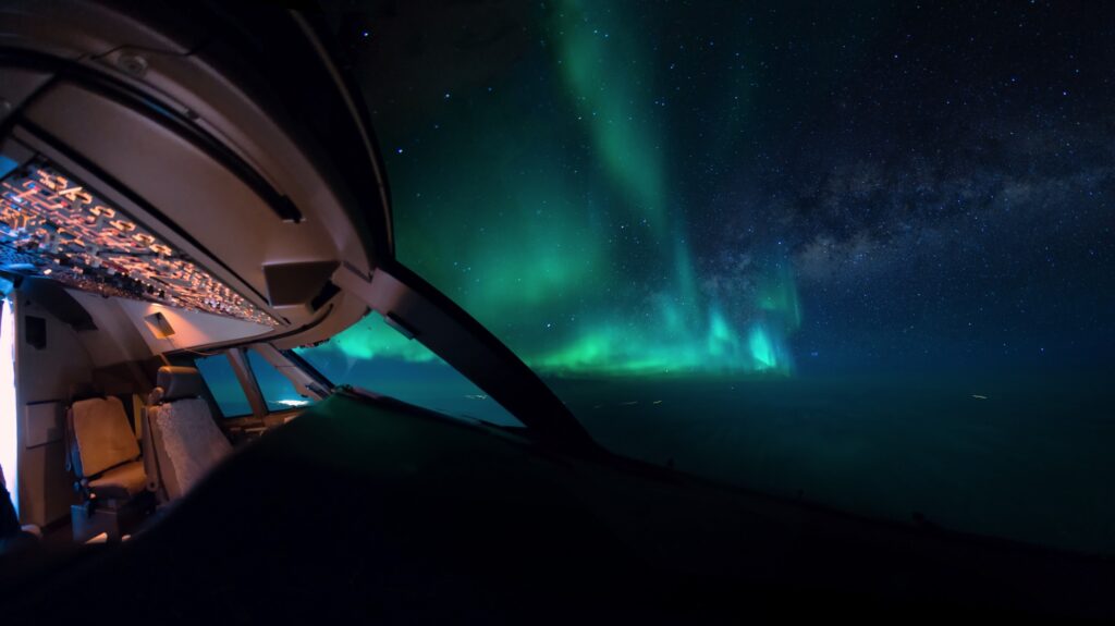
The Northern Lights displays we see, despite their “radioactive” green colour actually do not emit any radiation that reaches us. Although, if you were up there, in it, it probably wouldn’t be great for you.

What are the numbers looking like?

The International Commission on Radiological Protection (ICRP) basically classify aircrew as ‘Radiation Workers’ and recommend a maximum of 20mSv a year averaged over 5 years. So a maximum of 100 mSv in 5 years. 

The average person in the US receives up to 3mSv, with a recommended dose of 1mSv per year. Anything between 3 and 20mSv is considered moderate.

So, how much are we getting?

Well, heading from the east to the west coast of the USA you probably get about 0.035mSv. Not a tremendous amount if you’re a passenger, but what about if you are doing flights several times a week?

2 sectors a day, 3 times a week, plus or minus a few for holidays, and you could be heading towards something in the region of 10mSv which is higher than normal but still in the moderate (and acceptable) range.

If you are flying from Athens to New York – a flight likely to take you along a relatively northerly route and at a flight level of 41,000ft or higher, then the 9 to 10 hours airborne are going to dose you up another 0.063mSv – 0.63mSv per 100 block hours.

A study carried out in 1998 suggested the average crew member flies around 673 block hours, getting an average cosmic ray dose of 2.27mSv, while the annual cosmic ray dose for a long haul Captain was calculated at around 2.19mSv.

Ok, that was back in 1998, but as far as we know the levels of cosmic rays haven’t increased. Our block time might be a few hundred higher, but still well within limits on the radiation dose front.

Sunglasses always necessary

How can you monitor it?

Airlines and operators should monitor this for you, but if you want to keep an eye on it you can via various apps out there in the mobile phone world. 

CRAYFIS is an app developed by scientists to help monitor the amount received via the pixels in your smartphone screen.

Apps like  TrackYourDose have options to plug in a route and uses average flight paths to help you monitor your dose on specific flights and days.

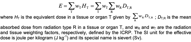
Or you can work it all out yourself using this handy little formula.

Maybe just use the app

So, should we be worried?

The figures suggest no.

A study of 10,211 pilots carried out in 2003 also supported this, with skin cancer showing slightly higher incidences.

So unless you are flying an excessive number of long haul Polar Flights, the overall the radiation dosage received by air crew is higher than the average ground dweller, but remains within acceptable limits.

That space weather is likely to have more of an impact on your HF than it is you.

Want to read some more (official) stuff?

The CDC offer some good guidance.

As do the FAA in this useful booklet for air crew.


The Bermuda Triangle: Fact or Fiction?

The Bermuda Triangle. A place of myths and legends. But how real is it, and what affect if any does it have on aircraft flying through it?

Where exactly?

The Bermuda is a fairly loosely defined area out in the great Atlantic Ocean, generally mapped out with its three corners reaching Bermuda, Miami and the northwestern corner of Puerto Rico. It varies in size from around 500,000 sq. miles to 1,500,000 sq. miles depending on how its boundaries are drawn.

Why do we talk about it in Aviation?

It has a reputation for disappearances – sinking ships and vanishing airplanes, dots on the radar that are gone in a blink, never to be seen again. Some say it is haunted, some say aliens use it as a human abduction point, others reckon it is home to an immense Kraken that swallows ships whole…

These might be tall tales, but in fact is has been the location of a higher-than-its-fair-share of naval and aviation disappearances, and random technical malfunctions too. Somewhere in the region of 50 ships and 20 airplanes since folk started paying attention.

In 2017, a Turkish Airlines A330-200 experienced a series of electrical and mechanical malfunctions while routing over the Triangle. Routing from Istanbul to Cuba, they ended up making a diversion to Washington Dulles. Flight 19 was a squadron of five Torpedo Bombers that disappeared in the area. And of course the famous Amelia Earhart’s final flight was rumored to have gone down in this general location.

It gained its name from an article written back in 1964, which started with an attention grabbing hook –

Fact or Fiction?

Read through the list of sea and air incidents and accidents and you will notice something – the vast majority of events happened last century. Aside from TK183 and a few light aircraft accidents, all the rest generally took place between the 1940s and 1970s.

The investigations into Flight 19 and Amelia Earhart’s disappearance both concluded that poor weather, a loss of situational awareness regarding their actual positions, and ultimately running out of fuel were most likely to blame.

Flight 19 was attributed to the Flight Leader mistaking the Bahamas for the Florida Keys, a broken compass and the fact that the advice for if you got lost in the area back then was to just “take up a heading of 270”. And the Turkish Airlines flight was a fairly uneventful malfunction and diversion.

The high numbers of events can also be put down to the high amount of traffic that routes through this region. It is a fairly major shipping route between the East Coast of the US and the Gulf of Mexico, and in more modern times it has become a fairly busy area for aircraft too.

What is causing it all then?

Well, weather seems an obvious answer. It is a pretty popular area for hurricanes to aim towards. In fact, Bermuda (the island) sits in Hurricane alley – the more frequent path taken by Atlantic Hurricanes. So it is no surprise old airplanes and ships without the use of modern weather radar systems might fly into this region and be surprised by some really nasty ship-sinking / airplane-crashing storms.

Another explanation offered up by science is to do with magnetism. You all know this, but the Earth’s magnetic pole isn’t quite in the same spot as True North. Your compass points to magnetic north, but there are these things called Agonic Lines which line up magnetic and true north and along these your compass is Truly (pun intended) accurate. One such line runs from Lake Superior and down through the Gulf of Mexico.

Back in the days before GPS, when pioneering navigators relied on compasses and stars (which they couldn’t see because of all the bad weather), they would have potentially corrected for Magnetic to True. But correcting along an agonic line would actually have led them astray.

Then there is the depth of the trenches in this area of the ocean. Most of the sea floor is as far down as 19,000 feet, some areas over 27,500 feet. Which means when things do sink there, they are not easily found. So your sunken ship or ditched airplane is not likely to be found and the conspiracies about aliens and wormholes start to run rampant.

So, the lack of recent aviation events attributable to supernatural phenomena do suggest that it was probably due to more standard reasons that incidents were higher here than in others areas. Added to the fact it makes a good story, and we find we just have an area of bad weather, lots of traffic, and disappointingly unexciting reasons for accidents.

Are there any things modern aviators should look out for in the region?

Yes. Those hurricanes are worth keeping an eye on. The main Atlantic Hurricane season runs from June to the end of November. We wrote a bit about it here.

If you are flying to Bermuda itself then the fact it is a very remote island is also worth thinking about. TXKF/Wade International is your main airport, and some of the nearest alternates lie a good 650 miles away on the east coast of the US.

Some serious fuel planning is a good idea then – Isolated Airport Procedures usually require you to carry at least 2 hours additional fuel (at normal cruise consumption above the destination aerodrome). Here is a useful CAA produced checklist for Isolated Airport Procedures.

The surrounding airspace is also a threat. To the East you have the open Atlantic and all the procedures and challenges associated with that. To the West you have the East coast of the US, including the Florida Metroplex airspace, along with KMIA/Miami and KFLL/Fort Lauderdale – two of the busiest airports, in some of the busiest airspace of the USA.

Did you know there is a Bermuda Triangle in space?

Yep, astronauts have their own ‘Bermuda Triangle’ to contend with. It lies over the South Pacific, stretching between Chile and Zimbabwe, and is rather more real than its earthly counterpart.

This area of space is where the inner Van Allen radiation belt comes closest to the Earth. These rings of charged particles – loads of electrons in the outer ring and high-energy protons in the inner –  surround the planet, and are caused by the Earth’s magnetic field which protects us from this harmful radiation by trapping these particles in its magnetic grip.

Unfortunately, in this particular area, the Earth’s magnetic field is weakest, so all those particles are free to swoosh around more. They have also managed to get much closer to the Earth which means our satellites, space equipment and space travelers sometimes orbit through it.  This pretty much messes with electrical equipment, and people for that matter.

For the Hubble telescope, which passes through it about 10 times a day, it means a disruption in its workings for about 15% of each day. Satellites often experience temporary system failures when passing through during high flux days, and the astronauts onboard the ISS have to be shielded to prevent excess radiation. They often report seeing random white flashes, and having issues with communication equipment.

Disappointingly then it seems the Bermuda Triangle is just the stuff of fiction

Most authorities and Scientific organizations agree, but if you fancy reading some more about it then these are some good places to head to:


Space Weather: Here Comes Hubble…

History has shown that every ten years or so, earth comes under attack from high amounts of space weather– and we’re about to embark on the next cycle.

Wait, there’s weather in space?

Yep, but not in the conventional sense. That big ball of burning energy we call the Sun does more than provide us with the light and warmth we all seek on vacation.

It also constantly spews gas and particles into space, in what is known as the solar wind. These particles are charged with electricity, and are flung towards earth at up to a million miles an hour.

Luckily for us, our atmosphere and the earth’s magnetic field acts like a shield. But sometimes these determined particles make it through to our atmosphere. When that happens we are often treated to the spectacular light shows we know as auroras. If you fly at high latitudes at night, chances are you have been lucky enough to see them. Sadly space weather can have more serious consequences for aviation than struggling to capture that illusive insta shot on your trusty iPhone 4.

Like the earth weather we’re used to, space weather is changeable – its severity depends on what is happening on the sun.

Its surface is a busy place – hot gases are constantly on the move as powerful magnetic fields twist and turn. When things get especially rowdy, a storm occurs and the solar wind gets stronger. Occasionally these storms produce a solar flare – essentially the sun burps, and sends significant amounts of radiation towards earth. This is where the trouble can occur.

What kind of trouble?

Communications. During solar events, HF and satellite communications can be disrupted. In severe cases, even disabled. There may be effects on CPDLC and ADS-C services. Line of sight VHF is less likely to be impacted, but that does not help much when you’re over the middle of the ocean.

Systems. Some of your aircraft’s systems are sensitive to radiation storms. Space weather may induce sudden electrical failures that can range broadly from insignificant to ‘ruin your day.’ Systems that rely on magnetism can also be affected

Navigation. The sun’s particles disrupt the upper layers of the atmosphere, which can interfere with GNSS signals from satellites. You guessed it – the result is unexpected position errors. If it gets really bad, the signal may be lost all together. We’re using RNAV based approaches more than ever these days, and the likelihood of not having ground based aids as a backup is increasing.

The Body. During these storms, you can be exposed to unusually high levels of ionising radiation (the nasty one for humans, think Chernobyl). As a general rule, the higher you fly or the higher the latitude, the more exposed you are. The effects of this on crew is the subject of ongoing studies. But the more you can avoid higher exposure levels the better.

What can we do about it?

Here’s the best news: space weather is predictable. And ICAO are onto it.

Solar monitoring has improved significantly in recent years. A number of countries have joined forces to create three agencies responsible for issuing ICAO Space Weather Advisories (SWX) around the clock.

Space Weather Advisories have a standardised format, and are not the same thing as a SIGMET.

They are only issued whenever space weather conditions get bad – essentially moderate and severe impacts, and only when operations above FL250 are affected. They are activated for comms, GNSS and radiation interference, so seeing an SWX advisory during your pre-flight briefing is a pretty good indicator to have a closer look.

They predict the effect of space weather at six hourly intervals across a twenty four hour period. To define the areas affected, SWX advisories effectively draw a box. They divide the world into six bands of latitude, and tell you how wide the box is with longitude. Still confused? A picture always helps…

For a full briefing, the FAA has recently published a helpful information bulletin which explains how Space Weather Advisories work in more detail. And if you’re really brave, more info can also be found in ICAO Doc 10100.

Some other useful stuff: