The FAA Northeast Corridor Atlantic Coast Routes Project

Update 18 July 2022: The FAA has postponed the final phase of its ‘Northeast Corridor Atlantic Coast Routes Project.’ A whole bunch of new and modified routes along the East Coast were meant to become active from Nov 3. This has been pushed back until 20 April 2023 to avoid the busy summer and winter peaks. The new procedures will still be published in September, but will not be authorized for use until then.

Where are we talking about?

The Airspace: All along the Atlantic East coast of the US.

The Airports:

  • KBWI/Baltimore Washington
  • KIAD/Dulles
  • KDCA/Ronald Reagan
  • KHEF/Manassas
  • KADW/Joint Base Andrews
  • KPHL/Philadelphia
  • KEWR/Newark
  • KTEB/Teterboro
  • KLGA/La Guardia
  • KDOV/Dover Air Force Base
  • KWRI/McGuire Air Force Base
  • KCHS/Charleston
  • KJZI/Charleston Executive
  • KATL/Hartsfield-Jackson
  • KRDU/Raleigh-Durham

What’s changing?

Q, Y and J Routes are changing – some have been amended, some have been deleted and some are brand new. There are also someone SIDs and STARs. Basically, the whole airspace is getting PBN-ed up!

The main change is a large number of new or modified routes (more than 150 in fact) which will replace the existing high-altitude route structure up and down the East Coast. Basically, J Routes are out, new or amended Q and Y Routes are in.

Why? Because PBN (less ground-based Navaids).

This will include super high sector routes (that’s FL400 and above). The full details of the Sector 30 super high sector routes are not yet known but we are expecting:

  • 09 DIW Ultra High from FL360-390.
  • 50 YKT Ultra High between FL360-390.
  • 30 MSN Super High FL400 and above.

Tell me the specifics.

22 Q-Routes (including 9 new ones) and 4 Y-Routes are getting amended.

If you want the full list, go check out the official FAA presentation which you can download via the NBAA site.

The FAA map… or an extremely complex game of Pick Up Sticks?

What does it all mean for folk flying there?

It means much more efficient ATC as it will help reduce their workload, and also the messiness of the current route structure. This means time and fuel savings for the operators operating in this region, as well as increased safety!

What has happened so far?

You’re going to have been seeing a lot of this already, it’s been going on since 2019 with 106 route changes implemented so far.

  • In May 2021 two Q-Routes (Q75 and Q475) were amended.
  • Through the rest of 2020 a large number of J-Rouete were deleted, and modified Q-Route were brought in. 
  • AR7 and AR25 were removed.
  • There was also the whole Florida Metroplex stuff, which we mentioned before here.
  • And a bunch of new, amended, deleted SIDs and STARs at the major airports along this region

The Florida bit of the project.

So what do you really need to know?

The route changes will be published September 8. They will go active 20 April 2023. If you do absolutely nothing else, just be aware that if you file a flight plan from that date you’re going to be filing the new Q-Routes, and you’re also going to be PBN-ing a lot more.

Where can you go for more info?

The official FAA presentation is probably the best spot to find the answers to your questions. Here the link (to the link) is again.

And here is some other stuff on NAS changes like the Northwest Corridor.

You can also ask folk directly, depending on where you are/which area you want to know about, or contact the lead FAA people on the project: paul.m.withers@faa.gov /joseph.b.tinsley@faa.gov


The Bermuda Triangle: Fact or Fiction?

The Bermuda Triangle. A place of myths and legends. But how real is it, and what affect if any does it have on aircraft flying through it?

Where exactly?

The Bermuda is a fairly loosely defined area out in the great Atlantic Ocean, generally mapped out with its three corners reaching Bermuda, Miami and the northwestern corner of Puerto Rico. It varies in size from around 500,000 sq. miles to 1,500,000 sq. miles depending on how its boundaries are drawn.
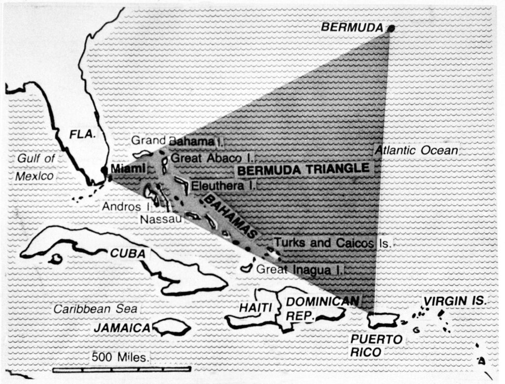
Why do we talk about it in Aviation?

It has a reputation for disappearances – sinking ships and vanishing airplanes, dots on the radar that are gone in a blink, never to be seen again. Some say it is haunted, some say aliens use it as a human abduction point, others reckon it is home to an immense Kraken that swallows ships whole…

These might be tall tales, but in fact is has been the location of a higher-than-its-fair-share of naval and aviation disappearances, and random technical malfunctions too. Somewhere in the region of 50 ships and 20 airplanes since folk started paying attention.

In 2017, a Turkish Airlines A330-200 experienced a series of electrical and mechanical malfunctions while routing over the Triangle. Routing from Istanbul to Cuba, they ended up making a diversion to Washington Dulles. Flight 19 was a squadron of five Torpedo Bombers that disappeared in the area. And of course the famous Amelia Earhart’s final flight was rumored to have gone down in this general location.

It gained its name from an article written back in 1964, which started with an attention grabbing hook –

Fact or Fiction?

Read through the list of sea and air incidents and accidents and you will notice something – the vast majority of events happened last century. Aside from TK183 and a few light aircraft accidents, all the rest generally took place between the 1940s and 1970s.

The investigations into Flight 19 and Amelia Earhart’s disappearance both concluded that poor weather, a loss of situational awareness regarding their actual positions, and ultimately running out of fuel were most likely to blame.

Flight 19 was attributed to the Flight Leader mistaking the Bahamas for the Florida Keys, a broken compass and the fact that the advice for if you got lost in the area back then was to just “take up a heading of 270”. And the Turkish Airlines flight was a fairly uneventful malfunction and diversion.

The high numbers of events can also be put down to the high amount of traffic that routes through this region. It is a fairly major shipping route between the East Coast of the US and the Gulf of Mexico, and in more modern times it has become a fairly busy area for aircraft too.
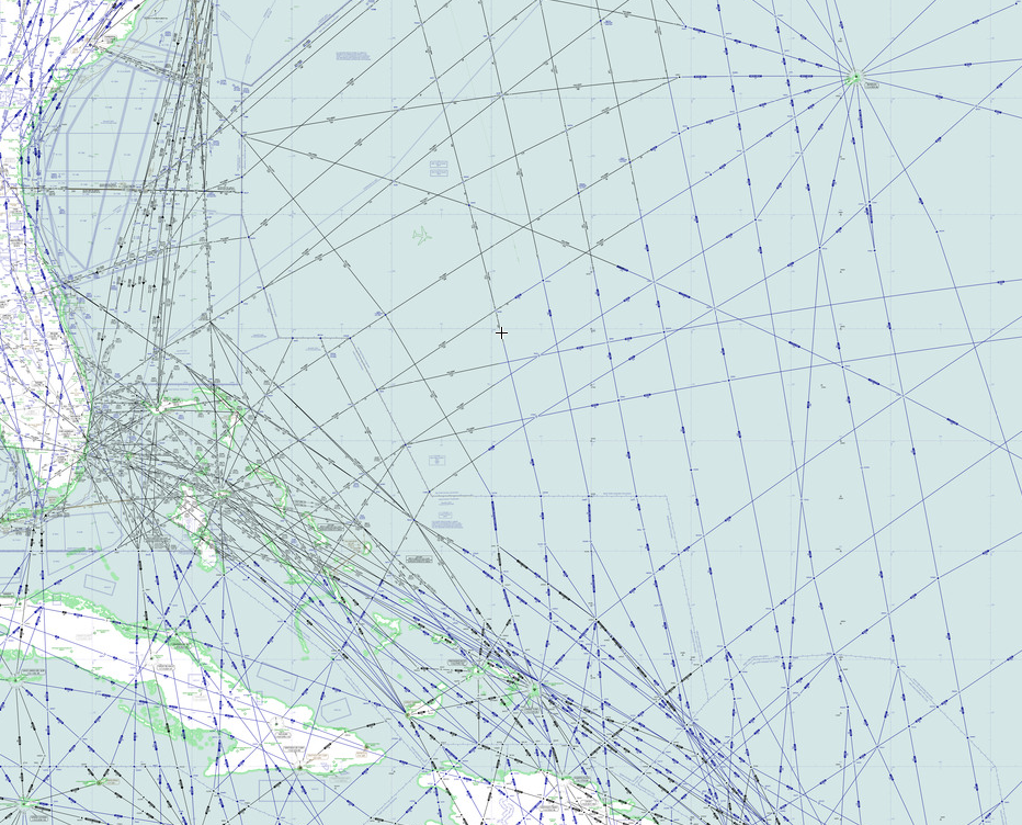
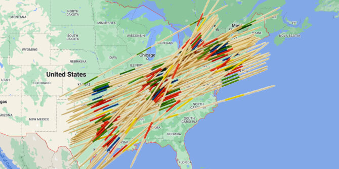
What is causing it all then?

Well, weather seems an obvious answer. It is a pretty popular area for hurricanes to aim towards. In fact, Bermuda (the island) sits in Hurricane alley – the more frequent path taken by Atlantic Hurricanes. So it is no surprise old airplanes and ships without the use of modern weather radar systems might fly into this region and be surprised by some really nasty ship-sinking / airplane-crashing storms.
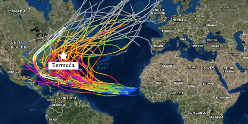
Another explanation offered up by science is to do with magnetism. You all know this, but the Earth’s magnetic pole isn’t quite in the same spot as True North. Your compass points to magnetic north, but there are these things called Agonic Lines which line up magnetic and true north and along these your compass is Truly (pun intended) accurate. One such line runs from Lake Superior and down through the Gulf of Mexico.

Back in the days before GPS, when pioneering navigators relied on compasses and stars (which they couldn’t see because of all the bad weather), they would have potentially corrected for Magnetic to True. But correcting along an agonic line would actually have led them astray.

Then there is the depth of the trenches in this area of the ocean. Most of the sea floor is as far down as 19,000 feet, some areas over 27,500 feet. Which means when things do sink there, they are not easily found. So your sunken ship or ditched airplane is not likely to be found and the conspiracies about aliens and wormholes start to run rampant.

So, the lack of recent aviation events attributable to supernatural phenomena do suggest that it was probably due to more standard reasons that incidents were higher here than in others areas. Added to the fact it makes a good story, and we find we just have an area of bad weather, lots of traffic, and disappointingly unexciting reasons for accidents.

Are there any things modern aviators should look out for in the region?

Yes. Those hurricanes are worth keeping an eye on. The main Atlantic Hurricane season runs from June to the end of November. We wrote a bit about it here.

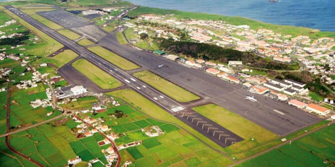
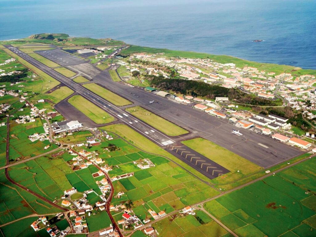
If you are flying to Bermuda itself then the fact it is a very remote island is also worth thinking about. TXKF/Wade International is your main airport, and some of the nearest alternates lie a good 650 miles away on the east coast of the US.

Some serious fuel planning is a good idea then – Isolated Airport Procedures usually require you to carry at least 2 hours additional fuel (at normal cruise consumption above the destination aerodrome). Here is a useful CAA produced checklist for Isolated Airport Procedures.

The surrounding airspace is also a threat. To the East you have the open Atlantic and all the procedures and challenges associated with that. To the West you have the East coast of the US, including the Florida Metroplex airspace, along with KMIA/Miami and KFLL/Fort Lauderdale – two of the busiest airports, in some of the busiest airspace of the USA.

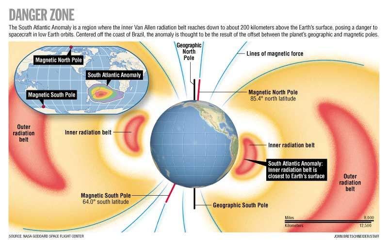
Did you know there is a Bermuda Triangle in space?

Yep, astronauts have their own ‘Bermuda Triangle’ to contend with. It lies over the South Pacific, stretching between Chile and Zimbabwe, and is rather more real than its earthly counterpart.

This area of space is where the inner Van Allen radiation belt comes closest to the Earth. These rings of charged particles – loads of electrons in the outer ring and high-energy protons in the inner –  surround the planet, and are caused by the Earth’s magnetic field which protects us from this harmful radiation by trapping these particles in its magnetic grip.

Unfortunately, in this particular area, the Earth’s magnetic field is weakest, so all those particles are free to swoosh around more. They have also managed to get much closer to the Earth which means our satellites, space equipment and space travelers sometimes orbit through it.  This pretty much messes with electrical equipment, and people for that matter.

For the Hubble telescope, which passes through it about 10 times a day, it means a disruption in its workings for about 15% of each day. Satellites often experience temporary system failures when passing through during high flux days, and the astronauts onboard the ISS have to be shielded to prevent excess radiation. They often report seeing random white flashes, and having issues with communication equipment.

Disappointingly then it seems the Bermuda Triangle is just the stuff of fiction

Most authorities and Scientific organizations agree, but if you fancy reading some more about it then these are some good places to head to:


The Lajes Lowdown: Atlantic Stopover and ETOPS Alternate

In 2001, Air Transat Flight 236, a heavily laden Airbus A330, developed a massive fuel leak midway across the Atlantic and lost power to both engines. It was hundreds of miles from land. The pilots managed to glide the stricken jet to an emergency landing at a lesser known air force base, Lajes, in the middle of the ocean. Its runway saved the lives of 306 people.

LPLA/Lajes is a large military airfield located in the Azores Islands – a Portuguese territory found midway across the Atlantic Ocean. It’s nestled amongst the NAT Tracks, 1900nm east of New York City, and 800nm west of Lisbon.

LPLA/Lajes was approved for civilian use by ANAC (the Portuguese Aviation Authority) in 2018.

Since then, it has grown considerably in popularity as a convenient stopover, refuelling point and ETOPs alternate airport for aircraft crossing the Atlantic. Lajes is regularly used by a variety of operations including scheduled airline services, ferry flights, air ambulance, VIP and private traffic. 

The Lajes Lowdown

It’s long enough, and strong enough. The fully lit asphalt runway is 10,870 feet (3,330m) long and 164 feet (50m) wide and has no weight restriction.

It’s fully IFR equipped. ILS approaches are available for landing in either direction and the runway is equipped with PAPI slope guidance and a Category 1 approach lighting system.

There’s always someone home. The airport is open and ATC is on watch 24 hours a day. There is no curfew at night and landing fees remain competitive. RFF category 8 and emergency medical services are available around the clock, along with accurate weather forecasting. Santa Maria FIR will direct aircraft experiencing an emergency in their airspace to LPLA/Lajes.

Fuel is available.  Jet A1 is available through Petrogal/Galp (a reputable Portuguese company) in partnership with WFS World Fuel Services, Total Aviation, AEG Fuels, US Government Air Card and AML Global. They will also happily accept cash and credit card payments.

It was good enough for the Space Shuttle. Lajes was used by NASA as an emergency landing site in the event of aborted shuttle launches. Emirates have also used Lajes as a primary alternate for their A380 aircraft crossing the Atlantic since they received approval in 2013. The USAF and NATO forces regularly use Lajes for large scale air exercises.

There’s ample parking. It has a spacious ramp capable of accommodating the largest transport category aircraft in the world including the A380 and Antonov AN225.

It is an EU entry point. Customs and immigration are on hand to process entry to Europe, and the terminal has both Schengen and non-Schengen circulation areas.

It has all the usual amenities. A well-equipped terminal includes check in counters, dining, security, customs and immigration, lounges, ground handling and rental cars. The airport is located an easy twenty-minute drive from downtown where ample accommodation options exist for crew and passengers.

How do I land there?

To land at LPLA/Lajes you need prior approval.

The good news is that it is really easy to get. Your request will generally be processed within four hours by the Civilian Terminal Operations.

If it is just a simple fuel stop you need, refuelling at the airport is also now authorised with passengers onboard.

If you prefer to handle things yourself, you can apply directly here or call airport operations on +351 295 545 461.

However, there are several local handling agents who can take care of clearances, approval, fuel, lavatory servicing and catering for you:

GROUNDLINK
Phone: +351 217 923 750
Email: portugal@groundlink.pt

SATA AZORES AIRLINES
Phone: +351 295 540 033
Email: terklsp@sata.pt
By VHF radio: 131.700 MHZ

WEXJET SUPPORT
Phone: +351 218 701 025
Cell: +351 938 650 864
Email: lpla@wexjet.com

For fuel enquiries contact:

PETROGAL/GALP
Lisbon Office
Mr Joao Meneses
Phone: +351 217 240 739
Email: joao.c.meneses@galp.com

Terceira (local) Office
Mr Gilberto Pereira
Phone: +351 295 512 396
Email: galpair.lgs@mail.telepac.pt


Thanks to Miguel Santos for this post. Visit www.atlantis-lajes.com for more information.