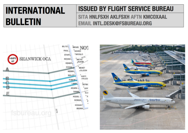
No more NAT tracks at FL330 and below

Big news from the NAT. From March 1, 2022, FL330 and below will no longer be part of the NAT Organised Track Structure (OTS).

What does this mean?

It means operators will have the flexibility to file random routes at FL330 and below when flying between Europe and North America.

Particularly for operators unable to file routes across OTS tracks with active flight levels, this means much greater flexibility in choosing their own trajectory.

Why is this helpful?

NATS quoted a study which suggested every extra minute over the ocean equates to about £51, or $70. It might not be the most radical change, but it is a step towards further improving the efficiency for operators, and ultimately to reducing fuel burn.

Why now?

It comes down to the introduction of ADS-B. This allows controllers to receive updates every 7-8 seconds instead of every 840 seconds (14 minutes).

What about the rest of the tracks?

This change forms part of NATS 2030 NAT vision, and more improvements can be expected. Unfortunately, it isn’t a direct result of their NAT tracks NIL experiment and abolishment of all the OTS isn’t on the cards anytime soon.

However, studies from the ‘OTS Nil’ trial are being reviewed and there are plans to simulate further OTS Nil on busier traffic days to see if viable, useful, doable…

What do you need?

If you want to fly at FL330 or below (down to FL285) then remember you are still in the NAT HLA, just not on the OTS, so the same HF, long range nav and comms requirements apply, as do datalink mandates.

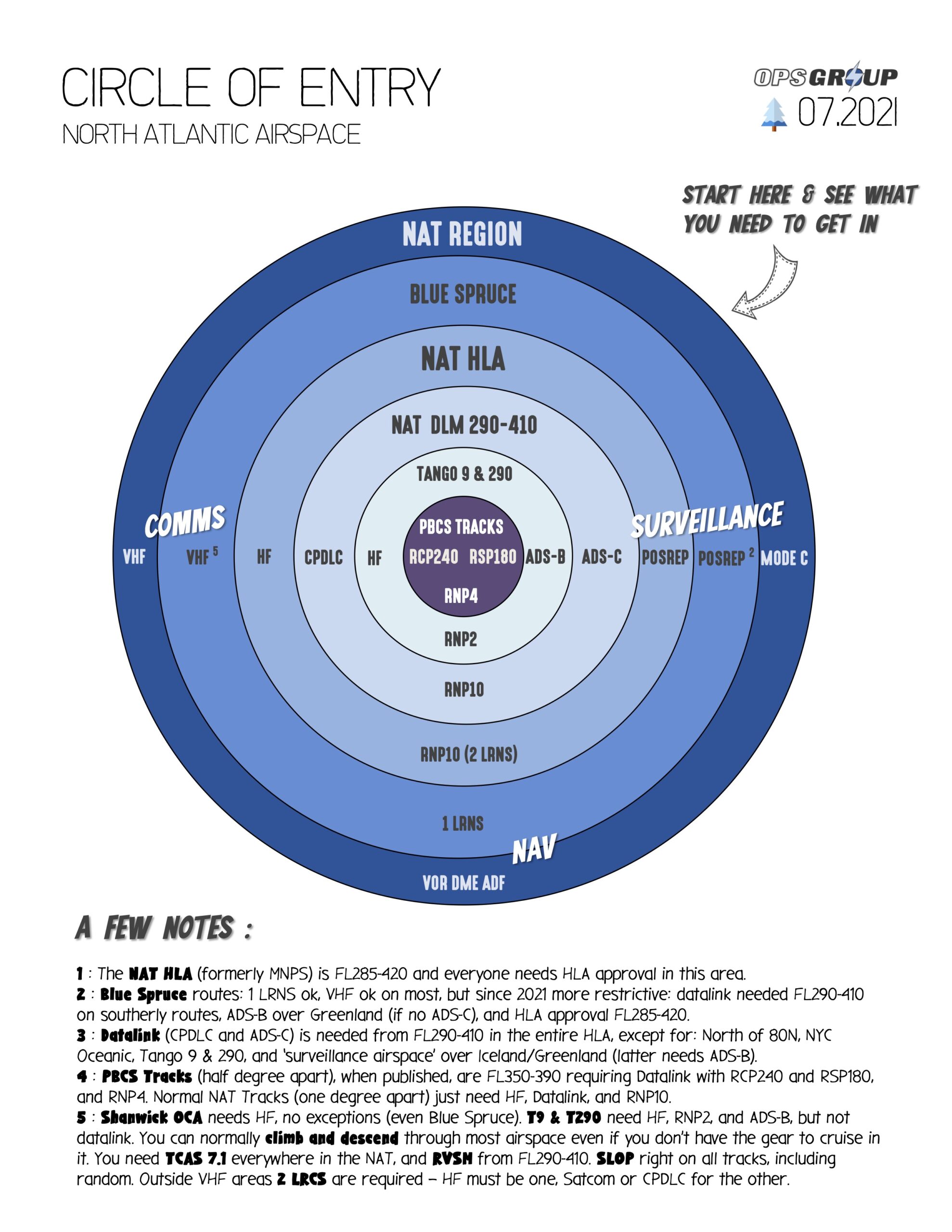
This is our NAT Airspace Circle of Entry 2021 – easily check what you need for Nav, Comms and ATC Surveillance depending on which bit of the NAT you will be flying through.

Anything else?

Unfortunately no, that’s the news for now. Any questions on this feel free to direct them to us at team@ops.group

If you want to read the “official” NATS notice then you can do so here. We don’t yet have a reference for the official NAT Docs.


Monday Briefing: NAT Track Changes, Russia-Ukraine airline ban

26OCT2015 In around two weeks time, significant changes will occur to the design and structure of North Atlantic Tracks (NAT OTS), which have existed in their current lateral structure since the OTS introduction in 1965. The key changes are: a reduction in separation to ‘half-track’ compared to the existing structure, introduction of 24 new Oceanic Entry Points (OEP’s), and a new requirement for RNP4. A special briefing on these changes is below.

26OCT2015 With effect from yesterday, almost all Ukrainian and Russian airlines are barred from each others airports and airspace. Ukraine issued a sanctions list in September barring all except one Russian airline from operating, and in return Russia banned the three Ukrainian airlines from operating to Russia. GA, Business Aviation, and non-scheduled flights are not affected.


EGPX/Scottish FIR High delays this morning 26OCT in Scottish airspace due to ATC radio system failure. EGPF/Edinburgh airport departures were suspended, now resumed, with enroute traffic rerouted to avoid Antrim, Galloway, Tay, and Talla sectors. Situation is slowly improving but potential for afternoon delays exists.

KORD/Chicago O’Hare There will be a TFR in effect for Oct 27 and Oct 28 due to VIP movement. Please see NOTAM 5/1931 for further details.

MMXX/Mexico The impact of Hurricane Patricia was less than feared. MMPR/Puerto Vallarta Airport, MMZH/Ixtapa, and MMZO/Manzanillo have all reopened and are operating normally.

KXXX/USA Current runway closures: BWI-RWY 10/28 CLOSED, IAD-RWY 01R/19L CLOSED, DTW-RWY 03R/21L 09L/27R CLOSED, SEA-RWY 16C/34C CLOSED

NAT/North Atlantic ASD15 Exercise Trident Juncture (At Sea Demonstration) military exercise until 31OCT. The designated firing areas incorporate elements of Scottish FIR/UIR, Shanwick and Reykjavik FIR as well as notified UK Danger areas. Flight planning restrictions will be applied affecting NAT Traffic on northerly routes, monitor NOTAMs.

South Pacific Tropical Cyclone Season 2015-16 begins on 01NOV. Tropical cyclone warnings in the South Pacific region, please consult the Joint Typhoon Warning Center, Fiji’s regional meteorological center responsible for tropical cyclone warnings in the South Pacific region, or Australia’s Bureau of Meteorology.

View the full International Ops Bulletin for 26OCT2015.