Honduras has a New Airport
Here is the lowdown on the new international airport in Honduras, for anyone who might be thinking of heading there.
Where is it?
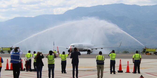
MHPR/Palmerola, also known as Comayagua International, has been built on what was the Soto Cano Air base. Inaugurated in October 2021, it is now the new civil and commercial international airport for Honduras.
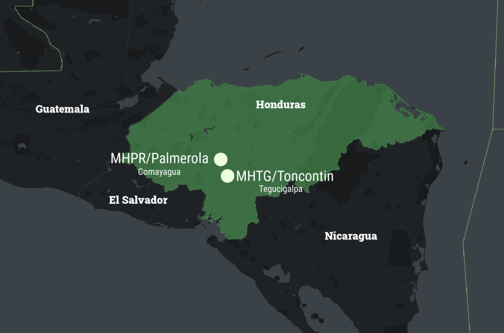
The new airport is approximately 80km from the old one which lies in the Capital, Tegucigalpa.
What has it got?
The new airport boasts a 2441m / 8009′ runway with an RNP approach to both runway 17 and 35, and backup VOR approaches. There is no ILS and there are currently no approach lighting for night or IMC ops.
It is planned for 24/7 operations, but for now it is only open during daylight hours (06-18L). After hours permission may be available by contacting the airport manager on +504 3140 3317 in advance.
A report from someone who has headed in recently suggested that “All traffic is routed mostly via TGU and in contact with TGU approach as far as I know for traffic landing north.”
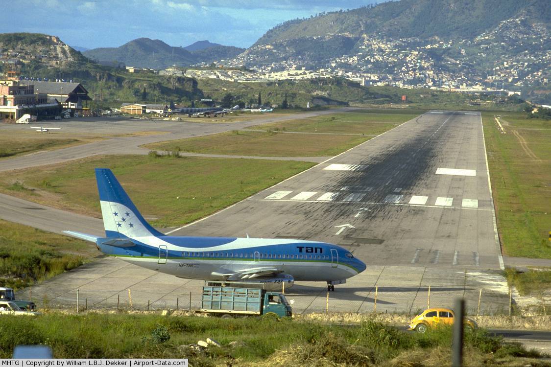
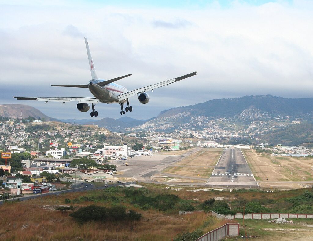
The old airport, MHTG/Toncontin, has a 2021m / 6631′ runway with an RNP (AR) approach to runway 20, and a VOR to runway 02.
Here’s a quick look at the new airport:
Things to look out for at MHPR/Palmerola
- The airport elevation is 2064 feet, and there is some tricky terrain all round with the airport sitting in a valley, giving it an MSA of 9900′. The terrain also means departures (unless you’re in a super climb-achieving military jet) are limited to runway 17.
- RNP Rwy 17 brings you in from point PR702, at 5600′. There is a chunky hill right under it with a mast on top sitting at 3675′, so after you pass here you need to descend to 4300′ by PT701, which is only 4 nm away. The vertical approach path is a nice standard 3 degree, but you’re going to want to look out for the climb gradient for the missed approach because it requires a minimum of 300’/nm.
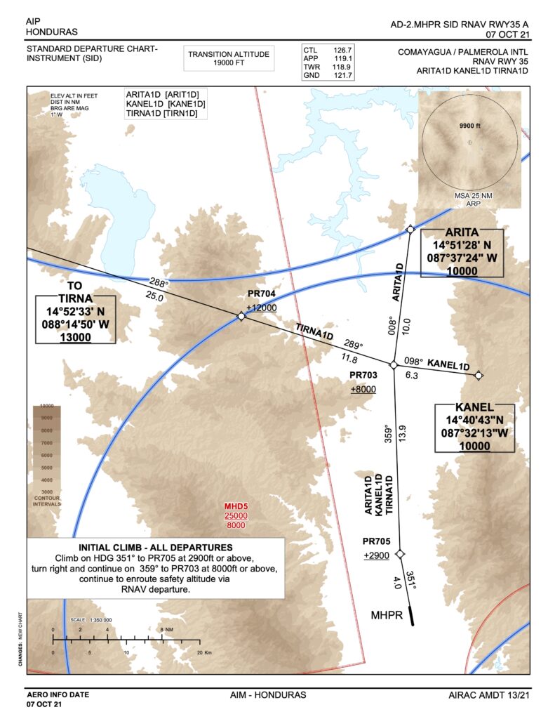
- The missed approach is also quite complicated with a bunch of “head here once you’ve reached xxxx altitude” instructions. The approach and missed approach for runway 35 is a little less complicated since (once you’re over the terrain to the south of the airport) it is less challenging.
- Not that you would be there anyway (because of the terrain) but to the east, south and west lie various Danger or Restricted areas to look out for.
- The airport lies in a valley. With terrain either side. That means there is a chance of some mean topographic turbulence if the wind is blowing the right way. The old Toncontin airport overview suggests wind shear and downdrafts on short finals. The new airport will probably have similar threats.
- The old MHTG/Toncontin airport requires a specific ‘Mountainous Terrain’ Airport Qualification. While the new airport does not, the terrain is a challenge so look out!
- The region sees fairly nice temperatures through the year with highs of 29°C (85°F) and lows of 16°C (60°F). Rainfall peaks in September to November with an average of 119mm (4.7″). Watch out for thunderstorms though which occur throughout the year, particularly between June and August.
What happened to MHTG/Toncontin?
All scheduled international services have been transferred from MHTG/Toncontin to MHPR/Palmerola, but the old airport is still available for international bizav flights.
MHTG/Toncontin is still available for international bizav flights (and still features some challenging terrain all around).
Any contacts?
If you want to head to either MHPR/Palmerola or MHTG/Toncontin then try talking to one of the following:
- ASMCorp. Email at ops@asmcorp.com.mx or by phone +52 81 8122 5100.
- Consorcio Aviation. Email at fltops@consorcioaviation.com / occ@consorcioaviation.com or by phone +5955 981 193063.