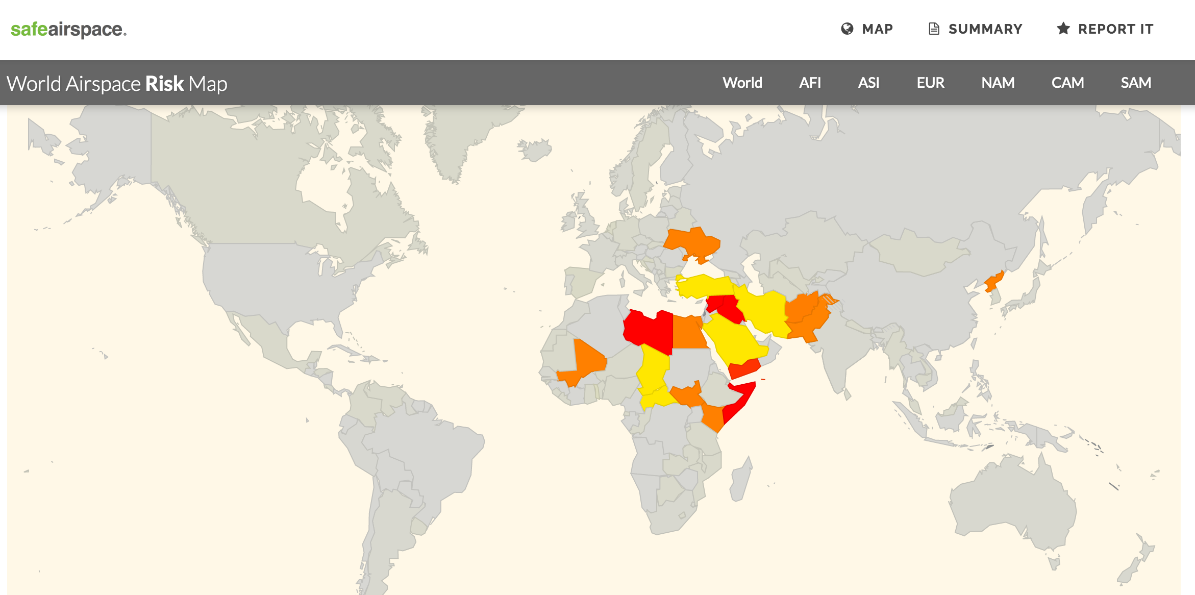
New airspace warnings – Turkey, Iran

Today Flight Service Bureau has published ION05/16 – an updated Unsafe Airspace Summary, with new warnings for Turkey, and Iran, and a new map at safeairspace.net. This replaces 04/16 issued in August.
Turkey: 23SEP16 Germany B1289/16 Do not plan flights to LTAJ due potential ground to ground firing in the vicinity of LTAJ/Gaziantep Airport.
Iran: 09SEP16 FAA Notam KICZ 19/16 Exercise caution within Tehran FIR due military activity.
New information in the PDF is marked with a I beside it. Please distribute the PDF to anyone you like, we are keen to make sure as many operators as possible are aware of the risks.
- Download the new Unsafe Airspace Summary
- View the current map at safeairspace.net