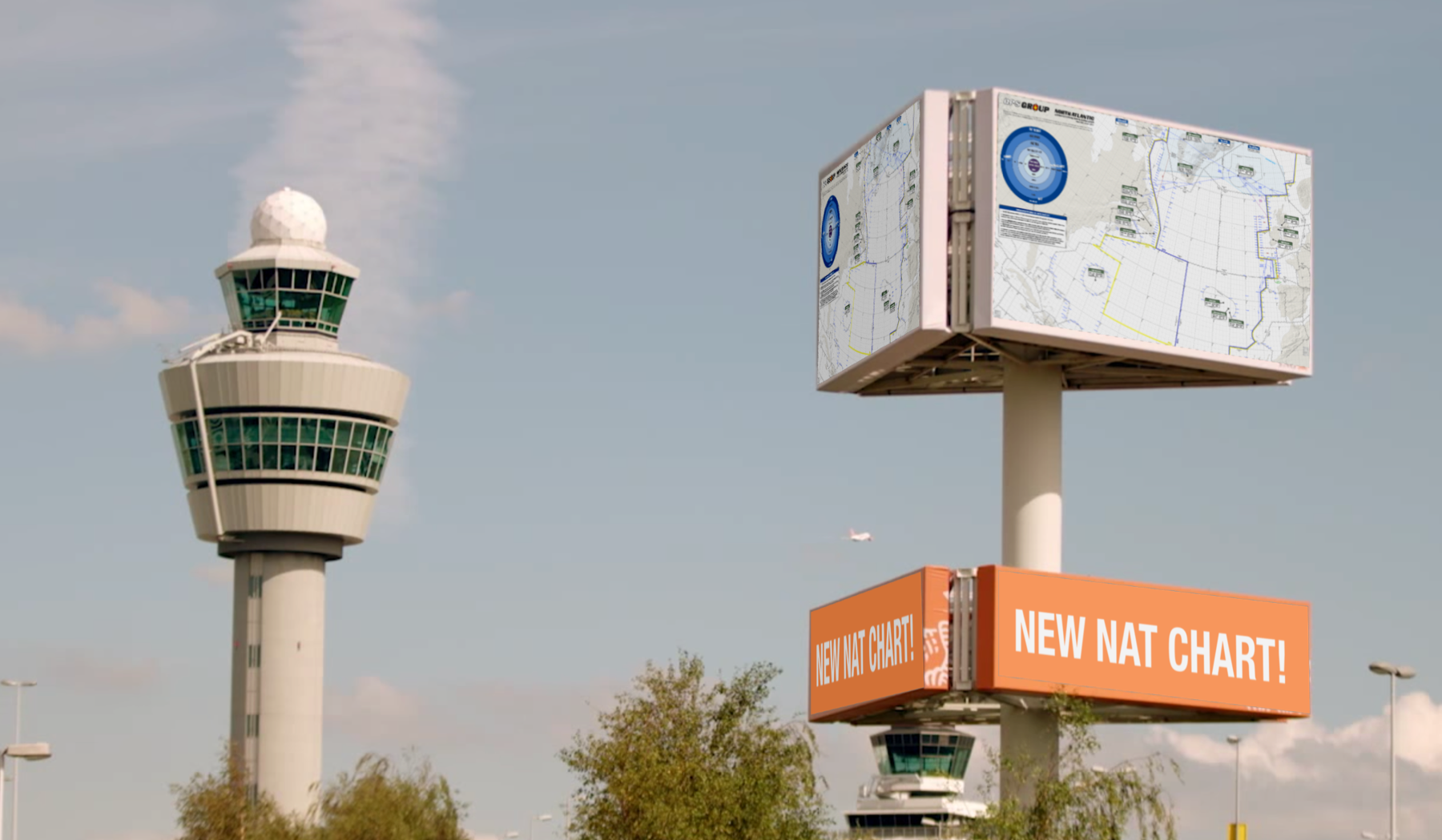
Hi members!
First, thanks to all the group members who were part of making this. We sat down from scratch and wanted to build the best possible NAT chart we could. A lot of work went into this, and we’re grateful to you all! With this format and structure, we’re also looking at making useful plotting charts for other areas like the Pacific, Africa, etc. – but for now, enjoy this completely updated NAT map for 2021.
So .. It’s ready! You can grab it in Slack, or in your Dashboard. View it on your iPad or Laptop etc. as a PDF, or print it out as a giant wall map! It prints really well up to 15 feet wide – but you can also just put it onto A3 or A2 size paper.
If you’re not a member, read on for how to get a copy.
About the 2021 NAT Chart
This chart is completely new – we started from scratch, expanded the coverage area, and then worked as a group to add all the useful things we could think of that a pilot or dispatcher crossing the North Atlantic might need.
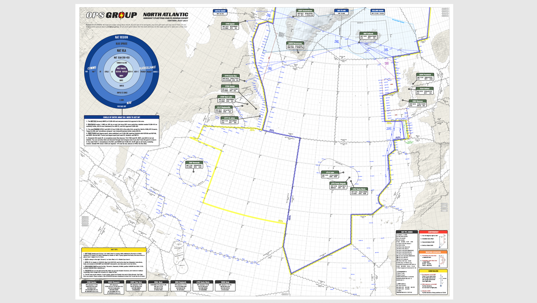
New on this chart – effective July 2021:
- FULLY UDPATED for 2021 post-COVID flying!
- EXPANDED coverage area – much further down into the Atlantic, and further west.
- NEW! NAT Tips – using NAT Tracks, SLOP, filing an Oceanic Flight Plan, and helpful tips
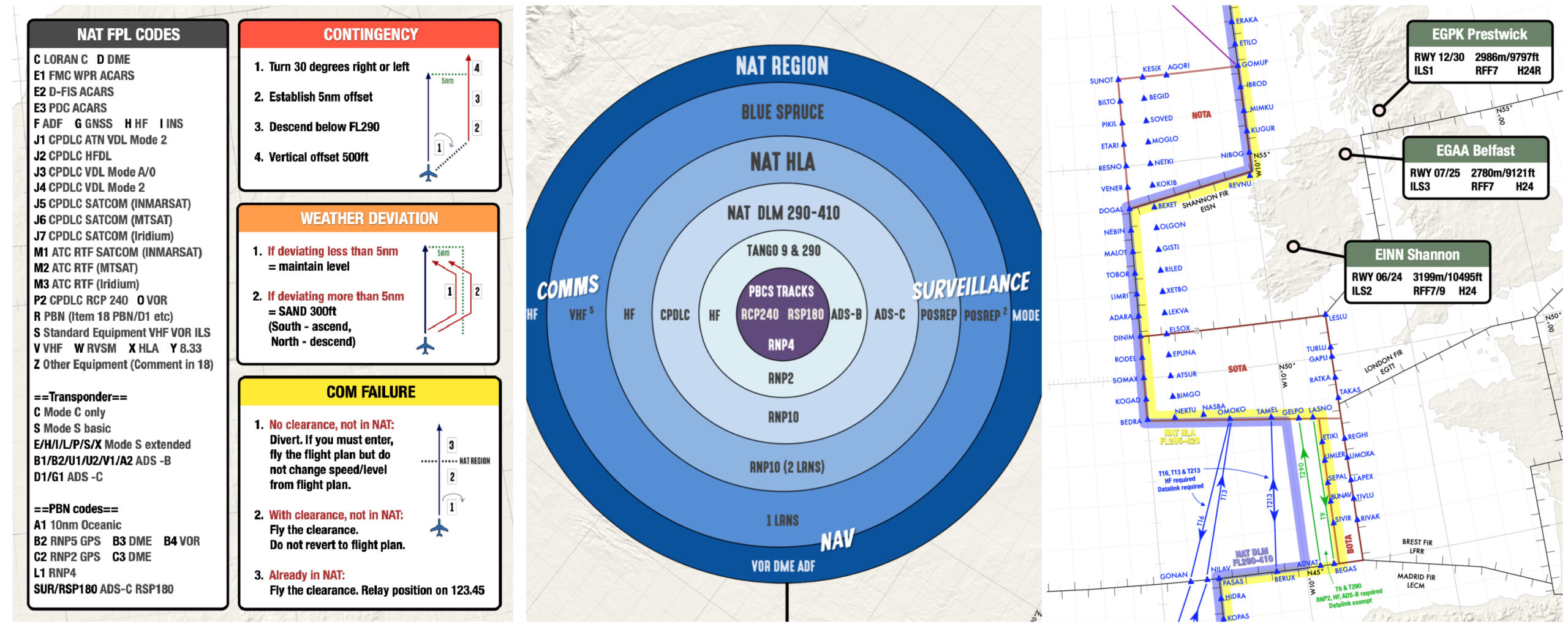
- NEW! Quick reference for contingency, weather, and comms failure with easy graphics.
- Updated: NAT Airspace Circle of Entry 2021 – easily check what you need for Nav, Comms and ATC Surveillance depending on which bit of the NAT you will be flying through.
- Additional diversion airports, now 16 total primary NAT alternates with runway, approach, length, RFF, and hours
- Easy view of boundaries for HLA and DLM/Datalink mandated airspace
- Updated NAT FPL codes, clearance frequencies, Satcom, and HF
- Fully updated “South East Corner” with new Tango routes
- and … Treasure Boxes!
Other chart features:
:: Requirements for NAT tracks, PBCS tracks, datalink mandate.
:: Common NAT Diversion Airports.
:: Runway Orientation, Length, best IFR Approach.
:: RFF Category and Opening hours.
:: NAT FPL Codes and sample FPL.
:: Blue Spruce routes and equipment requirements.
:: All NAT Entry/Exit points with associated required landfall fixes.
How to get the new chart, if you’re not a member?
- Option 1: Buy the chart in the store ($35)
- Option 2: Join OPSGROUP, and get it for free!
OPSGROUP members get this and other publications free of charge, all available through your member dashboard.
There have been many changes on the North Atlantic since we published our previous chart in 2019. Here’s a few things to read up on:
- Feb 2021 changes here
- July 2021 changes here
- The full NAT timeline of all changes going back to 2015
We hope you find it super useful, but also have fun using it!

More on the topic:
- More: NAT Datalink Exempt Airspace: 2023 Changes
- More: NAT Ops: Atlantic Thunder 22
- More: NAT Basics: An Unofficial Checklist For Pilots
- More: ACARS Oceanic Clearances on the NAT
- More: NAT Conundrums: Volume II
More reading:
- Latest: US Midwest: Cicada’s are coming to town
- Latest: Saudi Arabia Overflights – Free Route Gotcha
- Latest: International Ops Bulletin
- Safe Airspace: Risk Database
- Weekly Ops Bulletin: Subscribe
- Membership plans: Why join OPSGROUP?


I purchased the Oceanic plotting chart but when I select download item it goes to a blank screen?